

The Rider’s Reader was a small four page periodical put out by CTA and distributed via buses, streetcars, and “L” cars between 1948 and 1951.
One of the advantages of an electronic book, besides the ease of use on your home computer, is that it can easily be updated when new information becomes available. We have recently obtained14 additional issues of the CTA Rider’s Reader, which was published from 1948 to 1951. In addition, we now have the 1964 CTA rapid transit system track map.
Since we already had two copies of Rider’s Reader before, this brings our collection to 16 out of what appear to be 18 issues in all:
Volume 1, Number 1 – March 1948
Volume 1, Number 2 -May 1948
Volume 1, Number 3 – July-August 1948
Volume 1, Number 4 – October 1948
Volume 1, Number 5 – December 1948
Volume 2, Number 1 – March 1949
Volume 3, Number 1 – May 1949 (appears to be a numbering error– should be Volume 2, Number 2)
Volume 2, Number 3 – August 1949
Volume 2, Number 4 – November 1949
Volume 2, Number 5 – December 1949
Volume 2, Number 6 – February 1950
Volume 3, Number 1 – May 1950
Volume 3, Number 2 – July 1950
Volume 3, Number 3 – October 1950
Volume 3, Number 5 – February 1951
Volume 4, Number 1 – June 1951
The final issue has a very different format than the others, de-emphasizing the Rider’s Reader name, probably suggesting a change in direction at CTA that led to this publication being discontinued. Perhaps it was felt preferable to use flyers that were targeted to more specific topics. It’s been our experience that such publications often include a lot of useful tidbits of information not found elsewhere.
We are still in need of Volume 3, Number 4 – late 1950 or early 1951. If any of our readers can help us fill out our collection, we would be greatly appreciative. (We’re not entirely sure, but there may also have been a Volume 3, Number 6 in early 1951, which would make 19 issues in all. If so, we need that one too.)
High-resolution scans have been made of these issues, and the 14 additional ones have now been added our two E-books that cover the CTA:
Chicago’s PCC Streetcars: The Rest of the Story – DVD02
The “New Look” in Chicago Transit: 1938-1973 – DVD03
While most of the material on these discs is unique, there is inevitably some overlap between them, there is inevitably some overlap, since CTA publications often covered both the surface system and rapid transit. But in general, DVD02 concentrates on streetcars, while DVD03 favors the rapid transit and buses.
You will find these and other fine products in our Online Store.
Update Service
We haven’t forgotten those who have already purchased these DVD data discs from us. If you bought one of these before, and now wish to have an updated disc, we can send you one for just $5.00 within the United States. Just drop us a line and we can send you an online invoice.
Your other alternative is to download the updated files via Dropbox, a cloud-based file sharing service that you can use for free. That is usually the preferred alternative if you live outside the US.
We will continue to add to both these titles in the future.
Help Support The Trolley Dodger

This is our 116th post, and we are gradually creating a body of work and an online resource for the benefit of all railfans, everywhere. To date, we have received over 118,000 page views, for which we are very grateful.
You can help us continue our original transit research by checking out the fine products in our Online Store. You can make a donation there as well.
As we have said before, “If you buy here, we will be here.”
We thank you for your support.
Some highlights from the Rider’s Reader:

CTA surface system improvements for the second quarter of 1948 included putting PCC streetcars on Madison and 63rd Street. They were already running on Clark-Wentworth and Broadway-State. They would be put on Western Avenue in the third quarter, which involved a partial substitution by buses on the outer ends of the route.

“Another New CTA Bus,” in this case, is a trolley bus. These were put into service on Montrose Avenue in late March, 1948.

CTA A/B “skip stop” service, introduced on the Lake Street “L” in April 1948, may very well have saved this line from eventual elimination. A/B service was soon expanded to other routes but has since been discontinued.

The #97 was CTA’s first suburban bus route and replaced the Niles Center “L” service on March 27, 1948. Just over 16 years later, however, CTA introduced the Skokie Swift over the same trackage. The #97 bus continued in service.

Artist’s rendering of a “flat door” 6000-series “L” car. These were needed to begin service in the Dearborn-Milwaukee subway. As it turned out, deliveries did not begin until 1950 and the subway opened in February 1951.

Once A/B service was put into effect on the LakeStreet “L” in 1948, CTA considered the Market Street stub terminal unnecessary and it was torn down. At the time, it was also reported that the City of Chicago wanted it removed, probably because it stood in the way of eventual construction of Lower Wacker Drive, which was related to the Congress Expressway project.

9763, the CTA’s first and only articulated trolley bus, was termed the “Queen Mary” by fans. It seems to have been a semi-official name since it is called that in an issue of the Rider’s Reader. It has since been preserved at the Illinois Railway Museum.

In this 1950 diagram, CTA explained why it was sometimes necessary to use switchbacks to prevent the bunching up of streetcars.

The Rider’s Reader gave a rundown on the Met “L” bridge over the Chicago River, which was actually two bridges with a total of four tracks. Since this bridge served three lines, service could continue to operate even if something happened to one of the bridges. This river bridge, unlike the others, was operated by CTA and not the city.

CTA reproduced this Minneapolis Star editorial cartoon in July 1950. We will let the readers decide whether this was indicative of an increasing anti-streetcar sentiment on the part of CTA.

The first train of new 6000-series cars put into service in 1950.

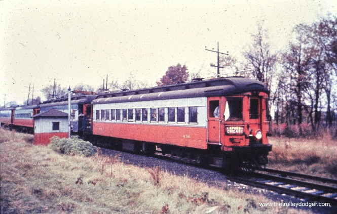
CTA streetcars in the winter of 1950-51. One of our readers says this is “Clark Street looking north around Hubbard.”

We have three of the four 1948 issues.

Five issues came out in 1949.

We have four out of the five issues from 1950.

Only two issues appear to have come out in 1951. The final issue has a completely different format.

The October 1964 CTA rapid transit track map joins the June 1958 version in two of our publications.
Mystery Photos
Finally, here are a couple of “mystery photos” from downtown Chicago in the late 1920s or early 1930s. If you can help us figure out the locations and what event this might have been, we would appreciate it:

This picture, and the next, appear to have been taken in the late 1920s or early 1930s. The banners would indicate an event, but we are not sure of the occasion. One of our readers says this is “State and Washington looking south.” This could also be circa 1926 at the time of the Eucharistic Congress.

Our readers have identified this as being “Holy Name Cathedral at State and Chicago.” The occasion may be the Eucharistic Congress in 1926.
Recently, there was another such mystery posed to the Chicagotransit Yahoo group by P. Chavin:
Roughly a quarter of the way down on the web page linked below, at “May 23, 2015 – 6:24 pm”, is a color photo of a streetcar and a wide boulevard. The caption reads: “PHOTO – CHICAGO – DOUGLAS PARK – PULLMAN STREETCAR – 1951 – EDITED FROM AN AL CHIONE IMAGE”
I assume this photo shows a westbound Ogden Ave. car at about S. California Ave. and that the view is northeasterly down Ogden Ave. (Blvd.).
If anyone can confirm or correct my assumption, I’d appreciate it.

That sounds plausible. There is some evidence in the picture that we are near a park. But what is the explanation for the streetcar taking a jog at this point?
If this is Ogden and California, then there don’t appear to be any of the old buildings left that could be checked against the picture. (PS- I note there are a few pictures on that page that could have been lifted from The Trolley Dodger, but that’s OK.)
P. Chavin:
Thanks, David, for giving it a shot. At least I know my query wasn’t completely underwhelming to the group. The explanation for the streetcar taking a jog could well be that the car was coming off tracks that were on the sides of the wide boulevard but at this point, they were narrowing to a normal middle-of-the-street double track layout.
Later, Dennis McClendon came up with a very good answer:
The sun angle, the US34 and US66 signs, the view of the Board of Trade, and the park benches on the left all make me think we’re indeed looking northeast across California. The four-story round-cornered apartment building on the corner matches the fire insurance map.
Why are the tracks shifting from the service drives to the center roadway? My only theory is that the Park District was in charge of the service drives through Douglas Park, but not the original width of Ogden (which predated establishment of the West Parks Commission), and declined to permit the streetcar line to occupy the park service drives. The 1938 and 1953 aerial photos aren’t clear enough to show the tracks.
Daniel Joseph writes:
I rode this part of the Ogden streetcar line many times as a child and can explain the “what” but not the “why”. North east of the location of this photo (which is about mid way between Sacramento and California) the streetcar tracks were in the service drive until Roosevelt Road. East of Ogden on Roosevelt the tracks continued in the service drive until Ashland. On Ogden. west of the location of the photo, the track continued in the center of the street and the service drive was a boulevard until the end at Albany.

Ogden and California Avenue today, looking to the northeast.
Keep those cards and letters coming in, folks. You can leave a comment on this or any other post directly, or you can drop us a line at:
thetrolleydodger@gmail.com
-David Sadowski
PS- Thanks to the generosity of Mark Llanuza, we have added a few more pictures to our previous post Trolley Dodger Mailbag, 1-29-2016:

The CERA fantrip train in Lombard, still just three cars at this point. The date is October 26, 1958. (Mark Llanuza Collection)
The four-car CERA fantrip train at Raymond Street in Elgin. Mark Llanuza says the entire day was cold and rainy, and they had to add a fourth car at Wheaton because of the large number of people on this trip. (Mark Llanuza Collection)

This must be the April 1962 train taking CA&E equipment purchased by RELIC, the predecessor to the Fox River Trolley Museum. According to Don’s Rail Photos, “11 was built by Brill in 1910, (order) #16483. It was rebuilt to a line car in 1947 and replaced 45. It was acquired by Railway Equipment Leasing & Investment Co in 1962 and came to Fox River Trolley Museum in 1984. It was lettered as Fox River & Eastern.” This picture was taken in Glen Ellyn along the C&NW. (Mark Llanuza Collection)

The rescue train taking CA&E cars purchased by RELIC through Glen Ellyn. (Mark Llanuza Collection)
The mystery photos were likely taken during the Eucharistic Congress of 1926. The church is Holy Name Cathedral, so we’re looking south on State Street. See http://library.depaul.edu/about/library-news/full-text-blog/Pages/Here-Comes-Everybody-the-28th-Eucharistic-Congress.aspx for another angle. The flower shop seen in the picture is the one associated with the murder of Capone gangster Dean O’Banion.
That’s a brilliant deduction, thanks. I had considered it as one of the possibilities, but it’s great to have it confirmed.
The Flower shop was owned by Dion O’Banion, who was a North Side organization member, not from what at the time was the Torrio organization of the South Side. (Capone was a Torrio underboss, and did not take over until 1925, when Torrio got out of Chicago, and went to Italy for a few years, until Mussolini went after the Mafia in Italy…he then went to New York.
A wonderful treasure from the good days. So many memories, including the very special artwork of train schedules now diminished as we print our own on our laptops.
Richard
Regarding Ogden and California, some portions of Ogden may have originally been designated as boulevards, and under City law, that meant the streetcars would have been confined to the service drives, like along the portion of Roosevelt Road that was built like, and designated as, a boulevard. I imagine things could get hairy for people parking along the service drives in a case like that! It doesn’t really explain the shift away from the service drives at that point.
In the end, the signal improvements on Ogden, using overhead mounts on monotube beam structures (called “goalposts” by City employees) spelled the end for any overhead trolley wires, since they spanned the widths of the main and service drives. And I might add that making these signals work is a pain in the posterior for this sort of roadway, from personal experience.
Correct – the streetcar tracks went from being in the service drives to the main roadway just west of California on Ogden. In bus days, Ogden buses continued in the service drives to Albany, then went into the main roadway. However, Motor Coach 36-Douglas buses used the main roadway (also on Roosevelt) until the CTA era. Apparently by some quirk the main roadway was Park District property while the service roads were considered city streets! Maybe part of the answer would lie in when Ogden and Roosevelt were rebuilt into their current configuration. I imagine at least into the 1860’s both must have looked like pretty ordinary city streets, like they do elsewhere, and at some point some park district (or possibly city?) had them rebuilt with the service roadways. Randolph St between Union Park and Desplaines Av also had the service roadways added, though the streetcars stayed in the middle, while Ashland between Union Park and Roosevelt was left alone even though it was also a boulevard (probably too many big buildings already?)
A quick chronology of horsecars on these streets:
Randolph – 1859
Ogden – 1876 to Western, 1881 to Albany, 1886 to Homan, 1892 to Pulaski
Roosevelt – 1878
Ashland – 1893 (streetcars, on Paulina)
I suppose that is the case: the streets were widened after being established, probably where property was acquired and older buildings demolished or moved. The City took over the boulevards in 1959, and that brought an influx of old Park Dsitrict traffic engineering personnel to what was then the Bureau of Street Traffic and Bureau of Electricity.
[…] two pictures appeared in The Rider’s Reader (January 31, […]