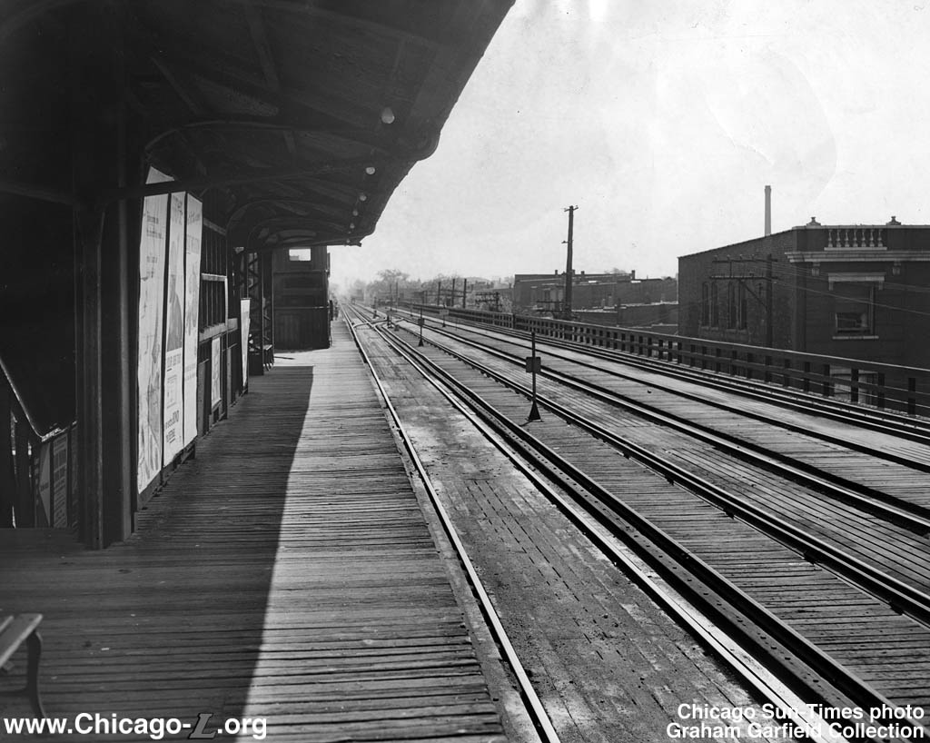
Chasing Sanborn (Our 275th Post)

This 1953 view looks to the northwest and shows the old Canal Street station on the Metropolitan

This 1953 view looks to the northwest and shows the old Canal Street station on the Metropolitan “L”, which was near Union Station. They were connected by a walkway nicknamed “Frustration Walk,” since many people would miss their train in the time it took to make the journey. The “L” here closed in 1958 and was demolished soon after. (Jon R. Roma Collection)

This is our 275th Trolley Dodger blog post, so we thought we would make this one extra special for you.

Recently, Jon R. Roma sent us some Sanborn insurance maps that were made in 1906 and 1917, mainly to show sections of the old Garfield Park “L” in greater detail. This was in response to some of our previous posts, where we discussed just where it used to run, before it was replaced by the Congress rapid transit line in 1958.

Learning from history is a process, and as historians, we are continually reaching out to the past, studying the historical record, looking for clues that will inform us today and further our understanding. Photographs, of course, are invaluable, but so are the kind of detailed maps that were made for insurance purposes long ago. They detail pretty much every structure and many of the businesses that once existed.

As an example of what you can learn from these maps, consider the one below showing the layout of old West Side Park, where the Chicago Cubs played through the 1915 season.

A story has gone around in recent years, that supposedly the expression “from out of left field” originated at West Side Park. Cook County Hospital was just north of the park, and the story goes that mental patients there would yell things out during Cubs games, which gave birth to the expression, which has taken on a meaning of something completely unexpected.

Unfortunately, there is no record of “from out of left field” being used in print with this meaning prior to the 1940s, by which time the Cubs had been in Wrigley Field for 25 years. But if you look at the Sanborn map of West Side Park, there was apparently an open area just north of the grandstands, so the hospital would have been some further distance away. I am not sure how much of the field would have been visible from the hospital anyway, so after looking at the map, the story seems unlikely.

What is more likely is how the expression could have evolved just generally from baseball lore. Occasionally, the left fielder will make a throw all the way to home plate during a game. Such a throw, coming “from out of left field,” tends to be unexpected, and it may be that over time, it took on this other meaning colloquially.

In addition, we have more electric traction, steam, and diesel photos taken around 1970 by John Engleman, some recent new photo finds of our own, and correspondence with Larry Sakar.

I guess we will always be “chasing Sanborn,” and other things like it.

We are very grateful to all our contributors. Sanborn fire insurance maps provided courtesy of the Map Library at the University of Illinois at Urbana-Champaign.

Enjoy!

-David Sadowski

PS- If you enjoy reading these posts, you might consider joining our Trolley Dodger Facebook Group as well. We currently have 429 members.

Sanborn Maps from 1917:

The area covered by this volume.

The area covered by this volume.

This includes the Met

This includes the Met “L” line heading to Humboldt Park and Logan Square. There was a station at Madison Street, opened in 1895, which is not delineated on this 1917 map. It closed in 1951. This section of “L” has since been rebuilt, and is now part of the CTA Pink Line.

The Met

The Met “L” branch leading to Humboldt Park and Logan Square made a bit of a jog near Ogden Avenue, an angle street. This is the section just north of Marshfield Junction.

This section of map shows the Garfield Park

This section of map shows the Garfield Park “L” and includes the station at Western Avenue, which was open from 1895 to 1953. When Western was widened in the 1930s, the front of the station was removed and a new Art Deco front replaced it. The same thing was done to three other “L” stations on Western. This station closed in September 1953, due to construction of the Congress Expressway, and we have featured pictures of its quick demolition in previous posts.

A close-up of the Western Avenue

A close-up of the Western Avenue “L” station. I suppose the area marked “iron” refers to the station canopy.

This map includes a section of the Garfield Park

This map includes a section of the Garfield Park “L”.

This map includes a section of the Garfield Park

This map includes a section of the Garfield Park “L”, including part of the station at Hoyne Avenue, which was open from 1895 to 1953. The area between Van Buren and Congress is now occupied by the Eisenhower expressway. The CTA Blue Line tracks are in approximately the same location as the former Garfield Park “L”, but in the depressed highway.

This map shows part of the Garfield Park

This map shows part of the Garfield Park “L”, including the station at Hoyne Avenue.

This includes the old Garfield Park

This includes the old Garfield Park “L”.

This includes the Garfield Park

This includes the Garfield Park “L”, including the station at Ogden Avenue, which was open between 1895 and 1953.

A close-up of the Garfield Park

A close-up of the Garfield Park “L” station at Ogden Avenue.

The map shows the section of the Met

The map shows the section of the Met “L” lines just west of Marshfield Junction, where all the various branch lines came together.

The Met

The Met “L” branches ran over a building that housed the Dreamland roller skating rink. When the Congress Expressway was built, a new section of “L” was built running north-south to connect the Douglas Park “L” to the tracks formerly used by the Humboldt Park and Logan Square lines prior to 1951. This became part of a new routing for Douglas that brought its trains to the Loop via the Lake Street “L”, where another new connection was built. This is the path that the CTA Pink Line follows today. Douglas trains were connected to the new Congress rapid transit line via a ramp that followed the old Douglas path starting in 1958.

The same location today.

The same location today.

This map shows Marshfield Junction on the Garfield Park

This map shows Marshfield Junction on the Garfield Park “L”, where all the Met lines came together.

A close-up of the Marshfield Junction track arrangement and station layout. Notice that the Aurora, Elgin & Chicago (later the CA&E) had its own platform here. This station was in use from 1895 to 1954. From September 1953 to April 1954, it was only used by Douglas Park trains, as Garfield trains were re-routed to ground level tracks here in Van Buren Street.

A close-up of the Marshfield Junction track arrangement and station layout. Notice that the Aurora, Elgin & Chicago (later the CA&E) had its own platform here. This station was in use from 1895 to 1954. From September 1953 to April 1954, it was only used by Douglas Park trains, as Garfield trains were re-routed to ground level tracks here in Van Buren Street.

This map includes the Laflin

This map includes the Laflin “L” station on the Garfield Park main line.

The Metropolitan

The Metropolitan “L” main line included a station at Laflin Avenue, which originally had two island platforms. Between 1896 and 1914, it was reconfigured with three platforms so the tracks did not have to make sharp curves around the ends of the platforms. This station was open from 1895 to 1951. Notice the complex track arrangement west of the station, which gave the Met maximum flexibility for routing their trains going downtown.

The Met

The Met “L” main line between Loomis and Laflin.

The Met

The Met “L” facilities shown here represent somewhat of a mystery. There is a general repair shop on Laflin, including maintenance of way, and “batteries” on Loomis.

When the Met

When the Met “L” was built in the 1890s, they had to generate their own electric power, which they did via this massive power plant between Loomis and Throop. This map indicates that by 1917, the facility was co-owned by what is now Commonwealth Edison.

A close-up of the previous map. Note the Met had a

A close-up of the previous map. Note the Met had a “store house” east of the 1894 power plant.

The Met's Throop Street Shops. The Met's

The Met’s Throop Street Shops. The Met’s “L” station at Racine is also shown.

The Met's Throop Street Shops are at left, and the Racine

The Met’s Throop Street Shops are at left, and the Racine “L” station at right. Like Laflin and Halsted, it originally had two island platforms, and was reconfigured to the four side platforms you see here, in order to straighten out the tracks. This station was open from 1895 to 1954. It remained in use until Douglas Park “L” trains could be re-routed downtown via the Lake Street “L”.

The Met Main Line. From 1953-58, when the Garfield Park

The Met Main Line. From 1953-58, when the Garfield Park “L” ran on temporary trackage in part of Van Buren Street, it reconnected with the existing structure via a ramp near Aberdeen. The tracks you see here would have been at the very north end of the expressway footprint.

This section of the Met Main Line was not directly in the way of the Congress Expressway, although it was reduced from four tracks to two during the construction period. The two tracks to the south were removed. The

This section of the Met Main Line was not directly in the way of the Congress Expressway, although it was reduced from four tracks to two during the construction period. The two tracks to the south were removed. The “L” was very close to the highway at this point, though.

The Met Main Line. From 1953-58, the Garfield Park

The Met Main Line. From 1953-58, the Garfield Park “L” ran on ground-level trackage in Van Buren Street. Douglas Park trains used the old Met structure until April 1954.

The Met Main Line had four tracks in this area, which were reduced down to two during the period from 1953-58. The Halsted

The Met Main Line had four tracks in this area, which were reduced down to two during the period from 1953-58. The Halsted “L” station was open from 1895 to 1958, when the new Congress rapid transit line opened in the adjacent expressway median. Many great photos were taken from the east end of the Halsted station, where you had a great view of a double curve.

Like Racine and Laflin, the Met's Halsted

Like Racine and Laflin, the Met’s Halsted “L” station originally had two island platforms, which meant there were sharp curves in the track at the ends of those platforms. This slowed down operations, so over a period of time leading up to 1914, those three stations were reconfigured. Halsted then had three platforms and the tracks were straightened. During the construction of the adjacent Congress Expressway in the mid-1950s, the two tracks to the south here were removed along with one of the three platforms. It was that close to the highway. However, the station itself remained in use by Garfield trains until the Congress line opened in 1958.

This map shows the Met's Douglas Park branch heading south, and includes the Polk Street

This map shows the Met’s Douglas Park branch heading south, and includes the Polk Street “L” station.

The Polk Street

The Polk Street “L” station on the Douglas Park branch opened in 1896 and remains in use today by the CTA Pink Line. It was rebuilt in 1983.

This is the second West Side Park, home of the Chicago National League Ballclub from 1893 through 1915. They were not officially called the Cubs until the 1907 season. Starting in 1916, the Cubs vacated West Side Park in favor of what had been Weegham Park, which had been home to the Chicago Whales of the short-lived Federal League, now known as Wrigley Field. West Side Park was torn down in 1920. Home plate was located at the northwest corner, and it was 560 feet to center field, where there was a club house, somewhat in the manner of New York's Polo Grounds and other early stadiums. Oftentimes, in those years, if there was a large crowd, fans stood in part of the outfield, as there were no seats there.

This is the second West Side Park, home of the Chicago National League Ballclub from 1893 through 1915. They were not officially called the Cubs until the 1907 season. Starting in 1916, the Cubs vacated West Side Park in favor of what had been Weegham Park, which had been home to the Chicago Whales of the short-lived Federal League, now known as Wrigley Field. West Side Park was torn down in 1920. Home plate was located at the northwest corner, and it was 560 feet to center field, where there was a club house, somewhat in the manner of New York’s Polo Grounds and other early stadiums. Oftentimes, in those years, if there was a large crowd, fans stood in part of the outfield, as there were no seats there.

The Met's Douglas Park

The Met’s Douglas Park “L” ran through this area, and is now the CTA Pink Line.

The Met's Douglas Park

The Met’s Douglas Park “L” branch and the Roosevelt Road (formerly 12th Street) station.

The Roosevelt Road (formerly 12th Street)

The Roosevelt Road (formerly 12th Street) “L” station on the Metropolitan’s Douglas Park branch opened in 1896 and closed in 1952. In December 1951, the CTA turned it into a “partial service” station, where there was no ticket agent. You could enter the station by placing a token into a turnstyle. This experiment was short-lived, and the station was closed in May 1952.

This shows the Douglas Park

This shows the Douglas Park “L”, today’s CTA Pink Line.

Sanborn Maps from 1906:

A key to the areas covered by this 1906 set of maps.

A key to the areas covered by this 1906 set of maps.

This map shows the Halsted station on the Lake Street

This map shows the Halsted station on the Lake Street “L”. It was open from 1893 until 1994. It closed during the two-year rehabilitation project for what is now the CTA Green Line and was eventually replaced by a new station at Morgan Street, which opened in 2012.

A close-up of the Halsted

A close-up of the Halsted “L” station on the Lake Street line.

The Lake Street

The Lake Street “L”.

The Lake Street “L”.

The Lake Street “L”.

The Lake Street

The Lake Street “L” station at Canal. The “L” crosses the Chicago River here, and in 1906, there was a swing bridge which was eventually replaced. Swing bridges were a hazard to navigation.

The Canal Street

The Canal Street “L” station on the Lake Street line opened in 1893 and was replaced by the Clinton station one block west in 1909.

The Lake Street

The Lake Street “L” station at Canal.

North is to the left on this map, which shows a curve on the old Metropolitan

North is to the left on this map, which shows a curve on the old Metropolitan “L” main line west of the Chicago River. This was part of a double curve east of Halsted Street.

The Met

The Met “L” Main Line.

The Met

The Met “L” Main Line near Clinton Street. Chicago renumbered many streets after this map was made in 1906. In 1911, the Chicago, Burlington and Quincy railroad built its headquarters at 547 W. Jackson, just to the north of the “L”. While the “L” here closed in 1958 and was removed soon after, that building remains and its shape was partially determined by the “L”. Note the Chicago Union Traction cable power house.

The Met

The Met “L” station at Canal Street. A new Union Station was built nearby and opened in 1925. The “L” station had a direct enclosed walkway to it, which was used by thousands of people each day.

The Met

The Met “L” station at Canal Street opened in 1895 and was rebuilt after a fire in 1922. The platform configuration remained the same, but a new headhouse was built, designed by Arthur U. Gerber. This station closed in 1958 when the new Congress rapid transit line opened nearby, which connected to the Milwaukee-Dearborn-Congress Subway.

The Met

The Met “L” crossed the tracks leading to Union Station at an angle, and also crossed the Chicago River this way.

North is to the left on this map, which shows the Met

North is to the left on this map, which shows the Met “L” curving a bit towards the north, just east of the Halsted station. Once the buildings surrounding the “L” were cleared away in the early 1950s, for construction of what is now the Kennedy Expressway, this became a favorite site for photographers looking to the east from the “L” station.

Recent Finds

For a minute, I thought this might be Chicago, but apparently not. There was a streetcar #6093 in Chicago, but not until 1914 and the beginnings of the CSL era. That's not a CSL logo on the side of the car. And Route 9 here was Ashland, not something going to Exchange Depot, whatever that was. It might possibly be Philadelphia, as they had cars like these in a 6000-series (later converted to Peter Witts with the addition of a center door), and they were an early adopter of numbered routes. But there is also a strange logo on the side of the car that I do not recognize. Frank Hicks: "This is International Railway Company in Buffalo. It's part of a series of 200 Nearside cars built for them by Kuhlman in 1912, a follow-on to their original order for Nearside cars from Brill in 1911."

For a minute, I thought this might be Chicago, but apparently not. There was a streetcar #6093 in Chicago, but not until 1914 and the beginnings of the CSL era. That’s not a CSL logo on the side of the car. And Route 9 here was Ashland, not something going to Exchange Depot, whatever that was. It might possibly be Philadelphia, as they had cars like these in a 6000-series (later converted to Peter Witts with the addition of a center door), and they were an early adopter of numbered routes. But there is also a strange logo on the side of the car that I do not recognize. Frank Hicks: “This is International Railway Company in Buffalo. It’s part of a series of 200 Nearside cars built for them by Kuhlman in 1912, a follow-on to their original order for Nearside cars from Brill in 1911.”

A close-up of the unusual logo on the side of the car.

A close-up of the unusual logo on the side of the car.

An eastbound single-car Douglas Park train passes by the old Met

An eastbound single-car Douglas Park train passes by the old Met “L” powerhouse and shops at Throop Street, built in 1894. William C. Hoffman took this picture on October 29, 1950. Work was already underway clearing buildings for construction of the Congress Expressway, today’s I-290 (aka the Eisenhower). The discoloration of the brick was caused by some sort of chemical leaching process.

A close-up of the previous picture, showing the 1894 construction date for the massive Met power house. The

A close-up of the previous picture, showing the 1894 construction date for the massive Met power house. The “L” opened the following year. The blue line through the date is actually a scratch on the original slide.

The view looking northwest from Congress and Racine on May 14, 1950, showing the old Met

The view looking northwest from Congress and Racine on May 14, 1950, showing the old Met “L” power house, the Throop Street Shops, and a bit of the Racine station. (William C. Hoffman Photo)

The old Marshfield

The old Marshfield “L” station, or at least, the CA&E platform at that station, circa 1951. The red Pullman streetcar is running on Route 9 – Ashland, but here, is on Paulina one block west of Ashland. Streetcars could not run on boulevards, and Ashland was a boulevard between Lake Street and Roosevelt Road. Hence the diversion. A sign advertises the late Carol Channing in the stage version of Gentlemen Prefer Blondes. The curving tracks are for the Douglas Park branch. This is where all the various Met “L”s diverged from each other, heading to the west, south, and north from here.

This duplicate slide did not come with any information, but I am wondering if this was taken from the old Met "L" looking to the north, which would mean the streetcar is on Van Buren. The Van Buren line was converted to bus in 1951 and the Garfield Park "L" was re-routed via temporary ground level tracks on Van Buren starting in 1953. Since the buildings around the "L" have been cleared away, that is further evidence that this is the Congress Expressway construction area. Michael Franklin has now identified this as Van Buren and Marshfield.

This duplicate slide did not come with any information, but I am wondering if this was taken from the old Met “L” looking to the north, which would mean the streetcar is on Van Buren. The Van Buren line was converted to bus in 1951 and the Garfield Park “L” was re-routed via temporary ground level tracks on Van Buren starting in 1953. Since the buildings around the “L” have been cleared away, that is further evidence that this is the Congress Expressway construction area. Michael Franklin has identified now this as Van Buren and Marshfield.

The same location today.

The same location today.

CTA 6025-6026 is ascending the ramp that brings the Ravenswood

CTA 6025-6026 is ascending the ramp that brings the Ravenswood “L” up from ground level between Rockwell and Western Avenue. The date is September 30, 1951.

This picture looks north towards Tower 18 on the Loop

This picture looks north towards Tower 18 on the Loop “L” at Lake and Wells. Since a Douglas Park train is making a turn here, it must have been taken between 1954 and 1958, when that line ran downtown via the Lake Street “L”. As the Loop was uni-directional then, running counterclockwise, the train is coming towards us.

This is the Deerpath Avenue station on the North Shore Line's Skokie Valley Route.

This is the Deerpath Avenue station on the North Shore Line’s Skokie Valley Route.

This is Glencoe on the North Shore Line's Shore Line Route. The circular white sign would indicate this was a Central Electric Railfans' Association fantrip, possibly just prior to the 1955 abandonment.

This is Glencoe on the North Shore Line’s Shore Line Route. The circular white sign would indicate this was a Central Electric Railfans’ Association fantrip, possibly just prior to the 1955 abandonment.

This is the Franklin Avenue station on the NYCTA-BMT Myrtle Avenue elevated in Brooklyn on June 14, 1958, with trolley bus 3039 running on Route 48 - Lorimer Street. Trolley buses were replaced by diesels in 1960, and the Myrtle Avenue El was closed on October 4, 1969. It was the last place on the New York system that used wooden cars. this was nearly 12 years after they were last used in Chicago. The El here opened in 1885, but the station you see here is not the original, but a more modern (and cheaply built) replacement. NY decided that upgrading this El would be too costly, so they got rid of it without replacement. Note the cool 1950s two-toned cars.

This is the Franklin Avenue station on the NYCTA-BMT Myrtle Avenue elevated in Brooklyn on June 14, 1958, with trolley bus 3039 running on Route 48 – Lorimer Street. Trolley buses were replaced by diesels in 1960, and the Myrtle Avenue El was closed on October 4, 1969. It was the last place on the New York system that used wooden cars. this was nearly 12 years after they were last used in Chicago. The El here opened in 1885, but the station you see here is not the original, but a more modern (and cheaply built) replacement. NY decided that upgrading this El would be too costly, so they got rid of it without replacement. Note the cool 1950s two-toned cars.

This is a view of the same location today. The building at left replaced the one shown in the 1958 picture some time after 2013. The other three buildings appear to be the same, with modifications.

This is a view of the same location today. The building at left replaced the one shown in the 1958 picture some time after 2013. The other three buildings appear to be the same, with modifications.

The first photo shows the length of the ramp that connected the Lake Street

The first photo shows the length of the ramp that connected the Lake Street “L” to the ground level portion west of Laramie. The cross street is Long Avenue (5400 W.), which means the incline ramp was exactly two blocks long. A current view of the same location follows. Streetcars ran on Lake Street until May 30, 1954 when they were replaced by buses. For a few blocks, they ran parallel to the ground level “L”, which was also powered by overhead wire. We are looking east.

The Racine

The Racine “L” station on the Englewood branch on January 10, 1956.

This picture was taken on January 10, 1956, and shows the ground-level portion of the Lake Street

This picture was taken on January 10, 1956, and shows the ground-level portion of the Lake Street “L” in Oak Park, just east of the Marion Street station. It was relocated to the Chicago & North Western embankment in 1962.

This would seem to be a view of the Quincy and Wells

This would seem to be a view of the Quincy and Wells “L” station on the Loop on January 10,l 1956, looking north.

This is a view of the North Shore Line's Harrison Street Shops in Milwaukee in the late 1950s, taken from an early Ektachrome slide that has unfortunately shifted to red. I did what I could to improve the color. Not sure which express motor car that is.

This is a view of the North Shore Line’s Harrison Street Shops in Milwaukee in the late 1950s, taken from an early Ektachrome slide that has unfortunately shifted to red. I did what I could to improve the color. Not sure which express motor car that is.

A colorized view of the old Loop

A colorized view of the old Loop “L” station at State and Van Buren, sometime prior to the end of cable car service in 1906, looking north. There is a picture of this station in 1959 in my book Chicago’s Lost “L”s. It closed in 1973 and by 1975 nearly all of it had been removed, except for a short segment of the platform. A new station opened here in 1997 to serve the new Harold Washington Library.

This view, looking north from the old Loop

This view, looking north from the old Loop “L” station at State and Van Buren, dates to between 1952 and 1955. That seems to be prewar PCC 4051, painted in the new CTA colors, heading north. From 1955-56, the prewar cars ran on Western Avenue, but in this time frame, they were used on Route 4 – Cottage Grove.

Another slide I did not win... this one has a real small town feel. Johnstown Traction Electric Streetcar #356 Original Kodachrome Slide Processed by Kodak Oakhurst, Pennsylvania 27 July 1958 Photographer Credit: William D. Volkmer Bob Bresse-Rodenkirk adds:

Another slide I did not win… this one has a real small town feel. Johnstown Traction Electric Streetcar #356 Original Kodachrome Slide Processed by Kodak Oakhurst, Pennsylvania 27 July 1958 Photographer Credit: William D. Volkmer Bob Bresse-Rodenkirk adds: “356 is now at the Shore Line Trolley Museum in East Haven, CT along with Johnstown 357.”

Here is a slide I did not win. It shows two interurban cars on the Iowa Terminal in August 1967. Waterloo & Cedar Falls Northern 100 had just been restored, but unfortunately was destroyed in a fire a few months later. The fate of the North Shore Line box express motor car is less clear. The number seems to be 34, and according to Don's Rail Photos this car should have been somewhere else in 1967, although it does say it too was destroyed by fire.

Here is a slide I did not win. It shows two interurban cars on the Iowa Terminal in August 1967. Waterloo & Cedar Falls Northern 100 had just been restored, but unfortunately was destroyed in a fire a few months later. The fate of the North Shore Line box express motor car is less clear. The number seems to be 31, which was also destroyed in the same fire.

The Ravenswood terminal at Kimball and Lawrence in the mid-1950s. The occasion was probably a Sunday fantrip on wooden

The Ravenswood terminal at Kimball and Lawrence in the mid-1950s. The occasion was probably a Sunday fantrip on wooden “L” cars. Since the Ravenswood only ran to Armitage on Sundays in those days (that was changed to Belmont after the North Shore Line quit), there were lots of opportunities to have leisurely photo stops, without interfering with regular service trains. There was also a much more lax attitude back then about having people near the 600 volt third rail.

Photos by John Engleman, Circa 1970

Work car M-454 in Pittsburgh. After it was taken out of regular service in the mid-1950s, it operated as a utility car for Pittsburgh Railways and was also used on some late 1960s fantrips. By 1973 it was sitting derelict on a siding and in sad shape, with its windows smashed, so I assume it has not survived. John Engleman: "The orange car is Pittsburgh Railways M454 on a fantrip somewhere on Pittsburgh's North Side." Larry Lovejoy adds: "Work car M454 on a fantrip in Pittsburgh in the early-1960s, inbound at the corner of California Avenue and Brighton Place. After it was taken out of regular passenger service in 1940, “highfloor” car 4115 it was converted into snowplow M454 by Pittsburgh Railways and was routinely used on fantrips during the 1960s. In derelict condition by the early 1970s, it was acquired by Pennsylvania Trolley Museum and scrapped for parts. M454 is survived by sister cars 4145 (nee snowplow M459) and tow-car M200 (nee snowplow M458, nee passenger car 4140), both in PTM’s collection."

Work car M-454 in Pittsburgh. After it was taken out of regular service in the mid-1950s, it operated as a utility car for Pittsburgh Railways and was also used on some late 1960s fantrips. By 1973 it was sitting derelict on a siding and in sad shape, with its windows smashed, so I assume it has not survived. John Engleman: “The orange car is Pittsburgh Railways M454 on a fantrip somewhere on Pittsburgh’s North Side.” Larry Lovejoy adds: “Work car M454 on a fantrip in Pittsburgh in the early-1960s, inbound at the corner of California Avenue and Brighton Place. After it was taken out of regular passenger service in 1940, “highfloor” car 4115 it was converted into snowplow M454 by Pittsburgh Railways and was routinely used on fantrips during the 1960s. In derelict condition by the early 1970s, it was acquired by Pennsylvania Trolley Museum and scrapped for parts. M454 is survived by sister cars 4145 (nee snowplow M459) and tow-car M200 (nee snowplow M458, nee passenger car 4140), both in PTM’s collection.”

John Engleman:

John Engleman: “The GG1 photos, judging by the time of day, are pulling the southbound Silver Star out of Baltimore’s Pennsylvania Station passing B&P Tower on its’ way to Washington. I was an operator at this tower (my favorite one) thus these are non-trespassing photos. I transferred to the B&O in May, 1971, so the GG1s at B&P Jct. were taken prior to that, sometime in 1970. Unfortunately no vegetation around to denote the season though.”

John Engleman:

John Engleman: “The Metroliner is southbound at Middle River, Maryland, just east of Baltimore.”

John Engleman:

John Engleman: “The single unit diesel and coach is all that was left of the Northern Central service at the time. It was a Washington-Harrisburg coach that reversed direction and changed locomotives in Baltimore, connecting to NY-Chicago and St. Louis trains at Harrisburg. We called it The Afternoon Ridiculous.”

John Engleman:

John Engleman: “The 759 photos (without train) were taken in the Western Maryland Ry.’s Port Covington yard, currently being totally gentrified at the present time.”

John Engleman:

John Engleman: “The Nickel Plate 759 photos (with train) were taken at Westport, an inner south Baltimore suburb. The MTA light rail line currently operates crossways where I was standing. The power station is BG&E’s Spring Garden substation. Looking forward along the train in the direction it is going one can see the Spring Garden Street trestle bridge, still in place but fire damaged and abandoned. The B&O South Baltimore Branch crosses the WM Ry. at grade looking in the direction the train (obviously a fantrip) is coming from. “

This photo is from one of the annual New Years Eve fantrips that used to take place on the Philadelphia streetcar system. John Engleman:

This photo is from one of the annual New Years Eve fantrips that used to take place on the Philadelphia streetcar system. John Engleman: “The SEPTA car is at Richmond & Westmoreland loop of the 15 & 60 lines.”

John Engleman:

John Engleman: “The Baltimore Streetcar Museum photos appear to be taken on BSM’s opening day judging by the location of the streetcars. This was the first “end of the line”. The bus is Baltimore Transit 1096, the very first GM branded transit bus built (in 1945) and it is now in the BSM collection, although very unappreciated, and currently in quite unprotected storage pending a major amount of work eventually. The two gentlemen in the picture inside BSM’s carhouse are John Thomsen (L) and Henry Wells (R). This photo shows BSM’s first gift shop.”

Recent Correspondence

Larry Sakar writes:

I just found a great “Then and Now” of the The Milwaukee Electric Rapid Transit line at 35th St. The “Then” photo was taken by Don Ross (Don’s Depot) whom I know you know as do I and the “Now” photo was taken by me having not seen his. The “Then” picture shows a two-car train of 1100’s accelerating away from the 35th St. stop and going under the viaduct. That beam in Don’s photo is probably one of the railings from the steps that lead from the viaduct to the station down below. The steps are long gone but the abandoned right of way is still there.

When I first began photographing the abandoned r.o.w. ln Milwaukee in 1968 I thought it would be “cool” to snap a picture or two showing where the Rapid Transit line went beneath the 35th St. viaduct, so I took a chance and found a way to get down there. I made sure there were no WEPCO employees anywhere in the vicinity.

Don Ross worked for the Railway Express Agency, after working as a towerman for both the Milwaukee Road and the Chicago & North Western. When he worked for the C&NW, one of the towers he worked was Chase Avenue, situated within sight of Harrison St, shops. He said that when he worked a night shift he would see the sparks from the poles of the NSL interurbans. He also founded the National Railway Historical Society’s Milwaukee chapter.

Keep those cards and letters coming in, folks!

-David Sadowski

The Trolley Dodger On the Air

I recently appeared on the Dave Plier Show on WGN radio, to discuss Chicago’s Lost “L”s. You can hear that discussion here.

Our Latest Book, Now Available:

Chicago’s Lost “L”s

From the back cover:

Chicago’s system of elevated railways, known locally as the “L,” has run continuously since 1892 and, like the city, has never stood still. It helped neighborhoods grow, brought their increasingly diverse populations together, and gave the famous Loop its name. But today’s system has changed radically over the years. Chicago’s Lost “L”s tells the story of former lines such as Garfield Park, Humboldt Park, Kenwood, Stockyards, Normal Park, Westchester, and Niles Center. It was once possible to take high-speed trains on the L directly to Aurora, Elgin, and Milwaukee, Wisconsin. The L started out as four different companies, two starting out using steam engines instead of electricity. Eventually, all four came together via the Union Loop. The L is more than a way of getting around. Its trains are a place where people meet and interact. Some say the best way to experience the city is via the L, with its second-story view. Chicago’s Lost “L”s is virtually a “secret history” of Chicago, and this is your ticket. David Sadowski grew up riding the L all over the city. He is the author of Chicago Trolleys and Building Chicago’s Subways and runs the online Trolley Dodger blog.

The Images of America series celebrates the history of neighborhoods, towns, and cities across the country. Using archival photographs, each title presents the distinctive stories from the past that shape the character of the community today. Arcadia is proud to play a part in the preservation of local heritage, making history available to all.

Title Chicago’s Lost “L”s
Images of America
Author David Sadowski
Edition illustrated
Publisher Arcadia Publishing (SC), 2021
ISBN 1467100007, 9781467100007
Length 128 pages

Chapters:
01. The South Side “L”
02. The Lake Street “L”
03. The Metropolitan “L”
04. The Northwestern “L”
05. The Union Loop
06. Lost Equipment
07. Lost Interurbans
08. Lost Terminals
09. Lost… and Found

Each copy purchased here will be signed by the author, and you will also receive a bonus facsimile of a 1926 Chicago Rapid Transit Company map, with interesting facts about the “L” on the reverse side.

The price of $23.99 includes shipping within the United States.

For Shipping to US Addresses:

For Shipping to Canada:

For Shipping Elsewhere:

NEW DVD:

A Tribute to the North Shore Line

To commemorate the 50th anniversary of the demise of the fabled North Shore Line interurban in January 2013, Jeffrey L. Wien and Bradley Criss made a very thorough and professional video presentation, covering the entire route between Chicago and Milwaukee and then some. Sadly, both men are gone now, but their work remains, making this video a tribute to them, as much as it is a tribute to the Chicago North Shore & Milwaukee.

Jeff drew on his own vast collections of movie films, both his own and others such as the late William C. Hoffman, wrote and gave the narration. Bradley acted as video editor, and added authentic sound effects from archival recordings of the North Shore Line.

It was always Jeff’s intention to make this video available to the public, but unfortunately, this did not happen in his lifetime. Now, as the caretakers of Jeff’s railfan legacy, we are proud to offer this excellent two-hour program to you for the first time. The result is a fitting tribute to what Jeff called his “Perpetual Adoration,” which was the name of a stop on the interurban.

Jeff was a wholehearted supporter of our activities, and the proceeds from the sale of this disc will help defray some of the expenses of keeping the Trolley Dodger web site going.

Total time – 121:22

# of Discs – 1
Price: $19.99 (Includes shipping within the United States)

Help Support The Trolley Dodger

This is our 275th post, and we are gradually creating a body of work and an online resource for the benefit of all railfans, everywhere. To date, we have received over 796,000 page views, for which we are very grateful.

You can help us continue our original transit research by checking out the fine products in our Online Store.
As we have said before, “If you buy here, we will be here.”

We thank you for your support.

DONATIONS

In order to continue giving you the kinds of historic railroad images that you have come to expect from The Trolley Dodger, we need your help and support. It costs money to maintain this website, and to do the sort of historic research that is our specialty.

Your financial contributions help make this web site better, and are greatly appreciated.


101 Dalmatians

CSL prewar PCC 4022 heads west on Madison Street in the late 1940s. It is signed for the Madison-Fifth branch line. Fifth Avenue is an angle street that heads southwest. Service on the branch line terminated at the Garfield Park

CSL prewar PCC 4022 heads west on Madison Street in the late 1940s. It is signed for the Madison-Fifth branch line. Fifth Avenue is an angle street that heads southwest. Service on the branch line terminated at the Garfield Park “L” station at Pulaski Road. Several parts of Fifth Avenue have been truncated since streetcars stopped running there in early 1954. (Edward Frank, Jr. Photo)

It has been nearly two months since our last post, but we are back with a bevy of classic traction photos for your consideration.

Things have been quite busy of late, as we worked as an election judge for two recent elections (three in the last six months). Although you have not seen a new post for a while, work behind the scenes continued. We scanned hundreds of images, and many needed extra help in Photoshop.

When you see as post such as this, it is like the tip of an iceberg. For every image we share, there are others that, for whatever reason, do not make the grade, as well as others that are being stored up in an inventory of images, waiting for their moment in the sun.

Leopards, they say, never change their spots… but I assume you can identify certain breeds of dogs, such as Dalmatians, by the location of their spots. Spots factor into our images in any number of ways. Our readers often help us determine just which spot a picture was taken at. And we often have to do spot removal, a tedious practice, on old images.

Brian Wilson has his Pet Sounds, and we have our own pet images. Today’s batch are particular favorites, but each one is a different animal– a horse of a different color, you could say. You should have seen some of these pictures before we got hold of them and gave them triage. On second thought, just stick to the finished product you see here.

There are many, many hours of work that go into each post, and money too. When you see an image here, figure that it cost at least $10 on average to obtain it. We are fortunate that some of our readers have shared images from their extensive collections with us.

In particular, today’s post benefited tremendously from the generosity of both William Shapotkin and Jeffrey L. Wien, both of whom recently celebrated birthdays.

So, we are calling this post 101 Dalmatians, as we have at least that many new pictures here, and after working on them for so long, we are starting to see spots everywhere we look. We hope you will appreciate our modest efforts, and we will be back soon with more posts.

-David Sadowski

Our best wishes also go out to Ray DeGroote, the dean of Chicago railfans at age 88, who was recently injured in a fall. We wish him a speedy recovery. If anyone can do it at that age, Ray can.

Recent Finds

A bird's-eye view of the Wells Street Terminal used by the Chicago, Aurora and Elgin interurban on September 19, 1953. The following day, CA&E stopped running trains downtown, and their track connection with the CTA was severed forever in suburban Forest Park. There is a similar image, taken in 1960, showing the same terminal, or what was left after the CTA built a new track connection to the Loop elevated through it in 1955. You can find that in my book Building Chicago's Subways.

A bird’s-eye view of the Wells Street Terminal used by the Chicago, Aurora and Elgin interurban on September 19, 1953. The following day, CA&E stopped running trains downtown, and their track connection with the CTA was severed forever in suburban Forest Park. There is a similar image, taken in 1960, showing the same terminal, or what was left after the CTA built a new track connection to the Loop elevated through it in 1955. You can find that in my book Building Chicago’s Subways.

On July 27, 1962, a CTA Douglas Park “B” train pulls away from us at the Racine stop on the Congress rapid transit line., then only four years old. The train will go downtown through the Dearborn Subway, and then out to Logan Square via the Milwaukee Avenue tube.

On May 28, 1978, photographer William D. Lloyd caught this picture of CTA Historic cars 4271-4272 on the north side “L”. Now nearing the century mark, they are still on the property today. Here, they were only about five years out of regular service.

On January 26, 1964, approximately one year after the North Shore Line quit, the two Electroliners were rechristened as Liberty Liners on the Red Arrow's 13-mile line between Philadelphia and Norristown. In the distance, we see a pair of early 1930s Bullet cars, which had a storied history of their own.

On January 26, 1964, approximately one year after the North Shore Line quit, the two Electroliners were rechristened as Liberty Liners on the Red Arrow’s 13-mile line between Philadelphia and Norristown. In the distance, we see a pair of early 1930s Bullet cars, which had a storied history of their own.

MBTA (Boston) ex-Dallas double-end PCC 3336 at Mattapan yards on December 5, 1976. (Ed McKernan Photo)

MBTA (Boston) ex-Dallas double-end PCC 3336 at Mattapan yards on December 5, 1976. (Ed McKernan Photo)

picture255

Two CRT Met cars at the Laramie Shops in 1947. (John Gibb Smith, Jr. Photo)

In the last couple years of red car service in Chicago, which ended in 1954, the CTA painted a few of the older streetcars green. It was not an attractive color for them. Here, we see inbound car 6172 jogging from one side of Lake Street to another via Pine Avenue. To this day, tracks are still visible under the viaduct. At this point, streetcars crossed the Lake Street

In the last couple years of red car service in Chicago, which ended in 1954, the CTA painted a few of the older streetcars green. It was not an attractive color for them. Here, we see inbound car 6172 jogging from one side of Lake Street to another via Pine Avenue. To this day, tracks are still visible under the viaduct. At this point, streetcars crossed the Lake Street “L”, which ran on the ground here until 1962.

CSL 1466 was used as a training car for the three river tunnels. (Edward Frank, Jr. Photo)

CSL 1466 was used as a training car for the three river tunnels. (Edward Frank, Jr. Photo)

CSL 173X (full number not visible) is heading west on Madison Street in the 1930s. The Civic Opera House, built by Samuel Insull in 1929, is visible at rear. (Edward Frank, Jr. Photo)

CSL 173X (full number not visible) is heading west on Madison Street in the 1930s. The Civic Opera House, built by Samuel Insull in 1929, is visible at rear. (Edward Frank, Jr. Photo)

A maintenance of way car along the overhead section of the North Side “L”, exact date and location unknown. Jeff Wien adds that this is: “Wilson Avenue, freight connection to Buena Yards, probably in the early 50s.”

Laurel Line car 31 is at the Plains substation on August 3, 1952. Edward Skuchas writes: “I believe the locations of the two Laurel Line photos are incorrect. The top photo is Pittston. The lower photo may be the Plains sub-station. West Pittston is on the other side of the Susquehanna River, and the Laurel Line did not go there.”

Laurel Line car 39 is at the Plains sub-station on December 28, 1952, shortly before abandonment.

Laurel Line car 39 is at the Plains sub-station on December 28, 1952, shortly before abandonment.

The interior of Lehigh Valley Transit car 1007, showing its leather bucket seats, which were popular when this car was built for the Cincinnati and Lake Erie in the early 1930s.

The interior of Lehigh Valley Transit car 1007, showing its leather bucket seats, which were popular when this car was built for the Cincinnati and Lake Erie in the early 1930s.

Conductors on a Humboldt Park

Conductors on a Humboldt Park “L” train, circa 1907-15.

A Loop-bound Metropolitan

A Loop-bound Metropolitan “L” train, circa 1907-15.

The Chicago Surface Lines used trailers during the 1920s, as a way of dealing with increasing crowds of riders. But with the advent of the Great Depression, ridership fell sharply, and the trailers were no longer needed. Some thought was given to reviving them during World War II, but this did not happen. Here, 1756 pulls 8049. Don's Rail Photos notes,

The Chicago Surface Lines used trailers during the 1920s, as a way of dealing with increasing crowds of riders. But with the advent of the Great Depression, ridership fell sharply, and the trailers were no longer needed. Some thought was given to reviving them during World War II, but this did not happen. Here, 1756 pulls 8049. Don’s Rail Photos notes, “8056 was built by Brill in 1921, #21272. It became a shed at 77th and scrapped on July 17, 1957.” 1756 was a “169” or Broadway-State car. Again, Don Ross: “1756 was built by CSL in 1923. It was rebuilt as one-man in 1949.”

CTA prewar PCC 7028 on private right-of-way at the south end of Route 4 - Cottage Grove, in June 1953.

CTA prewar PCC 7028 on private right-of-way at the south end of Route 4 – Cottage Grove, in June 1953.

CTA Sedan (aka Peter Witt) 3848 on priate right-of-way at the south end of Route 4 - Cottage Grove in June 1952. Here, the line ran parallel to the Illinois Central Electric suburban service, now the Metra Electric.

CTA Sedan (aka Peter Witt) 3848 on priate right-of-way at the south end of Route 4 – Cottage Grove in June 1952. Here, the line ran parallel to the Illinois Central Electric suburban service, now the Metra Electric.

After the Chicago Transit Authority retired the last of the wooden

After the Chicago Transit Authority retired the last of the wooden “L” cars in 1957, some were used for a few more years in work service. Here, a Met car has been renumbered as S-308 at Skokie Shops.

CTA single cat unit 23 is outbound on the Skokie Swift at Niles Center Road on August 20, 1970.

CTA single cat unit 23 is outbound on the Skokie Swift at Niles Center Road on August 20, 1970.

CTA single car unit 26 on the open-cut section of the Skokie Swift in August 1978.

CTA single car unit 26 on the open-cut section of the Skokie Swift in August 1978.

CTA postwar PCC 4337, built by Pullman, heads south on State Street in the early 1950s.

CTA postwar PCC 4337, built by Pullman, heads south on State Street in the early 1950s.

An outbound CTA Douglas Park train ascends the ramp that will take from the Congress (now Eisenhower) Expressway to the old

An outbound CTA Douglas Park train ascends the ramp that will take from the Congress (now Eisenhower) Expressway to the old “L” structure in the mid-1960s. This ramp is not used much now, as Douglas trains, now renamed the Pink Line, have been rerouted to the Lake Street “L” via the Paulina Connector. (Mark D. Meyer Photo)

I ought this Red Border Kodachrome slide, which dates to the early 1950s, thinking perhaps it might e the old Park Theater on Chicago’s west side (on Lake near Austin). But after studying the image for a while, I am inclined to think it’s somewhere else. While the facade looks similar to the actual Park Theater, it is not identical. There should be streetcar tracks visible– the movie theater closed in 1952, about two years before the streetcar quit. And the theater on Lake Street at Austin Boulevard did not have a streetlight such as the one seen at right. There was a light attached to a line pole that held the trolley wire– a line pole not visible in this picture. That, plus the rounded nature of the signage, which I have never seen in any other pictures of the Park, tell me that this is not it. But we have in the past posted several pictures of streetcars near the actual theater. If you type “park theater” or “lake austin” in the search window on our page, these various pictures will come up.

CSL 1039 at Wabash and Lake in June 1947. Signed for the Indiana-Lincoln through route #3, it is southbound, and headed to Indiana and 51st.

CSL 1039 at Wabash and Lake in June 1947. Signed for the Indiana-Lincoln through route #3, it is southbound, and headed to Indiana and 51st.

CSL 6284 on Wabash at Roosevelt Road on June 13, 1947. Although the car is full of people, for some reason the side sign says Not In Service.

CSL 6284 on Wabash at Roosevelt Road on June 13, 1947. Although the car is full of people, for some reason the side sign says Not In Service.

A two-car CTA train of 4000s at right, in Evanston shuttle service, heads southbound approaching Howard in the 1950s.

A two-car CTA train of 4000s at right, in Evanston shuttle service, heads southbound approaching Howard in the 1950s.

TMER&T 1121, on a December 4, 1949 fantrip on the North Shore Line.

TMER&T 1121, on a December 4, 1949 fantrip on the North Shore Line.

CTA historic cars 4271-4272 at McCormick Boulevard (Yellow Line aka Skokie Swift) on July 16, 1989. (Bruce C. Nelson Photo)

CTA historic cars 4271-4272 at McCormick Boulevard (Yellow Line aka Skokie Swift) on July 16, 1989. (Bruce C. Nelson Photo)

The CTA has a yard for the Green Line (formerly the Lake Street

The CTA has a yard for the Green Line (formerly the Lake Street “L”) just west of the Harlem Avenue terminal in suburban Forest Park. Here, various cars in the 2000-series are seen, along with a Metra commuter train on the adjacent Union Pacific West Line. This picture was most likely taken during the 1990s. (Bruce C. Nelson Photo)

CTA gate car 2318 is parked along the outer portion of the Douglas Park line in February 1950.

CTA gate car 2318 is parked along the outer portion of the Douglas Park line in February 1950.

Chicago Rapid Transit Company gate car 305 is seen on the Loop

Chicago Rapid Transit Company gate car 305 is seen on the Loop “L” in the 1940s, signed as a Wilson Avenue Local.

The presence of double track would seem to indicate that this picture of a South Shore Line train was taken in East Chicago, Indiana in the 1950s. The street running through the middle of town was replaced by a new section running parallel to the Indiana Toll Road in 1956.

The presence of double track would seem to indicate that this picture of a South Shore Line train was taken in East Chicago, Indiana in the 1950s. The street running through the middle of town was replaced by a new section running parallel to the Indiana Toll Road in 1956.

CTA Holiday Trains have become an annual tradition. Photographer Bruce C. Nelson captured this one on December 2, 2017.

CTA Holiday Trains have become an annual tradition. Photographer Bruce C. Nelson captured this one on December 2, 2017.

Chicago Surface Lines red Pullman 426 is most likely running on Route 65 - Grand, as it is signed to go to Grand and Armitage. Chances are, this photo was taken circa 1939-40, and shows temporary trackage for construction of Chicago's first subways.

Chicago Surface Lines red Pullman 426 is most likely running on Route 65 – Grand, as it is signed to go to Grand and Armitage. Chances are, this photo was taken circa 1939-40, and shows temporary trackage for construction of Chicago’s first subways.

October 27, 1962 was the last day of ground-level operation on the CTA Lake Street

October 27, 1962 was the last day of ground-level operation on the CTA Lake Street “L”. The following day, service was relocated to the adjacent Chicago & North Western embankment. Here, we see a pair of 4000s heading west on South Boulevard at Kenilworth.

After serving Chicago for many years, some of the original CTA

After serving Chicago for many years, some of the original CTA “flat door” 6000s had a second life on Philadelphia’s Norristown High-Speed Line. 6089-6090 are approaching Radnor on April 10, 1987.

Here is a view of the old Tower 18 on Chicago's Loop

Here is a view of the old Tower 18 on Chicago’s Loop “L”, when this was the world’s busiest railroad crossing. The old Loop ran both tracks in only one direction, but this changed in 1969, when the CTA wanted to connect the Lake Street “L” with the new Dan Ryan line. Therefore, the old tower had to go, as it was situated right where the new tracks had to go.

Both CTA and CA&E trains are visible in this July 8, 1953 photo taken at Laramie on the Garfield Park

Both CTA and CA&E trains are visible in this July 8, 1953 photo taken at Laramie on the Garfield Park “L”. Just a little over two months later, the CA&E interurban cut back service to Forest Park, a few miles west of here (and behind the photographer).

The Milwaukee Rapid Transit & Speedrail Company's car 60, seen here in 1950, was a Cincinnati curved-side car. The ill-fated attempt to keep electric transit service going in Milwaukee was doomed to failure, once a horrific head-on collision took the lives of several people.

The Milwaukee Rapid Transit & Speedrail Company’s car 60, seen here in 1950, was a Cincinnati curved-side car. The ill-fated attempt to keep electric transit service going in Milwaukee was doomed to failure, once a horrific head-on collision took the lives of several people.

CA&E 425 is passing over Union Station in this undated photo. Trains going more or less straight would end up at the Wells Street Terminal, while the tracks in the background leading off to the right connected to the Loop

CA&E 425 is passing over Union Station in this undated photo. Trains going more or less straight would end up at the Wells Street Terminal, while the tracks in the background leading off to the right connected to the Loop “L” Van Buren. When Lower Wacker Drive was being built, this necessitated tearing down this second connection to thee Loop, and building a new one through the second floor of Wells Terminal. The switchover between the two took place in 1955.

Riders at the old Laramie stop on the CTA's Garfield Park

Riders at the old Laramie stop on the CTA’s Garfield Park “L” in 1947. Met cars are seen in storage in the background. (John Gibb Smith, Jr. Photo)

A CRT gate car, running in service on the old Garfield Park

A CRT gate car, running in service on the old Garfield Park “L” in 1947. This is the Laramie stop. (Charles R. Griffin Photo)

This CTA brochure, dated July 1949, explains the changes that were coming from the CTA's plan to revise north-south

This CTA brochure, dated July 1949, explains the changes that were coming from the CTA’s plan to revise north-south “L” and subway service. This included A/B “skip stop” service and making the Evanston branch a shuttle.

new935new936new937

From the Wien-Criss Archive:

One of the two North Shore Line Electroliners on Chicago's South Side

One of the two North Shore Line Electroliners on Chicago’s South Side “L” on February 17, 1962. (Wien-Criss Archive)

A North Shore Line Electroliner barrels through, having just crossed under the EJ&E, on January 12, 1963, a little over a week before the end of service. (Wien-Criss Archive)

A North Shore Line Electroliner barrels through, having just crossed under the EJ&E, on January 12, 1963, a little over a week before the end of service. (Wien-Criss Archive)

A North Shore Line Electroliner on June 1, 1962. (Wien-Criss Archive)

A North Shore Line Electroliner on June 1, 1962. (Wien-Criss Archive)

A North Shore Line Electroliner at Edison Court on February 17, 1962. (Wien-Criss Archive)

A North Shore Line Electroliner at Edison Court on February 17, 1962. (Wien-Criss Archive)

Chicago Surface Lines experimental pre-PCC car 7001 at 77th and Vincennes in October 1956. It is a shame that this historic car, which ran in Chicago from 1934 to 1944, was not saved. (Wien-Criss Archive)

Chicago Surface Lines experimental pre-PCC car 7001 at 77th and Vincennes in October 1956. It is a shame that this historic car, which ran in Chicago from 1934 to 1944, was not saved. (Wien-Criss Archive)

A Milwaukee streetcar, presumably on Route 10, in the 1950s. (Wien-Criss Archive)

A Milwaukee streetcar, presumably on Route 10, in the 1950s. (Wien-Criss Archive)

Interior shots were not easy for photographers on September 4, 1962, when Robert F. Collins took this picture of the North Shore Line's Milwaukee terminal. (Wien-Criss Archive)

Interior shots were not easy for photographers on September 4, 1962, when Robert F. Collins took this picture of the North Shore Line’s Milwaukee terminal. (Wien-Criss Archive)

Don's Rail Photos:

Don’s Rail Photos: “E223, sweeper, was built by McGuire-Cummings in 1908 as CCRys E23. It was renumbered E223 in 1913 and became CSL E223 in 1914. It was sold to Illinois Railway Museum on August 29, 1958.” (Wien-Criss Archive)

On March 17, 1957 the late James J. Buckley caught this terrific 3/4 view of a Chicago, Aurora & Elgin freight train at Lakewood. (Wien-Criss Archive)

On March 17, 1957 the late James J. Buckley caught this terrific 3/4 view of a Chicago, Aurora & Elgin freight train at Lakewood. (Wien-Criss Archive)

It's June 1963, several months after the CTA elevated the Lake Street

It’s June 1963, several months after the CTA elevated the Lake Street “L” onto the Chicago & North Western embankment. A four-car train made up of “circus wagons,” the fan’s name for experimental high-speed cars, is making a rare appearance at Harlem Avenue, the end of the line. This view looks east. (Wien-Criss Archive)

CTA postwar PCC 7237 is running southbound on Clark Street in the late 1950s. (Wien-Criss Archive)

CTA postwar PCC 7237 is running southbound on Clark Street in the late 1950s. (Wien-Criss Archive)

CTA postwar PCC 7196 is at 81st and Halsted, the southern end of Route 22 - Clark-Wentworth. (Wien-Criss Archive)

CTA postwar PCC 7196 is at 81st and Halsted, the southern end of Route 22 – Clark-Wentworth. (Wien-Criss Archive)

CTA 7195 is southbound on Clark at Washington. (Heier Industrial Photo, Wien-Criss Archive)

CTA 7195 is southbound on Clark at Washington. (Heier Industrial Photo, Wien-Criss Archive)

CTA red Pullman 144, which is now at the Illinois Railway Museum. (Wien-Criss Archive)

CTA red Pullman 144, which is now at the Illinois Railway Museum. (Wien-Criss Archive)

CTA red Pullman 144, which is now at the Illinois Railway Museum. (Wien-Criss Archive)

CTA red Pullman 144, which is now at the Illinois Railway Museum. (Wien-Criss Archive)

CTA PCC 7187 on Clark Street on September 6, 1957, the last day of street railway service on Chicago's north side. (Charles H. Thorpe Photo, Wien-Criss Archive)

CTA PCC 7187 on Clark Street on September 6, 1957, the last day of street railway service on Chicago’s north side. (Charles H. Thorpe Photo, Wien-Criss Archive)

On September 6, 1957, CTA 4372 pulls into the turnaround loop at Clark and Howard. (Charles H. Thorpe Photo, Wien-Criss Archive)

On September 6, 1957, CTA 4372 pulls into the turnaround loop at Clark and Howard. (Charles H. Thorpe Photo, Wien-Criss Archive)

CTA 7189 is southbound at Clark and Ohio on September 6, 1957. (Charles H. Thorpe Photo, Wien-Criss Archive) Daniel Joseph notes, "The Hotel Wacker was at Clark and Huron."

CTA 7189 is southbound at Clark and Ohio on September 6, 1957. (Charles H. Thorpe Photo, Wien-Criss Archive) Daniel Joseph notes, “The Hotel Wacker was at Clark and Huron.”

On September 6, 1957, Charles H. Thorpe took this picture of CTA 7139, the last pull-out from Devon Station (car barn). (Wien-Criss Archive)

On September 6, 1957, Charles H. Thorpe took this picture of CTA 7139, the last pull-out from Devon Station (car barn). (Wien-Criss Archive)

CTA 4379 is on north Clark Street on September 6, 1957. (Charles H. Thorpe Photo, Wien-Criss Archive) Daniel Joseph adds, "This streetcar is traveling southbound to 81st & Halsted (as the destination sign states) somewhere near Clark and Glenlake." (This is, however, on the northern portion of Clark Street as we stated.)

CTA 4379 is on north Clark Street on September 6, 1957. (Charles H. Thorpe Photo, Wien-Criss Archive) Daniel Joseph adds, “This streetcar is traveling southbound to 81st & Halsted (as the destination sign states) somewhere near Clark and Glenlake.” (This is, however, on the northern portion of Clark Street as we stated.)

CTA 7195 is on Halsted Street, near the south end of Route 22 - Clark-Wentworth. (Heier Industrial Photo, Wien-Criss Archive)

CTA 7195 is on Halsted Street, near the south end of Route 22 – Clark-Wentworth. (Heier Industrial Photo, Wien-Criss Archive)

CTA Sedan (aka Peter Witt) 3360 is running Route 4 - Cottage Grove, circa 1951-52. (Wien-Criss Archive)

CTA Sedan (aka Peter Witt) 3360 is running Route 4 – Cottage Grove, circa 1951-52. (Wien-Criss Archive)

CTA 7154 is near Limits Station (car barn), near 2700 N. Clark Street, on September 6, 1957. (Charles H. Thorpe Photo, Wien-Criss Archive)

CTA 7154 is near Limits Station (car barn), near 2700 N. Clark Street, on September 6, 1957. (Charles H. Thorpe Photo, Wien-Criss Archive)

CTA steeple cab S-343, a

CTA steeple cab S-343, a “yard shifter,” serving the rapid transit system, is at 64th and Prairie. Don’s Rail Photos notes, “S-343 was built by Chicago City Ry in 1909 as Chicago City Ry C50. It was renumbered L202 in 1913 and became CSL L202 in 1914. It was rebuilt as S-343 in 1959 and acquired by Railway Equipment Leasing & Investment Co in 1979. It was acquired by Fox River Trolley Museum in 1983 and restored as L202.” (Wien-Criss Archive)

Chicago Surface Lines crane car X-4 at the Illinois Railway Museum. Don's Rail Photos says,

Chicago Surface Lines crane car X-4 at the Illinois Railway Museum. Don’s Rail Photos says,”X4, derrick, was built by McGuire-Cummings in 1910 as CRys 2. It was renumbered N2 in 1913 and became CSL N2 in 1914. It was rebuilt as X4 in 1947 and rebuilt as S344 in 1958. It was sold to Electric Railway Historical Society in 1963 and donated to Illinois Railway Museum in 1973.” (Wien-Criss Archive)

CTA postwar PCC 7220, a product of the St. Louis Car Company, on Route 22. (Wien-Criss Archive)

CTA postwar PCC 7220, a product of the St. Louis Car Company, on Route 22. (Wien-Criss Archive)

From the William Shapotkin Collection:

CSL 5301 is at Lake and Ashland, running on Route 9, in April 1937. Streetcars were not permitted on boulevards, and the section of Ashland between Lake and Roosevelt was just such a boulevard. Therefore, in that stretch, Ashland streetcars jogged over the nearby Paulina. (William Shapotkin Collection)

CSL 5301 is at Lake and Ashland, running on Route 9, in April 1937. Streetcars were not permitted on boulevards, and the section of Ashland between Lake and Roosevelt was just such a boulevard. Therefore, in that stretch, Ashland streetcars jogged over the nearby Paulina. (William Shapotkin Collection)

This picture was taken on a Central Electric Railfans' Association fantrip on the Illinois Central Electric on April 24, 1966. (William Shapotkin Collection)

This picture was taken on a Central Electric Railfans’ Association fantrip on the Illinois Central Electric on April 24, 1966. (William Shapotkin Collection)

The slide mount for this had the word

The slide mount for this had the word “junk” written on it, but I don’t agree. This is also from that same April 24, 1966 fantrip. (William Shapotkin Collection)

picture056

A photo stop at Washington Park race track on the April 24, 1966 CERA fantrip on the IC. (William Shapotkin Collection)

Illinois Central Electric 1427 and 1186 on the Washington Park Branch on the April 24, 1966 CERA fantrip. Note that the motor unit in this pair faces north. (William Shapotkin Collection)

Illinois Central Electric 1427 and 1186 on the Washington Park Branch on the April 24, 1966 CERA fantrip. Note that the motor unit in this pair faces north. (William Shapotkin Collection)

The Illinois Central Electric at Blue Island in June 1978. (William Shapotkin Collection)

The Illinois Central Electric at Blue Island in June 1978. (William Shapotkin Collection)

This slide mount has George Strombeck written on it, but I am not sure whether that is the name of the photographer, or the man in the picture. Either way, this shows a Milwaukee Road commuter train in Downtown Chicago on April 21, 1973. (William Shapotkin Collection)

This slide mount has George Strombeck written on it, but I am not sure whether that is the name of the photographer, or the man in the picture. Either way, this shows a Milwaukee Road commuter train in Downtown Chicago on April 21, 1973. (William Shapotkin Collection)

The GM&O

The GM&O “Abe Lincoln” at 18th Street in Chicago on April 22, 1966. (William Shapotkin Collection)

Ryan Tower

Photos of Ryan Tower, where the North Shore Line crossed the Chicago & North Western, are scarce, as this was a somewhat remote location for fans. But thanks to the good offices of Bill Shapotkin, here are several such views, along with his usual contemporary photos showing what the area looks like today.

Milwaukee County, WI - A pair of CNS&M cars (the

Milwaukee County, WI – A pair of CNS&M cars (the “Silverliner” at left is on a fantrip) pass one another at Ryan Tower – crossing with the C&NW “New Line.” Note that the once-double-tracked C&NW is now ut a single-track line through here (the one-time westbound main has been removed). The view looks north. (William Shapotkin Collection)

Ryan Tower, WI - TM interurban #1121, in fantrip service, heads southbound on the CNS&M as it crosses over the C&NW

Ryan Tower, WI – TM interurban #1121, in fantrip service, heads southbound on the CNS&M as it crosses over the C&NW “New Line” at Ryan Tower on December 4, 1949. The view looks north. (William Shapotkin Collection)

Milwaukee County, WI - A southbound CNS&M

Milwaukee County, WI – A southbound CNS&M “Silverliner” (in fantrip service) is about to cross over the (now single-track) C&NW “New Line” at Ryan Tower. View looks north. (William Shapotkin Collection)

On the stretch between Milwaukee limits and Racine station, a North Shore train crosses North Western freight route at Ryan Road. (A. C. Kalmbach Photo, William Shapotkin Collection)

On the stretch between Milwaukee limits and Racine station, a North Shore train crosses North Western freight route at Ryan Road. (A. C. Kalmbach Photo, William Shapotkin Collection)

Milwaukee County, WI - In 1958, a southbound CNS&M passenger train approaches the crossing with C&NW

Milwaukee County, WI – In 1958, a southbound CNS&M passenger train approaches the crossing with C&NW “New Line” at Ryan Road (that’s Ryan Tower at left). The view looks north. (William Shapotkin Collection)

Near the Milwaukee County line, a North Shore car crosses the C&NW freight line at an acute angle. (A. C. Kalmbach Photo, William Shapotkin Collection)

Near the Milwaukee County line, a North Shore car crosses the C&NW freight line at an acute angle. (A. C. Kalmbach Photo, William Shapotkin Collection)

Milwaukee County, WI - Looking N/NW (timetable NB) on long-abandoned right-of-way of CNS&M from

Milwaukee County, WI – Looking N/NW (timetable NB) on long-abandoned right-of-way of CNS&M from “Old Ryan Road,” (formerly Ryan Road). The CNS&M once crossed the C&NW (now UP) “New Line” – visible at right at “Ryan Tower,” located behind the photographer on the south side of the road. Photo by William Shapotkin on September 20, 2003.

(William Shapotkin Photo)

(William Shapotkin Photo)

Milwaukee, WI - Looking SB on UP (ex-C&NW)

Milwaukee, WI – Looking SB on UP (ex-C&NW) “New Line” from “Old Ryan Road” (new Ryan Road is visible overhead in the distance). This once double-tracked line once crossed the long-abandoned CNS&M at “Ryan Tower,” located south of the Roadway. Photo by William Shapotkin on September 6, 2003.

C&WT 104 at the end of the line in LaGrange. (William Shapotkin Collection)

C&WT 104 at the end of the line in LaGrange. (William Shapotkin Collection)

C&WT 164 on Lake Street. (William Shapotkin Collection)

C&WT 164 on Lake Street. (William Shapotkin Collection)

C&WT 145 is westbound on Lake Street at Harlem Avenue. To the left is the Marshall Field & Company store, a local landmark. (William Shapotkin Collection)

C&WT 145 is westbound on Lake Street at Harlem Avenue. To the left is the Marshall Field & Company store, a local landmark. (William Shapotkin Collection)

This picture is not very sharp, but it does show a C&WT streetcar stopped at the south parking lot of Brookfield Zoo, sometime in the 1940s. (William Shapotkin Collection)

This picture is not very sharp, but it does show a C&WT streetcar stopped at the south parking lot of Brookfield Zoo, sometime in the 1940s. (William Shapotkin Collection)

C&WT 133 has changed ends at Madison and Austin, and is ready to head west. Across the street from Oak Park into Chicago, riders could change to a Chicago Surface Lines PCC for a fast ride into the city. (William Shapotkin Collection)

C&WT 133 has changed ends at Madison and Austin, and is ready to head west. Across the street from Oak Park into Chicago, riders could change to a Chicago Surface Lines PCC for a fast ride into the city. (William Shapotkin Collection)

This shows westbound C&WT car 108, signed Berwyn-Lyons, on Stanley having just passed Oak Park Avenue circa 1941. At right is the Berwyn stop on the Chicago Burlington & Quincy. Today, Pace bus route 302 runs here, and commuter train service is under the auspices of Metra. (William Shapotkin Collection)

This shows westbound C&WT car 108, signed Berwyn-Lyons, on Stanley having just passed Oak Park Avenue circa 1941. At right is the Berwyn stop on the Chicago Burlington & Quincy. Today, Pace bus route 302 runs here, and commuter train service is under the auspices of Metra. (William Shapotkin Collection)

I am not sure of where this C&WT photo was taken. (William Shapotkin Collection) Patrick Cunningham: “The unidentified C&WT photo looks like it was taken just east of the Stone Ave. station on the CB&Q in LaGrange. The view is east. If you look at the prior photo of the end of the C&WT in LaGrange (which was at Brainard Ave.), you’ll note that the line was single track. This appears to be a passing siding or layover point.” On the other hand. Michael Murray writes, “I believe the 7th C&WT picture is looking east at Harlem and Stanley Aves. Page 128 of the Buckley book shows the signal on the pole, the track alignment, the CBQ shelter, and the CBQ signal in a photo near where yours was taken. I originally thought the same about the C&WT picture, but it’s Berwyn, not La Grange. The Buckley book confirms the location. ” Charles R. Vlk: “The “I am not sure of where this C&WT photo was taken. (William Shapotkin Collection)” photo is looking East on Stanley Avenue where the single track line crossing the Burlington at Harlem Avenue goes to double track. Harlem Avenue is behind the camera to the West.”

C&WT 112 is eastbound at Stanley and Oak Park Avenue. The CB&Q Berwyn stop is at left. (William Shapotkin Collection)

C&WT 112 is eastbound at Stanley and Oak Park Avenue. The CB&Q Berwyn stop is at left. (William Shapotkin Collection)

We have seen this picture of C&WT 141 before (it is also in my book Chicago Trolleys), but why pass up another chance to see it again? This is the bridge where the LaGrange line crossed the DesPlaines River, and I believe we are looking the the southeast. (William Shapotkin Collection)

We have seen this picture of C&WT 141 before (it is also in my book Chicago Trolleys), but why pass up another chance to see it again? This is the bridge where the LaGrange line crossed the DesPlaines River, and I believe we are looking the the southeast. (William Shapotkin Collection)

I assume these are the C&WT tracks in LaGrange. (William Shapotkin Collection) Michael Murray: “I’m skeptical that photo 10 is on the La Grange line. There wasn’t any single track on the line similar to the one in the photo. My guess is perhaps the Berwyn-Lyons line? Ogden Ave. on the right, and this is the easternmost passing track, which, according to the Buckley book, was west of Harlem. Note that the line poles are only briefly wide of the main “march” of poles into the distance.”

A C&WT streetcar in LaGrange. (William Shapotkin Collection) Michael Murray: “Photo 11, which you have captioned as “A C&WT streetcar in LaGrange” is found on page 129 of the Buckley book, and is captioned: “Between Harlem Ave and the Des Plaines River, the Berwyn-Lyons streetcar line was built on private right-of-way on the south side of Ogden Ave. It was abandoned October 26, 1933 because the land was wanted to widen Ogden Ave. The railway here was single track with two passing sidings. Car 133 was photographed on the passing siding near the Des Plaines River in October 1933, a few days before abandonment.”

C&WT 111. (William Shapotkin Collection)

C&WT 111. (William Shapotkin Collection)

C&WT 105 on Cermak Road. (William Shapotkin Collection)

C&WT 105 on Cermak Road. (William Shapotkin Collection)

An unidentified C&WT car, probably in the 1930s. (William Shapotkin Collection)

An unidentified C&WT car, probably in the 1930s. (William Shapotkin Collection)

C&WT 107. (William Shapotkin Collection)

C&WT 107. (William Shapotkin Collection)

C&WT 165 is at Lake and Austin, the east end of the line, in suburban Oak Park. (William Shapotkin Collection)

C&WT 165 is at Lake and Austin, the east end of the line, in suburban Oak Park. (William Shapotkin Collection)

C&WT 158 in LaGrange. Not sure why this section of track is blocked off, except that perhaps it is due to the tracks being unstable, due to the nearby excavation going on. (William Shapotkin Collection) Patrick Cunningham adds, “C&WT 158 is just east of LaGrange Road. In the background, you can just make out the Jackson Moving and Storage sign on the building with the towers. The building is there, the towers are gone. Probably about here: https://www.google.com/maps/@41.8166104,-87.8687401,3a,75y,70.46h,80.48t/data=!3m6!1e1!3m4!1st0yuoCYe7FXm6EGEmBkuQA!2e0!7i16384!8i8192!5m1!1e1

From a high vantage point, here we see C&WT 112 has just turned from Ridgeland onto Stanley in suburban Berwyn, and is heading west, just north of the CB&Q, which it will cross at Harlem Avenue one mile west of here. (William Shapotkin Collection)

From a high vantage point, here we see C&WT 112 has just turned from Ridgeland onto Stanley in suburban Berwyn, and is heading west, just north of the CB&Q, which it will cross at Harlem Avenue one mile west of here. (William Shapotkin Collection)

C&WT 132 on Cermak Road in the late 1930s. (William Shapotkin Collection)

C&WT 132 on Cermak Road in the late 1930s. (William Shapotkin Collection)

C&WT 105 at the Harlem and Cermak car barn. (William Shapotkin Photo)

C&WT 105 at the Harlem and Cermak car barn. (William Shapotkin Photo)

C&WT 111 on Cermak Road. (William Shapotkin Photo)

C&WT 111 on Cermak Road. (William Shapotkin Photo)

The Trolley Dodger On the Air

We appeared on WGN radio in Chicago last November, discussing our book Building Chicago’s Subways on the Dave Plier Show. You can hear our 19-minute conversation here.

Order Our New Book Building Chicago’s Subways

There were three subway anniversaries in 2018 in Chicago:
60 years since the West Side Subway opened (June 22, 1958)
75 years since the State Street Subway opened (October 17, 1943)
80 years since subway construction started (December 17, 1938)

To commemorate these anniversaries, we have written a new book, Building Chicago’s Subways.

While the elevated Chicago Loop is justly famous as a symbol of the city, the fascinating history of its subways is less well known. The City of Chicago broke ground on what would become the “Initial System of Subways” during the Great Depression and finished 20 years later. This gigantic construction project, a part of the New Deal, would overcome many obstacles while tunneling through Chicago’s soft blue clay, under congested downtown streets, and even beneath the mighty Chicago River. Chicago’s first rapid transit subway opened in 1943 after decades of wrangling over routes, financing, and logistics. It grew to encompass the State Street, Dearborn-Milwaukee, and West Side Subways, with the latter modernizing the old Garfield Park “L” into the median of Chicago’s first expressway. Take a trip underground and see how Chicago’s “I Will” spirit overcame challenges and persevered to help with the successful building of the subways that move millions. Building Chicago’s subways was national news and a matter of considerable civic pride–making it a “Second City” no more!

Bibliographic information:

Title Building Chicago’s Subways
Images of America
Author David Sadowski
Edition illustrated
Publisher Arcadia Publishing (SC), 2018
ISBN 1467129380, 9781467129381
Length 128 pages

Chapter Titles:
01. The River Tunnels
02. The Freight Tunnels
03. Make No Little Plans
04. The State Street Subway
05. The Dearborn-Milwaukee Subway
06. Displaced
07. Death of an Interurban
08. The Last Street Railway
09. Subways and Superhighways
10. Subways Since 1960

Building Chicago’s Subways is in stock and now available for immediate shipment. Order your copy today! All copies purchased through The Trolley Dodger will be signed by the author.

The price of $23.99 includes shipping within the United States.

For Shipping to US Addresses:

For Shipping to Canada:

For Shipping Elsewhere:

Redone tile at the Monroe and Dearborn CTA Blue Line subway station, showing how an original sign was incorporated into a newer design, May 25, 2018. (David Sadowski Photo)

Redone tile at the Monroe and Dearborn CTA Blue Line subway station, showing how an original sign was incorporated into a newer design, May 25, 2018. (David Sadowski Photo)

Help Support The Trolley Dodger

gh1

This is our 228th post, and we are gradually creating a body of work and an online resource for the benefit of all railfans, everywhere. To date, we have received over 504,000 page views, for which we are very grateful.

You can help us continue our original transit research by checking out the fine products in our Online Store.

As we have said before, “If you buy here, we will be here.”

We thank you for your support.

DONATIONS

In order to continue giving you the kinds of historic railroad images that you have come to expect from The Trolley Dodger, we need your help and support. It costs money to maintain this website, and to do the sort of historic research that is our specialty.

Your financial contributions help make this web site better, and are greatly appreciated.

Recent Finds, 10-14-2017

You would be forgiven if you think this is CTA red Pullman 144 heading north on Wentworth Avenue at Cermak Road in Chicago's Chinatown neighborhood. But it is actually car 225 with its number hidden by a piece of red oilcloth. This was a fantrip organized by the late Maury Klebolt in 1955. He had promised the fans that car 144 would be used. Car 225 was built in 1908 and was sold to Seashore Trolley Museum in 1957. I previously wrote a post about this fantrip in 2013.

You would be forgiven if you think this is CTA red Pullman 144 heading north on Wentworth Avenue at Cermak Road in Chicago’s Chinatown neighborhood. But it is actually car 225 with its number hidden by a piece of red oilcloth. This was a fantrip organized by the late Maury Klebolt in 1955. He had promised the fans that car 144 would be used. Car 225 was built in 1908 and was sold to Seashore Trolley Museum in 1957. I previously wrote a post about this fantrip in 2013.

This close-up of the previous picture shows how the "144" is on an oilcloth patch over the actual number 225.

This close-up of the previous picture shows how the “144” is on an oilcloth patch over the actual number 225.

Today, we are featuring many rare transit photographs that we recently collected. Most are from the Chicagoland area, but some are from Milwaukee and Philadelphia.

What they all have in common is I think they are interesting. I hope that you will agree.

October 17 is the 74th anniversary of the opening of Chicago’s first subway. We have included a few subway pictures to help commemorate that historic event.

-David Sadowski

PS- I will be making a personal appearance at 1:00 pm on Saturday, October 21, 2017 at The Museums at Lisle Station Park in Lisle, IL. This presentation is for my new book Chicago Trolleys, from Arcadia Publishing. You can purchase an autographed copy via our Online Store. We look forward to seeing you there.

Recent Finds

This is a very unusual picture. At first, I thought it might show the ramp at Sacramento on the Garfield Park "L", where the line descended to temporary trackage in Van Buren Street. Then, I noticed that this is single track. This makes it the loop at the west end of the line at DesPlaines Avenue, as it was configured in 1953 to allow the CA&E (not seen here) to pass underneath. There are lots of pictures showing this ramp taken from the ground. But to take this picture, the photographer either had to be in another railcar, or was standing on the walkway. At left, you can see the Altenhiem building, described in the next picture. The DesPlaines Avenue yard was reconfigured again in 1959 and this ramp was eliminated. We previously posted another picture of this crossover here.

This is a very unusual picture. At first, I thought it might show the ramp at Sacramento on the Garfield Park “L”, where the line descended to temporary trackage in Van Buren Street. Then, I noticed that this is single track. This makes it the loop at the west end of the line at DesPlaines Avenue, as it was configured in 1953 to allow the CA&E (not seen here) to pass underneath. There are lots of pictures showing this ramp taken from the ground. But to take this picture, the photographer either had to be in another railcar, or was standing on the walkway. At left, you can see the Altenhiem building, described in the next picture. The DesPlaines Avenue yard was reconfigured again in 1959 and this ramp was eliminated. We previously posted another picture of this crossover here.

Altenhiem, described here as an "old people's home," is still in business today.

Altenhiem, described here as an “old people’s home,” is still in business today.

Once CA&E trains were cut back to Forest Park in September 1953, joint timetables were issued for the benefit of passengers who wanted to continue to the Loop. These schedules were changed several times over the nearly four years before the CA&E abandoned passenger service. This is the 14th, and perhaps last such timetable. Over time, I assume there were fewer CA&E trains as ridership was declining. We previously posted timetable #7 here.

Once CA&E trains were cut back to Forest Park in September 1953, joint timetables were issued for the benefit of passengers who wanted to continue to the Loop. These schedules were changed several times over the nearly four years before the CA&E abandoned passenger service. This is the 14th, and perhaps last such timetable. Over time, I assume there were fewer CA&E trains as ridership was declining. We previously posted timetable #7 here.

WORK ON CHICAGO'S SUBWAY STARTED Chicago, Ill.: Above photo shows crowd on North State Street at Chicago Avenue during ceremonies marking the start of work on the new subway, which will run under State Street. Mayor Edward Kelly and Secy. of the Interior Harold Ickes used pneumatic spades to start the project. (Acme Press Photo, December 17, 1938)

WORK ON CHICAGO’S SUBWAY STARTED
Chicago, Ill.: Above photo shows crowd on North State Street at Chicago Avenue during ceremonies marking the start of work on the new subway, which will run under State Street. Mayor Edward Kelly and Secy. of the Interior Harold Ickes used pneumatic spades to start the project. (Acme Press Photo, December 17, 1938)

STREET CARS CRASH IN TUNNEL; 7 INJURED Chicago - Its brakes failing to hold as it attempted up-grade run in Chicago street car tunnel, trolley at left slid backward down incline, crashed into front end of following car. Seven passengers were taken to hospital, 100 others shaken up. (Acme Press Photo, November 6, 1941)

STREET CARS CRASH IN TUNNEL; 7 INJURED
Chicago – Its brakes failing to hold as it attempted up-grade run in Chicago street car tunnel, trolley at left slid backward down incline, crashed into front end of following car. Seven passengers were taken to hospital, 100 others shaken up. (Acme Press Photo, November 6, 1941)

AT LAST -- THE CHICAGO SUBWAY All-steel cars from the elevated lines enter the tubes on the north side near Armitage and Sheffield Avenues, about 2 1/2 miles north of the Loop. Overhead is the existing elevated structure still used by local trains. Hard rubber plates have been placed between the ties and the steel rails to cushion the subway ride. (Acme Press Photo, October 21, 1943)

AT LAST — THE CHICAGO SUBWAY
All-steel cars from the elevated lines enter the tubes on the north side near Armitage and Sheffield Avenues, about 2 1/2 miles north of the Loop. Overhead is the existing elevated structure still used by local trains. Hard rubber plates have been placed between the ties and the steel rails to cushion the subway ride. (Acme Press Photo, October 21, 1943)

NO AN ART GALLERY--BUT PART OF MOSCOW'S SUBWAY LINE Moscow, Russia-- Beautiful inverted bowls throw light to the paneled ceiling of this archway part of the lighting system of the Sokolniki station of Moscow's new subway. Indirect light is used in many parts of the system. The subway, thrown open to the public amidst scenes of great jubilation, is called the "Metro." All Moscow went joy riding on opening day. (Acme Press Photo, May 17, 1935) What interested me about his photo was how the general configuration looks a lot like the Chicago subway, which was built a few years later. Is it possible that the design was influenced by Moscow's?

NO AN ART GALLERY–BUT PART OF MOSCOW’S SUBWAY LINE
Moscow, Russia– Beautiful inverted bowls throw light to the paneled ceiling of this archway part of the lighting system of the Sokolniki station of Moscow’s new subway. Indirect light is used in many parts of the system. The subway, thrown open to the public amidst scenes of great jubilation, is called the “Metro.” All Moscow went joy riding on opening day. (Acme Press Photo, May 17, 1935) What interested me about his photo was how the general configuration looks a lot like the Chicago subway, which was built a few years later. Is it possible that the design was influenced by Moscow’s?

The interior of DC Transit car 766, during an October 8, 1961 fantrip just a few months before Washington's streetcar system was abandoned. This car is now preserved at the National Capital Trolley Museum as Capital Traction Company 27 (its original umber). We have an excellent CD featuring audio recordings of 766 in operation in Washington, DC in our Online Store.

The interior of DC Transit car 766, during an October 8, 1961 fantrip just a few months before Washington’s streetcar system was abandoned. This car is now preserved at the National Capital Trolley Museum as Capital Traction Company 27 (its original umber). We have an excellent CD featuring audio recordings of 766 in operation in Washington, DC in our Online Store.

This picture was taken on the Wells leg of Chicago's Loop on April 16, 1926. If this is Quincy and Wells, the scaffolding at left may be related to work being done on the nearby Wells Street Terminal, which started at this time. The terminal got a new facade and was expanded, reopening on August 27, 1927.

This picture was taken on the Wells leg of Chicago’s Loop on April 16, 1926. If this is Quincy and Wells, the scaffolding at left may be related to work being done on the nearby Wells Street Terminal, which started at this time. The terminal got a new facade and was expanded, reopening on August 27, 1927.

This picture shows the old Wells Street bridge, carrying the "L" across the Chicago River as it heads north-south in the early 1900s.

This picture shows the old Wells Street bridge, carrying the “L” across the Chicago River as it heads north-south in the early 1900s.

This is Racine Avenue on the Metropolitan "L" main line. The autos below the "L" would suggest this picture was taken in the 1940s.

This is Racine Avenue on the Metropolitan “L” main line. The autos below the “L” would suggest this picture was taken in the 1940s.

"L" trains at the north State Street subway portal, probably in the 1940s.

“L” trains at the north State Street subway portal, probably in the 1940s.

The view looking north from the Howard "L" station. We ran a very similar picture to this in a previous post Chicago Rapid Transit Photos, Part Eight (November 16, 2016), where George Trapp suggested in was taken in the late 1920s or 1930s. This photo is dated December 17, 1930.

The view looking north from the Howard “L” station. We ran a very similar picture to this in a previous post Chicago Rapid Transit Photos, Part Eight (November 16, 2016), where George Trapp suggested in was taken in the late 1920s or 1930s. This photo is dated December 17, 1930.

Michael Franklin has identified this picture as showing the Armour station on the Stock Yards branch. He notes, "(the) clue was a station on one side but not one on the other." See below for another view of the same station.

Michael Franklin has identified this picture as showing the Armour station on the Stock Yards branch. He notes, “(the) clue was a station on one side but not one on the other.” See below for another view of the same station.

http://www.chicago-l.org/operations/lines/images/StockYards/cta2906%40armour.jpg

The above image is from Graham Garfield’s excellent web site, and looks to the northeast. The original www.chicago-l.org caption reads:

Looking north on September 28, 1957, ex-Metropolitan Elevated car 2906 has left Armour station (seen at right) and it about to rejoin the Stock Yards main line to head east to its terminal at Indiana. The Sock Yards branch is only a week away from abandonment at this time. (Photo from the IRM Collection, courtesy of Peter Vesic)

This picture was taken on the Evanston branch of the "L", and the wooden "L" car is signed "Howard Only," which suggests this was taken during the CTA era. Previously, all Evanston trains continued south into the city. The nearby curve would indicate that this picture was taken just north of Howard, and may show the viaduct where the line crossed Chicago Avenue, which is a continuation of Clark Street.

This picture was taken on the Evanston branch of the “L”, and the wooden “L” car is signed “Howard Only,” which suggests this was taken during the CTA era. Previously, all Evanston trains continued south into the city. The nearby curve would indicate that this picture was taken just north of Howard, and may show the viaduct where the line crossed Chicago Avenue, which is a continuation of Clark Street.

This picture is identified as showing Chicago streetcar conductors and motormen, and probably dates to the early 1900s.

This picture is identified as showing Chicago streetcar conductors and motormen, and probably dates to the early 1900s.

Here, we have a westbound train of wooden Met cars at Laramie on the old Garfield Park line. This was replaced by the Congress line in 1958.

Here, we have a westbound train of wooden Met cars at Laramie on the old Garfield Park line. This was replaced by the Congress line in 1958.

Chicago Surface Lines 2779 at Cicero and Montrose in 1934. This was the north end of the Cicero Avenue line. This car is part of a series known as "Robertson Rebuilds," and was built by St. Louis Car Co. in 1903. (Edward Frank, Jr. Photo)

Chicago Surface Lines 2779 at Cicero and Montrose in 1934. This was the north end of the Cicero Avenue line. This car is part of a series known as “Robertson Rebuilds,” and was built by St. Louis Car Co. in 1903. (Edward Frank, Jr. Photo)

CSL 970 on Waveland between Broadway and Halsted in 1936. This was the north end of the Halsted line. 970 was part of a series known as the "little" Pullmans, since they were slightly shorter than cars 101-750. It was built in 1910. (Edward Frank, Jr. Photo)

CSL 970 on Waveland between Broadway and Halsted in 1936. This was the north end of the Halsted line. 970 was part of a series known as the “little” Pullmans, since they were slightly shorter than cars 101-750. It was built in 1910. (Edward Frank, Jr. Photo)

CSL experimental pre-PCC car 7001 is shown heading south on Clark Street at North Avenue, across the street from the Chicago Historical Society (now the Chicago History Museum). This picture was probably taken in the 1930s. 7001 went into service in 1934 and was repainted in 1941 before being retired around 1944. (Edward Frank, Jr. Photo)

CSL experimental pre-PCC car 7001 is shown heading south on Clark Street at North Avenue, across the street from the Chicago Historical Society (now the Chicago History Museum). This picture was probably taken in the 1930s. 7001 went into service in 1934 and was repainted in 1941 before being retired around 1944. (Edward Frank, Jr. Photo)

The view looking east at Lake Street and Ridgeland, when the Lake Street "L" ran on the ground. Many years ago, the Rapid Transit Company put advertisements on the steps leading into such ground-level stations. The "L" was relocated onto the nearby C&NW embankment in 1962. This picture may be circa 1930.

The view looking east at Lake Street and Ridgeland, when the Lake Street “L” ran on the ground. Many years ago, the Rapid Transit Company put advertisements on the steps leading into such ground-level stations. The “L” was relocated onto the nearby C&NW embankment in 1962. This picture may be circa 1930.

The north end of the Merchandise Mart "L" station. This has since been rebuilt and the curved area of the platform has been eliminated.

The north end of the Merchandise Mart “L” station. This has since been rebuilt and the curved area of the platform has been eliminated.

We are looking west along Harrison at Wabash on November 12, 1928. In 2003, the Chicago Transit Authority straightened out this jog with a section of new "L" structure, occupying the area where the building at left once was.

We are looking west along Harrison at Wabash on November 12, 1928. In 2003, the Chicago Transit Authority straightened out this jog with a section of new “L” structure, occupying the area where the building at left once was.

Oakton Street in Skokie on December 11, 1931. The tracks with overhead wire were used by the North Shore Line and the Chicago Rapid Transit Company's Niles Center branch. Both were running on the NSL's Skokie Valley Route, built in 1925. The other set of tracks belong to the Chicago & North Western and were used for freight.

Oakton Street in Skokie on December 11, 1931. The tracks with overhead wire were used by the North Shore Line and the Chicago Rapid Transit Company’s Niles Center branch. Both were running on the NSL’s Skokie Valley Route, built in 1925. The other set of tracks belong to the Chicago & North Western and were used for freight.

CSL 2601 was a Robertson Rebuild car built in 1901 by St. Louis Car Company. In this wintry scene, it is signed for the 111th Street route, presumably in the 1940s. (Joe L. Diaz Photo)

CSL 2601 was a Robertson Rebuild car built in 1901 by St. Louis Car Company. In this wintry scene, it is signed for the 111th Street route, presumably in the 1940s. (Joe L. Diaz Photo)

Here is an unusual view. This shows the ramp taking the Garfield Park "L" down to grade level between Cicero Avenue and Laramie. It must be an early picture, since the area around the "L" seems largely unbuilt. The Laramie Yard would be to the right just out of view. This "L" was torn down shortly after the CTA opened the Congress line in 1958.

Here is an unusual view. This shows the ramp taking the Garfield Park “L” down to grade level between Cicero Avenue and Laramie. It must be an early picture, since the area around the “L” seems largely unbuilt. The Laramie Yard would be to the right just out of view. This “L” was torn down shortly after the CTA opened the Congress line in 1958.

The old Cermak Road station on the south Side "L". Note there are three tracks here. This station was closed in 1977 and removed. A new station replaced it in 2015.

The old Cermak Road station on the south Side “L”. Note there are three tracks here. This station was closed in 1977 and removed. A new station replaced it in 2015.

Here. a wooden "L" car train descends the ramp near Laramie on the Lake Street "L". This must be an early photo, as it looks like Lake Street is unpaved. Streetcar service was extended west to Harlem Avenue here by the Cicero & Proviso in 1891. Chicago Railways took over the city portion in 1910. Service west of Austin Boulevard was provided by the West Towns Railways.

Here. a wooden “L” car train descends the ramp near Laramie on the Lake Street “L”. This must be an early photo, as it looks like Lake Street is unpaved. Streetcar service was extended west to Harlem Avenue here by the Cicero & Proviso in 1891. Chicago Railways took over the city portion in 1910. Service west of Austin Boulevard was provided by the West Towns Railways.

Wooden gate car 3105 and train in the Loop. This was originally built for the Lake Street "L". Don's Rail Photos says, "3103 thru 3118 were built by McGuire-Cummings in 1893 as LSERR 103 thru 118. In 1913 they were renumbered 3103 thru 3118 and became CRT 3103 thru 3118 in 1923."

Wooden gate car 3105 and train in the Loop. This was originally built for the Lake Street “L”. Don’s Rail Photos says, “3103 thru 3118 were built by McGuire-Cummings in 1893 as LSERR 103 thru 118. In 1913 they were renumbered 3103 thru 3118 and became CRT 3103 thru 3118 in 1923.”

The view looking west along the Douglas Park "L" at 49th Avenue in Cicero on February 4, 1944. The station we see in the background is 50th Avenue. After it closed in 1978, this station was moved to the Illinois Railway Museum in Union, where it is used to board the museum's fleet of retired "L" cars.

The view looking west along the Douglas Park “L” at 49th Avenue in Cicero on February 4, 1944. The station we see in the background is 50th Avenue. After it closed in 1978, this station was moved to the Illinois Railway Museum in Union, where it is used to board the museum’s fleet of retired “L” cars.

Here, we are looking south from Garfield (55th Street) on the South Side "L".

Here, we are looking south from Garfield (55th Street) on the South Side “L”.

61st Street on the South Side "L", looking north on November 13, 1944.

61st Street on the South Side “L”, looking north on November 13, 1944.

Photos of the old Humboldt Park "L" branch are quite rare. This photo looks west from Western Avenue on January 26, 1931. This branch closed in 1952, although portions of the structure remained into the early 1960s.

Photos of the old Humboldt Park “L” branch are quite rare. This photo looks west from Western Avenue on January 26, 1931. This branch closed in 1952, although portions of the structure remained into the early 1960s.

This picture looks south from Randolph and Wells on the Loop "L". The date is not known, but the construction of the building at right may provide a clue. Andre Kristopans writes, "The overhead shot on Wells showing platform construction is early 20’s, when platforms were extended to accommodate longer trains. For instance Randolph/Wells and Madison/Wells were once separate platforms, after the early 20’s they were a continuous platform. Also at that time, LaSalle/Van Buren and State/Van Buren were connected and the separate station at Dearborn/Van Buren became an auxiliary entrance to State, until a building next to it blew up in the very early 60’s and destroyed the Outer Loop side."

This picture looks south from Randolph and Wells on the Loop “L”. The date is not known, but the construction of the building at right may provide a clue. Andre Kristopans writes, “The overhead shot on Wells showing platform construction is early 20’s, when platforms were extended to accommodate longer trains. For instance Randolph/Wells and Madison/Wells were once separate platforms, after the early 20’s they were a continuous platform. Also at that time, LaSalle/Van Buren and State/Van Buren were connected and the separate station at Dearborn/Van Buren became an auxiliary entrance to State, until a building next to it blew up in the very early 60’s and destroyed the Outer Loop side.”

North Shore Line 156 and several others at Waukegan in December 1962. Since there are about a dozen cars visible, they are being stored on a siding which you will note is outside the area of the catenary. (George Niles, Jr. Photo)

North Shore Line 156 and several others at Waukegan in December 1962. Since there are about a dozen cars visible, they are being stored on a siding which you will note is outside the area of the catenary. (George Niles, Jr. Photo)

This shows TMER&T 1121 running on a 1949 fantrip on the North Shore Line at the Kenosha station. We ran a similar picture in our previous post Traction in Milwaukee (September 16, 2015).

This shows TMER&T 1121 running on a 1949 fantrip on the North Shore Line at the Kenosha station. We ran a similar picture in our previous post Traction in Milwaukee (September 16, 2015).

Speedrail car 60 at the Waukesha Quarry, date unknown but circa 1949-51.

Speedrail car 60 at the Waukesha Quarry, date unknown but circa 1949-51.


Larry Sakar
writes:

The photo of Speedrail car 60 in your latest postings at the Waukesha Gravel pit was taken on 10-16-49. The occasion was the inaugural fan trip using a 60-series curved side car. It was sponsored by the short lived Milwaukee Division of the Electric Railroaders Association and was run by Milwaukeean James P. Harper who authored CERA Bulletin 97, “The Electric Railways of Wisconsin” published in 1952.

At the start of the private right-of-way at 8th St., the motors on the rear truck began having problems. At Waukesha, the car pulled onto one of the 2 side tracks leading back into the gravel pit. George Krambles accessed the rear trucks via a panel in the floor and disconnected the motor leads to the troublesome rear trucks. From that point forward the car ran on only 2 motors for the remainder of the fan trip. Car 65 had been the car originally intended to do the trip, but it was down with mechanical problems of its own. This caused the trip to be postponed for a week and the substitution of car 60.

When the car pulled into gravel pit siding one of the fans on board remarked, “Wow, look at this. They’ve got it in the scrap line already!”.

In addition to George Krambles, Al Kalmbach was on the trip, as was well-known railfan and photographer Barney Neuberger. He can be seen siting in about the 4th row of the car on the left side wearing a pork pie hat.

I’ve attached a few items related to that fan trip including a photo of Jay Maeder walking alongside car 60. This was taken at the first photo stop which was 44th St. where Milwaukee County Stadium would be built starting a year later. Car 60 was doing a photo run-by by backing down the line. The fans formed a photo line facing the car.

Philadelphia Stories

Philadelphia Peter Witt 8534 in July 1996. Don's Rail Photos: "8534 was built by Brill Car in 1926, #22353." It is part of the Electric City Trolley Museum collection in Scranton, PA. Here, it is shown in Philadelphia, during the time it was leased to SEPTA for trolley tours.

Philadelphia Peter Witt 8534 in July 1996. Don’s Rail Photos: “8534 was built by Brill Car in 1926, #22353.” It is part of the Electric City Trolley Museum collection in Scranton, PA. Here, it is shown in Philadelphia, during the time it was leased to SEPTA for trolley tours.

SEPTA 2750 and 8534 on a fantrip in August 1996. Apparently 8534 has broken down and is being towed.

SEPTA 2750 and 8534 on a fantrip in August 1996. Apparently 8534 has broken down and is being towed.

SEPTA 2785 in November 2002.

SEPTA 2785 in November 2002.

SEPTA 2750 and 8534 in August 1996.

SEPTA 2750 and 8534 in August 1996.

Three generations of Philadelphia streetcars in May 1999.

Three generations of Philadelphia streetcars in May 1999.

2785 in November 2002.

2785 in November 2002.

SEPTA 2785 in November 2002, with a commuter train nearby. Kenneth Achtert writes, "The shot of SEPTA #2785 with the commuter train that you presumed to be in Chestnut Hill is actually approaching 11th and Susquehanna,southbound, a cut-back location for which the car is signed in the picture. The commuter train would be inbound toward Center City."

SEPTA 2785 in November 2002, with a commuter train nearby. Kenneth Achtert writes, “The shot of SEPTA #2785 with the commuter train that you presumed to be in Chestnut Hill is actually approaching 11th and Susquehanna,southbound, a cut-back location for which the car is signed in the picture. The commuter train would be inbound toward Center City.”

SEPTA 2785 in November 2002.

SEPTA 2785 in November 2002.

SEPTA PCC 2785 on the truncated route 23 in November 2002.

SEPTA PCC 2785 on the truncated route 23 in November 2002.

8534 in August 1996. Kenneth Achtert: "The view of #8534 being “manually switched” three photos later shows 8534 being coupled to its leader (2750) after apparently becoming disabled. Several of your other photos show the subsequent towing operation."

8534 in August 1996. Kenneth Achtert: “The view of #8534 being “manually switched” three photos later shows 8534 being coupled to its leader (2750) after apparently becoming disabled. Several of your other photos show the subsequent towing operation.”

The fantrip train is having trouble clearing this auto in August 1996.

The fantrip train is having trouble clearing this auto in August 1996.

Looks like an attempt was made to move the offending car out of the way. August 1996.

Looks like an attempt was made to move the offending car out of the way. August 1996.

Recent Correspondence

Kenneth Gear writes:

Look who is in the new HISTORIC RAIL & ROADS catalog!

Thanks!

In case you missed it, here is Kenneth Gear’s review of the book:

I just finished reading your book and I enjoyed it very much. Good, clear, concise, and informative writing.

I must compliment you on the choice and presentation of the photographs. It is obvious that you spent much time and effort to present these wonderful photos as perfectly restored as possible.

So many times the authors of books that are primarily “picture books” seem to have a complete disregard for the condition of the photos reproduced. I’ve often seen photos that are yellowed with age, water stained, ripped, folded, and scratched. Other times a book might contain photos that are not properly exposed, are crooked, out of focus, or the composition could have been easily corrected with a little cropping.

The photos in your book are absolutely fantastic! They are pristine, sharp, and have absolutely no blemishes at all. You also packed a lot of information into the captions as well. It’s a fine book and you should be proud, as I’m sure you are, to have your name on the cover.

Another reader writes:

Your book arrived and it is JUST AWESOME. I am completely taken by some of the imagery, and of course enjoy the way you seem to simplify historical writing. VERY nice work!! THANK YOU!!!

Help Support The Trolley Dodger

gh1

This is our 197th post, and we are gradually creating a body of work and an online resource for the benefit of all railfans, everywhere. To date, we have received over 329,000 page views, for which we are very grateful.

You can help us continue our original transit research by checking out the fine products in our Online Store.

As we have said before, “If you buy here, we will be here.”

We thank you for your support.

DONATIONS

In order to continue giving you the kinds of historic railroad images that you have come to expect from The Trolley Dodger, we need your help and support. It costs money to maintain this website, and to do the sort of historic research that is our specialty.

Your financial contributions help make this web site better, and are greatly appreciated.

Chicago Rapid Transit Photos, Part Six

This could be an "as new" photo showing Metropolitan West Side "L" car 876. Don's Rail Photos: "2873 thru 2887 were built by Pullman in 1906 as M-WSER 873 thru 887. In 1913 they were renumbered 2873 thru 2887 and in 1923 they became CRT 2873 thru 2987." (George Trapp Collection)

This could be an “as new” photo showing Metropolitan West Side “L” car 876. Don’s Rail Photos: “2873 thru 2887 were built by Pullman in 1906 as M-WSER 873 thru 887. In 1913 they were renumbered 2873 thru 2887 and in 1923 they became CRT 2873 thru 2987.” (George Trapp Collection)

Our latest post features another generous selection of Chicago rapid transit photos from the collections of George Trapp. We thank him again for sharing these with our readers.

There will be additional installments in this series. Today, we go back to the west side for some classic shots of the Lake Street and Metropolitan “L” branches, forerunners of today’s CTA Green, Blue and Pink Lines.

As always, if you have anything interesting to add to the discussion, you can either leave a comment here on this post, or contact us directly at:

thetrolleydodger@gmail.com

Thanks.

-David Sadowski

PS- To find earlier posts in our series, just type “Chicago rapid transit” in the search window at the top of the page.


The Metropolitan “L”:

This picture was taken at Wells and Van Buren, and shows the old connection between the Met lines and the Loop. The Insurance Exchange building is at right. In 1955, this connection was replaced by one that went right through the old Wells Street Terminal, last used by CA&E trains in 1953 (and CTA in 1951). The terminal can be seen in this picture on the left hand side, where there is a walkway connecting it to the Quincy and Wells station. Once the Congress median line opened in 1958, no such connections were needed, and they were removed by 1964. (Joe L. Diaz Photo, George Trapp Collection)

This picture was taken at Wells and Van Buren, and shows the old connection between the Met lines and the Loop. The Insurance Exchange building is at right. In 1955, this connection was replaced by one that went right through the old Wells Street Terminal, last used by CA&E trains in 1953 (and CTA in 1951). The terminal can be seen in this picture on the left hand side, where there is a walkway connecting it to the Quincy and Wells station. Once the Congress median line opened in 1958, no such connections were needed, and they were removed by 1964. (Joe L. Diaz Photo, George Trapp Collection)

I've zoomed in to show the old Wells Street Terminal.

I’ve zoomed in to show the old Wells Street Terminal.

This photo is rather curious, as a blow-up on the section behind CTA 6097-6098 (a Douglas Park train) appears to show tracks leading off to the right. That could possibly be the track connection, used from 1955-58, that ran through the old location of Wells Street Terminal. On the other hand, Myron Moyano says, "the shot was taken from the LaSalle and Van Buren platform, looking west towards the junction at Wells and Van Buren. The platform furthest away after the junction was Franklin Street." George Trapp adds, "6097-6098, photo is at LaSalle and Van Buren, Insurance Exchange Building is above car 6097 and rear half of 6098. Junction is with Wells Street leg of Loop "L" and station in distance is Franklin and Van Buren used by Met trains." He guesses the photo dates to about 1952. (Allen T. Zagel Photo, George Trapp Collection)

This photo is rather curious, as a blow-up on the section behind CTA 6097-6098 (a Douglas Park train) appears to show tracks leading off to the right. That could possibly be the track connection, used from 1955-58, that ran through the old location of Wells Street Terminal. On the other hand, Myron Moyano says, “the shot was taken from the LaSalle and Van Buren platform, looking west towards the junction at Wells and Van Buren. The platform furthest away after the junction was Franklin Street.” George Trapp adds, “6097-6098, photo is at LaSalle and Van Buren, Insurance Exchange Building is above car 6097 and rear half of 6098. Junction is with Wells Street leg of Loop “L” and station in distance is Franklin and Van Buren used by Met trains.” He guesses the photo dates to about 1952. (Allen T. Zagel Photo, George Trapp Collection)

A close-up of the previous picture.  Are those tracks leading off to the right?  Apparently they are, but just the ones leading to the Wells leg of the "L".  The station further in the distance is part of the Met main line.

A close-up of the previous picture. Are those tracks leading off to the right? Apparently they are, but just the ones leading to the Wells leg of the “L”. The station further in the distance is part of the Met main line.

CTA 6113-6114, signed for Douglas, on the Loop "L". If I had to guess, I would say this might be the Van Buren leg, but I'm not 100% sure about that. George Trapp: "6113-6114 at same location and probably same day (as photo with 6097-6098, which is on the Van Buren leg), further east closer to Clark Street. My guess is photo probably dates to 1952." (George Trapp Collection)

CTA 6113-6114, signed for Douglas, on the Loop “L”. If I had to guess, I would say this might be the Van Buren leg, but I’m not 100% sure about that. George Trapp: “6113-6114 at same location and probably same day (as photo with 6097-6098, which is on the Van Buren leg), further east closer to Clark Street. My guess is photo probably dates to 1952.” (George Trapp Collection)

CRT 4102 and its "plus one" are heading west, just after having crossed the Chicago River on the four-track Met main line. They are serving both Logan Square and Humboldt Park, meaning this two-car train will be split at Damen and North. The station is Canal, which also had walkways connecting directly to Union Station. It closed in June 1958 when the Congress median line opened. (George Trapp Collection)

CRT 4102 and its “plus one” are heading west, just after having crossed the Chicago River on the four-track Met main line. They are serving both Logan Square and Humboldt Park, meaning this two-car train will be split at Damen and North. The station is Canal, which also had walkways connecting directly to Union Station. It closed in June 1958 when the Congress median line opened. (George Trapp Collection)

The four-track Met bridge over the Chicago River (actually, two two-track bridges).

The four-track Met bridge over the Chicago River (actually, two two-track bridges).

This certainly has the appearance of a Met station. Looking at this photo under magnification shows the bridge in the background, and some of the buildings, match up with the old station at Madison and Paulina. The presence of 6000s here would date the picture to late 1950 or early 1951, before the Dearborn-Milwaukee subway went into service. We are looking north. We posted another photo taken towards the north end of this station in our post Chicago Rapid Transit Photos, Part Four (September 20, 2016). (George Trapp Collection)

This certainly has the appearance of a Met station. Looking at this photo under magnification shows the bridge in the background, and some of the buildings, match up with the old station at Madison and Paulina. The presence of 6000s here would date the picture to late 1950 or early 1951, before the Dearborn-Milwaukee subway went into service. We are looking north. We posted another photo taken towards the north end of this station in our post Chicago Rapid Transit Photos, Part Four (September 20, 2016). (George Trapp Collection)

A close-up of the previous picture. Note how there is something covering over the coupler. George Trapp: "6000's at Madison-Paulina, cars fitted with gloves over couplers like Illinois Terminal's PCC's to protect electrical contacts. By the time 6131-6200 series delivered, hinged covers were fitted."

A close-up of the previous picture. Note how there is something covering over the coupler. George Trapp: “6000’s at Madison-Paulina, cars fitted with gloves over couplers like Illinois Terminal’s PCC’s to protect electrical contacts. By the time 6131-6200 series delivered, hinged covers were fitted.”

Don's Rail Photos: "2756 was built by Barney & Smith in 1895 as M-WSERy 756. In 1913 it was renumbered 756. It became CRT 2756 in 1923. At an unknown date it was rebuilt as a medical car. It was primarily used for physical exams for employees, and occasionally even made it to Milwaukee on the CNS&M." This picture would seem to show it in funeral car configuration. (George Trapp Collection)

Don’s Rail Photos: “2756 was built by Barney & Smith in 1895 as M-WSERy 756. In 1913 it was renumbered 756. It became CRT 2756 in 1923. At an unknown date it was rebuilt as a medical car. It was primarily used for physical exams for employees, and occasionally even made it to Milwaukee on the CNS&M.” This picture would seem to show it in funeral car configuration. (George Trapp Collection)

Don's Rail Photos says, "2281 was built by Pullman in 1900 as M-WSER 281. It was rebuilt in 1912 and in 1913 it was renumbered 2281. It became CRT 2281 in 1923." The car is signed for 5th Avenue. This was the original name of Wells Street until 1916. So it is that 5th Avenue and not one of the stops used by Westchester Branch trains from 1926 to 1951 on the CA&E main line. Therefore, the picture dates to between 1913 and 1916. (George Trapp Collection)

Don’s Rail Photos says, “2281 was built by Pullman in 1900 as M-WSER 281. It was rebuilt in 1912 and in 1913 it was renumbered 2281. It became CRT 2281 in 1923.” The car is signed for 5th Avenue. This was the original name of Wells Street until 1916. So it is that 5th Avenue and not one of the stops used by Westchester Branch trains from 1926 to 1951 on the CA&E main line. Therefore, the picture dates to between 1913 and 1916. (George Trapp Collection)

CRT 2705, signed for Wells Street, so we know the photo is from 1916 or later. This picture was probably taken at Laramie Yard in the 1940s. Don's Rail Photos: "2701 thru 2756 were built by Barney & Smith in 1895 as M-WSER 701 thru 756. In 1913 they were renumbered 2701 thru 2756 and in 1923 they became CRT 2701 thru 2756." (Joe L. Diaz Photo, George Trapp Collection)

CRT 2705, signed for Wells Street, so we know the photo is from 1916 or later. This picture was probably taken at Laramie Yard in the 1940s. Don’s Rail Photos: “2701 thru 2756 were built by Barney & Smith in 1895 as M-WSER 701 thru 756. In 1913 they were renumbered 2701 thru 2756 and in 1923 they became CRT 2701 thru 2756.” (Joe L. Diaz Photo, George Trapp Collection)

Met car 2730, again signed for 5th Avenue, which limits this photo to 1916 or earlier. This time we are at the Logan Square yard. (George Trapp Collection)

Met car 2730, again signed for 5th Avenue, which limits this photo to 1916 or earlier. This time we are at the Logan Square yard. (George Trapp Collection)

CRTR 2866, most likely t Laramie Yard in the 1940s. Don's Rail Photos says, "2859 thru 2871 were built by Pullman in 1906 as M-WSER 859 thru 871. In 1913 they were renumbered 2859 thru 2871 and in 1923 they became CRT 2859 thru 2871." (Joe L. Diaz Photo, George Trapp Collection)

CRTR 2866, most likely t Laramie Yard in the 1940s. Don’s Rail Photos says, “2859 thru 2871 were built by Pullman in 1906 as M-WSER 859 thru 871. In 1913 they were renumbered 2859 thru 2871 and in 1923 they became CRT 2859 thru 2871.” (Joe L. Diaz Photo, George Trapp Collection)

CRT 2802, signed for 5th Avenue, which would date this picture to no later than 1916. (George Trapp Collection)

CRT 2802, signed for 5th Avenue, which would date this picture to no later than 1916. (George Trapp Collection)

Don's Rail Photos says, "2721 was built by Barney & Smith in 1895 as Metropolitan-West Side Elevated Ry 721. In 1913 it was renumbered 721. In 1919 it was rebuilt as a merchandise dispatch car to be leased to the North Shore line. After a short time it was replaced by new and similar MD cars built for the North Shore. It was then returned to the CRT and used in work service. It became CRT 2721 in 1923." The location is likely Laramie Yard. (Joe L. Diaz Photo, George Trapp Collection) We ran a different picture of 2721 in our post Chicago Rapid Transit Photos, Part Four (September 20, 2016).

Don’s Rail Photos says, “2721 was built by Barney & Smith in 1895 as Metropolitan-West Side Elevated Ry 721. In 1913 it was renumbered 721. In 1919 it was rebuilt as a merchandise dispatch car to be leased to the North Shore line. After a short time it was replaced by new and similar MD cars built for the North Shore. It was then returned to the CRT and used in work service. It became CRT 2721 in 1923.” The location is likely Laramie Yard. (Joe L. Diaz Photo, George Trapp Collection) We ran a different picture of 2721 in our post Chicago Rapid Transit Photos, Part Four (September 20, 2016).

CRT 4383 is signed as going to Maywood and Westchester via the Garfield Park "L". It is coupled to an older gate car. We are at one of the ground-level stations. (George Trapp Collection)

CRT 4383 is signed as going to Maywood and Westchester via the Garfield Park “L”. It is coupled to an older gate car. We are at one of the ground-level stations. (George Trapp Collection)

The Douglas Park Yards at 54th Avenue in the 1950s. (George Trapp Collection)

The Douglas Park Yards at 54th Avenue in the 1950s. (George Trapp Collection)

One of the 5001-5004 "doodlebugs" and a Met car at Logan Square along with a work car. George Trapp: "One of the Pullman built doodlebugs, 5001-5002 at Logan Square appears to be coupled to the Met's original steel dreadnought #2717. Odd for doodlebug to be at Logan Square at this time, 6000's in background with cream roofs date photo to 1950-51. Doodlebugs had been assigned to Evanston for over a year by this time." Coupling modern equipment to 2717, and the timeframe, may provide an answer. Perhaps these cars were being used for testing in the Dearborn-Milwaukee subway, which opened in February 1951. Wood cars were banned from the subway by city ordinance, due to fire safety concerns, but this did not apply to 2717, as it was an early experiment with an all-steel car. (Edward Frank, Jr. Photo, George Trapp Collection)

One of the 5001-5004 “doodlebugs” and a Met car at Logan Square along with a work car. George Trapp: “One of the Pullman built doodlebugs, 5001-5002 at Logan Square appears to be coupled to the Met’s original steel dreadnought #2717. Odd for doodlebug to be at Logan Square at this time, 6000’s in background with cream roofs date photo to 1950-51. Doodlebugs had been assigned to Evanston for over a year by this time.” Coupling modern equipment to 2717, and the timeframe, may provide an answer. Perhaps these cars were being used for testing in the Dearborn-Milwaukee subway, which opened in February 1951. Wood cars were banned from the subway by city ordinance, due to fire safety concerns, but this did not apply to 2717, as it was an early experiment with an all-steel car. (Edward Frank, Jr. Photo, George Trapp Collection)

CTA "flat door" cars 6003-6004 at Logan Square in the 1950s. Note the slightly different paint scheme compared to later cars in this series. George Trapp: "6003-6004 at Logan Square, in addition to the different paint scheme from 6005-6130, notice extra metal sheets riveted to large window posts between 1st and 2nd windows from each end. Only 6001-6004 had them." (George Trapp Collection)

CTA “flat door” cars 6003-6004 at Logan Square in the 1950s. Note the slightly different paint scheme compared to later cars in this series. George Trapp: “6003-6004 at Logan Square, in addition to the different paint scheme from 6005-6130, notice extra metal sheets riveted to large window posts between 1st and 2nd windows from each end. Only 6001-6004 had them.” (George Trapp Collection)

CTA 6007-6008. Note how the ends of these cars were painted differently than 6001-6004. (George Trapp Collection)

CTA 6007-6008. Note how the ends of these cars were painted differently than 6001-6004. (George Trapp Collection)

We have restored these four badly faded color prints as best we could. This one shows CTA single car unit 41 in 1959, as new, at Logan Square. Note it has not yet been fitted with trolley poles, which this car used when put into service in Evanston in 1961. (Robert Geis Photo, George Trapp Collection)

We have restored these four badly faded color prints as best we could. This one shows CTA single car unit 41 in 1959, as new, at Logan Square. Note it has not yet been fitted with trolley poles, which this car used when put into service in Evanston in 1961. (Robert Geis Photo, George Trapp Collection)

A lineup of 6000s at Logan Square in 1959. (Robert Geis Photo, George Trapp Collection)

A lineup of 6000s at Logan Square in 1959. (Robert Geis Photo, George Trapp Collection)

CTA 6151-6152, 17, and 18 at the Logan Square bumper post in 1959. The greenish blob in the lower left corner of the picture is lens flare caused by the sun, essentially internal reflections of the glass elements of the lens that occur when you shoot into the light. (Robert Geis Photo, George Trapp Collection)

CTA 6151-6152, 17, and 18 at the Logan Square bumper post in 1959. The greenish blob in the lower left corner of the picture is lens flare caused by the sun, essentially internal reflections of the glass elements of the lens that occur when you shoot into the light. (Robert Geis Photo, George Trapp Collection)

Brand new CTA single car unit 18 at Logan Square in 1959. (Robert Geis Photo, George Trapp Collection)

Brand new CTA single car unit 18 at Logan Square in 1959. (Robert Geis Photo, George Trapp Collection)


The Lake Street “L”:

CRT 3042 was a Lake Street car. According to Don's Rail Photos, "3001 thru 3100 were built by Gilbert in 1893 as Lake Street Elevated RR 1 thru 100. In 1913 they were renumbered 3001 thru 3100 and became Chicago Rapid Transit 3001 thru 3100 in 1923." (George Trapp Collection)

CRT 3042 was a Lake Street car. According to Don’s Rail Photos, “3001 thru 3100 were built by Gilbert in 1893 as Lake Street Elevated RR 1 thru 100. In 1913 they were renumbered 3001 thru 3100 and became Chicago Rapid Transit 3001 thru 3100 in 1923.” (George Trapp Collection)

A two-car Lake Street "A" train (one car is numbered 1708) on the Loop "L". Not sure of the exact location, but as you can see in back, this is an area where there was a continuous platform connection stations. This allowed for more trains to stop at the same time, and was likely the inspiration for the continuous platforms in Chicago's downtown subways. Myron Moyano adds, "Car 1708 under the Lake Street section is at Madison and Wells." (George Trapp Collection)

A two-car Lake Street “A” train (one car is numbered 1708) on the Loop “L”. Not sure of the exact location, but as you can see in back, this is an area where there was a continuous platform connection stations. This allowed for more trains to stop at the same time, and was likely the inspiration for the continuous platforms in Chicago’s downtown subways. Myron Moyano adds, “Car 1708 under the Lake Street section is at Madison and Wells.” (George Trapp Collection)

Brand new CTA cars 2003-2004 (paired with 2001-2002) in demonstration service at Randolph and Wabash in 1964. (George Trapp Photo)

Brand new CTA cars 2003-2004 (paired with 2001-2002) in demonstration service at Randolph and Wabash in 1964. (George Trapp Photo)

CTA 2003-4 and 2001-2 on demonstration runs on the Wabash leg of the Loop "L" in 1964. This was the first series of rapid transit cars to come with air conditioning as standard equipment, something we take for granted today. Unfortunately, the AC was underpowered for the job it had to do, and the ceiling-mounted units tended to drip water on people. (George Trapp Photo)

CTA 2003-4 and 2001-2 on demonstration runs on the Wabash leg of the Loop “L” in 1964. This was the first series of rapid transit cars to come with air conditioning as standard equipment, something we take for granted today. Unfortunately, the AC was underpowered for the job it had to do, and the ceiling-mounted units tended to drip water on people. (George Trapp Photo)

An ancient view of Lake and Market, showing where the Market Street stub branched off. (George Trapp Collection)

An ancient view of Lake and Market, showing where the Market Street stub branched off. (George Trapp Collection)

A rare photo of the old Market Street stub terminal, where some Lake Street "L" trains terminated in the days before A/B "skip stop" service. It was torn down in the late 1940s. (George Trapp Collection)

A rare photo of the old Market Street stub terminal, where some Lake Street “L” trains terminated in the days before A/B “skip stop” service. It was torn down in the late 1940s. (George Trapp Collection)

The old Lake Street "L" bridge over the Chicago River. (George Trapp Collection)

The old Lake Street “L” bridge over the Chicago River. (George Trapp Collection)

A pair of shiny new 5000s (first pair is 5001-5002) on the Lake Street "L" bridge over the Chicago River, circa 1947-48. (Allen T. Zagel Photo, George Trapp Collection)

A pair of shiny new 5000s (first pair is 5001-5002) on the Lake Street “L” bridge over the Chicago River, circa 1947-48. (Allen T. Zagel Photo, George Trapp Collection)

Here is the Lake Street view of Lake Transfer, with two woods in the station. Riders could change here for the Met "L" Logan Square and Humboldt Park trains. (George Trapp Collection)

Here is the Lake Street view of Lake Transfer, with two woods in the station. Riders could change here for the Met “L” Logan Square and Humboldt Park trains. (George Trapp Collection)

CRT 4338 heads up a Lake Street Local train somewhere on the west side. This photo is probably no later than 1943, since all the 4000s were shifted to the State Street subway then. (Allen T. Zagel Photo, George Trapp Collection)

CRT 4338 heads up a Lake Street Local train somewhere on the west side. This photo is probably no later than 1943, since all the 4000s were shifted to the State Street subway then. (Allen T. Zagel Photo, George Trapp Collection)

CRT S-200 in the Lake and Hamlin yard. Don's Rail Photos says, "S-200 was built by Barney & Smith in 1901 at M-WSER 783. It was renumbered in 1913 as 2783. In 1916 it was rebuilt as a work motor and numbered S-200. It became CRT S-200 in 1923." In this photo, it looks like it is being used to string trolley wire. You can see the ramp leading up to the "L" at right. (George Trapp Collection)

CRT S-200 in the Lake and Hamlin yard. Don’s Rail Photos says, “S-200 was built by Barney & Smith in 1901 at M-WSER 783. It was renumbered in 1913 as 2783. In 1916 it was rebuilt as a work motor and numbered S-200. It became CRT S-200 in 1923.” In this photo, it looks like it is being used to string trolley wire. You can see the ramp leading up to the “L” at right. (George Trapp Collection)

There was a short stretch, less than half a mile actually, where Lake Street trains ran parallel under wire right next to streetcars, as you can see here. The trolley is heading west, while the train of wood cars is going east, and just starting to head up the ramp. Route 16 streetcars crossed the "L" and turned north a block east of Central Avenue. (George Trapp Collection)

There was a short stretch, less than half a mile actually, where Lake Street trains ran parallel under wire right next to streetcars, as you can see here. The trolley is heading west, while the train of wood cars is going east, and just starting to head up the ramp. Route 16 streetcars crossed the “L” and turned north a block east of Central Avenue. (George Trapp Collection)

Editor’s note: Lake and Pine is perhaps the only place left in Chicago where streetcar tracks are still visible. Here are four pictures that I took there on July 7, 2016. The view is looking south:

p1070069

p1070068

p1070064

p1070063

Here's an interesting streetscape that could not be duplicated today. According to the back of the picture, it shows the view looking east from South Boulevard and Austin, on the eastern edge of Oak Park. The Lake Street "L", where it ran on the ground, had a very narrow right-of-way that the 6000s, with their bulging sides, could not fit in. So, looking for a place to build space for CRT/CTA employee use, there was nowhere to go but up. Not sure which bus routes are there in back, but this was the Chicago side of the street, which would argue against West Towns. It must be Chicago, since Oak Park was "dry" at the time and liquor is being sold. Bill Shapotkin adds: "If this is indeed at Austin (and I believe it is), the street is still called Lake (NOT South Blvd -- as I understand that is strictly an Oak Park name). There were de facto two Lake Streets at this point-- one north of the C&NW and one south of the C&NW. The name "Corcoran" (again as I understand it) did not come along until possibly the time the 'L' was rerouted onto the C&NW embankment). As for the bus -- probably a W/B E16 -- Lake. The bus looped via W/B Lake-N/B Austin-E/B Lake-S/B Mayfield-E/B Lake. That said, there appears to be a bus heading E/B as well -- and that I cannot explain." George Trapp adds, "Lake Street photo at South Blvd. and Austin, buses are Chicago Motor Coach TD-4502's at terminal of Route 31 Washington Blvd. Buses are in their original 1940 paint jobs so photo dates to 1940's." (George Trapp Collection)

Here’s an interesting streetscape that could not be duplicated today. According to the back of the picture, it shows the view looking east from South Boulevard and Austin, on the eastern edge of Oak Park. The Lake Street “L”, where it ran on the ground, had a very narrow right-of-way that the 6000s, with their bulging sides, could not fit in. So, looking for a place to build space for CRT/CTA employee use, there was nowhere to go but up. Not sure which bus routes are there in back, but this was the Chicago side of the street, which would argue against West Towns. It must be Chicago, since Oak Park was “dry” at the time and liquor is being sold. Bill Shapotkin adds: “If this is indeed at Austin (and I believe it is), the street is still called Lake (NOT South Blvd — as I understand that is strictly an Oak Park name). There were de facto two Lake Streets at this point– one north of the C&NW and one south of the C&NW. The name “Corcoran” (again as I understand it) did not come along until possibly the time the ‘L’ was rerouted onto the C&NW embankment). As for the bus — probably a W/B E16 — Lake. The bus looped via W/B Lake-N/B Austin-E/B Lake-S/B Mayfield-E/B Lake. That said, there appears to be a bus heading E/B as well — and that I cannot explain.” George Trapp adds, “Lake Street photo at South Blvd. and Austin, buses are Chicago Motor Coach TD-4502’s at terminal of Route 31 Washington Blvd. Buses are in their original 1940 paint jobs so photo dates to 1940’s.” (George Trapp Collection)

In this current map, it appears that Lake Street crosses over from south of the UP embankment to the north at Pine, where the CSL/CTA route 16 streetcar did. West of Pine, the street on the south side of the embankment is called Corcoran Place. (West of Austin, in suburban Oak Park, this is South Boulevard.) However, there is some question as to when the name was changed to Corcoran Place (see the next map).

In this current map, it appears that Lake Street crosses over from south of the UP embankment to the north at Pine, where the CSL/CTA route 16 streetcar did. West of Pine, the street on the south side of the embankment is called Corcoran Place. (West of Austin, in suburban Oak Park, this is South Boulevard.) However, there is some question as to when the name was changed to Corcoran Place (see the next map).

In this early 1940s Chicago street map, the street south of the embankment is labelled as Lake all the way to Austin Boulevard, where it apparently crosses over to the north of the embankment in Oak park. There is no sign of any Corcoran Place. The solid line, shown crossing over from north to the south of the tracks at Pine Street, is the route of the route 16 - Lake streetcar. However, the map does not really make it clear whether, technically, the street to the north of the tracks was called Lake in this section, or was a continuation of Kinzie, as it was east of Pine. Were there in fact two Lake Streets in this section? There wouldn't have been duplicate street numbers, since in this area, each half would've only had buildings on one side of the street. Perhaps a map expert can clarify all this.

In this early 1940s Chicago street map, the street south of the embankment is labelled as Lake all the way to Austin Boulevard, where it apparently crosses over to the north of the embankment in Oak park. There is no sign of any Corcoran Place. The solid line, shown crossing over from north to the south of the tracks at Pine Street, is the route of the route 16 – Lake streetcar. However, the map does not really make it clear whether, technically, the street to the north of the tracks was called Lake in this section, or was a continuation of Kinzie, as it was east of Pine. Were there in fact two Lake Streets in this section? There wouldn’t have been duplicate street numbers, since in this area, each half would’ve only had buildings on one side of the street. Perhaps a map expert can clarify all this.

The same view today.

The same view today.

This is a Lake Street local train, heading west on the ground level section, which was elevated in 1962. Since this photo predates A/B "skip stop" service, it must date to before April 5, 1948. (George Trapp Collection)