

In 1938, a visitor to Chicago from the Soviet Union snapped this picture of Chicago PCC 4032 running on route 20 – Madison downtown, and brought it home. Now, more than 80 years later, it has returned to Chicago.
They say you can never go home again. But no matter how far we may wander from home, there is something, almost like an unseen force, that calls us back to the places we lived in, grew up in, or love the most. And while we often feature transit photos from other cities, Chicago remains our home and will always be our favorite. So today, we are featuring Chicago-area streetcars, rapid transit, interurbans, and buses.
We do have a couple examples of things that, improbably, did find their way home. First, a picture of a Chicago PCC streetcar that has come back “from Russia with love.” Second, prints and negatives of Chicago transit, taken in 1952, that have been reunited after who knows how many years.
We also have some recent photo finds of our own, including a news report from Miles Beitler on the new Pulse bus rapid transit operation in Chicago’s northwest suburbs, and more classic photos shared by Bill Shapotkin and Jeff Wien of the Wien-Criss Archive. Finally, there is some correspondence with Andre Kristopans.
We thank all our contributors.
Enjoy!
-David Sadowski
PS- If you have comments on individual photos, and I am sure you will, please refer to them by their image number, which you can find by hovering your mouse over the photo (for example, the picture at the top of this post is img882). That is more helpful to me than just saying something was the seventh photo down, etc. We always appreciate hearing from you if you have useful information to contribute regarding locations and other details. Thanks in advance.
We also should not let the opportunity pass to wish Raymond DeGroote, Jr. a happy belated 89th birthday. Ray is a world traveler, a raconteur, and the Dean of Chicago railfans.
Recent Finds

CSL “Matchbox” 1412 is on the Morgan-Racine-Sangamon route in this photo by Edward Frank, Jr. Don’s Rail Photos adds, “1412 was built by St Louis Car Co in 1906 as CUT 4641. It was renumbered 1412 in 1913 and became CSL 1412 in 1914. It was retired on March 30, 1948… These cars were built by St. Louis Car in 1903 and 1906 for Chicago Union Traction Co. They are similar to the Robertson design without the small windows. Cars of this series were converted to one man operation in later years and have a wide horizontal stripe on the front to denote this. Two were used for an experimental articulated train. A number of these cars were converted to sand and salt service and as flangers.” Car 1374 in this series has been lovingly restored to operating condition, at the Illinois Railway Museum.

A two-car Chicago Aurora & Elgin train, headed up by 433, is just west of the Canal Street station on the Metropolitan four-track main line in August 1953, a month before CA&E service was cut back to Forest Park. (John Szwajkart Photo)

CTA 4060 is at the front of a two-car Ravenswood “L” train approaching Kimball and Lawrence in this undated photo (1950s-60s).

CTA Pullman 460 is on either Route 8 – Halsted or 9 – Ashland in the early 1950s, you can’t quite make it out on the roll sign. However, I am leaning towards Halsted, as Ashland got bussed in 1951, and the auto at left looks more like 1953 vintage. This streetcar was saved by the CTA, and is now at the Illinois Railway Museum. It is one of only three red Pullmans saved, the others being 144 (also at IRM) and 225 (at the Seashore Trolley Museum in Maine). Charles F. Amstein adds that 460 is “on Ashland, just north of 95th Street, looking north-northwet. I grew up in this area and spent much of my time at Beverly Bowling Lanes, seen in the distance at right.”

CTA 4374 is southbound on Clark Street, just south of Diversey, on September 6, 1957, the last day for the north half of Route 22 – Clark-Wentworth. Ricketts (no relation to the current Cubs ownership) was a popular restaurant. At left, down the street, you can just make out the marquee of the Parkway Theater. Autos visible include several Chevys, a Studebaker, and (at left) a 1957 Ford. (Charles H. Thorpe Photo) The tracks curving off to the left went into the CTA’s Limits car barn (station), which was located at 2684 N. Clark. It got its name because, a long time earlier, this had been the city limits. There were facilities for cable cars at this location dating back to 1888. Limits car house opened in 1909, and was last used by streetcars in 1954 (the end of the Red Car era). It was used by buses until 1994, and the building was torn down in 1998.

CTA Met car 2907 is at Indiana Avenue, running the Kenwood shuttle on the last day of service, November 30, 1957 (also the last day for regular passenger service for wooden “L” cars).

CTA one-man car 1769 (here painted green, not red) is at Lake and Austin, west end of Route 16. The date of this Bob Selle photo is December 19, 1953, one year to the day before I was born. The Park Theater at right appears to already be closed.

CTA one-man car 1732, in red, heads southwest on Fifth Avenue at Harrison on July 5, 1953. Madison-Fifth was part of Route 20, but as of May 11, 1952, buses were substituted for streetcars on weekends– except for the Fifth Avenue branch, which used streetcars. That must be a Harrison bus in the background. (Robert Selle Photo)

On June 19, 1953 CTA PCC 7070 heads south on Roue 8 – Halsted, passing by the Congress Expressway construction site. PCCs were soon taken off Halsted, which ended streetcar service the following year using older equipment. This photo was taken from the nearby Halsted “L” station, which was not in the expressway footprint. (Robert Selle Photo)

On May 12, 1954, Bob Selle took this picture of CTA Pullman 600, southbound on Route 8 – Halsted. This was less than three weeks before the end of streetcar service on this line. We are just south of the Metropolitan “L” station at Halsted, and crossing over the Congress Expressway construction. That looks like a Studebaker at left.

In this undated (probably late 1960s) photo taken on the Red Arrow Lines in suburban Philadelphia, Brilliner 10 appears to be changing ends. It is signed for the Media route, although this is not the end of that line. Perhaps there was track work going on. Matthew Nawn adds, “The photo of Red Arrow Lines #10 was taken at the Penn Street stop in Clifton Heights, PA. This is a stop on the Sharon Hill Line.”

This is how the interior of Chicago Aurora & Elgin car 301 looked on August 8, 1954, the date of a fantrip for the Central Electric Railfans’ Association. Don’s Rail Photos: “301 was built by Niles Car & Mfg Co in 1906. It was modernized in December 1940.” (Robert Selle Photo)

CA&E car 434 at an unidentified terminal. possibly Elgin.

Once CA&E service stopped running to downtown Chicago, less equipment was needed. Here, wooden cars 137 and 141 are on the scrap track at the Wheaton Shops. Bob Selle took this picture on August 8, 1954. These cars were purchased from the North Shore Line in 1946.

CA&E car 701, ex-Washington, Baltimore & Annapolis. Don’s Rail Photos: “701 was built by Cincinnati Car Co in 1913 as WB&A 81. It was sold as CA&E 701 in 1938.”
Don also notes, “In 1937, the CA&E needed additional equipment. Much was available, but most of the cars suffered from extended lack of maintenance. Finally, 5 coaches were found on the Washington Baltimore & Annapolis which were just the ticket. 35 thru 39, built by Cincinnati Car in 1913, were purchased and remodeled for service as 600 thru 604. The ends were narrowed for service on the El. They had been motors, but came out as control trailers. Other modifications included drawbars, control, etc. A new paint scheme was devised. Blue and grey with red trim and tan roof was adopted from several selections. They entered service between July and October in 1937.”

CA&E 401 at the end of the line in Elgin.

CA&E 452 at either Elgin or Aurora.

CA&E 457 at the front of a two-car train near the end of either the Aurora or Elgin terminals, as it is operating with overhead wire instead of third rail.

CA&E 429 at the head of a two-car train.

CA&E 451 heads up a two-car limited heading towards Chicago.

Speedrail (Milwaukee) car 63, a curved-sided product of Cincinnati Car Company, is operating as a local on the turnback track in Waukesha, on June 28 1951, two days before abandonment. (Photo by R. H. Adams, Jr.)

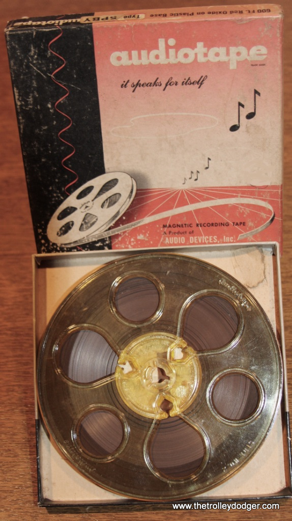
Six years ago, I purchased a couple strips of 35mm Super-XX black-and-white negatives and ran the photos on the blog I had at that time. There was no way to tell the exact date the pictures were taken, but they did contain various clues that helped narrow down the date. I posted the images, and several people guessed as to when they were shot. The consensus that eventually emerged was they were taken between Fall 1952 and Spring 1953. Well, in an act of serendipity, Jeff Wien (by way of Mr. Edward Springer) donated a set of snapshots to me that were made from these same negatives. They are dated December 1952, which is a better answer than we had before. You can see the rest of the photos here.

Pulse Bus Rapid Transit Celebration

Pace launched its Pulse bus rapid transit this week with the Pulse Milwaukee line which runs between Golf Mill in Niles and the Jefferson Park transit center in Chicago. Pace held a celebration event earlier today (August 15th) at Milwaukee and Touhy in Niles featuring speeches by various politicians, agency bureaucrats, and public transit advocates. A new Pulse bus was parked at the event and was available for public inspection, as well as a Pulse bus station with its passenger amenities.
Since you include bus photos on your blog, I have attached several photos of the event. Feel free to post any or all of them. The Pace website has detailed information about the Pulse service.
Ironically, Richmond (VA) has operated a bus rapid transit line for over a year which is very similar, and it’s also called “Pulse”. I don’t know if this is just a coincidence or if there is some connection between them. However, the Richmond line has dedicated bus-only lanes for part of its length, while our line runs in mixed traffic along Milwaukee Avenue.
-Miles Beitler


From the Collections of William Shapotkin:

On June 21, 1958 an eastbound CTA train is in the station at Pulaski Road on the new Congress rapid transit line, then also known as the West Side Subway. Notice how little fencing there was separating the right-of-way from the highway. Eventually, this was replaced by concrete Jersey barriers after numerous vehicle crashes that impacted the “L”. That way, when something hits the fence, it can take a “Jersey bounce.”

On June 21, 1958 a woman enters the new CTA rapid transit station at Pulaski Road on the Congress line, which replaced the Garfield Park “L” the following day. On this day, free rides were given out between Halsted and Cicero Avenues. The fiberglass panels on the sides of the entrance ramp were eventually cut down to allow for better visibility from outside.

A North Shore Line Electroliner on December 28, 1962, less than a month before the end of the line for this interurban.

A new 2000-series CTA train at (I am guessing) the Douglas Park yards at 54th Avenue in Cicero on October 25, 1964.

What I presume is the Douglas Park yard on October 25, 1964.

CTA articulated car set 51 (formerly 5001) found new life on the Skokie Swift after being oddball equipment on other lines, along with its three mates. Here, they are seen on the Swift on October 25, 1964, where they helped provide much-needed capacity in the face of unexpectedly large ridership several months after the new branch line began service.

The date stamped on this slide is April 18, 1964, when demonstration rides were given out on the new CTA Skokie Swift branch line. However, that date may be incorrect, as my understanding is on that day, single car units 1-4 were coupled together and operated as a unit to provide demonstration rides, Regular service began on April 20, 1964. So either the units were uncoupled, or the date is wrong. Here, one of the high-speed cars is lowering its pan trolley, at the point where the line changed from overhead wire to third rail “on the fly.”

On October 25, 1964 a pair of 4000-series “L” cars are seen at the Dempster terminal on the Skokie Swift, presumably on a fantrip.

This picture of the Dempster terminal is dated April 18, 1964, which would have been the very first day people could ride the Skokie Swift.

Line car S-606 at the Dempster terminal on October 25, 1964. Don’s Rail Photos adds, “S-606 was built by Cincinnati in January 1923, #2620, as Chicago North Shore & Milwaukee 606. In 1963 it became CTA S-606 and burned in 1978. The remains were sold to the Indiana Transportation Museum.” Since the museum was evicted from its home, whatever portion of the car that survives has been taken on by another preservation group, in hopes that it can eventually be rebuilt or restored.
The following South Shore Line photos, again courtesy of William Shapotkin, are all dated October 1965 and are from a fantrip.


Here are some classic postcard views, again from the collections of William Shapotkin:


From Jeff Wien and the Wien-Criss Archive:
These pictures of the Illinois Terminal Railroad were taken on July 4, 1950:

Don’s Rail Photos: “1565, Class B, was built at Decatur in 1910. It was sold to Illinois Power & Light Co at Campaign on April 10, 1955. It was acquired by Illinois Railway Museum in 1960.”

IT 270.

IT 273.

Don’s Rail Photos: “276 was built by St Louis Car in 1913. It was air conditioned and the arch windows were covered. It was sold for scrap to Compressed Steel Co on March 13, 1956.”

IT 281.

IT 284.

Don’s Rail Photos: “1201 was built by McGuire-Cummings in 1910 as an express motor with 20 seats at the rear. In 1919 it was rebuilt with a small baggage section at the front and the trucks were changed from Curtis to Baldwin.”

IT 052. This looks like a sleeping car or bunk car and is unpowered.
Again from the Wien-Criss Archive, here are a series of photos taken at the Chicago Aurora & Elgin’s Wheaton Yards, in August 1959 after the line had stopped running even freight service. Several cars were sold to museum interests and moved off the property in early 1962. Everything else was scrapped. It’s possible that these pictures may have been taken by the late Joseph Saitta of New York.


Looking somewhat worse for wear, here is CA&E car 321 as it looked at the Illinois Electric Railway Museum in North Chicago on June 9, 1962. This and the other cars that were saved from the line had been stored outdoors for a few years, and exposure to the elements took their toll. The museum, now just IRM, moved to Union in 1964. (Wien-Criss Archive Photo)
The following pictures, also from the Wien-Criss Archive, are not very sharp, but do show Chicago transit vehicles in September 1953 and May 1954. There are several shots of the temporary ground-level trackage used from 1953 to 1958 by the Garfield Park “L”, during construction of the Congress Expressway. Those pictures were taken at Van Buren and Western. Some of the PCC photos were snapped in the vicinity of Roosevelt Road, which is also where the Greyhound bus picture was probably taken.


Recent Correspondence
We recently asked Andre Kristopans about which Chicago streetcars, including PCCs, were converted to one-man operation in the CTA era. Here’s what he reports:
In 1951, all 83 prewar PCCs to OMC on AFE S14000. At same time, 21 Sedans to OMC (3325,3347-3349,3351-3352,3354-3355,3357,3360-3363,3368,3372,3378-3379,6303,6305,6310,6319) on AFE S14001
However almost immediately 20 postwars 4052-4061,7035-7044 to OMC on S14011
155 older cars 1721-1785,3119-3178,6155-6198 to convertible OMC 1948 on S11381
Some additional info. Of the 169 cars in the three groups listed for one-manning, the following were already gone when the plan was announced:
6 under CSL 1945-47 1738,1754,1770,3133,3170,3176
8 under CTA 1948 1727,1763,3130,3150,3152,3155,3159,6197169 minus above 14 leaves 155 for conversion in 1949
Me: Thanks… and none of the Peter Witts were used in one-man service, right?
Andre: Redone then scrapped replaced by postwars?
Me: Didn’t this have to do with the decision not to one-man 63rd Street? Or was it simply that mixing the Sedans with PCCs would have slowed things down?
Andre: Supposedly one of the aldermen along 63rd pitched a bitch about the sedans after he saw one. Thought they would be “unsafe”. Not sure on what grounds, suspect had to do with center door arrangement. But plan was dropped and sedans scrapped.
Me: Thanks!
Now Available On Compact Disc

RRCNSLR
Railroad Record Club – North Shore Line Rarities 1955-1963
# of Discs – 1
Price: $15.99
Railroad Record Club – North Shore Line Rarities 1955-1963
Newly rediscovered and digitized after 60 years, most of these audio recordings of Chicago, North Shore and Milwaukee interurban trains are previously unheard, and include on-train recordings, run-bys, and switching. Includes both Electroliners, standard cars, and locomotives. Recorded between 1955 and 1963 on the Skokie Valley Route and Mundelein branch. We are donating $5 from the sale of each disc to Kenneth Gear, who saved these and many other original Railroad Record Club master tapes from oblivion.
Total time – 73:14
 [/caption]


RRC-OMTT
Railroad Record Club Traction Rarities – 1951-58
From the Original Master Tapes
# of Discs- 3
Price: $24.99
Railroad Record Club Traction Rarities – 1951-58
From the Original Master Tapes
Our friend Kenneth Gear recently acquired the original Railroad Record Club master tapes. These have been digitized, and we are now offering over three hours of 1950s traction audio recordings that have not been heard in 60 years.
Properties covered include:
Potomac Edison (Hagerstown & Frederick), Capital Transit, Altoona & Logan Valley, Shaker Heights Rapid Transit, Pennsylvania Railroad, Illinois Terminal, Baltimore Transit, Niagara St. Catharines & Toronto, St. Louis Public Transit, Queensboro Bridge, Third Avenue El, Southern Iowa Railway, IND Subway (NYC), Johnstown Traction, Cincinnati Street Railway, and the Toledo & Eastern
$5 from the sale of each set will go to Kenneth Gear, who has invested thousands of dollars to purchase all the remaining artifacts relating to William A. Steventon’s Railroad Record Club of Hawkins, WI. It is very unlikely that he will ever be able to recoup his investment, but we support his efforts at preserving this important history, and sharing it with railfans everywhere.
Disc One
Potomac Edison (Hagerstown & Frederick):
01. 3:45 Box motor #5
02. 3:32 Box motor #5, May 24, 1953
03. 4:53 Engine whistle signals, loco #12, January 17, 1954
04. 4:13 Loco #12
Capital Transit:
05. 0:56 PCC car 1557, Route 20 – Cabin John line, July 19, 1953
06. 1:43
Altoona & Logan Valley:
07. 4:00 Master Unit car #74, August 8, 1953
Shaker Heights Rapid Transit:
08. 4:17 Car 306 (ex-AE&FRE), September 27, 1953
09. 4:04
10. 1:39
Pennsylvania Railroad GG-1s:
11. 4:35 August 27, 1954
12. 4:51
Illinois Terminal:
13. 5:02 Streamliner #300, northward from Edwardsville, February 14, 1955
14. 12:40 Car #202 (ex-1202), between Springfield and Decatur, February 1955
Baltimore Transit:
15. 4:56 Car 5706, January 16, 1954
16. 4:45 Car 5727, January 16, 1954
Niagara, St. Catharines & Toronto:
17. 4:19 Interurbans #83 and #80, October 1954
18. 5:20 #80, October 1954
Total time: 79:30
Disc Two
St. Louis Public Service:
01. 4:34 PCCs #1708, 1752, 1727, 1739, December 6, 1953
Queensboro Bridge Company (New York City):
02. 5:37 Cars #606, 605, and 601, December 31, 1954
03. 5:17
Third Avenue El (New York City):
04. 5:07 December 31. 1954
05. 4:47 Cars #1797, 1759, and 1784 at 59th Street, December 31, 1954
Southern Iowa Railway:
06. 4:46 Loco #400, August 17, 1955
07. 5:09 Passenger interurban #9
IND Subway (New York City):
08. 8:40 Queens Plaza station, December 31, 1954
Last Run of the Hagerstown & Frederick:
09. 17:34 Car #172, February 20, 1954 – as broadcast on WJEJ, February 21, 1954, with host Carroll James, Sr.
Total time: 61:31
Disc Three
Altoona & Logan Valley/Johnstown Traction:
01. 29:34 (Johnstown Traction recordings were made August 9, 1953)
Cincinnati Street Railway:
02. 17:25 (Car 187, Brighton Car House, December 13, 1951– regular service abandoned April 29, 1951)
Toledo & Eastern:
03. 10:36 (recorded May 3-7, 1958– line abandoned July 1958)
Capital Transit:
04. 16:26 sounds recorded on board a PCC (early 1950s)
Total time: 74:02
Total time (3 discs) – 215:03

The Trolley Dodger On the Air
We appeared on WGN radio in Chicago last November, discussing our book Building Chicago’s Subways on the Dave Plier Show. You can hear our 19-minute conversation here.
 Chicago, Illinois, December 17, 1938– Secretary Harold Ickes, left, and Mayor Edward J. Kelly turn the first spadeful of earth to start the new $40,000,000 subway project. Many thousands gathered to celebrate the starting of work on the subway.
Order Our New Book Building Chicago’s Subways

There were three subway anniversaries in 2018 in Chicago:
60 years since the West Side Subway opened (June 22, 1958)
75 years since the State Street Subway opened (October 17, 1943)
80 years since subway construction started (December 17, 1938)
To commemorate these anniversaries, we have written a new book, Building Chicago’s Subways.
While the elevated Chicago Loop is justly famous as a symbol of the city, the fascinating history of its subways is less well known. The City of Chicago broke ground on what would become the “Initial System of Subways” during the Great Depression and finished 20 years later. This gigantic construction project, a part of the New Deal, would overcome many obstacles while tunneling through Chicago’s soft blue clay, under congested downtown streets, and even beneath the mighty Chicago River. Chicago’s first rapid transit subway opened in 1943 after decades of wrangling over routes, financing, and logistics. It grew to encompass the State Street, Dearborn-Milwaukee, and West Side Subways, with the latter modernizing the old Garfield Park “L” into the median of Chicago’s first expressway. Take a trip underground and see how Chicago’s “I Will” spirit overcame challenges and persevered to help with the successful building of the subways that move millions. Building Chicago’s subways was national news and a matter of considerable civic pride–making it a “Second City” no more!
Bibliographic information:
Title Building Chicago’s Subways
Images of America
Author David Sadowski
Edition illustrated
Publisher Arcadia Publishing (SC), 2018
ISBN 1467129380, 9781467129381
Length 128 pages
Chapter Titles:
01. The River Tunnels
02. The Freight Tunnels
03. Make No Little Plans
04. The State Street Subway
05. The Dearborn-Milwaukee Subway
06. Displaced
07. Death of an Interurban
08. The Last Street Railway
09. Subways and Superhighways
10. Subways Since 1960
Building Chicago’s Subways is in stock and now available for immediate shipment. Order your copy today! All copies purchased through The Trolley Dodger will be signed by the author.
The price of $23.99 includes shipping within the United States.
For Shipping to US Addresses:
For Shipping to Canada:
For Shipping Elsewhere:
 Redone tile at the Monroe and Dearborn CTA Blue Line subway station, showing how an original sign was incorporated into a newer design, May 25, 2018. (David Sadowski Photo)
Help Support The Trolley Dodger

This is our 236th post, and we are gradually creating a body of work and an online resource for the benefit of all railfans, everywhere. To date, we have received over 539,000 page views, for which we are very grateful.
You can help us continue our original transit research by checking out the fine products in our Online Store.
As we have said before, “If you buy here, we will be here.”
We thank you for your support.
DONATIONS
In order to continue giving you the kinds of historic railroad images that you have come to expect from The Trolley Dodger, we need your help and support. It costs money to maintain this website, and to do the sort of historic research that is our specialty.
Your financial contributions help make this web site better, and are greatly appreciated.


