West Towns Streetcars in Color

One of our readers writes, "The 141 crossing the IHB tracks at Oak Street in LaGrange Park. The car is headed westbound, the train is southbound, possibly entering the sidings that are just south of Oak. The trolley turned south and paralleled the IHB down to the CB&Q tracks where it turned west along Hillgrove. The home under construction in the background is the second or third house north of Oak on the west side of Beach." (Or, perhaps the steam train is backing up and the trolley waited for it to clear the crossing, based on the lingering smoke near the streetcar.)

One of our readers writes, “The 141 crossing the IHB tracks at Oak Street in LaGrange Park. The car is headed westbound, the train is southbound, possibly entering the sidings that are just south of Oak. The trolley turned south and paralleled the IHB down to the CB&Q tracks where it turned west along Hillgrove. The home under construction in the background is the second or third house north of Oak on the west side of Beach.” (Or, perhaps the steam train is backing up and the trolley waited for it to clear the crossing, based on the lingering smoke near the streetcar.)

The Chicago & West Towns, while not an extremely large streetcar operator, played an important role in the development of many of Chicago’s western suburbs in the first half of the 20th century. You can see a map of the West Towns car lines here, and a list of important dates in its operations here.

Central Electric Railfans’ Association put out the best and most comprehensive history of the West Towns in 2006, and you can read more about it here.

We have written about the Chicago & West Towns Railways before on the CERA Members Blog (see these posts here and here) but nearly all those photos were in black-and-white. Since streetcar service was abandoned in April 1948, color pictures are scarce.

Color film was expensive in 1948, and most fans did not have a 35mm camera to shoot it with. So we can be thankful for those railfans who did have the wherewithal to shoot Kodachrome slides, which give us an idea of what life was like in an earlier and simpler time.

Today we offer you rarely seen color pictures of West Towns streetcars. Even better, several of them show car 141, the sole survivor of the fleet. You can read about how this car was preserved and lovingly restored here. The Electric Railway Historical Society bought the car body in 1959, after it had been used as a storage shed, and donated it to the Illinois Railway Museum in 1973. You can ride that car at the museum.

While we are not sure of all the exact locations in these images, most of them seem to be on the line that ran between LaGrange and Cicero. Perhaps our keen-eyed readers can help identify some of these areas.

In a few cases, we have presented “then and now” photos, so you can see that while a lot has changed in the nearly 70 years that trolleys have been gone, but there are still a few things that remain from the old days.

When the Chicago Transit Authority was just getting started, they looked into the possibility of purchasing the West Towns, and I believe they entered into negotiations, but it never happened. The West Towns completed its conversion to buses in 1948 and remained a private operator until 1981. These services are operated today as part of the Pace suburban bus system.

-David Sadowski

The corner of Lincoln and Beach as it looks today in LaGrange Park. Lincoln ends in a cul-de-sac near the railroad tracks at rear. We are not far from where image 471 was taken.

The corner of Lincoln and Beach as it looks today in LaGrange Park. Lincoln ends in a cul-de-sac near the railroad tracks at rear. We are not far from where image 471 was taken.

Chicago & West Towns Railways car 112 heads south at Harlem and Cermak on August 17, 1947.

Chicago & West Towns Railways car 112 heads south at Harlem and Cermak on August 17, 1947.

If the building at right is a car barn, this may be Harlem and Cermak. If so, car 112 would be turning east onto Cermak.

If the building at right is a car barn, this may be Harlem and Cermak. If so, car 112 would be turning east onto Cermak.

This may show the 111 heading west, preparing to cross First Avenue to reach the Brookfield Zoo.

This may show the 111 heading west, preparing to cross First Avenue to reach the Brookfield Zoo.

The 159 may be on on the LaGrange line, heading east towards Cermak and Kenton.

The 159 may be on on the LaGrange line, heading east towards Cermak and Kenton.

The 111 at the Brookfield Zoo parking lot.

The 111 at the Brookfield Zoo parking lot.

The 141 somewhere along the route between LaGrange and Cermak Road.

The 141 somewhere along the route between LaGrange and Cermak Road.

The corner of Lincoln and Blanchan in Brookfield as it looks today. This is the approximate location of image 466.

The corner of Lincoln and Blanchan in Brookfield as it looks today. This is the approximate location of image 466.

The apartment building at 9436 Lincoln in Brookfield. It can be seen in image 466 to the right of the West Towns streetcar.

The apartment building at 9436 Lincoln in Brookfield. It can be seen in image 466 to the right of the West Towns streetcar.

This house is visible in image 466. Our approximate location is 3528 Cleveland in Brookfield.

This house is visible in image 466. Our approximate location is 3528 Cleveland in Brookfield.

The 141 at Cermak and Kenton, the border between Cicero and Chicago. Here riders could change to the Chicago Surface Lines route 21 streetcar for points east. In the background, we see the Western Electric plant.

The 141 at Cermak and Kenton, the border between Cicero and Chicago. Here riders could change to the Chicago Surface Lines route 21 streetcar for points east. In the background, we see the Western Electric plant.

Car 128 near Cermak and Kenton.

Car 128 near Cermak and Kenton.

Cermak and Kenton as it looks today.

Cermak and Kenton as it looks today.

The 141 may be heading east, crossing the Illinois Central near 26th and Harlem. The streetcar briefly diverted from the roadway to make this crossing.

The 141 may be heading east, crossing the Illinois Central near 26th and Harlem. The streetcar briefly diverted from the roadway to make this crossing.

This shows where the West Towns crossed the Illinois Central near 26th and Harlem.

This shows where the West Towns crossed the Illinois Central near 26th and Harlem.

Car 128 in zoo service, heading south on Woodside at 31st in Riverside. Further north, this street becomes DesPlaines Avenue.

Car 128 in zoo service, heading south on Woodside at 31st in Riverside. Further north, this street becomes DesPlaines Avenue.

DesPlaines and 31st as it looks today, looking north. The West Towns streetcar ran where the grassy median is today, and continued a few blocks further south, before turning west to cross the DesPlaines River and First Avenue before reaching the Brookfield Zoo.

DesPlaines and 31st as it looks today, looking north. The West Towns streetcar ran where the grassy median is today, and continued a few blocks further south, before turning west to cross the DesPlaines River and First Avenue before reaching the Brookfield Zoo.

This may be Harlem and Cermak, looking north, with the car barn to the left.

This may be Harlem and Cermak, looking north, with the car barn to the left.

I believe this view looks to the northeast along Woodside in Riverside, between 26th and 31st.

I believe this view looks to the northeast along Woodside in Riverside, between 26th and 31st.

The 141 heading west, crossing Salt Creek.

The 141 heading west, crossing Salt Creek.

An aerial view showing where the West Towns crossed the DesPlaines River (just north of Park Place).

An aerial view showing where the West Towns crossed the DesPlaines River (just north of Park Place).

Car 126 at an unidentified location.

Car 126 at an unidentified location.

The Chicago World’s Fair, by Streetcar

In this Chicago Surface Lines brochure, visitors were encouraged to see Chicago by streetcar, trolley bus, and, apparently, Zeppelin.

In this Chicago Surface Lines brochure, visitors were encouraged to see Chicago by streetcar, trolley bus, and, apparently, Zeppelin.

Chicago’s second World’s Fair took place in 1933 and 1934, and celebrated “A Century of Progress” since the city’s founding. Coming, as it did, in the depths of the Great Depression, this was a bold (and successful) venture, under the able leadership of Lenox Lohr (1891-1968). Chicago’s fair made a profit, while the later 1939-40 New York World’s Fair lost money.

Getting the 48,469,227 fair visitors back and forth to the lakefront site was a tremendous undertaking, and the Chicago Surface Lines played an important role. The fair opened on May 27, 1933, and it quickly became apparent that transportation needed improvement.

Two streetcar line extensions, among the last ones in Chicago, were hurriedly undertaken. The Roosevelt Road extension was the more elaborate of the two, since there were more obstacles in its path, namely the Illinois Central train station and tracks. The IC tracks were below grade, since they were built at the original ground level Downtown, which was raised several feet after the 1871 Chicago Fire.*

Chicago’s new Mayor Edward Joseph Kelly (1876-1950) took the controls of the first streetcar over the viaduct on August 1st, and posed for a good many press photos along the way. The two line extensions, from Roosevelt and Cermak, were retained for about 20 years, and continued to serve the Field Museum, Shedd Aquarium, Adler Planetarium, and Soldier Field. They both had turnaround loops, to permit the use of single-ended as well as double-ended cars.

CSL had two modern experimental streetcars built, and used them to shuttle visitors to and from the fair. Of the two, at least part of car 4001 has survived to this day, while 7001 was perhaps more influential on the eventual design of the highly successful PCC cars, starting in 1936. The general configuration of this single-ended car, and its door arrangement, were followed on Chicago’s 683 PCCs.

Today, we present a Chicago Surface Lines brochure touting their service to the World’s Fair and all parts of Chicago. Along with this, we have some additional photos showing the Roosevelt Road extension. You can find some additional pictures of this operation in later days in one of our earlier posts. There is also a photo showing car 7001 on State Street in 1934, in World’s Fair service.

After the CTA converted the Roosevelt Road streetcar line to bus, the extension to the “Museum Loop” operated as a shuttle between August 12, 1951 to April 12, 1953, when it was abandoned, and eventually demolished. There’s a picture of the route 12A shuttle operation on the CERA Members Blog, here. (The same blog also shows the last known picture of car 7001, shortly before it was scrapped in 1959.)

The last route 21 – Cermak streetcar ran on May 30, 1954.

PCCs occasionally did run to the Museum Loop during special events, for example, on April 26, 1951, when General Douglas MacArthur (1880-1964) made a personal appearance after his dismissal by President Harry S Truman. You can read more about that historic event here.

Northerly Island, the site of A Century of Progress, was built on landfill. After the fair, it was used as Meigs Field, an airport for small planes, from 1948 to 2003.

Now that planning is underway for the Lucas Museum of Narrative Art to be built in the “Museum Campus” area, various ideas have been floated for improving transit in this area. These proposals include a streetcar line.

So, when it comes to Chicago’s lakefront, what goes around may yet come around- especially if it’s a streetcar.

-David Sadowski

*This is approximately correct.  It would be difficult to determine what “ground” level truly was when the City was first settled, since Chicago was built on a swamp.  Ground level was raised 10 feet downtown in the 1860s to permit the easy installation of a sewer system, and there have been numerous additions via landfill, especially east of Michigan Avenue, which was originally the shoreline. You would apparently have to go as far south as Jackson Park before the Lake Michigan shoreline is in its pre-development location.

For more information, go here.

1939-40 New York World’s Fair

Capture32

It’s worth mentioning that when New York put on their World’s Fair in 1939-40, they built a rapid transit extension of the IND subway system to reach the south end of the site. This operation was called the World’s Fair Railroad, and required payment of a second 5-cent fare. This branch line was constructed at a cost of $1.2m.

This extension ran partly through Jamaica yard, and went 8,400 feet beyond it, for a total length of just under two miles.

The privately owned BMT and IRT subway/elevated systems shared service on what is now the 7 line, and fairgoers could get there via the Willets Point station, which now serves Citi Field, home of the New York Mets. The regular fare was charged, and these trains reached the north end of the site.

The Long Island Rail Road opened a station along their line adjacent to Willets Point, which remains in use today.

After the fair closed, the World’s Fair Railroad spur was dismantled and removed, the only such IND service to suffer this fate. During the course of the fair, New York City took over operation of both the IRT and BMT, unifying the three subway operations under municipal ownership.

No rapid transit extensions were provided for the 1964-65 World’s Fair, which took place on the same location. However, there was a monorail for moving people around within the fair site itself.

A CSL map showing how the Roosevelt Road and Cermak Road streetcar lines were extended to new loops serving A Century of Progress.

A CSL map showing how the Roosevelt Road and Cermak Road streetcar lines were extended to new loops serving A Century of Progress.

The Roosevelt Road extension to the World's Fair site is under construction in this June 24, 1933 view. The Illinois Central station lies between here and what we now call the "Museum Campus."

The Roosevelt Road extension to the World’s Fair site is under construction in this June 24, 1933 view. The Illinois Central station lies between here and what we now call the “Museum Campus.”

From the looks of things, this picture was also taken on June 24, 1933.

From the looks of things, this picture was also taken on June 24, 1933.

It's August 1, 1933. The World's Fair extension along Roosevelt Road is now completed, and Mayor Edward Kelly (posing for pictures) is at the controls of the first service car. Kelly had succeeded Anton Cermak as mayor earlier that year after the latter was assassinated in Miami.

It’s August 1, 1933. The World’s Fair extension along Roosevelt Road is now completed, and Mayor Edward Kelly (posing for pictures) is at the controls of the first service car. Kelly had succeeded Anton Cermak as mayor earlier that year after the latter was assassinated in Miami.

A close-up of the previous scene.

A close-up of the previous scene.

The first service car over the Illinois Central viaduct, with Mayor Kelly at the throttle, in a picture taken at 9:30 am on August 1, 1933.

The first service car over the Illinois Central viaduct, with Mayor Kelly at the throttle, in a picture taken at 9:30 am on August 1, 1933.

An artist's rendering of CSL experimental pre-PCC streetcar 4001, built by Pullman. It entered service in 1934 and was retired in 1944. Its body shell is preserved at the Illinois Railway Museum.

An artist’s rendering of CSL experimental pre-PCC streetcar 4001, built by Pullman. It entered service in 1934 and was retired in 1944. Its body shell is preserved at the Illinois Railway Museum.

An artist's rendering of CSL experimental pre-PCC streetcar 7001, built by Brill. It entered service in 1934 and was retired in 1944. It was scrapped in 1959. Note that the car is signed for Clark-Wentworth, the busiest line on the Chicago system. Ironically, while this design resembles the PCC car of 1936, Brill refused to license the patented PCC technology, and as a result, was driven out of the streetcar market within a five years, after building but a few dozen "Brilliners."

An artist’s rendering of CSL experimental pre-PCC streetcar 7001, built by Brill. It entered service in 1934 and was retired in 1944. It was scrapped in 1959.
Note that the car is signed for Clark-Wentworth, the busiest line on the Chicago system.
Ironically, while this design resembles the PCC car of 1936, Brill refused to license the patented PCC technology, and as a result, was driven out of the streetcar market within a five years, after building but a few dozen “Brilliners.”

A side view of pre-PCC car 7001, showing how the general arrangement of doors was quite similar to that used on the later Chicago PCCs. (CSL Photo)

A side view of pre-PCC car 7001, showing how the general arrangement of doors was quite similar to that used on the later Chicago PCCs. (CSL Photo)

img434

img435

img436

img437

img438

img439

img440

img441

img442

img444

img445

CSL 7001, as it appeared on March 18, 1939.

CSL 7001, as it appeared on March 18, 1939.

Chicago Mayor Edward Kelly presides over the opening ceremonies for A Century of Progress at Soldier Field, May 27, 1933.

Chicago Mayor Edward Kelly presides over the opening ceremonies for A Century of Progress at Soldier Field, May 27, 1933.

1933WF

Skokie Swift: The “True Gen”

A Yellow Line train turns back south of Howard, with Red Line trains in the background.

A Yellow Line train turns back south of Howard, with Red Line trains in the background.

The “True Gen,” in military parlance, means genuine, accurate, useful information, the kind you can stake your life on in wartime.  (It’s also the title of my favorite book about Ernest Hemingway.)

Today, we’ll apply that phrase to the Chicago Transit Authority‘s Yellow Line, aka the Skokie Swift.  More than 50 years after service begin in April 1964, there seems to be a bit of confusion about its origins.  Even the Wikipedia page had some misinformation on it, which we corrected.  (That is both the blessing and the curse of the Wikipedia; but if anyone can come up with a better system, I’d like to know what it is.)

We like our history fresh from the source.  So, here are a couple of newspaper articles with the “true gen” on how the Swift came to be.  They set straight a couple of “factoids” that have made the rounds– that CTA supposedly already owned the right-of-way to Skokie Shops (it didn’t) and that the Swift was dependent on receiving federal aid (it wasn’t).

Not that you can take all newspaper reports as gospel, of course.  You always have to consider the source.  But I think that as far as these articles, go, however, we’re on pretty safe ground.  As one of the original riders that first week, I can assure you that the high-speed “spam cans” did make much of the five mile journey at 60 mph, a thrilling ride indeed.

I’ve supplemented this post with some pictures I took last April 26, when the CTA celebrated a half-century of the Swift, none of which have been published before.  I’ve written about the Skokie Swift before on the CERA Members Blog, and you can find some of those posts here and here.  If you like what you see here, you might want to check those out too.

And that’s the True Gen.

-David Sadowski

Chicago Tribune, August 2, 1963, page 12:

HIGH-SPEED CTA SKOKIE TRANSIT ROUTE PLANNED

Use North Shore Strip to Dempster St.

By Thomas Buck

The Chicago transit authority expects to establish a new high speed, nonstop rapid transit service this fall over a five mile stretch of the abandoned North Shore railroad right of way between the Howard street terminal and Dempster street, Skokie.

Plans for the new rapid transit service were announced by George DeMent, chairman of the CTA, and Walter J. McCarter, the transit authority’s general manager.

“We are still negotiating for the purchase of this five mile section of the North Shore right-of-way, and we are hopeful that these negotiations can be completed in time to create this new service this fall,” said DeMent.

May Seek U.S. Grant

In addition to the North Shore railroad, DeMent said, the negotiations also are being carried on with Commonwealth Edison company, which for many years has owned part of the right of way for power line use.

DeMent also indicated the CTA may seek a grant from the federal government for paying two-thirds of the cost of establishing the new route as a “demonstration project.”

McCarter described the proposed new service to Dempster street, Skokie, as an “excellent opportunity to extend rapid transit into suburban areas where large parking facilities also would be provided for ‘park-and-ride’ patrons of the CTA.”

“We would use high speed cars as single car shuttle trains which could operate for much of the nonstop five mile trip at 60 miles an hour,” said McCarter.  “Our plans call for providing at least 600 parking spaces at the Dempster street station.”

The high speed, one-car trains, McCarter estimated, would cover the five mile trip in eight to 10 minutes, compared with 24 to 25 minutes required for the CTA’s present buses between Dempster street and the Howard terminal.  He also explained that the rapid transit service would be operated only in periods of heavy demand and that the buses would continue operating “around the clock.”

Skokie Votes $17,000

DeMent pointed out that Myron Greisdorf, president of Skokie, and other Skokie village board members have “shown their definite interest by voting $17,000 to help establish the new service.”  No estimate was given on the cost of providing the new rapid transit shuttle service…

Chicago Tribune, October 4, 1963, page 4:

CTA APPROVES PURCHASING OF SKOKIE ROUTE

Total Cost Would Be Two Million

By Thomas Buck

The acquisitions of a five mile stretch of the North Shore railroad right-of-way for a new rapid transit train service between the Howard street terminal and Dempster street, Skokie was authorized yesterday by the board of the Chicago transit authority.

The board acted on a recommendation by Walter J. McCarter, CTA general manager, who reported that a price of 2 million dollars had been negotiated with the North Shore railroad.

Would Pay 1.7 Million

Under a purchase agreement, McCarter said, the CTA would pay 1.7 million dollars of the cost.  The remaining $300,000, he said, is to be paid by Commonwealth Edison company in return for converting its easements into perpetual rights for power transmission lines along the property.

In addition, Commonwealth Edison is to pay the CTA a monthly rental of $700 on the easements for an initial period of two years.  The rental payments, McCarter said, would be used to help cover any operating losses that migth be incurred during a two-year experimental period.

Village Must Agree

“We expect to have this new service in operation within two to three months,” said George DeMent, CTA chairman.  “The plan also is contingent upon a pending agreement with the village of Skokie whereby it would provide parking spaces for at least 400 cars at the Dempster street station.”

DeMent said the CTA also expects to file a request for federal government financial assistance to help pay any operating deficit for the first two years as a “demonstration project.”  Under this plan, the federal government would pay two-thirds of operating losses and the CTA one-third.

Meanwhile, McCarter said the CTA will continue to operate its Skokie bus route which makes local stops in the same general area.

DeMent indicated, however, that the CTA would undertake the project on its own in the event the operation is not accepted by the federal government as an experiment.

McCarter explained that single-car trains, without any intermediate stops, would make the five mile trip in 6 1/2 to 7 minutes.  He said the single cars would be operated at 10 minute intervals from early morning until late evening, but that no late night service would be provided.

The CTA already must acquire half of the five-mile stretch, McCarter explained, because of the necessity to maintain tracks to its shops at 3701 W. Oakton st., Skokie.

DeMent also said that the CTA is studying the costs of using the North Shore right-of-way still further north, possibly to Glenview or Northfield.  However, DeMent said that for any further extensions, the suburbs involved would be asked to pay for right-of-way acquisition and necessary equipment, as well as to guarantee the CTA against operating losses.

Joe Stupar writes:

That is interesting but not surprising about Edison paying a portion. At the time of abandonment, Edison had a non-exclusive lease with the North Shore for the tower line there, dated March 8, 1957. Interestingly enough, that lease was not due to expire until December 31, 2008.

Early abandonment forecasts from the North Shore from 1961 were uncertain whether the CTA would purchase any line at all. They mention construction of a new shop facility at Forest Park. However, by 1963 it appears certain they would purchase the line. Three proposals were prepared, purchase from Howard -> East Prairie Rd (2.75 Miles), Howard -> Dempster St (5 Miles), and Howard -> Glenview Rd (7 Miles). The most expensive section of track was from Howard -> East Prairie Rd, with a book value of $3,896,784, and a suggested selling price of $1,500,000. The scrap value of the North Shore was related to book value, replacement cost, and value of physical infrastructure as scrap. As such, with the many bridges (including channel bridge), this was one of the most expensive sections of track. From East Prairie to Dempster had a book value of $776,334 and a suggested asking price of $500,000; from Dempster to Glenview Rd $548,032, and a suggested asking price of $350,000.

I thought I remembered reading somewhere that part of the reason to operate to Dempster St instead of Glenview Rd was due to car miles, and availability of equipment to operate the service. A 1963 estimate lists annual car miles of 127,500 to Dempster St, and 250,000 to Glenayre.

Another interesting fact is an April 1963 fare comparison. CTA was proposing a 55 cent fare Loop to Dempster, or a 70 cent fare Loop to Glenview. This 55/70 compares to 62/75 on the Milw, 69/81 on the CNW, and 78/86 actual North Shore. The CTA did not propose to sell monthly tickets, but it also lists equivalent monthly fares of 45/51 on Milw, 40/47 on CNW, and 52/56 on North Shore.

There is one other advantage to constructing the line to Dempster St vs East Prairie Rd or Glenview Rd as well. Available land for a parking lot. According to Chicago Tribune articles of the time, the village of Skokie paid to construct a large parking lot at Skokie. Even in 1963, there were a lot of houses near the Glenview station and I don’t know if there would have been room for a parking lot. Same with East Prairie Rd.

Interestingly enough, at one point the North Shore seriously considered selling the right of way from Oakton to Lake Bluff to the CNW. They even went so far as to suggest that the CNW may want to purchase the stations and resume passenger service. I thought this seemed kind of far fetched, but I recently stumbled across a Chicago Tribune article from December 63 / January 64 about a proposed CNW restart of service to Skokie, and possibly Glenview / Northbrook.

There is one other factor that hasn’t been mentioned for going to Dempster St. This is a minor detail, but by going to there, they pick up another substation on the line. If they had only purchased up to East Prairie, the whole line would be fed by the Howard end. I’m not sure if the Skokie substation figures into the value of that portion or not.

I also read another letter written to the editor in December of 63. It was a suggestion that the CTA re-open the stations on the line, since otherwise the trains would just be passing all of the potential riders in the dense areas.

The "fantrip" train at the Dempster terminal.

The “fantrip” train at the Dempster terminal.

The 4000s at Dempster.

The 4000s at Dempster.

The special train at Asbury in Evanston.

The special train at Asbury in Evanston.

An eastbound train of 5000s at the Oakton curve.

An eastbound train of 5000s at the Oakton curve.

The 4000s at East Prairie Road.

The 4000s at East Prairie Road.

Southbound at Oakton.

Southbound at Oakton.

Northbound at Oakton.

Northbound at Oakton.

The 4000s pair southbound at Oakton.

The 4000s pair southbound at Oakton.

Southbound at Main.

Southbound at Main.

Northbound at Main.

Northbound at Main.

Westbound at Ridge in Evanston.

Westbound at Ridge in Evanston.

Eastbound at Ridge in Evanston.

Eastbound at Ridge in Evanston.

Eastbound at Ridge in Evanston.

Eastbound at Ridge in Evanston.

Westbound at Ridge in Evanston.

Westbound at Ridge in Evanston.

The Westchester Branch – What Remains

The IC underpass, looking south.

The IC underpass, looking south.

Following up on our previous post CTA’s Westchester Branch – What Might Have Been, we decided to scout out the old right-of-way, more than 63 years since the last trains ran, to see what we could find.  Fortunately, there are many traces of the old line that are still visible.

For your consideration, we present some modern-day shots of the same locations where “L” trains once ran, both along the CA&E main line and the Westchester branch.  If you ever decide to go exploring, to see these areas for yourself, we hope our efforts will give you a bit of a “leg up” on the work.

Interestingly, one entire half-block where the Harrison station once was, remained vacant land as late as 2011.  This has now been developed, and we have some “before and after” pictures for comparison.

Since there are so few streets that cross the former Westchester right-of-way south of I290, it would appear that some housing was built adjacent to the line even before abandonment in December 1951. The line still being in use would provide a logical reason for keeping new grade crossings to a minimum.

If the CTA Blue Line is ever extended west to Mannheim Road, it would cross the old Westchester right-of-way very close to this spot.  If a station is built there, that would be even more ironic.  Someday you may be able to take a CTA rapid transit train to much the same location that you could in 1951, but not since.

-David Sadowski

You might think that the CA&E followed a straight path to the DesPlaines terminal, but such was not the case. Heading east from First Avenue, where the Illinois Prairie Path ends now, it actually headed southeast before turning east and crossing the DesPlaines River where I290 does today, then connecting with the terminal from the south.

You might think that the CA&E followed a straight path to the DesPlaines terminal, but such was not the case. Heading east from First Avenue, where the Illinois Prairie Path ends now, it actually headed southeast before turning east and crossing the DesPlaines River where I290 does today, then connecting with the terminal from the south.

Approximately the same view as image 194 in our last post (showing a Westchester car heading west, crossing First Avenue). The old Refiner's Pride gas station has long since been replaced by an oil change shop.

Approximately the same view as image 194 in our last post (showing a Westchester car heading west, crossing First Avenue). The old Refiner’s Pride gas station has long since been replaced by an oil change shop.

Looking southeast from First Avenue. The CA&E tracks headed through this area, before turning east to cross the DesPlaines River. There were also some storage tracks in this area, now occupied by Commonwealth Edison.

Looking southeast from First Avenue. The CA&E tracks headed through this area, before turning east to cross the DesPlaines River. There were also some storage tracks in this area, now occupied by Commonwealth Edison.

Looking east from First Avenue. The CA&E right-of-way veered off here to the right, while the Chicago Great Western freight line went straight ahead. Some years ago, a new bridge was built where the CGW crossed the DesPlaines River, for pedestrian and bike traffic.

Looking east from First Avenue. The CA&E right-of-way veered off here to the right, while the Chicago Great Western freight line went straight ahead. Some years ago, a new bridge was built where the CGW crossed the DesPlaines River, for pedestrian and bike traffic.

The Illinois Prairie Path begins at First Avenue in Maywood. We are looking west.

The Illinois Prairie Path begins at First Avenue in Maywood. We are looking west.

We are looking east from 6th Avenue in Maywood, about the same view as seen in image 181 in our previous post (showing the CA&E 5th Avenue station).

We are looking east from 6th Avenue in Maywood, about the same view as seen in image 181 in our previous post (showing the CA&E 5th Avenue station).

The old CA&E right-of-way looking west from 6th Avenue in Maywood.

The old CA&E right-of-way looking west from 6th Avenue in Maywood.

The old CA&E main line, looking west from Madison and 19th.

The old CA&E main line, looking west from Madison and 19th.

Looking east from 25h near Madison, where a former CA&E station was located.

Looking east from 25h near Madison, where a former CA&E station was located.

Looking west from Madison and 25th. Some of the same high tension lines are visible in image 196 in our previous post.

Looking west from Madison and 25th. Some of the same high tension lines are visible in image 196 in our previous post.

The Illinois Prairie Path, at right, follows the right-of-way of the Chicago, Aurora & Elgin interurban.

The Illinois Prairie Path, at right, follows the right-of-way of the Chicago, Aurora & Elgin interurban.

Where the CA&E main line once crossed under the Indiana Harbor Belt RR. Since the railroad was scrapped in 1962, some concrete walls have been erected.

Where the CA&E main line once crossed under the Indiana Harbor Belt RR. Since the railroad was scrapped in 1962, some concrete walls have been erected.

The Westchester line branched off from the CA&E main line near the top of the picture, then curved to the south to fololow a path between Marshall and Bellwood Avenues. This was approximately the location of Mark Drive, which is designated as a street for a short stretch, but is mostly an alley. From Jackson it headed south, and there was a station at Harrison just west of Bellwood Avenue.

The Westchester line branched off from the CA&E main line near the top of the picture, then curved to the south to fololow a path between Marshall and Bellwood Avenues. This was approximately the location of Mark Drive, which is designated as a street for a short stretch, but is mostly an alley. From Jackson it headed south, and there was a station at Harrison just west of Bellwood Avenue.

An exception to the rule that you can follow the right-of-way via the telephone poles. These connect with the ones that follow the Westchester line, but the tracks were actually a bit west of this location on Madison Street (as can be seen in some of our other photos that show the actual location).

An exception to the rule that you can follow the right-of-way via the telephone poles. These connect with the ones that follow the Westchester line, but the tracks were actually a bit west of this location on Madison Street (as can be seen in some of our other photos that show the actual location).

This house can also seen in image 199 in our previous post, in a photo showing a Westchester car crossing Madison Street.

This house can also seen in image 199 in our previous post, in a photo showing a Westchester car crossing Madison Street.

The Westchester line crossed Madison at approximately this spot, where the house in the middle of the picture is now located. From here, the track curved off to run to the west of Bellwood Avenue.

The Westchester line crossed Madison at approximately this spot, where the house in the middle of the picture is now located. From here, the track curved off to run to the west of Bellwood Avenue.

Looking southeast at the old Westchester right-of-way, at Monroe between Bellwood and Marshall Avenues.

Looking southeast at the old Westchester right-of-way, at Monroe between Bellwood and Marshall Avenues.

Along Mark Drive in Bellwood.

Along Mark Drive in Bellwood.

Along Mark Drive in Bellwood.

Along Mark Drive in Bellwood.

Along Mark Drive in Bellwood.

Along Mark Drive in Bellwood.

Along Mark Drive in Bellwood.

Along Mark Drive in Bellwood.

Along Mark Drive in Bellwood.

Along Mark Drive in Bellwood.

Along Mark Drive in Bellwood.

Along Mark Drive in Bellwood.

Along Mark Drive in Bellwood.

Along Mark Drive in Bellwood.

Along Mark Drive in Bellwood.

Along Mark Drive in Bellwood.

Looking north from Van Buren.

Looking north from Van Buren.

Part of the old Westchester right of way has been turned into "Park Place," which appears to be a new street.

Part of the old Westchester right of way has been turned into “Park Place,” which appears to be a new street.

Looking north from Van Buren.

Looking north from Van Buren.

Looking north from Van Buren.

Looking north from Van Buren.

Bellwood Estates.

Bellwood Estates.

Bellwood Estates, as seen from the corner of Bellwood Avenue and Harrison, just north of I290. This development was not here in 2011.

Bellwood Estates, as seen from the corner of Bellwood Avenue and Harrison, just north of I290. This development was not here in 2011.

Bellwood Estates.

Bellwood Estates.

Looking south from Van Buren. The new Bellwood Estates development is at left.

Looking south from Van Buren. The new Bellwood Estates development is at left.

Looking north from Van Buren, the approximate right-of-way of the Westchester branch is now called Park Place.

Looking north from Van Buren, the approximate right-of-way of the Westchester branch is now called Park Place.

Looking south at the old Westchester right-of-way from Van Buren in 2011. The tracks followed the alignment of the telephone poles. This area has been built up since then.

Looking south at the old Westchester right-of-way from Van Buren in 2011. The tracks followed the alignment of the telephone poles. This area has been built up since then.

This 2011 view of the then-empty half block at Harrison and Bellwood, looking much as it had 60 years earlier.

This 2011 view of the then-empty half block at Harrison and Bellwood, looking much as it had 60 years earlier.

Undeveloped land near the old Harrison station, as it appeared in 2011 prior to the construction of Bellwood Estates.

Undeveloped land near the old Harrison station, as it appeared in 2011 prior to the construction of Bellwood Estates.

Bellwood and Harrison in 2011, before the construction of Bellwood Estates.

Bellwood and Harrison in 2011, before the construction of Bellwood Estates.

After crossing where I290 is today, the Westchester branch headed south and ran alongside the eastern edge of what is now Gladstone Park. The line went under the Illinois Central tracks and there was a station at Roosevelt Road, along with a couple of storage tracks.

After crossing where I290 is today, the Westchester branch headed south and ran alongside the eastern edge of what is now Gladstone Park. The line went under the Illinois Central tracks and there was a station at Roosevelt Road, along with a couple of storage tracks.

The right-of-way looking north from Kitchner Street in Westchester, just south of I290.

The right-of-way looking north from Kitchner Street in Westchester, just south of I290.

Grace Central Church on Kitchner Street in Westchester, some of the construction that has built up in the area since 1951.

Grace Central Church on Kitchner Street in Westchester, some of the construction that has built up in the area since 1951.

Looking south from Kitchner Street.

Looking south from Kitchner Street.

Looking south from Kitchner Street.

Looking south from Kitchner Street.

In places, it is only possible to follow the path of the old right-of-way via telephone poles.

In places, it is only possible to follow the path of the old right-of-way via telephone poles.

Looking south from Kitchner Street in Westchester.

Looking south from Kitchner Street in Westchester.

Looking north from the IC underpass.

Looking north from the IC underpass.

A dirt road passes under the partly filled-in Illinois Central underpass. We are looking south.

A dirt road passes under the partly filled-in Illinois Central underpass. We are looking south.

The Illinois Central underpass, as viewed from the south.

The Illinois Central underpass, as viewed from the south.

The partially filled-in underpass that once took Westchester trains under the Illinois Central.

The partially filled-in underpass that once took Westchester trains under the Illinois Central.

Here, the line continued to run south between Balmoral Avenue and Westchester Boulevard.

Here, the line continued to run south between Balmoral Avenue and Westchester Boulevard.

Finally, heading south past the station at Canterbury, the line curved to the southwest, following the general alignment of Balmoral Avenue until ending just short of Mannheim and 22nd. Insull planned for eventual extension west from this point to what we now call Oakbrook.

Finally, heading south past the station at Canterbury, the line curved to the southwest, following the general alignment of Balmoral Avenue until ending just short of Mannheim and 22nd. Insull planned for eventual extension west from this point to what we now call Oakbrook.

The #317 Pace bus stops at the exact location of the former Westchester rapid transit station at Canterbury.

The #317 Pace bus stops at the exact location of the former Westchester rapid transit station at Canterbury.

Looking north from Canterbury.

Looking north from Canterbury.

The right-of-way looking south from Canterbury.

The right-of-way looking south from Canterbury.

Near Mannheim and 22nd Street.

Near Mannheim and 22nd Street.

Near Mannheim and 22nd Street.

Near Mannheim and 22nd Street.

Near Mannheim and 22nd Street.

Near Mannheim and 22nd Street.

The Westchester right-of-way near Mannheim and 22nd Street, looking north.

The Westchester right-of-way near Mannheim and 22nd Street, looking north.

A bank now occupies the end of the Westchester line at Mannheim and 22nd Street.

A bank now occupies the end of the Westchester line at Mannheim and 22nd Street.

Bill Shapotkin writes:
It is interesting to see that the idea of looking at the r-o-w (such as the Westchester ‘L’) is not just my own personnel domain anymore. We can still learn a lot about the past by reviewing the remains of the present. (I especially like the before/after photos of the same house on Madison St in Bellwood (shown below).)

Kudos to you, Dave.
A few thoughts concerning the Westchester ‘L’ as it relates to the present-day: Some time ago, a fellow wrote (in a thread to this group) how the Westchester ‘L’ is missed (by the present-day residents) today. Not so — but just how are the residents of the area served today?
PACE #317 (successor to CTA #17) http://www.pacebus.com/pdf/schedules/317sched.pdf operates hourly (thirty minute rush) betw Des Plaines Ave and Balmoral/Canterbury. Service does NOT begin until later in the morning and does NOT run late into the evening. That said, on Weekdays/Saturday, PACE #303/310 http://www.pacebus.com/pdf/schedules/303sched.pdf and http://www.pacebus.com/pdf/schedules/310sched.pdf provide twenty-minute service as far west of 19th Ave — AND there are those two late-night trips (what would otherwise be pull-in trips) that cover the route west along Madison St.
It appears that whatever REAL traffic potential along the route of the ‘L’ is along Madison St — NOT in Bellwood or Westchester.
That said, PACE #301 http://www.pacebus.com/pdf/schedules/301sched.pdf  now provides frequent (thirty minute or better) along Roosevelt Rd on Weekdays/Saturday and forty-five minute service on Sunday. Of course, this also provides service along a route one mile south of Madison St and provides better west-end destinations (Hillside Mall (at least what is left of it), Oakbrook and (on weekdays), points along Roosevelt as far west as Wheaton. Wow! I can recall when this was a weekday-only route (on a sixty-minute headway) betw Des Plaines Ave and Hillside — and did not operate after 7:00 PM.
Further south, PACE #322 http://www.pacebus.com/pdf/schedules/322sched.pdf operates on a thirty-minute headway (Weekdays and Saturday) and hourly on Sunday (Sunday being the only real hours-restrictive  portion of the operation. Like the #301, there are good west-end destinations (Oakbrook and Yorktown).
Sadly, the north-south service of PACE #330 http://www.pacebus.com/pdf/schedules/330sched.pdf has not lived up to (what I believe is) its full potential. If the route served the Midway ‘L’ (instead of Archer/Neva) on its south end and actually served Metra’s MILWW line on a full-time basis (i.e.: served the Franklin Park (instead of the Mannheim) station), it would have a lot more of a following — and the corresponding service levels that the other routes now serving the area now have.
I believe many of us (and I include myself to a certain degree) have rose-colored glasses on when we look at some of the long-gone rail transit services. It appears to me that the present-day routes actually serve the are better — providing service to where people actually live and/or where they want to travel, which sadly the ‘L’ would not be able to do.
Slowly but surely (heavy on the slowly, light on the surely), I am documenting the Westchester ‘L’ and its present-day bus replacement services. Good Lord willing, this documentation will be completed later this year. When completed, the program will be offered to any interested group (such as CERA or OSA) for public viewing.


CTA’s Westchester Branch – What Might Have Been

The "Westchester-Maywood" route, from a 1948 CTA map.

The “Westchester-Maywood” route, from a 1948 CTA map.

This 1943 map shows where the Westchester branch ran.

This 1943 map shows where the Westchester branch ran.

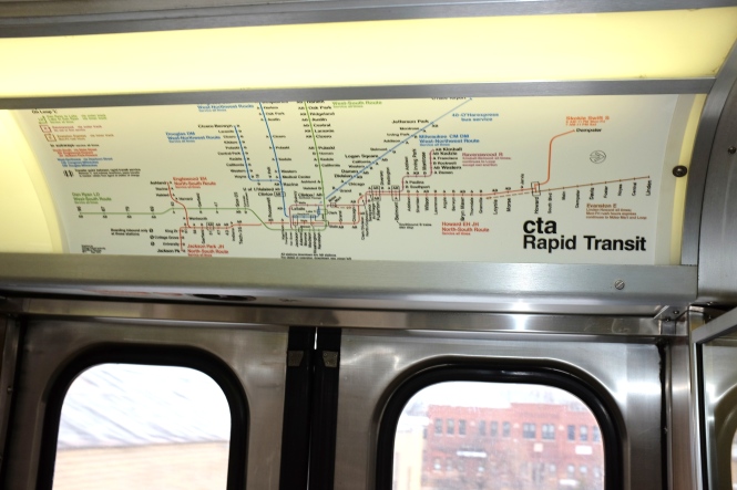
Today’s photo essay features pictures of the former Chicago Rapid Transit/Chicago Transit Authority Westchester branch, which ran from 1926 to 1951. You can find an excellent track map here.  (You can also read our follow-up post, showing what traces of the old line are still visible here.)

It’s always interesting to speculate on what “might have been,” especially in the case of the Chicago, Aurora & Elgin, whose trains ran from 1902 to 1957 in Chicago’s western suburbs. What could have been saved? What should have been saved?  And, what can we learn today?

As you may know, ultimately nothing was saved, except the portion between DesPlaines Avenue and Laramie, which was taken over by the CTA in the early 1950s. That operates today as the outer portion of the Chicago Transit Authority‘s Forest Park branch of the Blue Line.

Speculation usually centers on whether the entire railroad could have been saved, bought by the State of Illinois, or at least, the portion to Wheaton. But in general, this section, the most viable part of the interurban, ran parallel to the Chicago & North Western‘s West Line, which continues to operate today under the aegis of Metra.

The State of Illinois made an offer to buy CA&E in 1956, and then backed out of the deal for various reasons. The only public entity that could have operated any portion of the railroad would have been the CTA, and yet their operating area was limited to most of Cook County.

Still, the CTA did some engineering studies.* In the short run, the idea was to put third rail shoes on some of the remaining PCC streetcars, and run a shuttle service between Forest Park and Wheaton. Just as with the CA&E operations between 1953-57, this would not have been a “one-seat ride” to the Loop.  (Some say these studies were made to demonstrate the impracticality of CTA actually doing it.)

In the long run, CTA would have ordered more new rapid transit cars, high speed versions of the single car units 1-50 that were built in 1960. These type of cars would also have been used if the CTA had been able to take over larger portions of the North Shore Line than the five miles that became the Skokie Swift (today’s Yellow Line) in 1964.

In retrospect, the opening of the Congress (now Eisenhower) expressway would have depressed ridership, so there is no way of knowing if such a CTA shuttle service would have been successful. But there was no way to pay for it, in the political context of the time, and therefore these plans were unrealized. But, if it had happened, most likely such a service would today be a treasured part of Chicagoland’s transit infrastructure.

But if we go back a little further in time, incredibly, there was rapid transit service operated by the CTA that ran to Mannheim and 22nd Street as late as 1951. This was the 5.6 mile long Westchester branch, a victim of budget cuts and expressway construction.

The Westchester branch was part of an ambitious mid-1920s Insull plan to create a high-speed CA&E bypass, similar to the North Shore Line’s Skokie Valley Route. However, there was less of a need for it, and by the time the Depression hit and Samuel Insull‘s empire collapsed, only 2.2 miles of it had been built off the CA&E main line, and local service was being provided by the Chicago Rapid Transit Company.

The Depression also put a stop to the pace of housing development in Bellwood and Westchester, as it had in Niles Center, where the CRT ran local service in a similar fashion. The “build it, and they will come” strategy was not unusual at the time, and had been successfully followed some years earlier when rapid transit service was extended to the Ravenswood neighborhood.

With the CRT in receivership, things remained “status quo” until the creation of the Chicago Transit Authority, which took over operations on October 1, 1947. In these heady early days, it was thought that modernization would reaped quick benefits, and there were efforts by the CTA to improve service to outlying areas, with the creation of extension bus lines and express buses.

Within a few years, however, there was nothing but red ink, and without taxing authority, the cash-strapped CTA had no choice but to cut unprofitable services wherever possible. The lightly-used Westchester branch was an obvious target for elimination, since CTA was a tenant, paying rent to the CA&E, who owned the tracks.

From CTA’s point of view, they saved money by eliminating rapid transit service west of DesPlaines Avenue, and tried to retain whatever ridership was there with replacement bus service, creating the #17 route, which continued to run for decades (and has now been completely replaced by parallel Pace suburban bus service, the #317).

Expressway construction was also a factor. The CA&E and CTA shared each other’s tracks, and compensated each other in turn. By the early 1950’s, these payments totaled about $250,000 per year and largely cancelled each other out. But a 2.5 mile section of the CTA’s Garfield Park/Met “L” would need to be relocated for five years, since it ran smack dab in the middle of where the Congress expressway would be built.

After nearly 50 years of joint operation on Chicago’s west side, coordinating the plethora of daily CTA and CA&E trains was difficult at best, and required near split-second timing. Schedules were complicated and there were various passing sidings, where expresses would be routed ahead of locals.

The CTA (and the City of Chicago’s) original idea for relocating Garfield service was for a wooden “L” structure along Van Buren Street. Presumably this grade separated service would have been fine with the CA&E, but the local alderman objected, and rather than face a lawsuit, which would have delayed the project, the City Council turned to Plan B– grade level rapid transit service, bisected by several cross streets.

This was originally promoted as a “street railway” service, which may be how they justified not using crossing gates. At first, it was thought that overhead wire could be used, but the Met cars did not have trolley poles, and this would have involved shifting around a lot of equipment. So, ultimately, the Van Buren Street temporary trackage used third rail without any more crossing protection than stop lights.

In 1951, CA&E management decided that this plan was unworkable for them, and would cause too many problems for efficient and safe operation. In a letter to their shareholders, CA&E proposed elimination of rail service on the interurban (presumably, freight service would continue), to be replaced by buses that would take riders from the western suburbs to the CTA Lake Street and Douglas Park “L”s.

CTA, for their part, anticipating that CA&E would soon become a bus operator only, began planning for a bus-to-rail transfer point between CA&E and CTA. At first, it was thought this would take place at Central Avenue, a point just west of where CTA’s own rails ended. But by 1953, this transfer point was moved west to DesPlaines Avenue in Forest Park.

Meanwhile, existing bus operators in the western suburbs had successfully blocked CA&E’s plans to substitute bus service for rail. Therefore, they had no real alternative to cutting back rail service to DesPlaines Avenue. This is how service was operated from September 1953 to July 1957. By then, CA&E ridership had been decimated, adn the railroad successfully petitioned to “temporarily” abandon rail service.

The abandonment actually helped facilitate expressway construction near the DesPlaines River, since no temporary service would need to be built. The railroad, in a sense, was still “made whole,” since by 1959 new rails were put in place for a connection to the CTA DesPlaines terminal. These are plainly visible in an aerial view in the 1961 CTA Annual Report, but they were never used, and the CA&E did not resume regular passenger service, and was liquidated in 1961. Attempts to save the interurban were too little, too late, and the suburbs that would have benefited from continuing service refused to contribute with tax revenue.

Between 1948 and 1957, the CTA eliminated about 25% of the rapid transit system it had inherited from CRT. This was mainly by slashing lightly-used branch lines (Stockyards, Kenwood, Humboldt Park, Normal Park, Niles Center, and Westchester). At one point, the CTA even proposed turning over the Evanston branch to the North Shore Line, but this did not happen.

By 1964, it seems the CTA had changed its mind about branch lines, for in April of that year, the phenomenally successful Skokie Swift service began running between Dempster and Howard, over five miles of former CNS&M right-of-way. By this time, some federal funding was available through a pilot program. CTA had to buy half of the Swift trackage anyway, just to access Skokie Shops.

Here, the CTA used fast, frequent service and a large park-and-ride lot to attract riders. And although it scarcely seems possible that the Westchester branch could have been saved in 1951, it would really fill a need today.

Imagine a west side corollary to the Skokie Swift.

By the early 50s, Bellwood and Westchester were prime areas for the postwar housing boom. This is especially true since these areas would soon have access to an important new highway. Growth in Westchester was being held back, however, since the same developer that had owned much of the property since the 1920s wanted to build all the housing themselves, thereby limiting construction somewhat.

After the CTA abandoned the Westchester branch, the CA&E liquidated the property, and the proceeds were distributed to the shareholders, instead of being reinvested in the money-losing railroad. This was the first of CA&E’s large-scale liquidations, where various portions of the railroad were sold to benefit the stockholders.

Getting back to what “might have been,” imagine how well the CTA would be doing today, if it had built a large park-and-ride lot at Mannheim and 22nd Street in the 1950s and kept the Westchester branch. As the area boomed in the mid-1950s, this service would have had tremendous potential.

And while this did not come to pass, the need persists, and something like a replacement for the Westchester branch may still be in CTA’s future. The Illinois Department of Transportation is working on plans for expanding and improving I-290 in the western suburbs, as the Chicago Tribune reported on February 27, 2013:

State transportation officials presented a narrowed list of four proposals that they say will improve travel on the Eisenhower Expressway, all of which include adding a lane to the highway and also extending the CTA Blue Line.

The four proposals, all of which include widening the highway between Austin Boulevard and Mannheim Road, extending the Blue Line to Mannheim and express bus service extending westward from Mannheim, were presented to a community task force. They will be further evaluated by state transportation officials as they study ways to make Interstate Highway 290 more efficient, said a manager of the project, Peter Harmet, bureau chief of programming for the Illinois Department of Transportation.

So, what “might have been,” may still be yet. We shall see.

-David Sadowski

PS- Christopher J. Lemm writes:

After reading your January 2015 story on the CTA Westchester Branch, the picture of the train crossing Madison street in Bellwood brought back some great memories. I grew up in that house, my grandfather was Clarence Lemm, track foreman for the Aurora and Elgin Railroad, he died in 1936. My father followed in grandpa’s footsteps, he worked at CTA 43 years, he started as a clerk and retired as the head of insurance and pensions. When my brother and I were very young my dad would take us for rides on the Aurora and Elgin, he used grandpa’s Sunset Lines employee pin and we all road free of charge. Thank you for some great memories!

According to transit historian Art Peterson:

CTA prepared studies for operation of both the CA&E (from Wheaton to Desplaines Av.) and for the North Shore from the Loop to Waukegan.  The CA&E study was based on use of the pre-War PCCs; for the North Shore it would have been higher-performance rapid transit PCC cars and an A/B service pattern up the Skokie Valley.  Both went no place, for lack of suitable funding sources.  CTA was prepared to accommodate CA&E in the Congress-Dearborn-Milwaukee subway (the west side connection to that opened on June 22, 1958, by which time CA&E was freight only.)

Some knowledgeable sources reported that CTA retained a section of the Humboldt Park Branch after the “L” shuttle service quit running in the E50s, to use as a CA&E turnback/layup facility.  Humboldt Park was the “L” line that ran parallel and to the north of North Avenue, joining the Milwaukee Avenue “L” line at the North/Damen station.

I believe we are looking east near Central Avenue, where the line curved around the south end of Columbus Park. This is approximately where the CTA Blue Line goes through the Lotus Tunnel. A small portion of Columbus Park soon gave way to the Congress (now Eisenhower) expressway.

I believe we are looking east near Central Avenue, where the line curved around the south end of Columbus Park. This is approximately where the CTA Blue Line goes through the Lotus Tunnel. A small portion of Columbus Park soon gave way to the Congress (now Eisenhower) expressway.

An eastbound single car near Central Avenue, at the south end of Columbus Park, now the site of the Eisenhower expressway.

An eastbound single car near Central Avenue, at the south end of Columbus Park, now the site of the Eisenhower expressway.

The passing tracks in this photo are a clue that we are near the Gunderson Avenue station in Oak Park. The Forest Park gas tank is at rear, so we are looking west.

The passing tracks in this photo are a clue that we are near the Gunderson Avenue station in Oak Park. The Forest Park gas tank is at rear, so we are looking west.

Looking west where the rapid transit crossed the B&OCT. Behind the car, the freight line branched off in two directions, to the CGW and Soo Line.

Looking west where the rapid transit crossed the B&OCT. Behind the car, the freight line branched off in two directions, to the CGW and Soo Line.

A pair of Met cars crosses the B&OCT heading east. This has since been grade separated. The gas tank in the background was a Forest Park landmark for many years.

A pair of Met cars crosses the B&OCT heading east. This has since been grade separated. The gas tank in the background was a Forest Park landmark for many years.

Here the the same crossing, but now we are looking east. This is now where I-290 runs through.

Here the the same crossing, but now we are looking east. This is now where I-290 runs through.

CTA 6051-6052 at the DesPlaines Avenue terminal in the 1950s. The Acme Feeds (7715 W. Van Buren) towers at are at the background. Among other things, they sold a product called Acme Worm Bouncer. After being abandoned for many years, the towers caught fire in 1980 and were demolished.

CTA 6051-6052 at the DesPlaines Avenue terminal in the 1950s. The Acme Feeds (7715 W. Van Buren) towers at are at the background. Among other things, they sold a product called Acme Worm Bouncer. After being abandoned for many years, the towers caught fire in 1980 and were demolished.

This is one of my favorite shots. An eastbound single car passes cemeteries in Forest Park, having just crossed over the DesPlaines River. This is the approximate location of the Eisenhower expressway today. The train is curving towards the DesPlaines Avenue station. The iconic gas tank was removed many years ago.

This is one of my favorite shots. An eastbound single car passes cemeteries in Forest Park, having just crossed over the DesPlaines River. This is the approximate location of the Eisenhower expressway today. The train is curving towards the DesPlaines Avenue station. The iconic gas tank was removed many years ago.

An eastbound Westchester car passes by Concordia Cemetery at right, having just crossed the DesPlaines River. This is where the Eisenhower expressway runs today.

An eastbound Westchester car passes by Concordia Cemetery at right, having just crossed the DesPlaines River. This is where the Eisenhower expressway runs today.

This picture presents somewhat of a mystery. Car 2311, signed for Westchester, is identified as being in Maywood on July 21, 1934, with a 4000-series car behind it. There were some storage tracks east of First Avenue, but I am not sure whether CRT used these. Or perhaps these cars are near DesPlaines Avenue.

This picture presents somewhat of a mystery. Car 2311, signed for Westchester, is identified as being in Maywood on July 21, 1934, with a 4000-series car behind it. There were some storage tracks east of First Avenue, but I am not sure whether CRT used these. Or perhaps these cars are near DesPlaines Avenue.

Here, we are just east of First Avenue, with an eastbound train approaching. You can just make out the sign on the Refiner's Pride gas station behind the car. We are looking northwest. Commonwealth Edison occupies this site today.

Here, we are just east of First Avenue, with an eastbound train approaching. You can just make out the sign on the Refiner’s Pride gas station behind the car. We are looking northwest. Commonwealth Edison occupies this site today.

A westbound Westchester car crosses First Avenue in Maywood. East of here (right), the line ran at an angle before crossing the DesPlaines River. This is where the Illinois Prairie Path starts today. The "Refiner's Pride" gas station at left was part of a chain run by "Montana Charlie" Reid, who also owned a restaurant in Villa Park. An oil change business now occupies the site of the former gas station. Reid also owned Montana Charlie's Flea Market in Bolingbrook, along historic Route 66, which is still in operation.

A westbound Westchester car crosses First Avenue in Maywood. East of here (right), the line ran at an angle before crossing the DesPlaines River. This is where the Illinois Prairie Path starts today. The “Refiner’s Pride” gas station at left was part of a chain run by “Montana Charlie” Reid, who also owned a restaurant in Villa Park.  An oil change business now occupies the site of the former gas station. Reid also owned Montana Charlie’s Flea Market in Bolingbrook, along historic Route 66, which is still in operation.

On December 7, 1958, CA&E wood cars 319 and 320 operated the last passenger train on that venerable railroad as a charter. Here, we are at Fifth Avenue station looking east. After the CTA abandoned the Westchester branch, this station was repainted in CA&E colors, and the interurban took over all service here from 1951-57.

On December 7, 1958, CA&E wood cars 319 and 320 operated the last passenger train on that venerable railroad as a charter. Here, we are at Fifth Avenue station looking east. After the CTA abandoned the Westchester branch, this station was repainted in CA&E colors, and the interurban took over all service here from 1951-57.

While I'm not sure of the exact location, we are looking to the northwest along that portion of the CA&E main line, where it ran parallel to the CGW through Bellwood and Maywood.

While I’m not sure of the exact location, we are looking to the northwest along that portion of the CA&E main line, where it ran parallel to the CGW through Bellwood and Maywood.

We are looking west, with the IHB crossing in the background. 25th Avenue would be behind us, and Madison Street is to our left. Here, the CA&E ran parallel to the CGW. The Illinois Prairie Path runs here now.

We are looking west, with the IHB crossing in the background. 25th Avenue would be behind us, and Madison Street is to our left. Here, the CA&E ran parallel to the CGW. The Illinois Prairie Path runs here now.

A westbound Westchester car passing under the Indiana Harbor Belt. The two lines were grade separated in 1930-31. This is now the site of the Illinois Prairie Path.

A westbound Westchester car passing under the Indiana Harbor Belt. The two lines were grade separated in 1930-31. This is now the site of the Illinois Prairie Path.

A southbound Westchester train crosses Madison Street in Bellwood, where Marshall Avenue begins today. The house at right is still standing. The Bellwood station was just north of here, near where the line merged back into the CA&E main line. We are just west of Bellwood Avenue.

A southbound Westchester train crosses Madison Street in Bellwood, where Marshall Avenue begins today. The house at right is still standing. The Bellwood station was just north of here, near where the line merged back into the CA&E main line. We are just west of Bellwood Avenue.

A northbound train at Harrison Street, with new postwar housing in the background. In the foreground, sidewalks that were already about 20 years old go past an empty lot.

A northbound train at Harrison Street, with new postwar housing in the background. In the foreground, sidewalks that were already about 20 years old go past an empty lot.

Westchester car 2814 heading south at Harrison. A small child in blue jeans waits for the train to pass.

Westchester car 2814 heading south at Harrison. A small child in blue jeans waits for the train to pass.

A southbound single car passes storage tracks just north of Roosevelt Road, which was the original terminal before the line was extended in 1930.

A southbound single car passes storage tracks just north of Roosevelt Road, which was the original terminal before the line was extended in 1930.

A single Westchester car passes under the Illinois Central near the Roosevelt Road station.

A single Westchester car passes under the Illinois Central near the Roosevelt Road station.

A two car train passes under the Illinois Central near the Roosevelt Road station.

A two car train passes under the Illinois Central near the Roosevelt Road station.

Here we see the south end of the Roosevelt Road station.

Here we see the south end of the Roosevelt Road station.

A single car at the Roosevelt Road station.

A single car at the Roosevelt Road station.

Here, we are just south of Roosevelt Road, at the beginning of double track.

Here, we are just south of Roosevelt Road, at the beginning of double track.

We are just south of the Roosevelt Road station looking north. From here to Mannheim and 22nd, it was single track.

We are just south of the Roosevelt Road station looking north. From here to Mannheim and 22nd, it was single track.

The Chicago & West Towns Railways also had some private right-of-way in the western suburbs. Car 160 is shown near LaGrange in December 1945.

The Chicago & West Towns Railways also had some private right-of-way in the western suburbs. Car 160 is shown near LaGrange in December 1945.

PS- You can read more about Acme Worm Bouncer here.  You can also see some additional pictures of the Westchester branch here.

Chicago Streetcars in Black-and-White

CSL 7001 northbound at State and Washington, 1934. This experimental pre-PCC car transported visitors back and forth to A Century of Progress. Note that there are only three stars on the Chicago flag. The fourth star, symbolizing Fort Dearborn, was added in 1939. (CSL Photo)

CSL 7001 northbound at State and Washington, 1934. This experimental pre-PCC car transported visitors back and forth to A Century of Progress. Note that there are only three stars on the Chicago flag. The fourth star, symbolizing Fort Dearborn, was added in 1939. (CSL Photo)

Chicago’s last streetcar ran in 1958, but while they lasted, they were a popular subject for railfan photographers. Today, they are artifacts of a time gone by, of neighborhoods, people, and fashions that were once so commonplace that few people took any special notice of them at the time.

Pictures like these are still coming out of the “woodwork,” and we have taken the opportunity to compile a sampling of them here for your enjoyment. Perhaps they will stimulate your memory if you are old enough to recall some of these times and places firsthand. If you are younger than that, we hope they will pique your curiosity.

If you can help us out with some of the missing locations, information or other trivia about what you see, we look forward to hearing from you with your comments.

-David Sadowski

PS- Clicking on each picture will bring up a larger version in your browser.

CTA 6127 on Kedzie at Catalpa. (Joe L. Diaz Photo)

CTA 6127 on Kedzie at Catalpa. (Joe L. Diaz Photo)

Bob Lalich writes, "CTA 6305 is turning north about to leave the private right of way just south of 94th St and enter the median of Stony Island. The water tank in the right distance was located on the BRC near their South Chicago engine house." (Joe L. Diaz Photo)

Bob Lalich writes, “CTA 6305 is turning north about to leave the private right of way just south of 94th St and enter the median of Stony Island. The water tank in the right distance was located on the BRC near their South Chicago engine house.” (Joe L. Diaz Photo)

(Joe L. Diaz Photo)

(Joe L. Diaz Photo)

(Joe L. Diaz Photo)

(Joe L. Diaz Photo)

CSL 840 on Ravenswood Avenue at Rose Hill Cemetery on the Lincoln route circa 1947.

CSL 840 on Ravenswood Avenue at Rose Hill Cemetery on the Lincoln route circa 1947.

CSL 6200. Bill Shaptokin: "There appears to be an IC suburban station off to the left. This would indicate that the pic is on 75th, 79th, 87th or the east end of 95th." (Joe L. Diaz Photo)

CSL 6200. Bill Shaptokin: “There appears to be an IC suburban station off to the left. This would indicate that the pic is on 75th, 79th, 87th or the east end of 95th.” (Joe L. Diaz Photo)

CSL 5722 on South Chicago northbound at 94th Street. (Joe L. Diaz Photo)

CSL 5722 on South Chicago northbound at 94th Street. (Joe L. Diaz Photo)

CSL 282 crossing the Illinois Central right-of-way in 1940.

CSL 282 crossing the Illinois Central right-of-way in 1940.

CTA 684 at the "Museum Loop," the eastern terminal of Route 12. Lake Shore Drive and the Field Museum are to the right, with the Illinois Central tracks at left.

CTA 684 at the “Museum Loop,” the eastern terminal of Route 12. Lake Shore Drive and the Field Museum are to the right, with the Illinois Central tracks at left.

CSL 5731 at 95th and Ewing on Route 5. (Joe L. Diaz Photo)

CSL 5731 at 95th and Ewing on Route 5. (Joe L. Diaz Photo)

CSL 3231 on State Street, turning westbound onto 59th. (Joe L. Diaz Photo)

CSL 3231 on State Street, turning westbound onto 59th. (Joe L. Diaz Photo)

CSL 1775 in yet another patriotic paint scheme, this time at West Shops in October, 1943. (CSL Photo)

CSL 1775 in yet another patriotic paint scheme, this time at West Shops in October, 1943. (CSL Photo)

CSL 1775 in 1942, sporting the first of three patriotic paint schemes for this car.

CSL 1775 in 1942, sporting the first of three patriotic paint schemes for this car.

CSL 3226 on 67th Street between Oglesby and Stony Island, on the 67-69-71st Street route. (Joe L. Diaz Photo)

CSL 3226 on 67th Street between Oglesby and Stony Island, on the 67-69-71st Street route. (Joe L. Diaz Photo)

CSL 1781 in patriotic garb. (Joe L. Diaz Photo)

CSL 1781 in patriotic garb. (Joe L. Diaz Photo)

CSL 2589 on 134th Street westbound of Indiana. Bob Lalich adds, "CSL 2589 is about to cross a track that led from IC’s Wildwood Yard to the B&OCT and PRR at Riverdale." (Joe L. Diaz Photo)

CSL 2589 on 134th Street westbound of Indiana. Bob Lalich adds, “CSL 2589 is about to cross a track that led from IC’s Wildwood Yard to the B&OCT and PRR at Riverdale.” (Joe L. Diaz Photo)

CSL 536 eastbound on Washington at Franklin in the 1940s, emerging from the tunnel that took streetcars under the Chicago River.

CSL 536 eastbound on Washington at Franklin in the 1940s, emerging from the tunnel that took streetcars under the Chicago River.

Bill Shapotkin says, "This is a W/B car on Harrison St. between Canal and Clinton (that is the main Post Office building in the background). View looks east." (Joe L. Diaz Photo)

Bill Shapotkin says, “This is a W/B car on Harrison St. between Canal and Clinton (that is the main Post Office building in the background). View looks east.” (Joe L. Diaz Photo)

CTA 78 is shown at the east end of the Madison-Fifth shuttle in February, 1954. But wait-- wouldn't car 78 be on the Hammond, Whiting, and East Chicago? In actuality, I think this is car 1781. Perhaps part of the number has fallen off. At left in the background you can see Fohrman Motors, a Chicago car dealer from 1912 to 1979. Three people were killed at the dealership by a disgruntled customer on January 7, 1966. The neighborhood, not far from the construction site for the Congress (now Eisenhower) expressway, is already showing signs of urban decay. We discuss this in our post Some Thoughts on “Displaced” (August 30, 2016).

CTA 78 is shown at the east end of the Madison-Fifth shuttle in February, 1954. But wait– wouldn’t car 78 be on the Hammond, Whiting, and East Chicago? In actuality, I think this is car 1781. Perhaps part of the number has fallen off. At left in the background you can see Fohrman Motors, a Chicago car dealer from 1912 to 1979. Three people were killed at the dealership by a disgruntled customer on January 7, 1966. The neighborhood, not far from the construction site for the Congress (now Eisenhower) expressway, is already showing signs of urban decay. We discuss this in our post Some Thoughts on “Displaced” (August 30, 2016).

CTA 7013 on Wabash Avenue at 14th on August 6, 1954.

CTA 7013 on Wabash Avenue at 14th on August 6, 1954.

CTA 4402 at the Western-Berwyn loop.

CTA 4402 at the Western-Berwyn loop.

CTA 4340 southbound on State Street in 1947.

CTA 4340 southbound on State Street in 1947.

CTA 7143 on Clark Street near Lincoln Park. (Chicago Transit Authority Photo)

CTA 7143 on Clark Street near Lincoln Park. (Chicago Transit Authority Photo)

CSL 4051 is shown with an experimental door arrangement, which was tested on the busy Milwaukee Avenue car line.

CSL 4051 is shown with an experimental door arrangement, which was tested on the busy Milwaukee Avenue car line.

For many years, the Englewood "L" ended at 63rd and Loomis. In 1969, the CTA sensibly extended it a couple blocks west to Ashland, a more logical transfer point.

For many years, the Englewood “L” ended at 63rd and Loomis. In 1969, the CTA sensibly extended it a couple blocks west to Ashland, a more logical transfer point.

img298.tif img297.tif img296.tif img295.tif

A prewar PCC on 63rd Street heading eastbound.

A prewar PCC on 63rd Street heading eastbound.

From the subway entrance, we must be somewhere along the path of either the State or Dearborn-Milwaukee subways,

From the subway entrance, we must be somewhere along the path of either the State or Dearborn-Milwaukee subways,

img291.tif

My guess is this would be 63rd street.

My guess is this would be 63rd street.

img289.tif

Even after the CSL and CRT were merged to from the Chicago Transit Authority in 1947, there remained another privately owned bus operator, the Chicago Motor Coach Company, who operated double-decker buses on some of their routes. CTA purchased the Motor Coach operations in 1952.

Even after the CSL and CRT were merged to from the Chicago Transit Authority in 1947, there remained another privately owned bus operator, the Chicago Motor Coach Company, who operated double-decker buses on some of their routes. CTA purchased the Motor Coach operations in 1952.

In 1933, the Roosevelt Road streetcar was extended over the Illinois Central right-of-way in order to reach the "A Century of Progress" World's Fair and what we now call the Museum Campus.

In 1933, the Roosevelt Road streetcar was extended over the Illinois Central right-of-way in order to reach the “A Century of Progress” World’s Fair and what we now call the Museum Campus.

Chicago had three streetcar tunnels Downtown over the years, but which one is this? Bill Shapotkin: "This pic is the Van Buren St Tunnel -- view looks west across Franklin St. Note the "Met" train in the background:"

Chicago had three streetcar tunnels Downtown over the years, but which one is this? Bill Shapotkin: “This pic is the Van Buren St Tunnel — view looks west across Franklin St. Note the “Met” train in the background:”

CTA’s “Farewell to the 2400s”

The CTA "Farewell to the 2400s" train at Kimball and Lawrence on January 21, 2015.

The CTA “Farewell to the 2400s” train at Kimball and Lawrence on January 21, 2015.

The Chicago Transit Authority’s 2400-series cars first entered service in 1976, shortly before the first Mayor Daley died. For many years, they were workhorses of the fleet, but have experienced a kind of “long goodbye,” to paraphrase the title of a book by Raymond Chandler.

They seemingly had all disappeared from service last summer after a daring robbery, which may have taken advantage of the fact that these were the only remaining “L” cars without security cameras installed. They soon returned for a while, before the CTA announced that their last regular service runs had taken place on October 31, 2014. (Cars 2401-2424 have been retained for work service, as they have been used for perhaps the last 20 years.)

Still, the idea of a final “farewell trip” like the one for the 2200s retirement had a lot of appeal, and it is much to CTA’s credit that they did things up right. The cars that were in the best shape were chosen for a ceremonial last trip in regular service, which took place on January 21, 2015.

You can read the service bulletin for the trip here, and also a CTA handout from the trip, giving the history of the 2400s.

The basic schedule was as follows:

Loop Shuttle Service

We’ll operate a ceremonial late-morning trip on the Loop for those who wish to take part in the celebration.

The train will pick up passengers at about 10:20am at Washington/Wells (Outer Loop/Brown Line side), make two trips around the Loop, then drop off its passengers back at Washington/Wells around 10:50am.

No intermediate stops are scheduled for this ceremonial trip.

Ravenswood Service (All Stop train)

(Brown Line)

The train will make one round trip on the Brown Line between Kimball and the Loop, making all stops.

Use these selected, approximate timepoints as a guide on how to catch the train:

11:55am – Depart Kimball (to Loop)
12:16pm – Depart Fullerton (to Loop)
12:30pm – Depart Washington/Wells (to Kimball)
12:35pm – Depart Adams/Wabash (to Kimball)
12:40pm – Depart Clark/Lake (to Kimball)
12:56pm – Depart Fullerton (to Kimball)
1:17pm – Arrive Kimball

North-South Route (Howard-Englewood All Stop train)

(North Side Red Line & South Side Green Line)

Howard to Ashland/63rd, via Loop ‘L’
The train will make one trip from Howard to Ashland/63rd via the elevated lines and Loop.

The train will make all stops along the Red Line thru Fullerton, the Brown Line thru Merchandise Mart, and then the Green Line from Clark/Lake thru Ashland/63rd.

Use these selected, approximate timepoints as a guide on how to catch the train:

2:45pm – Depart Howard (toward downtown, via Red Line)
3:02pm – Depart Wilson (toward downtown, via Red Line)
3:12pm – Depart Fullerton (toward Loop, via Purple Line routing)
3:26pm – Depart Merchandise Mart (toward Loop, via Purple Line routing)
3:28pm – Depart Clark/Lake (toward Ashland/63rd, via Green Line)
3:35pm – Depart Roosevelt (toward Ashland/63rd, via Green Line)
3:40pm – Depart 35th-Bronzeville-IIT (toward Ashland/63rd, via Green Line)
4:00pm – Arrive Ashland/63rd

 Ashland/63rd to Howard, via State Street Subway

The train will then make one trip from Ashland/63rd to Howard via the State Street Subway—just like the old Englewood-Howard trains used to!

The route will take the train on the Green Line from Ashland/63rd thru 35th-Bronzeville-IIT, then onto the Red Line from Roosevelt thru Howard, making all stops along the way.

Use these selected, approximate timepoints as a guide on how to catch the train:

4:10pm – Depart Ashland/63rd (toward downtown, via Green Line)
4:19pm – Depart Garfield (toward downtown, via Green Line)
4:28pm – Depart 35th-Bronzeville-IIT (toward downtown, then via Red Line)
4:32pm – Train routes into Red Line subway via old incline near 13th St.
4:35pm – Depart Roosevelt subway station (toward Howard, via Red Line)
4:45pm – Depart Clark/Division (toward Howard, via Red Line)
4:52pm – Depart Fullerton (toward Howard, via Red Line)
5:05pm – Depart Wilson (toward Howard, via Red Line)
5:20pm – Arrive Howard

I decided to ride the Ravenswood portion of the journey.  I met the train Downtown and caught up to it on the second of its two trips around the Loop.  However, this was at Adams and Wabash, where the train did not stop.

So, I figured I could potentially get ahead of it by riding the Red Line subway to Belmont and wait fir its arrival.  I boarded the train there, and rode to the Brown Line terminal at Kimball and Lawrence.  By this time, the train was running about 10-15 minutes behind schedule.  (This was not a problem, since the train was making all stops by this time, and could simply function as another regular service train for whoever wanted to ride it.)

We were poised for a quick turnaround at Kimball when unfortunately one car got “tagged” with spray paint and was quickly removed from service.  Two cars were cut out and put in the yard for cleaning, leaving an 6-car train for the trip to the Loop and back.

I rode the train Downtown and got off at Adams and Wabash.  So, while I did not ride on the remainder of the trip, which was to feature the “old” Howard-Englewood routing among other things, I did ride part of the day’s trip.  A fine time was had by everyone on board, and it was great to see so many familiar faces, all paying tribute to railcars that served faithfully and well for so many years, in contrast to others of similar vintage in other cities that did not.

At least in this regard, we got some things right in the 1970s.  The 2400s set the standard for all the CTA railcars that have followed since.  If they are not going to be missed as much as the 2200s, that is probably because even after all these years, they still blended in quite well with today’s equipment.

But, when it comes to transit equipment, that’s what you want- evolution, not revolution.

The “long goodbye” for these cars may not even be over yet, since the CTA may very well keep some of the 2400s for use in charter service, as part of their historical fleet.

Meanwhile, I hope you will enjoy the photos and videos I took that day.

-David Sadowski

The CTA crew did a fantastic job preparing the 2400-series cars for this trip.

The CTA crew did a fantastic job preparing the 2400-series cars for this trip.

Authentic 1976-style system maps were recreated for this special trip.

Authentic 1976-style system maps were recreated for this special trip.

The Ravenswood (today's Brown Line) map as it looked circa 1976.

The Ravenswood (today’s Brown Line) map as it looked circa 1976.

Thanks for the memories.

Thanks for the memories.

The cars were spotlessly clean.

The cars were spotlessly clean.

DSCF3032

Fans mill about at the Brown Line terminal at Kimball and Lawrence.

Fans mill about at the Brown Line terminal at Kimball and Lawrence.

At Kimball and Lawrence.

At Kimball and Lawrence.

Just prior to one car getting "tagged" with spray paint.

Just prior to one car getting “tagged” with spray paint.

Graham Garfield, looking spiffy as usual in his authentic mid-1970s CTA uniform.

Graham Garfield, looking spiffy as usual in his authentic mid-1970s CTA uniform.

2400s interior.

2400s interior.

DSCF3040

Here, half of the 8-car train has been cut out in the yard, to remove the middle two cars (one of which had just been "tagged" with spray paint). Later, two czars were coupled back on to form a 6-car consist while the other two cars were to be cleaned in the yard.

Here, half of the 8-car train has been cut out in the yard, to remove the middle two cars (one of which had just been “tagged” with spray paint). Later, two czars were coupled back on to form a 6-car consist while the other two cars were to be cleaned in the yard.

Waiting for two cars to be recoupled.

Waiting for two cars to be recoupled.

DSCF3052

Fans board the train for its return trip south on the Brown Line.

Fans board the train for its return trip south on the Brown Line.

DSCF3054


52 Years Ago Today…

Car 736 on the Mundelein branch.

Car 736 on the Mundelein branch.

The U.S. lost one of its last electric interurban railways on January 21, 1963, a very cold day indeed, as the Chicago, North Shore & Milwaukee (aka the North Shore Line) stopped running. We thought we would commemorate that fateful anniversary by featuring some rare and seldom-seen photos.  (PS- you can bring up a larger version of each photo by clicking on it.)

I was just 8 years old at the time, and never got the chance to ride the North Shore Line, but I have certainly appreciated it since I was a kid and learned of its demise. Still pictures are fine, but motion pictures have a remarkable ability to bring things from the past back to life.

You too can experience the North Shore Line in motion by attending this Friday’s Central Electric Railfans’ Association program in Downtown Chicago. For further information, go here.

-David Sadowski

According to Don's Rail Photos, loco 453 "was built by General Electric in June 1918, (order) #6903."

According to Don’s Rail Photos, loco 453 “was built by General Electric in June 1918, (order) #6903.”

Electric loco 453 heads up a short freight train.

Electric loco 453 heads up a short freight train.

Silverliner 737 crawls along the bridge just south of the Milwaukee terminal.

Silverliner 737 crawls along the bridge just south of the Milwaukee terminal.

North Shore city streetcar 351 in Milwaukee prior to the abandonment of service on August 12, 1951. Sister car 354 is at the Illinois Railway Museum.

North Shore city streetcar 351 in Milwaukee prior to the abandonment of service on August 12, 1951. Sister car 354 is at the Illinois Railway Museum.

According to Don's Rail Photos, "(Birney) 327 was built by Cincinnati Car Co in December 1922, #2625. It was retired in 1947 and scrapped in April 1948." They were lettered for Chicago & Milwaukee Electric since that was the franchise holder.

According to Don’s Rail Photos, “(Birney) 327 was built by Cincinnati Car Co in December 1922, #2625. It was retired in 1947 and scrapped in April 1948.” It was lettered for Chicago & Milwaukee Electric since that was the franchise holder.

CNS&M 178 heads up a two-car train on Chicago's Loop. The 4000s in the background are heading in the same direction as the North Shore train.

CNS&M 178 heads up a two-car train on Chicago’s Loop. The 4000s in the background are heading in the same direction as the North Shore train.

Cars at Highwood, the North Shore headquarters.

Cars at Highwood, the North Shore headquarters.

A photo stop on one of the many North Shore Line fantrips in later years.

A photo stop on one of the many North Shore Line fantrips in later years.

Silverliner 762 gets flagged through the busy "throat" of the Milwaukee terminal, circa 1960.

Silverliner 762 gets flagged through the busy “throat” of the Milwaukee terminal, circa 1960.

Silverliners at the Milwaukee terminal.

Silverliners at the Milwaukee terminal.

Line car 606 at the Milwaukee terminal. According to Don's Rail Photos, "606 was built by Cincinnati in January 1923, (order) #2620. In 1963 it became Chicago Transit Authority S-606 and burned in 1978. The remains were sold to the Indiana Transportation Museum."

Line car 606 at the Milwaukee terminal. According to Don’s Rail Photos, “606 was built by Cincinnati in January 1923, (order) #2620. In 1963 it became Chicago Transit Authority S-606 and burned in 1978. The remains were sold to the Indiana Transportation Museum.”

Another fantrip train. Perhaps one of our knowledgeable readers can identify the location.

Another fantrip train. Perhaps one of our knowledgeable readers can identify the location.

A "railfan's view" along the Skokie Valley Route.

A “railfan’s view” along the Skokie Valley Route.

Silverliner 738 in the snow.

Silverliner 738 in the snow.

CNS&M 747 heads up a Chicago Limited.

CNS&M 747 heads up a Chicago Limited.

Along the Mundelein branch.

Along the Mundelein branch.

Car 758 heads up a train in 1941.

Car 758 heads up a train in 1941.

Electroliner 801-802 passes Tower 18 on Chicago's Loop.

Electroliner 801-802 passes Tower 18 on Chicago’s Loop.

Perhaps one of our keen-eyed readers can help identify this location.

Perhaps one of our keen-eyed readers can help identify this location.

CNS&M 725 on layover at Roosevelt Road on February 13, 1960, during a heavy snowstorm. (Richard H. Young Photo)

CNS&M 725 on layover at Roosevelt Road on February 13, 1960, during a heavy snowstorm. (Richard H. Young Photo)

A view showing the coupling and diaphragm between Silverliners 415 (dining car) and 768 (coach); special excursion train, Northbrook, February 1960. (Richard H. Young Photo)

A view showing the coupling and diaphragm between Silverliners 415 (dining car) and 768 (coach); special excursion train, Northbrook, February 1960. (Richard H. Young Photo)

CNS&M 237 heads up six multiple unit express motors at Pettibone Yard, North Chicago Junction, February 13, 1960. (Richard H.

CNS&M 237 heads up six multiple unit express motors at Pettibone Yard, North Chicago Junction, February 13, 1960. (Richard H. Young Photo)

CNS&M car 300 on a Central Electric Railfans' Association fantrip. For a few years, prior to WWII, the railroad let the fans use this as a "club car."

CNS&M car 300 on a Central Electric Railfans’ Association fantrip. For a few years, prior to WWII, the railroad let the fans use this as a “club car.”

Another view of CERA club car 300 on an early fantrip on the Shore Line route.

Another view of CERA club car 300 on an early fantrip on the Shore Line route.

Silverliner 768 at the Milwaukee terminal. This slide was processed in January 1963, meaning this could be the last day.

Silverliner 768 at the Milwaukee terminal. This slide was processed in January 1963, meaning this could be the last day.

You've probably seen "first day of issue" stamp covers before, but this is kind of the opposite. Some railfans mailed these commemorative envelopes to themselves on January 21, 1963, the day the North Shore Line finally passed into history.

You’ve probably seen “first day of issue” stamp covers before, but this is kind of the opposite. Some railfans mailed these commemorative envelopes to themselves on January 21, 1963, the day the North Shore Line finally passed into history.