We salute the people of Texas, who are recovering from one of the worst floods in American history. Here is a classic Dallas streetscape from July 31, 1950, showing Dallas Railway & Terminal Co. double-end PCC 612. Don’s Rail Photos says, “612 was built by Pullman-Standard in 1945, #W6699. It was sold as MTA 3334 in 1959 and sold to Trolleyville in 1991. It was transferred to Lake Shore Electric Ry in 2006. It was sold to McKinney Avenue Transit Authority and stored at Illinois Railway Museum in 2010.” I probably rode this car in Boston in 1977 on the Ashmont-Mattapan line. (John D. Koschwanez Photo)
Labor Day weekend is just around the corner, and I for one am thankful for all our reader contributions to this site. Today, we are featuring more great historic photos from Jack Bejna and Larry Sakar.
I hope that you will appreciate their efforts.
On a personal note, we received a few “author’s copies” of Chicago Trolleys this week. For the first time, I could hold the book in my hand.
It has been an honor and a privilege to write this new book. As with any such endeavor, there is always a lot of blood, sweat, toil, and tears involved. But in a sense, what had been my book is now your book. Now that it is finished, it belongs to you, the reader, and the people of Chicago.
I would like to thank all the various people who contributed photos to the book. In particular, numerous images came from the collections of George Trapp, who has so generously shared them with this blog in the past.
Being a very modest person, he did not even ask for an individual “by-line” for each picture, just a “thank you” in the Acknowledgements. But I want to give credit where credit is due. Thanks in large part to George Trapp, Chicago Trolleys is a much better book than would otherwise be the case, for which I am most appreciative.
-David Sadowski
PS- You can save $4 by pre-ordering Chicago Trolleys before Tuesday, September 5th. Right now, as part of our special introductory offer, we are providing free shipping within the United States. The shipping rates for books ordered starting on the 5th will be increased by $4 per book, so get your orders in today. Books will be shipped on or about the September 25th release date.
Recent Correspondence
Jack Bejna writes:
The Fifth Avenue Terminal (original name) was built by the West Side elevated Railroad in 1904 to provide a terminal for rush hour L train traffic. In 1905, the terminal also started hosting trains of the CA&E railroad. In the early days over 100 rush hour trains were common. The terminal had four tracks serving two platforms and was the only downtown Chicago terminal ever used by the CA&E. When the CA&E stopped using the terminal in 1953 because of construction of the Congress Street Expressway and the resulting loss of the CTA Garfield Park elevated line, the terminal was closed and later demolished in 1955.
Photos of the terminal and adjacent tracks are few and far between, and for the most part the quality of the photos is less than what I hoped to find. Never the less, here are a number of Photoshopped images of the terminal, tracks, and trains I was able to find. As an aside, the bridge over the Chicago River (2 parallel spans) was the first Scherzer Rolling Lift Bridge installed anywhere.
The original Wells Street Terminal facade.
The same facade, revised in the late 1920s.
The Wells Street Terminal, street side.
The terminal, looking east.
The north track, looking east.
The south track, looking east.
The four-track terminal, looking east.
The terminal, looking west. 457 and 458 are seen, which means the picture is from 1945-53.
The terminal tracks, looking west.
The terminal tower, looking west.
The terminal tower, looking west.
An eastbound CA&E train enters the terminal.
A westbound train (in the distance) leaves the terminal. The tracks at right connected with the Loop “L” via Van Buren to the south of the terminal.
The Chicago River bridge, which was really two bridges side by side.
An eastbound train crossing the Chicago River.
CA&E 38 heads up a westbound train leaving the terminal.
1950 Speedrail Disaster
The tragic result of a head-on collision between two Speedrail cars on a blind curve on September 2, 1950. Heavyweight cars 1192-1193, at left, ran into lightweight articulated cars 39-40. Ten people were killed and dozens were injured.
Larry Sakar writes:
Saturday, September 2nd marks the 67th anniversary (to the exact day) of the 1950 Speedrail accident during the NMRA convention in Milwaukee. I’ve put together a group of pictures for The Trolley Dodger of and related to that event.
Speedrail founder and president Jay E. Maeder poses with lightweight duplex 39-40 at Hales Corners Hillcrest loop just before starting the return trip to Milwaukee. The NMRA had specifically requested the ex TMER&L 1100 series heavy duplex trains (1180-1199) and that the charter be on the Hales Corners line because both represented a”classic” interurban and interurban line vs. the Waukesha line which was double track and more suburban . Why Maeder would take the tremendous risk of mixing a lightweight train among heavy duplexes was never explained. The car had been repainted by Speedrail employee David Strassman at Maeder’s request the night (9/1/50) before the trip. It featured a striking new application of Speedrail’s orange and maroon colors.
With his train 22 minutes behind schedule , Maeder and his regular motorman assigned to this trip, George Wolter decided to “play it safe” and pull into the Greenwood Jct. siding since they knew the regular southbound run to Hales Corners was on its way. Greenwood Jct. was a siding that had seen almost no use. It was the junction with the 5.5 mile westward extension of the Lakeside Belt Line from Powerton Jct. The Belt line was used to haul coal to the Lakeside power plant in St. Francis, Wi. The connection to the East Troy-Burlington line at Greenwood which was one block south of W. Howard Ave. also made it possible for freight coming from Racine via the M-R-K Milwaukee-Racine-Kenosha Line to the Rapid Transit freight terminal at 10th & St. Paul near the never-completed subway downtown. Here we see car 300 piloted by motorman Tom Burke passing the siding leading to the Belt Line. The photographer was William Wight, a 27 year old employee of the Kalmbach Publishing Co. He did not live to see his photo. He was killed in the crash about 10 minutes later. His camera was recovered from the wreck and the film developed. George Gloff who was a Speedrail employee and was on Maeder’s train gave me this photo. He went on to a very distinguished career as Art Director for Kalmbach Publishing Co.
One question that readers might ask is why, if Maeder and is motorman decided to play it safe by going into a siding, as they were 22 minutes behind schedule, that the fatal crash happened just 10 minutes later?
Larry:
After pulling out of Greenwood Jct. Maeder continued north. He was not planning on stopping at Oklahoma Ave., as he claimed he had been given clearance all the way to West Jct. by the dispatcher. However, Senior motorman John Heberling had the siding lined for Maeder’s train so he had to pull in. Heberling was in charge of training new motorman and had been a long time TMER&L employee. He knew Trip #4 with heavy duplex 1192-93 was due southbound within a few minutes so he thought it best to check with the dispatcher and make sure it was OK for Maeder to proceed. Maeder had a fit, and ordered Heberling to reset the siding and let him out at once! One does not argue with the head of the company if one wants to remain employed there so John did as he was told. No more than 15 seconds after Maeder left he heard the wailing of interurban horns and instantly knew what happened. He looked up at the Nachod signal on the pole across Oklahoma Avenue and saw that it was red. Heberling had no idea that Maeder had received clearance to West Jct. nor did he know that Tennyson had changed Maeder’s orders that all trains call-in from every siding to what he (Tennyson) had set up previous to 9/2 and supposedly had agreed on with Maeder. Those orders called for trains to call-in only if they got into trouble. LeRoy Equitz, motorman of 1192-93 was told this when he stopped at West Jct. But when he stopped at Brookdale siding northbound Tennyson did not tell Maeder he had changed the orders. I think if he had Maeder would have fired him on the spot! So Maeder thought Equitz would wait at West Jct. having been told by the dispatcher that he was on the way north. Unfortunately, Equitz was told only to go by signal indication. Having gotten the white light at West Jct. he headed south. If Maeder had not extended the photo stop at Hillcrest loop in Hales Corners where he arrived behind schedule and despite agreeing that there would be no photo stops northbound then “giving in” when the fans on his train asked for one, he would not have been behind schedule. He didn’t want to disappoint his fellow railfans and model railroaders. So I guess you could say it was a very unfunny comedy of errors that had fatal results. Both Maeder and Tennyson were to blame at least as I see it. Much of this was the “last straw” in the feud that had been going on between them since October of 1949.
This is the wreck site. It was between W. Arthur and W. Cleveland Aves. parallel to S. 100th St. Shrubs, a hill and a curve made it impossible for opposing trains to see each other in time to stop. This is lightweight duplex 45-46. I don’t know who took the picture or if this was before or after 9/2/50.
Heavy duplex 1192-93 coming southbound completely overrode car 39 the lead car on the northbound train which was being operated by Jay Maeder. The motorman of 1192-93 was LeRoy Equitz. Car 39 was demolished for nearly 3/4 its length. It was so badly damaged that it was pushed off the right-of-way along with the rear car car 40 which was not damaged. The 10 fatalities occurred in car 39.
Larry Sakar adds (regarding the picture above):
I’m not sure who those people are rummaging around in the wreck. It’s hard to believe the site wouldn’t have been cordoned off to prevent looting. Perhaps they were police personnel who were rounding up personal belongings. It’s not in any of the pictures I sent you but in some shots of the wreck looking north you see a second heavy duplex behind 1192-93. That is duplex 1184-85 trip #5 from Milwaukee. The passengers aboard that car were told about the accident when they reached West Jct. The train then proceeded slowly toward the wreck site where the able bodied NMRA members got off and walked to the wreck site to lend assistance in the rescue efforts. You know it had to be a horrible sight.
Once all of the trapped injured and dead had been removed from the wreck 1184-85 coupled on to 1193 the rear car on Equitz’s southbound car and tried to pull the wreck apart. It did not succeed. A Wisconsin National Guard tow truck had to pull the wreck apart. 1192-93 was covered with a tarp and hauled down to the Public Service Bldg. in the dark of night. It was initially kept in the back of the building where passengers boarding cars for Waukesha, West Jct. or Hales Corners could not see it. Once all of the investigations were completed it was again transported in the dark of night to the Waukesha Gravel Pit.
1192-93 figured into Speedrail history unwantedly on December 20th, 1950. Two teenaged vandals trespassing at the gravel pit went inside the train. The boys got cold so the geniuses decided they’d warm up by starting a fire in the rear car (1193).. he fire got out of hand and they were lucky to escape the car. The fire gutted 1193. I don’t know if Trustee Bitker pursued criminal charges against them but he certainly should have if he didn’t.
In this Lew Martin photo we see car 40 laying on its side after being pushed off the right-of-way. Lew said he was confronted by a man who identified himself as a “railroad detective” and ordered off the property or he would be arrested.
Two years have passed since the accident and the Speedrail line is being scrapped. Note the ties minus rails. Here we see Lee Brehmer (a friend of former Milwaukee resident Al Buetschle, who saved Milwaukee streetcar 978) at the crash site. holding up one of the doors from car 39. Today, the site has been completely obliterated by the National Ave. on and off ramps of the I-894 freeway.
Traces of Greenwood Jct. still remain. I took the next 4 photos. In this picture I was trying to position myself at the approximate point where the siding and Hales Corners mainline met. In the 66 years since Speedrail was abandoned, a second set of power transmission towers was added on the abandoned r.o.w. and the original towers moved, so trying to find an exact spot can be difficult. To the right you can see where the land comes into the arrow-straight abandoned r.o.w.. So this would have been about where the tracks met. These photos were taken in the 1990’s.
I’ve walked across the r.o.w. toward the western most set of power lines. The car seen passing in the center left background is eastbound on W. Howard Ave.
Looking south toward the junction from W. Howard Ave. The transmission tower in the right center background is at the approximate point where the 2 lines met.
I’m now looking north on the abandoned r.o.w. from the south side of W. Howard Ave.
Other sections of the abandoned Hales Corners line r.o.w. are still very visible. Here you see the crossing of W. Layton Ave. looking south. In the 1930’s a line was built southeast from this point for transporting work crews to the abuilding village of Greendale. The line was dismantled upon completion of construction.
The black truck pulling the trailer is at the approximate spot where the Hales Corners station used to stand. You are looking south along S. 108th St. aka Hwy 100 and the truck is westbound on W. Janesville Rd. Hwy. 100 was widened after the abandonment of Speedrail and its two right-hand northbound lanes occupy the Hales Corners line r.o.w.
One block further south is where interurbans headed for East Troy or Burlington turned onto North Cape Rd. Following the abandonment of the East Troy line in 1939 the line was cut back to a newly constructed loop 1/2 mile west of this point called Hillcrest. No trace of Hillcrest loop exists today. The site is now occupied by a home improvement store.
“Beautiful downtown Hales Corners” in the 1920’s.. This photo courtesy of John Schoenknecht of the Waukesha County Historical Society shows hales Corners in the “Roaring ’20’s”. You are looking west from W. Forest Home Ave. across Highway 100 and up North Cape Rd. The line to Burlington and East Troy comes from the left (southbound) and turns west. In later years the track configuration was changed.
Standing at almost that same spot today, Forest Home Ave. has taken over what was North Cape Rd. Although you can’t see it in this picture a McDonald’s occupies the empty lot seen in the left front of photo 14 and a Culver’s (another fast food chain) occupies the same space directly across the street. The gas station seen in the right center of photo 14 and all of the surrounding buildings are long gone. Their space is now occupied by the south end of a used car lot for a local automobile dealer.
Speedrail lightweight car 39 was smashed for 3/4 the length of the car by heavy duplex 1192-93 in the 9-2-50 fatal accident. Car 40, the rear car of this lightweight duplex was not damaged other than at the articulated joint. The only thing that could be done once rescue and recovery efforts were completed was to shove both halves of 39 & 40 off the embankment and dismantle them on the spot.
This is a much better shot of the intersection of Highway 100 & Forest Home Ave. in the 1990’s. The electric transmission towers are approximately where the TM r.o.w. was but that tower does not match the one in the same spot in the 1920’s photo.
In this photo I’ve moved just a few feet further west to get in more of the curve and the north side of the street. This is an extremely bust stretch of roadway but I’m sure not one motorist had any ideas of what had once run next to those electric transmission towers.
The late Ernie Maragos of Racine, Wisconsin took this photo of Milwaukee & Suburban Transport Corp. streetcar 978 in 1957. The eastbound car has just crossed the Milwaukee River on the bridge in the background and will stop at N. Water St. about a half block out of the picture at left. The large building seen behind the 978 is the Germania Bldg. on the southwest corner of N. Plankinton Ave. and W. Wells St. The domes with what look like spears were meant to simulate German Pith helmets. Due to anti-German sentiment during WW I the owner, Henry Brumder changed the name of the building to the Brumder Bldg. Brumder was a newspaper publisher who printed German language newspapers for Milwaukee’s large German population. The “Germania” name was restored in the 1980’s and the building given a complete renovation. The publishing of newspapers had ended many years before and the former printing press area in the basement was converted to a parking garage for the 4 top executives of Security Savings & Loan Assoc. on the northeast corner of 2nd & Wisconsin (adjacent to where the North Shore city carline ended). I worked for Security S&L for almost 20 years, then went to work for the bank that bought out Security in 1997. The 978 was saved by former Milwaukee resident Al Buetschle for the Wauwatosa Kiwanis Club. When they changed their mind, ownership reverted to him. When he left Milwaukee in 1961 to pursue a job in Northern California the car went to the Mid-Continent Railway Museum in North Freedom, Wi. The group that formed the East Troy Trolley Museum in 1972 – TWERHS, The Wisconsin Electric Railway Historical Society was formed at Mid-Continent and split off in 1967. Mr. Buetschle now resides in Contra Costa County, Ca. 60 miles northeast of San Francisco.
Down Three Dark Streets
I recently watched the 1954 crime drama Down Three Dark Streets, a pretty solid film starring Broderick Crawford, and noticed some interesting shots of the short Pacific Electric subway and the Glendale-Burbank double-end PCCs. This film was released about a year before the line was abandoned.
FBI agents are tailing a gangster’s moll as she tries to shake them on her way to her boyfriend’s hideout. She goes down into the PE subway terminal, gets on one car, switches to another, and then rides out to the end of the line.
In this film, at least, the double-end PCCs have a foghorn, reminding me of the “Blimp” cars. Not sure if this was ture in real life. At one point, an FBI agent refers to the “number three interurban,” although I doubt that the PE called it anything other than the Glendale-Burbank line.
The PCCs are shown really zipping along. Car 5000 is visible. Don’s Rail Photos says: “5000 was built by Pullman-Standard in October 1940, #W6642. It was retired in 1956 and was sold as Ferrocarril Gen Urquiza M.1500 and made modifications in 1959. It was retired in short time.” After having been stored in the samp subway tunnel for three or four years, the PCCs had badly deteriorated even though they were only used in service for about 15 years.
Here are some screen-shots:
Pre-Order Our New Book Chicago Trolleys
On the Cover: Car 1747 was built between 1885 and 1893 by the Chicago City Railway, which operated lines on the South Side starting in April 1859. This is a single-truck (one set of wheels) open electric car; most likely a cable car, retrofitted with a trolley and traction motor. The man at right is conductor William Stevely Atchison (1861-1921), and this image came from his granddaughter. (Courtesy of Debbie Becker.)
We are pleased to report that our new book Chicago Trolleys will be released on September 25th by Arcadia Publishing. You can pre-order an autographed copy through us today (see below). Chicago Trolleys will also be available wherever Arcadia books are sold.
Overview
Chicago’s extensive transit system first started in 1859, when horsecars ran on rails in city streets. Cable cars and electric streetcars came next. Where new trolley car lines were built, people, businesses, and neighborhoods followed. Chicago quickly became a world-class city. At its peak, Chicago had over 3,000 streetcars and 1,000 miles of track—the largest such system in the world. By the 1930s, there were also streamlined trolleys and trolley buses on rubber tires. Some parts of Chicago’s famous “L” system also used trolley wire instead of a third rail. Trolley cars once took people from the Loop to such faraway places as Aurora, Elgin, Milwaukee, and South Bend. A few still run today.
The book features 226 classic black-and-white images, each with detailed captions, in 10 chapters:
1. Early Traction
2. Consolidation and Growth
3. Trolleys to the Suburbs
4. Trolleys on the “L”
5. Interurbans Under Wire
6. The Streamlined Era
7. The War Years
8. Unification and Change
9. Trolley Buses
10. Preserving History
David Sadowski has been interested in streetcars ever since his father took him for a ride on one of the last remaining lines in 1958. He grew up riding trolley buses and “L” trains all over Chicago. He coauthored Chicago Streetcar Pictorial: The PCC Car Era, 1936–1958, and runs the online Trolley Dodger blog. Come along for the ride as we travel from one side of the city to the other and see how trolley cars and buses moved Chicago’s millions of hardworking, diverse people.
Images of Rail
The Images of Rail series celebrates the history of rail, trolley, streetcar, and subway transportation across the country. Using archival photographs, each title presents the people, places, and events that helped revolutionize transportation and commerce in 19th- and 20th-century America. Arcadia is proud to play a part in the preservation of local heritage, making history available to all.
The book costs just $21.99 plus shipping. Introductory Special: Order before September 5, and shipping within the US is included in the price. Shipping to Canada is just $5 additional, or $10 elsewhere.
Please note that Illinois residents must pay 10.00% sales tax on their purchases.
We appreciate your business!
For Shipping to US Addresses:
For Shipping to Canada:
For Shipping Elsewhere:
NEW – Chicago Trolleys Postcard Collection
We are pleased to report that selected images from our upcoming book Chicago Trolleys will be available on September 25th in a pack of 15 postcards, all for just $7.99. This is part of a series put out by Arcadia Publishing. Dimensions: 6″ wide x 4.25″ tall
The Postcards of America Series
Here in the 21st century, when everyone who’s anyone seems to do most of their communicating via Facebook and Twitter, it’s only natural to wax a little nostalgic when it comes to days gone by. What happened to more personal means of communication like hand-written letters on nice stationery? Why don’t people still send postcards when they move someplace new or go away on vacation?
If that line of thinking sounds familiar, then Arcadia Publishing’s Postcards of America was launched with you in mind. Each beautiful volume features a different collection of real vintage postcards that you can mail to your friends and family.
Pre-Order your Chicago Trolleys Postcard Pack today!
For Shipping to US Addresses:
For Shipping to Canada:
For Shipping Elsewhere:
Help Support The Trolley Dodger
This is our 193rd post, and we are gradually creating a body of work and an online resource for the benefit of all railfans, everywhere. To date, we have received over 316,000 page views, for which we are very grateful.
You can help us continue our original transit research by checking out the fine products in our Online Store.
As we have said before, “If you buy here, we will be here.”
We thank you for your support.
DONATIONS
In order to continue giving you the kinds of historic railroad images that you have come to expect from The Trolley Dodger, we need your help and support. It costs money to maintain this website, and to do the sort of historic research that is our specialty.
Your financial contributions help make this web site better, and are greatly appreciated.
This remarkable very early color picture shows NSL Birney car 332 and a variety of interurban cars in Milwaukee. In back, that’s car 300 in fantrip service. It was used by CERA as a club car circa 1939-42, which helps date the photo. Don’s Rail Photos: “332 was built by Cincinnati Car Co in December 1922, #2625. It was retired in 1947 and scrapped in April 1948… 300 thru 302 were built by Jewett in 1909 as mainline coaches. As the steel cars arrived, they were downgraded to local and school tripper service. In 1936 they became sleet cutters. In 1939 300 was turned over to the Central Electric Railfans’ Association as a private car. The ownership remained with the CNS&M, but the maintenance was taken over by CERA. During the war, with many members in service, CERA relinquished control, and the car was scrapped in 1947. 301 and 302 were retired in 1939 and scrapped in 1940.” CERA bulletins of the time say that fantrips, being non-essential travel were not allowed for much of the war, starting in 1942. By the time the war ended, car 300 had been stripped of some parts in order to keep other wood cars running. Several were sold to the Chicago, Aurora & Elgin in 1946. The North Shore Line had decided it no longer wanted to run wood cars in passenger service. Then, the 300 was vandalized and some windows were smashed. It was scrapped by CNS&M.
Today, we continue our look at the great Chicago interurbans* by featuring the North Shore Line. The Chicago, North Shore & Milwaukee last ran on January 21, 1963, just over 54 years ago.
This is widely considered the end of the Interurban Era.
But wait, there’s much more on offer in this, our 175th post. All of today’s black-and-white photos are scanned from the original negatives. This includes an original medium format neg taken by Edward Frank, Jr., which he traded with another collector. I don’t know what became of the rest of his negatives.
CNS&M wooden interurban car 303 in its days as a sleet cutter. Don’s Rail Photos: “303 thru 305 were built by American Car in 1910 and were almost identical. In 1939 they became sleet cutters and were retired and scrapped in 1940.”
CNS&M 704 getting washed at the Milwaukee terminal. Don’s Rail Photos: “704 was built by Cincinnati Car Co in May 1923, #2635.” (Walter Broschart Photo)
The information I received with this negative says that CNS&M 169 is a Special on the Shore Line Route in Wilmette in 1954. On the other hand, one of our long-time readers says this is actually Mundelein terminal on that branch line. Since this is apparently a fantrip car, the Shore Line Route sign may be incorrect. Don’s Rail Photos: “169 was built by Jewett in 1917.”
A not too sharp picture of a southbound train on the Shore Line Route at Wilmette.
Richard H. Young took this picture on June 2, 1960 from the back of a moving North Shore car somewhere near Mundelein. We see a line car at work on the other track. One of our regular readers says that we are looking east toward South Upton tower, with Rt. 176 at left (north).
A close-up of the line car. Not sure whether this is the 604 or the 606.
The same location today.
CNS&M 774 at the Milwaukee terminal. Don’s Rail Photos: “774 was built by Standard Steel Car Co in 1930, It was rebuilt as (a) Silverliner on May 9, 1950.” This photo appears to predate that.
CNS&M 761 at the Milwaukee terminal on May 29, 1950. Don’s Rail Photos: “761 was built by Standard Steel Car Co in 1930. It was modernized in 1949 and rebuilt as Silverliner in October 11, 1957.”
One of the two Electroliners passes a train of older cars in this wintry scene. Not sure of the exact location. The Electroliners entered service in 1941. Don Ross: “The Electroliner in the snow was at North Chicago. I have one similar from a different angle and no snow.” Jerry Wiatrowski: “The picture of the Southbound Electroliner is entering the curve to North Chicago Junction. The photographer is looking Northwest from North Chicago Junction. The bypass line continues South to the left.”
The same location today. We are looking north at about 2225 Commonwealth Avenue in North Chicago, IL. The cross-street, which was 22nd Street, is now Martin Luther King, Jr. Dr.
North Shore steeple cab 459 looks like it is backing up to connect with a couple of stalled cars. The information I got with this negative says this is Cudahy, Wisconsin in April 1954. That is just south of Milwaukee. However, it’s been pointed out to me that this municipality was a couple miles west of the right-of-way and the station in the picture looks more like Waukegan. Don’s Rail Photos: “459 was built by the SP&S in August 1941 as OERy 51. It was purchased by the North Shore in December 1947 and was completed as 459 on November 22, 1948.”
North Shore Birney car 335 in July 1947. Don’s Rail Photos: “335 was built by Cincinnati Car Co in December 1922, #2625. It was retired in 1947 and scrapped in April 1948.” The car is signed for Oklahoma Avenue in Milwaukee.
Car 409 on an early CERA fantrip, which may have been on June 4, 1939. It appears to be coupled to 716. The car at left may be 168. Car 255 is also supposed to have been used on that 1939 fantrip, but at that time, it was a full-length baggage car that had no seats and was often used to move musician’s instruments to and from Ravinia Park. The seats were not put in again until 1942. Don’s Rail Photos: “409 was built by Cincinnati Car in May 1923, #2465, as a dining car motor. In 1942 it was rebuilt as a coach and rebuilt as a Silverliner on March 30, 1955. Since it had no bulkhead between smoking and non-smoking sections, it was our favorite car to be used for meetings of the Milwaukee Division of the Electric Railroaders Association in Milwaukee. The North Shore was very cooperative in making sure that the car was in the location shown on meeting nights.”
I received no information with this negative, but this may show a bunch of North Shore Line cars in dead storage after the 1963 abandonment. Notice the destination sign is missing from combine 254. This car was not saved. Don’s Rail Photos: “254 was built by Jewett in 1917. The seating was changed to 28 on August 26, 1955.”
CNS&M 759 and train at South Upton on June 15, 1947. Don’s Rail Photos: “759 was built by Standard Steel Car Co in 1930. It was modernized in 1949.”
CNS&M 737 at Highwood in 1950. Don’s Rail Photos: “737 was built by Pullman in 1928. It was modernized in 1940 and rebuilt as Silverliner on June 30, 1950.” (Richard S. Short Photo)
CNS&M 739 near Glencoe. The date given is June 21, 1941; however, there was a CERA fantrip the following day, so the date may actually be June 22. The car is signed for charter service on the Shore Line Route. June 22, 1941 was also the day that Hitler invaded the Soviet Union. Don’s Rail Photos: “739 was built by Pullman in 1928. It was modernized in 1940 and rebuilt as (a) Silverliner on August 31, 1950.”
CNS&M 155 is a Skokie Valley Route Special at North Chicago on April 17, 1952. Don’s Rail Photos: “155 was built by Brill in 1915, #19605. It was damaged by fire at Highwood on August 11, 1955, and scrapped. One end from it was used to repair 735.”
South Shore Line
The other great Chicago interurban, of course, is the South Shore Line, which continues to operate between Chicago and South Bend, Indiana. We have just a couple vintage photos to show you today, but are sure to have more soon.
CSS&SB car 1 heads up a train at Randolph Street in downtown Chicago in 1946. Don’s Rail Photos: “1 was built by Pullman in 1926. It was later air-conditioned. It went to National Park Service in 1983 and (was) loaned to (the) Southern Michigan RR.” Spence Ziegler says, “The photo of CSS&SB #1 was more likely 1950-52; I have a slide from the Interurbans Slide set from 1983 showing #1 leaving Kensington in 1949 (on the rear of a train) still with the destination sign and train number sign on it’s end, though both were disused. Bill Wasik: “The CSS&SB car 1 at Randolph Street in downtown Chicago photo dated 1946 instead likely was taken between July 1952, when the giant Pabst sign on Randolph was dismantled, and mid-1953, when steel going up for the Prudential Building would have been visible in this view.”
CSS&SB freight motor 903 at Michigan City on July 17, 1956. Don’s Rail Photos: “903 was built by Baldwin-Westinghouse in September 1929, #61047, as IC 10001. It became CSS&SB 903 in July 1941.”
Chicago & West Towns Railways
The Chicago & West Towns Railways operated streetcars in Chicago’s western suburbs. But a 1942 Chicago guidebook referred to it as an “interurban,” probably referring to its longest and busiest line, which ran from Cicero to LaGrange and had sections of private right-of-way. Starting in 1934, it went to the Brookfield Zoo.
C&WT 163 at the Oak Park car barn on April 23, 1939. There was a CERA fantrip on the West Towns on this date. 163 was built by the Cummings Car Company in 1927. (LaMar M. Kelley Photo)
C&WT line car 15 at the Harlem and Cermak car barn. Don’s Rail Photos: “15 was built by Pullman Car in 1897 as Suburban RR 512. It was renumbered 515 and rebuilt as 15 in 1927. It was rebuilt in 1940 and scrapped in 1948.” (Edward Frank, Jr. Photo)
Edward Frank, Jr.’s famous bicycle, which appears in many of his pictures.
C&WT 146 at Lake and Austin, east end of the line. Riders could change across the street for a Chicago car. The Park Theater, at right, was showing Sutter’s Gold, starring Edward Arnold. That film was released in 1936, which may be the date of this photo. This car was built by McGuire-Cummings in 1924.
C&WT 105, described as being tan in color, in front of the North Riverside car barn on April 28, 1939. (However, if the date was actually the 23rd, there was a CERA fantrip.) Don’s Rail Photos: “105 was built by McGuire-Cummings in 1915.” (Gordon E. Lloyd Photo) Gordon E. Lloyd grew up in the Chicago area and would have been 14 years old at the time. He later became a well-known railfan photographer and authored some books. He died aged 81 in 2006. Pretty good picture for a teenager!
C&WT 105 at Cermak and Kenton, probably in the late 1930s. This was the east end of the long LaGrange line and this car is signed for the Brookfield Zoo. Note the CSL car at rear. Riders could change here to go east on route 21 – Cermak. Don’s Rail Photos: “105 was built by McGuire-Cummings in 1915.”
Angel’s Flight
The Angel’s Flight Railway is a narrow gauge funicular in the Bunker Hill neighborhood in Los Angeles. A funicular is somewhat like an elevator that goes up the side of a hill; when one car goes up, the other goes down. I’ve been on three of these myself– two in Pittsburgh and one in Dubuque, Iowa.
Most of these have operated for over a century without major incidents, but Angel’s Flight has been plagued by bad luck for a long time. First, starting in the early 1960s, the area around it was slated for redevelopment, and the surrounding buildings were torn down. The hill it was on was partly leveled.
Fortunately, Angel’s Flight was disassembled after it stopped running in 1969, and put into storage. It was moved a half block south and reopened in 1996.
Unfortunately, there were some problems with how the thing was engineered as reconstructed, which led to some accidents. While Angel’s Flight has not run for a few years, these safety concerns have been addressed one by one, and now all that stands in the way of its reopening is the installation of an emergency walkway in case the thing breaks down on its 298-foot journey. Meanwhile, the not-for-profit group that operates it has to pay thousands of dollars each month for insurance.
Still, Angel’s Flight is an LA landmark and we hope that it will operate once again, and safely.
In the meantime, I was surprised to find it featured in a brief scene in the film La La Land. The two leads (Ryan Gosling and Emma Stone) are shown riding and kissing on the funicular.
Although Angel’s Flight is closed to the public, the operators thought it would be OK to use it in a film, and I’m sure they benefit a great deal from the publicity. But while they have been reprimanded (right now, no one is supposed to ride except employees), I am glad it appears in the film.
Angel’s Flight has been appearing in movies for nearly 100 years now. You can read an article about this here.
Angel’s Flight at its original location (3rd and Hill Streets) on July 5, 1962, before nearby buildings were torn down. (Leo Callos Photo)
A view of Angel’s Flight in 1964, showing the building at left demolished.
A side view of Angel’s Flight in 1964, after nearby buildings were being demolished. (Leo Callos Photo)
The Angel’s Flight funicular on June 13, 1961. (George Basch Photo)
Recent Correspondence
Jack Bejna writes:
I enjoy the Trolley Dodger immensely, especially anything CA&E! I grew up in Broadview and walked to Proviso High School every day along the CA&E right of way from 9th avenue to 5th Avenue. This month’s CA&E images are some that I haven’t seen before and are great, especially since they’re medium format images. I have a request….I would like to see a good image of the old dispatcher’s office (before it was repainted and the upper windows covered over. I’m sure someone took pictures of the office but I’ve never seen one.
Thanks for all you do; it sure makes my day!
I post these images practically as soon as I can buy them, but I can put this request in my next post, in hopes that someone might be able to help.
Glad you enjoy the blog.
Thanks David, I’ll be looking and hoping for a good shot. Again, thanks for all you do for us CA&E fanatics!
Bill Shapotkin writes:
Dave — in your January 2015 posting, this photo was included:
CTA 78 is shown at the east end of the Madison-Fifth shuttle in February, 1954. But wait– wouldn’t car 78 be on the Hammond, Whiting, and East Chicago? According to Alan R. Lind’s CSL book, the CTA renumbered car 1780 to 78 in the waning days of red car service, in order to free up numbers in the 1780s for some buses. This was the only time a CSL streetcar was given a two-digit number, except for work cars. That’s one school of thought. On the other hand, the number on the side of this car looks like 1781, and according to Andre Kristopans, it was still 1781 when scrapped. It may in fact not be a renumbering at all, just a case where either the car’s paint got touched up and obscured part of the number, or part of the number fell off and did not get replaced, since red car service was ending in a few months anyway. At left in the background you can see Fohrman Motors, a Chicago car dealer from 1912 to 1979. Three people were killed at the dealership by a disgruntled customer on January 7, 1966. The neighborhood, not far from the construction site for the Congress (now Eisenhower) expressway, is already showing signs of urban decay. We discuss this in our post Some Thoughts on “Displaced” (August 30, 2016).
Your caption read (in part):
“CTA 78 is shown at the east end of the Madison-Fifth shuttle in February, 1954. But wait– wouldn’t car 78 be on the Hammond, Whiting, and East Chicago? In actuality, I think this is car 1781. Perhaps part of the number has fallen off”
Well, I have an explanation (courtesy of Roy Benedict — who seems to recall that he heard this from Glen Anderson). It JUST SO HAPPENED, both car #1781 AND bus #1781 were assigned to Kedzie station at the time. To avoid confusion, the decals for the digit”1″ were removed off the streetcar — thus avoiding any confusion. Roy had ridden car #78 on the Fifth Ave Shuttle on at least two occasions (and noticed the strange two-digit car number) — only to find out years later (again, he recalls that it was via Glen) as to the reason.
That’s great to know, thanks. I recently bought another copy of the Lind book, and while it does mention the renumbering, offers no explanation. (I have owned several copies of Chicago Surface Lines, An Illustrated History over the years, but have given some of them away, and other copies are in storage.)
The only thing that would need to be double-checked is whether there really was a bus 1781 working out of the Kedzie car house. I suppose Andre would know that.
Andre Kristopans writes:
There was a bus 1781 in 1954, but not at Kedzie. 1700’s at the time were at North Av, North Park, and Limits. Best explanation I can give is that when 1781 was last repainted, they didn’t have any “1” decals, and so out it went as “78”, and the problem was never corrected. Note it does appear the side number is 78 also! However, CTA’s streetcar retirements documentation show 1781, both in the AFR and the scrap ledger.
Gina Sammis wrote us a while back, looking for information on Gustav Johnson, a longtime Chicago Surface Lines employee (born June 23, 1855 – died November 23, 1946). He retired around 1925, after having worked on streetcars for 35 years.
As it happens, I recently purchased a copy of the December 1946 Surface Service, the CSL employee magazine. These do not often come up for sale, in comparison with the later CTA Transit News.
Mr. Johnson is mentioned in two places. There is the one you already know about on page 15, in a section titled In Memoriam.
But there are also reports from individual car houses (barns), and on page 8 it says,”Retired Motorman Gus Johnson passed away November 24.”
So, at least that tells you that he was driving the streetcars, and not just the conductor taking fares.
I took the liberty of writing to George Trapp, in order to find out just what streetcar lines would have been operating out of Devon Station (car house) in the early 1900s. Here is his reply:
I would guess the Evanston cars before 1913 or so before the barn on Central Street in Evanston was built and after 1901 when the Devon barn was built. The North Shore & Western dinkey may also have been stored there in the Winter when the golf club was closed. The Devon shuttle and the Lawrence Avenue lines as well and possibly the North Western line before being through routed with Western which also used the barn for part of the service from sometime in the 1930’s and half the service in the PCC era.
His answer needs a bit of further explaining. I did some additional research, From 1901, when the Devon car house opened, until 1913, Evanston streetcars would have used the facility. After that, they had their own barn.
You need to consider that this area was just getting built up around this time. So, there were a lot of changes. In general, the dates of the changes will give you a clue to about when development was happening.
The North Shore & Western Railway Company was formed and owned by the members of the Glen View Club in Golf, Illinois. It comprised two pieces of equipment, one streetcar and a snow plow. There were two employees, a motorman and conductor. The hours of operation were set for the convenience of the members of the golf club.
It operated from the golf club through a portion of Harms Woods crossing the North Branch of the Chicago River in the woods and ran straight east on what is now known as Old Orchard Road to Evanston, where the street becomes Harrison Street. It was nicknamed the Toonerville Trolley and a piece of a rail is on display at the Skokie Historical Society.
The membership tired of the trolley’s ownership and sold the line to the Evanston Railway Company.
George Trapp refers to their sole streetcar as a “dinky,” meaning it was small.
The “Devon Avenue Shuttle” would have run east-west. According to Alan R. Lind on page 254 of Chicago Surface Lines, An Illustrated History (Third Edition):
This short North Side shuttle started operation May 20, 1917 from Clark to Western. One-man cars took over the service March 13, 1921. A west extension opened December 14, 1925 from Western to Kedzie, and an east extension opened from Clark to Magnolia January 30, 1928. When Broadway cars began to run to Devon and Kedzie on July 10, 1932, the Devon shuttle car was discontinued.”
North Western Avenue is covered in the same book on page 312:
This extension of the regular Western route began October 18, 1915 between Lawrence and Bryn Mawr. Extensions brought the line to Devon on December 11, 1915, and to Howard on December 16, 1916. The line was through-routed with Western on May 1, 1923.
The busiest route working out of Devon station would have always been Clark, which started running downtown (from Howard) on October 21, 1906. It was through-routed with the south side Wentworth line on March 17, 1908.
Here is what Lind says about the Broadway route on page 231:
In 1906 this North Side trunk route ran from Clark and Howard at the city limits to a loop in downtown Chicago via Cark, Devon, Broadway, Clark, Randolph, LaSalle, Monroe, Dearborn, and Randolph. At this time streetcars to north suburban Evanston also ran on the Broadway route from the old Limits carbarn at Drummond and Clark to Central and Bennett in Evanston. The route was the same as the Broadway cars to Howard, then via Chicago, Dempster, Sherman, and Central to Bennett.
On July 24, 1907 the Evanston line was extended west from Bennett to Lincolnwood Dr. On the same day a single track extension line known as the North Shore & Western Railway began service via Lincolnwood and Harrison to the Glenview Golf Club west of the Chicago River.
The local Broadway cars and the Evanston service to Lincolnwood Dr. were operated by the Chicago Union Traction Company, a Yerkes property. The track north of Irving Park was owned by the Chicago Consolidated Traction Company. (The North Shore & Western was owned by some men with a stake in the golf club.) On February 25, 1908 CUT was reorganized as Chicago Railways Company. On December 27, 1910 Chicago Railways sold its suburban lines to the County Traction Company. At midnight on that date the track connection between the Broadway line, still under CRYs, and the Evanston line was cut at Clark and Howard. Through passengers had to walk across a 30-foot gap in the track from the Evanston cars, now in local Evanston service only under County Traction, to the Broadway cars, still under Chicago Railways.
Because of a franchise requirement of one of the underlying companies,, free transfers from Evanston to Broadway cars were issued starting December 31, 1910. County Traction was split into two companies on August 5, 1913: Evanston Traction and Chicago & West Towns Railway Co. Evanston Traction became (the Evanston Railways Company and in 1936) Evanston Bus Company.
In sum, if your relative worked at Devon station in the early 1900s, chances are most of his work would have been on the Clark and Broadway lines. On my blog, if you do a search on the words Clark or Broadway, you will turn up lots of photos showing service on those lines.
Gina replied:
You have been so helpful and I am very appreciative. Thank you David.
We have added a complete scan of the December 1946 Surface Service to our E-book Chicago’s PCC Streetcars: The Rest of the Story, available in our Online Store.
Keep those cards and letters coming in, folks. But better yet, why not write us at:
thetrolleydodger@gmail.com
Thanks.
-David Sadowski
Help Support The Trolley Dodger
This is our 175th post, and we are gradually creating a body of work and an online resource for the benefit of all railfans, everywhere. To date, we have received over 248,000 page views, for which we are very grateful.
You can help us continue our original transit research by checking out the fine products in our Online Store.
As we have said before, “If you buy here, we will be here.”
We thank you for your support.
DONATIONS
In order to continue giving you the kinds of historic railroad images that you have come to expect from The Trolley Dodger, we need your help and support. It costs money to maintain this website, and to do the sort of historic research that is our specialty.
As we mentioned in a previous post, we also are on a tight deadline to finish our new book Chicago Trolleys. Your financial contributions will help make this book better, and are greatly appreciated.
Here is a very rare photo taken at Laramie Yards in 1936. At left we see North Shore Line car 722, heading up a four-car train and signed for Wheaton. CNS&M cars did, of course, operate on parts of the Chicago “L” system, of course, but this is the first picture I have seen showing them at this location, posed next to CA&E cars 421 and 401. 722 was buit by Cincinnati Car Co. in 1926. I wonder what the occasion was that brought four North Shore Line cars to Wheaton? (Edward Frank, Jr. Photo)
The last Chicago, North Shore & Milwaukee interurban train ran in the early hours of a very cold January 21, 1963. George Hilton and John Due, in their classic book The Electric Interurban Railways in America called this the end of the Interurban Era in the United States. The 54th anniversary was just a few days ago.
Since this was also the second anniversary of this blog, we thought this an excellent opportunity to showcase the three great Chicago-area interurbans- the North Shore Line, South Shore Line, and Chicago, Aurora & Elgin.
We have been saving up images of these lines, and now find ourselves with enough for two posts. So today, we will begin with the “Roarin’ Elgin” and its one-time subsidiary, the Aurora, Elgin & Fox River Electric. The great majority of these images were scanned from the original medium-format negatives.
While we do lament the passing of the Interurban Era and two of the three major Chicago systems, we can celebrate them with these classic pictures. Some of these were made possible thanks to your recent generous donations.
We will round out January in a few days with our second installment of great Chicago interurbans, featuring the North Shore Line and South Shore Line. Watch this space!
-David Sadowski
A Bird’s Eye View
While visiting a friend at Rush hospital earlier this month, I took a few pictures from out the window. It just so happened his room had a spectacular view of where the Chicago Transit Authority’s Pink Line crosses over the Blue Line. There is a ramp at this location, which is also where the old Marshfied Junction was on the Met “L”. In previous posts, we have run pictures showing how this looked like before expressway construction in the early 1950s.
An inbound Blue Line train passes the point where part of an access ramp at the Damen-Ogden-Paulina station was damaged during a lightning storm. With the addition of chain-link fencing, it has since been reopened.
A southbound Pink Line train about to cross over the Blue Line.
An inbound Blue Line train.
A northbound Pink Line train has just passed the location of the old Marshfield Junction on the Met “L”.
The CA&E and AE&FRE
This is a rare photo, as it shows AE&FRE car 304 sometime prior to the abandonment of passenger service in 1935. Don’s Rail Photos: “304 was built by St Louis Car in 1924. #1306. In 1936 it was sold CI/SHRT (aka Shaker Heights Rapid Transit) as 304 and in 1954 it was sold to CP&SW (Trolleyville USA) as 304. It was sold to Fox River Trolley Museum in 2009.” I have had the pleasure of riding on this fine car at the Fox River Trolley Museum, as it has returned to its home rais after a 75-year absence. You can see pictures I took of it there on the previous blog that I worked on here. Long may it run.
Here is an excellent model that shows AE&FRE 300’s colors. (Bruce Moffat Photo)
CA&E wood car 138 at the Wheaton Yard on July 3, 1949. Don’s Rail Photos says, “138 was built by American Car Co in March 1910, #844, as C&ME 138. It was rebuilt in 1914 and no retired date.” This was one of several cars leased from the North Shore Line in 1936 and purchased from them a decade later. Ironically, this made them the last passenger cars bought by CA&E. They were considered surplus after service was cut back to Forest Park in 1953 and were scrapped shortly thereafter.
Don’s Rail Photos: “301 was built by Niles Car & Mfg Co in 1906. It was modernized in December 1940.”
Don’s Rail Photos: “105 was built by Stephenson in 1903. It was modernized in August 1940 and retired in 1955. “
CA&E 302 at the Wheaton Yard in July 1948. Don’s Rail Photos: “302 was built by Niles Car & Mfg Co in 1906. It was modernized in May 1940.”
Express car 15 at Wheaton on June 18, 1947. Don’s Rail Photos says, “15 was built by McGuire-Cummings in 1910. It was scrapped in 1953.”
CA&E 458 at Wheaton on June 18, 1947. This was part of an order of 10 curved-sided cars built in 1945 by St. Louis Car Company. Some consider these the last standard interurban cars built.
Don’s Rail Photos: “11 was built by Brill in 1910, #16483. It was rebuilt to a line car in 1947 and replaced 45. It was acquired by Railway Equipment Leasing & Invenstment Co in 1962 and became Fox River Trolley Museum in 1984. It was lettered as Fox River & Eastern.” Here we see it at Wheaton in July 1948.
In the days before scanners, fans tried to document things as best they could. Here is a not-so-successful attempt to photograph the blueprint for car 451 in August 1949.
Don’s Rai Photos: “9 was built by Niles Car in 1907. It was scrapped in 1959.” This picture was taken at Wheaton in April 1952.
Here is 425 at the Aurora terminal in October 1949. While the CA&E used third rail extensively, the Aurora and Elgin terminals had overhead wire. This terminal replaced street running in downtown Aurora in the late 1930s. The 425 was built by Cincinnati Car Co. in 1927.
Here, we see freight motor 9 at Wheaton in 1947. (Walter Broschart Photo)
CA&E 38 at the CTA Laramie Avenue Yards on May 17, 1948. Trackage west of here was owned by CA&E. Don’s Rail Photos: “38 was built by Stephenson in 1903. It was modernized in September 1939 and retired in 1959.”
CA&E 139 heads up a five-car train of woods in the maroon and cream paint scheme. I don’t know where this was taken. There is a siding with overhead wire, so perhaps that is a clue towards figuring it out. The water tower in the background may indicate that we are somewhere west of Laramie. Randall Hicks: “I believe the picture of 139 and train was taken facing north at Childs St. crossover. The train is pulling south off the west ladder. There was a short team track there under wire. And that is indeed somewhere west of Laramie. 🙂” Yes, Wheaton is indeed west of Laramie, thanks.
CA&E 300 and 453 in Wheaton. Don’s Rail Photos: “300 was built by Niles Car & Mfg Co in 1906. It was modernized in May 1942.” (Anderson Photo)
CA&E 311 at the CTA Laramie Avenue Yards on May 17, 1948. This shows a small area in the yards where CA&E could store a few trains in mid-day for use in the afternoon rush hour. I am pretty sure those 1920s Chicago bungalows at left are still there. Don’s Rail Photos adds, “311 was built by Kuhlman Car Co in 1909, #404. It was modernized at an unknown date.”
The approximate location of the previous photo is 5413 W. Flournoy, on Chicago’s west side. The area once occupied by the CA&E’s storage tracks is now part of the Eisenhower expressway footprint.
A two-car train of 300-series woods on a July 8, 1949 fantrip. From the “side of the road” location under wire, I would guess this is the Mt. Carmel branch along Mannheim Road.
Sunset Lines indeed! (Or sunrise, depending on the angle.) Here we see wood car 38 at an unknown location. (Walter Broschart Photo)
CA&E 407, built by Pullman in 1923, at Wheaton Yard. (Walter Broschart Photo)
CA&E 5 at Wheaton Yards in July 1948.
CA&E 141 on single-track private right-of-way at Batavia Junction on August 13, 1952. This was one of several woods that CA&E bought from the North Shore Line in 1946, after the latter decided it no longer wanted to run wood cars in passenger service. CA&E ran wood cars right up until the end of service.
CA&E 34 at the Wheaton Yards in June 1947. Don’s Rail Photos: “34 was built by Stephenson in 1903. It was modernized in February 1940 and retired in 1959.” (Walter Hulseweder Photo)
Here, part of the caption information I received with this negative must be wrong. This is CA&E 431 at the Illinois (Electric) Railway Museum. The date is given as November 17, 1962 but the location is said to be Union. Since the date is so specific, I would venture this is actually North Chicago instead. Cars were not moved to Union until 1964. (Richard S. Short Photo)
CA&E wood car 26 in Aurora. Don’s Rail Photos notes: “26 was built by Niles Car in 1902. It was modernized in June 1943 and retired in 1959.”
CA&E 142 at Wheaton in July 1948. Some of these cars were used on the North Shore Line as late as 1946. We wrote about that on the previous blog we worked on. Check out the post A Mystery Solved (August 6, 2013) for more details.
AE&FRE loco 23. The caption gives the location as Aurora, but this may be in error. After passenger service ended in 1935, this line was reduced to three miles of track in the South Elgin area– the current site of the Fox River Trolley Museum. Electric locos ran unti 1947, and the last freight move took place in 1972. Around 1940, there were a couple of fantrips.
AE&FRE electric freight loco 49 in Elgin in November 1939. This was one of two that the railroad had in its latter days.
AE&FRE loco 49. The neg envelope says this is Aurora, but it is much more likely to be Elgin.
You may have seen this picture before, but here we now have it from the original medium format negative. It shows a two-car train of Chicago Rapid Transit Company 4000s on an early CERA fantrip (#6) that took place on February 12, 1939. The CA&E connection is that here we see the cars on the Mt. Carmel branch. These rapid transit cars did get around– during World War II, some were operated on the North Shore Line to move service personnel around. (Anderson Photo)
This is a well-known photo showing the Wells Street Terminal, where CA&E cars ended up in downtown Chicago starting in 1905. CA&E trains did not go around the Loop, although this terminal was adjacent to it. There is some question as to whether all CA&E cars could actually make the Loop’s tight clearances. To the best of my knowledge, some could and perhaps others could not.
CA&E 428 at the Laramie Avenue Yards on November 3, 1940. This was built by the Cincinnati Car Co. in 1927. (Frank Krejcik Photo)
CA&E 426 at the Elgin terminal. Although this was the “Great Third Rail,” overhead wire was used here.
The CA&E’s Aurora terminal, after it was moved here in the late 1930s.
A 6-car train of CA&E woods near Laramie Avenue on May 7, 1937.
A two-car train of CA&E woods at the Bellwood station. (Edward Frank, Jr. Photo)
CA&E 134 and 137 under wire at State Road crossing on the Batavia branch, August 30, 1942. The flags would seem to indicate this was CERA fantrip #39. Wire was used here for a short distance instead of third rail, due to the width of the crossing.
A four-car train of the woods that were (at that time) being leased to CA&E by the North Shore Line. We see them at York Road in 1937. (Edward Frank, Jr. Photo)
Recent Correspondence
Jade C. Huguenot writes:
I’d like to ask you a question about some historical research I’ve been doing about my hometown, Mystic, CT. I’ve got a very old postcard (1907) that features two trolleys and a utility pole with several black and white diagonal stripes at its base on our main street, just a few hundred feet away from our bascule drawbridge (it can be seen here on the left utility pole http://www.groton-ct.gov/history/detail.asp?bibid=1079).
At first, I wondered if this signaled a trolley stop, but I know from researching other postcards from my area in that time period that a trolley stop was designated by a thick band of white (several feet thick) painted onto the utility pole, usually several feet up from the ground.
Then I wondered if it could be some sort of safety alert with “black and white stripes” placed several hundred feet before a drawbridge, like the one Boston instituted after a trolley of theirs crashed into the river while the drawbridge was open, killing 47 people (https://www.bostonglobe.com/metro/2016/10/29/trolleydisaster/c451CX1qx9SpPo5tJAupFP/story.html). However, the original report from Boston’s Public Safety Commission in 1917 said that the black and white striped alert should be on a mechanized gate.
Do you have any clue if this is related to trolleys at all? I would greatly appreciate your help with this!!
I will put it in my next post, thanks. Got any pictures I can use?
Yes! Here is the picture of the trolleys on our main street. The striped utility pole is shown to the left. Trolleys first began running in Mystic in 1905, and this postcard is dated 1907. I have also included a picture of a woman waiting by a trolley stop- which looks very different from the striped pole seen in the postcard. If you need any more pictures, let me know!
Perhaps one of our readers may know, thanks. A few years ago, I had the pleasure of spending an evening in Mystic, CT and even ate at Mystic Pizza, which was made famous by a film of the same name.
Keep those cards and letters coming in, folks. But better yet, why not write us at:
thetrolleydodger@gmail.com
Thanks.
-David Sadowski
Help Support The Trolley Dodger
This is our 174th post, and we are gradually creating a body of work and an online resource for the benefit of all railfans, everywhere. To date, we have received over 244,000 page views, for which we are very grateful.
You can help us continue our original transit research by checking out the fine products in our Online Store.
As we have said before, “If you buy here, we will be here.”
We thank you for your support.
DONATIONS
In order to continue giving you the kinds of historic railroad images that you have come to expect from The Trolley Dodger, we need your help and support. It costs money to maintain this website, and to do the sort of historic research that is our specialty.
As we mentioned in a previous post, we are on a tight deadline to finish our new book Chicago Trolleys. Your financial contributions will help make this book better, and are greatly appreciated.
CTA 3182 and 660 at Cottage Grove and 115th in December 1951. This was the south end of route 4. The Illinois Central Electric is up on the embankment.
For our latest post, we have a collection of nice color images of classic Chicago streetcars, both red cars and PCCs. We have spent many, many hours working to improve the quality of these images, including both color correction and restoration, plus quite a bit of tedious “spot removal.” We feel the results, while not always perfect, are a great improvement compared to how they looked when we got them.
We hope that you too will enjoy our efforts. As always, if you can have anything interesting to say about these pictures, don’t hesitate to either leave a Comment on this post, or drop us a line at:
thetrolleydodger@gmail.com
Thanks.
-David Sadowski
PS- To see earlier posts in this series, type Chicago streetcars in color in the search window at the top of the page.
CTA 7116 on the Museum Loop trackage near Soldier Field in January 1954. This would have been a short-turn on route 22 – Clark-Wentworth. These tracks were built in the early 1930s to serve the Century of Progress World’s Fair. In CERA Bulletin 146, there is another picture of this same car on the Museum Loop in 1951. It’s dark, but you can just make out an Illinois Central Electric train at right.
CTA PCC 7058 crossing the Congress Expressway construction site on Halsted in May 1952.
A Pullman-built PCC at the same location. Here, the bridge has been completed.
In the latter days of streetcar service on Halsted (1953-54), PCCs were replaced by older red Pullman streetcars such as this one. More progress has been made building the highway, as compared with the previous pictures.
CTA 4387 heading north on Clark, just north of Devon. On page 241 in CERA Bulletin 146, there is a different picture taken near this location.
The same location today.
This picture of CTA 528 was taken in January 1952 on Roosevelt Road near Ashland, where route 9 took a jog from Ashland to Paulina. There was a portion of Ashland where streetcars were not permitted to operate. One of our readers asks, “Why is there a gauntlet track in the foreground?” This is a picture of Roosevelt and Ashland (the north side of the street), where two different tracks converged into one. First, there was the Ashland car line turning onto Roosevelt towards Paulina. The other track would have been for Roosevelt, since at this point the line took a jog, and went off onto a sort of “service drive” on the sides of the street. In general, Roosevelt ran in the main part of the street, except for the section between Ogden and Ashland, which used this arrangement. (This arrangement is no longer used here, and the area where streetcars ran is now covered with grass.) So the two tracks, coming from different directions, could have converged into one at this spot. This is shown on the supervisor’s track maps. Lending credence to my theory, you can see the “L” on Paulina in the background.
The same view today, looking west from Roosevelt and Ashland.
This is an enlargement from the 1948 CTA supervisor’s track map, which can be found in our E-book Chicago’s PCC Streetcars: The Rest of the Story, available through our Online Store. Roosevelt is the street between Taylor and 14th.
CTA Pullman 136 on Roosevelt near Ashland. This is an Ashland car, making the jog between Paulina and Ashland, while the bus is serving Roosevelt. Daniel Joseph adds, “The 5000 series Twin Coach propane buses were not being delivered to Chicago until December 1950 according to the data in Andre Kristopans’ book.” So the picture cannot be earlier than that date. The marquee of the Joy Theater, located at 1611 W. Roosevelt Road, provides another clue. According to Cinema Treasures, “Located on the Near West Side, on Roosevelt Road at the intersection of Ashland Avenue, the Orpheus Theatre opened in 1913. The movie house was later operated by the Marks Brothers circuit, and still later, by the Essaness circuit. By the 1940’s, the theatre was renamed the Joy Theatre. In 1952, the Joy Theatre was acquired by the Gomez family, who renamed it the Cine Tampico, for their home town in Mexico. It was still in operation as a Spanish-language movie house by the mid-1970’s. A drive-up bank is located today where this movie theatre once stood.” That would make 1952 the latest date this photo could have been taken.
The same location today. We are looking to the southwest. The bus is heading east, as was the streetcar in the preceding picture.
CSL 1786 under the Lake Street “L” on November 23, 1952. Note the Chicago Motor Coach yard at right. CMC’s assets had been purchased by CTA a few months earlier, and were gradually being integrated into regular CTA operations. Bill Shapotkin adds, “This pic is actually at Lake/Kenton (not Cicero). The car is E/B. This is the only such photo I have ever seen at this location.”
CTA 1745 is westbound at Lake and Long in June 1952 on route 16. Here, it ran parallel to the ground-level portion of the Lake Street “L”, also under wire.
Lake and Long today. We are looking east. The CTA Green Line (formerly the Lake Street “L”) has run on the embankment since 1962 and connects with the steel “L” structure at Laramie.
Here, we see CTA 1745 at Lake and Austin, the west end of route 16, on June 15, 1952. In this view, looking east from suburban Oak Park, the Park Theatre is still in business. By the time streetcar service ended here in 1954, it had closed.
The same location today.
This view of CTA 1751 looks west from the Chicago side of Lake and Austin in December 1953. The movie theater has closed, and was eventually demolished. Riders heading west from here could take a Chicago & West Towns bus across the street. The Lake Street “L”, just to the south, continued west for another 1.5 miles.
CSL Pullman 786 on Van Buren in February 1952. Mike Franklin: “Car 786 is southbound on Clinton turning west onto Van Buren. The large buildings in the background are still there on Jefferson.”
Among these red cars at 77th and Vincennes, we see CTA Pullman 142 at left in November 1949.
CTA 3277 heads north on Cicero Avenue near Cermak in October 1951, crossing the Douglas Park “L”.
The same location today.
CTA 370 in the old Van Buren streetcar tunnel that ran under the Chicago River. This picture is dated October 1953.
CTA Pullman 812 crossing the Illinois Central Electric suburban service in August 1948. Not sure which line this is. Bill Shapotkin: “As for the “line” (presume you mean the IC, not CSL/CTA line), the one in the next photo is the IC South Chicago line. The carline is Stony Island.” M. E. writes, “I blew up this photo to read the destination sign. It seems to say 28 Stony Island, 93rd. If so, then this view is at 71st and Stony Island, and the streetcar is heading south. It was probably just south of 71st St. that Stony Island became very wide, with a private right-of-way for streetcars right down the middle of the street, then grassy swales on either side of the streetcar path, then one-way auto traffic on each side of the swales. I’m pretty sure this separation existed at 75th St. You see this private right-of-way in your photo here. Confirmation is at https://en.wikipedia.org/wiki/South_Shore,_Chicago where one paragraph states: Before the community came to be known as South Shore in the 1920s, it was a collection of settlements in southern Hyde Park Township. The names of these settlements—Essex, Bryn Mawr, Parkside, Cheltenham Beach, and Windsor Park—indicate the British heritage of the Illinois Central Railroad and steel mill workers who had come to inhabit them. Most of these settlements were already in place when the Illinois Central built the South Kenwood Station in 1881 at what is now 71st and Jeffrey Boulevard.” Tony Waller: “The photo at 71st & Stony Island could have been of a Stony Island car or a Windsor Park car, as the latter line diverged from Stony Island at 73rd St.” David Vartanoff: “pic of 812 might well be Stony Island and 71st. clues are, median streetcar ROW, and the name Parkside on the corner building. Parkside was the original name of the IC station at Stony Island.” Bob Lalich: “I agree. The view is NW.”
71st and Stony Island today. We are looking north.
Several CTA Sedans (aka Peter Witts) in the scrap yard on December 26, 1952. These cars were part of an order of 100 built in 1929 and potentially could have provided many more years of good service. Unfortunately, none were saved.
In 1953, the City of Chicago sold part of Cottage Grove Avenue (between 31st and 35th) to developers, who eventually built the Lake Meadows Apartments. This portion of street was closed to traffic, except for the route 4 streetcar, which received a series of reprieves from the City Council until buses replaced the PCCs in June 1955. If we can identify the church at left, we should be able to determine if we are facing north or south. This car is 4032. M. E. adds: “The destination sign seems to read 4 Cottage Grove, then either 93rd or 115th. Either way, the view is north, the streetcar is heading south. Confirming this are all the tall buildings at the right side, which must be near downtown.” Frank Hicks: “The photo on Cottage Grove is facing north, probably at 33rd; the church in the left background is Olivet Baptist at 31st & King Drive.” Eugene King: “The church in the pic with southbound Blue Goose 4032 is the Olivet Baptist Church. It is located at the south east corner of 31st Street and King Dr (South Parkway at the time of the photo). I am a member and know at least one other member who attends regularly lived in the neighborhood prior to the construction of the Lake Meadows and Prairie Shores apartments.”
Olivet Baptist Church today, with the Lake Meadows Apartments in the background. (This view is from a different vantage point than the preceding photo. Here we are north of the church on Martin Luther King Drive.)
CTA 4011 and other PCCs at the west end of the 63rd Street line in December 1951.
CTA 4047 crossing the Chicago River at State Street on December 7, 1953. This is a route 4 – Cottage Grove car.
CTA Pullman 252 in the early 1950s at an unknown location. One of regular readers thinks this is “Van Buren, one block east of Ashland, with the car heading east.” If so, the date can’t be later than 1951. Streetcar service on Van Buren ended then to allow for construction of the temporary Garfield Park “L” right-of-way at ground level, which opened in September 1953.
The same location today. We are looking west on Van Buren, just east of Ashland.
CTA 6204 on 93rd at Stony Island Avenue in 1949.
CTA 7197 is southbound at Clark and Thome. There is a similar picture taken at this location on page 155 of CERA Bulletin 146.
CTA D-304, a sprinkler converted into a snow plow, shown at 77th and Vincennes in September 1951.
CTA 3122 and 1764 at the east end of the Chicago Avenue line on March 29, 1952. A few of the older streetcars were painted green, but I don’t know of anyone who preferred this to CSL red.
New From Trolley Dodger Press
VIDEOS ON DVD:
The Guy Wicksall Traction Collection (1963-1975)
Our latest release, by special arrangement with Guy Wicksall, features video transfers of rare, high quality 16mm color films of electric railroads taken across the country between 1963 and 1975. These are much better quality than the more typical 8mm films railfans used back then. If you like classic railfan videos, you are sure to enjoy this collection, which features narration by the photographer. Mr. Wicksall receives a royalty on each disc sold.
Disc 1: 38 Chicago and New York Commuter Trains, 1963-1964 (18:24)
Includes Illinois Central Electric, South Shore Line, Chicago Transit Authority “L” trains in the Loop, on Lake Street, Howard, and Evanston lines, Chicago & North Western and Milwaukee Road commuters, Pennsylvania Railroad, New York Central, Long Island Rail Road, New Haven, and New York elevated trains.
Disc 2: 48 Commuter Trains, 1968-1975 (57:22)
Includes San Francisco Municipal Railway (Muni)PCCs (some double-ended), trolley buses, and cable cars, Philadelphia Suburban (Red Arrow Lines), including Straffords and Bullets), Penn Central,New Haven, Erie Lackawanna, South Shore Line, Illinois Central Electric, and more.
Total time – 75:46
# of Discs – 2 Price: $24.95
Help Support The Trolley Dodger
This is our 163rd post, and we are gradually creating a body of work and an online resource for the benefit of all railfans, everywhere. To date, we have received over 211,000 page views, for which we are very grateful.
You can help us continue our original transit research by checking out the fine products in our Online Store. You can make a contribution there as well.
As we have said before, “If you buy here, we will be here.”
Some railfans would not have taken this picture, due to the position of the signal, which obstructs the view of the train. But it does give you an idea of how “L” train movements were hampered during the nearly five years of operation on temporary trackage along Van Buren Street from 1953 to 1958. As the expressway, to the left, appears unfinished, I would guess this picture dates to around 1954. All trains had to come to a complete stop at each intersection, which is likely how that signal operates. I believe the cross street here is Western Avenue, and we are facing west. (Walter Hulseweder Photo)
Chicago author Robert Loerzel has written an article for Chicago public radio about the people who were displaced by the construction of the Eisenhower (formerly Congress) expressway. (It’s also a podcast, which you can listen to here.)
Several of the images used in “Displaced” were sourced from a series of blog posts I wrote for the CERA Members Blog a few years ago. My focus was on how the expressway project transformed the old Garfield Park “L” into today’s median rapid transit line. Robert’s piece takes a different tack, but is fascinating nonetheless.
From Garfield “L” to Congress MedianPart 4, Part 5, and Part 6 (August 22 to December 1, 2013) – Some of the articles listed above make up the first three posts in this series.
You can also find additional pictures of expressway construction in previous Trolley Dodger posts. Just type “Congress” or “Garfield” into the search window at the top of this page, and links to these things will come up.
A Few Thoughts on “Displaced”
Although the article doesn’t mention it, some buildings that were in the way of the expressway were moved rather than torn down. House moving, and building moving, seems to be a long Chicago tradition. (In 1929, Our Lady of Lourdes church at 1601 W. Leland was moved, lock stock and barrel, across the street to permit the widening of Ashland.)
In the old CERA blog, I posted pictures of a five-story building being moved near downtown, and a brick apartment building further west.
I know that there were houses moved as far west as Maywood during the expressway construction. Of course, since that was an area with lower density, it would have been easy to find empty lots.
I am pretty sure some buildings in Oak Park were also moved. Contemporary newspaper accounts say so.
As for where the people went who were displaced by the highway, my guess is they were dispersed all over the place, and some moved to other parts of the city and not just to the suburbs as the article implies. Most likely, a majority of displaced residents remained in the city.
Keep in mind that in the period after WWII, when construction began, there were still areas of the city that had not yet been developed.
During WWII, in the area of Galewood where I used to live, fully half the lots were still vacant. In the early 1960s, the last of these vacant lots got developed. (We did not get paved alleys until 1964. I was surprised recently when in Edgebrook to see that there are still unpaved alleys in that otherwise built-up neighborhood.)
And while I am sure that some of the Italians from the old neighborhood ended up in Elmwood Park, when my family moved there in 1964, it was still largely German. It became a lot more Italian after 1964, more than 10 years after people in the expressway’s path would have been displaced.
Although “Displaced” implies that expressway construction was responsible for the Jewish migration from the west side to the north side, I believe this trend was already occurring, going back to the 1930s.
As for the “Burnham connection” between his 1909 Plan of Chicago and the Congress expressway, there is a connection, but it’s more of a zig-zag line than a straight line.
Yes, Daniel Burnham envisioned an improved roadway along Congress, but this would have been more of a landscaped boulevard than a modern expressway. There weren’t a lot of automobiles in 1909, and the idea of such a highway didn’t exist yet. However, with publication of the plan, speculators bought up land along its path, and as time went on, wanted to cash in.
While the old Main Post Office building, as expanded in 1932, left a space for Burnham’s Congress parkway, as late as 1937, the roadway’s future was in considerable doubt.
It did not appear in highway plans proposed in 1937 by Mayor Edward J. Kelly, which favored turning several of Chicago’s “L”s (the Douglas, Humboldt Park, and Lake Street lines) into a disconnected series of elevated highways, which would have resembled New York’s ill-fated West Side Elevated Highway.
Chances are, this plan would have been a disaster. It would have decimated large parts of our rapid transit system, without really solving the highway problem as a whole. Since the City sought federal money for the project, as a works project, it needed the approval of FDR’s Harold L. Ickes. He did not like the plan.
Ickes put his clout behind a Congress parkway expressway, plans for which were finally approved in 1939.
We are gratified that posts we have made in this, and in our previous blog, are being used by researchers looking for source material. That has always been our goal.
For Further Reading
Of particular interest is a 1952 letter, sent by the Chicago, Aurora & Elgin interurban to their shareholders, detailing the railroad’s position at the beginnings of the expressway construction project.
If any of you have read Cooperation Moves the Public (Dispatch 1 of the Shore Line Interurban Historical Society) by Bruce Moffat, you know how CA&E operations on the CTA’s Garfield Park “L” depended on a high degree of professionalism and split-second timing. Once service on the “L” was shifted to the slow and ponderous temporary trackage on Van Buren Street, this level of service became impossible.
Whatever difficulties the CTA experienced from 1953 to 1958 with this operation would have been exacerbated by the additional of CA&E trains. The interurban was truly put into an impossible situation, which left them with little choice but to either sell out to another entity such as the CTA, or liquidate entirely.
Once the expressway portion crossing the DesPlaines River opened in October 1960, there would have been additional ridership losses on the CA&E, which was also facing stiff competition from the Chicago & North Western, which had by then put new air-conditioned bi-levels into service.
In the long run, if CA&E had survived, ridership would eventually have bounced back. But the railroad was unable to survive the many lean times that would have been ahead. The CA&E’s main interest in the 1950s became a gradual liquidation of assets, with the proceeds being distributed among their shareholders.
My conclusion is that the CA&E could only have been saved through a pro-active plan adopted at the beginnings of highway construction, and not the last-ditch efforts at the end. (See also our earlier post The CTA, the CA&E, and “Political Influence”, February 18, 2015).
Here is the original agreement between Oak Park and the State of Illinois for the construction of the expressway.
Plans were changed as they went along. Oak Park had the highway reduced by one lane in each direction, because of the number of buildings that would need to be demolished. Entrance and exit ramps at East Avenue were cancelled, after the village objected. They thought that this would detract from the quiet residential nature of the neighborhood, and would also lead to the widening of East Avenue.
Through Oak Park, both the rapid transit line and the B&O CT freight line were originally intended to run in the middle of the highway, but this would have cut off several local businesses from rail service, probably putting them out of business. Therefore, plans were changed so that the rail lines were put to the south of expressway traffic. There were a couple ramps along the freight line that connected to sidings. One was just east of Austin Boulevard, the other east of Harlem Avenue. Those are no longer in use.
Today, the only customer that still uses the freight line in this area is the Ferrara Candy Company in Forest Park.
Here are some Oak Park newspaper articles, covering the period from 1945 to 1960 concerning expressway construction:
In 2010, the Village of Oak Park proposed making the unusual left-hand exit and entrance ramps at Harlem and Austin landmarks. You can read some of that correspondence here.
-David Sadowski
It’s 1953, and just prior to the opening of the temporary Van Buren trackage, we see a test train crossing Paulina. The streetcar tracks are for CTA route 9 – Ashland, which was still in service until early 1954. The photographer was standing on the platform at Marshfield Junction. The tracks veering off to the right, where Logan Square and Humboldt Park trains once ran, had been out of service since 1951. Garfield and Douglas trains were still running on the “L” when this picture was taken.
The Van Buren Street temporary trackage as it appeared on July 17, 1954. The two-car train of flat-door 6000s may be 6071-6072. As for the cross street, my guess is California Avenue (2800 W.) meaning we are near the west end of the 2 1/2 miles of temporary right-of-way. There is a CTA bus just barely visible behind the train. Since the “L” made no stops along this section, bus service continued on Van Buren, even though it was only half a street for five years. Just to the left of the train, you can see streetcar trackage that would have been used until 1951. (Ed Malloy Photo)
Van Buren at California today. We are looking to the east.
Another view of the Van Buren trackage, circa 1953 since the old “L” is still extant at right.
In this March 17, 1958 photo by Kelly Powell, I think we are looking at construction just west of the Loop related to the Northwest expressway, and not Congress. By 1958, any such work for Congress had been taken care of years earlier. On the other hand, as of this date, CTA service was still running on the old Met “L” east of Aberdeen Street (1100 West), and would have crossed the NW highway footprint just east of Halsted. Once service in this area was shifted to the new expressway median line in June 1958, this section of “L” was removed.
CA&E 430 heads up a two car train at DesPlaines Avenue in the 1950s, while some CTA 6000s are at right.
To show you just how bad Chicago’s postwar housing shortage was, some people purchased surplus streetcar bodies for use as temporary homes. The caption on this press photo reads, “OVER-AGE STREET CAR BECOMES FAMILY’S HOME. CHICAGO- Mrs. Edith Sands prepares dinner on the small stove in the over-age streetcar where she and her husband, Arthur, and their five-month-old son, Jimmy, have just moved. The trolley car, which has seen nearly 50 years of service on Chicago streets, was purchased by the Sands at a recent public sale and propped up on a 5-acre site near Chicago’s southern edge. The car is lighted by gasoline lamps.” (April 16, 1946) In our post Lost and Found: Chicago Streetcar #1137 (June 5, 2015), we wrote about how one of these old streetcars, once used for housing, was recently discovered in Wisconsin. It has since been moved to a museum where it will hopefully be preserved.
If you’ve ever wondered where the old and new CTA tracks converged between 1958 and 1960, this blow-up of an old Roy Benedict map (dated May 15, 1959) shows how it was done. Service east of here began running in the new expressway median as of June 22, 1958, but construction between here and Forest Park was still ongoing, and there were various temporary rights-of-way involved. A track connection was retained to the old Laramie Yard for nearly a year, to permit shop work. This map shows a barrier where the old track connection would have been, probably indicating it had just been cut off. The median line made a turn to the north, immediately after leaving the Lotus Tunnel, to connect up with the old ground-level alignment west of here. All this would have been in the way of extending the Congress expressway west of Central. Once the old tracks connecting with Laramie Yard were removed in mid-1959, the expressway was opened to Central in early 1960. After CTA tracks were put into their current alignment south of the highway, roadwork proceeded quickly and the highway opened as far as First Avenue on October 12, 1960, essentially connecting all the separate links that had been built. On this map, there are diversions where both Central and Austin cross the CTA tracks. At Austin, a bridge was under construction, and at Central, it was an underpass. Regular traffic was routed around this.
Originally, I thought this was early 1960s night shot showed a CTA single-car unit in the 1-50 series, and those cars were used on the Congress-Douglas-Milwaukee line. But as Andre Kristopans has pointed out, the doors on those cars were closer to the ends than this one, which he identifies as being part of the 6511-6720 series. It just looks like there’s one car, since the other “married pair” behind it is not illuminated. This picture was most likely taken at the end of the line at DesPlaines Avenue. Anyway, this prompted some interesting correspondence with Andre Kristopans on the Philly Traction Yahoo Group.
I wrote:
Were the CTA’s single car units (first delivered in 1959), which were designed for one-man operation, ever used as one-car trains on any line besides Evanston or Skokie? I have seen a picture* of a single car on West-Northwest, but that was at the end of the line.
It was my impression that one-car trains were limited to certain lines due to labor union agreements. So, in general, on lines other than Skokie or Evanston, they were run in trains of two cars or longer.
Andre replied:
It COULD have been done, but wasn’t. The 1-50 series of 50 cars were bought with the intent they would be one-man operated. Obviously 50 was way too many for Evanston, in fact only 12 came with trolley poles (39-50) intended for Evanston. Skokie wasn’t even thought of in 1959. The rest were intended apparently for overnight and weekend West-Northwest service, where riding at the time (1959) was quite light. In fact the west side lines had been running single cars since the late 1940’s on some services, such as the Westchester non-rush service where a car was cut off WB from a Forest Park train at Laramie, ran to Westchester and back, then was added back to a Forest Park train. Normal Park on the south side was also a single car cut off an Englewood train at Harvard. Skokie before 1949 was a single woodie, too. But CTA quickly realized that if you had to have a 2-man crew, why not run a 2 car train, so the 1-50 cars always were in pairs on WNW, and used almost exclusively in rush hours.
Me again:
So, in the PCC era, it would have been possible to operate a one-car train on other lines than Evanston or Skokie, but only with a two-man crew?
Andre:
Correct. In the PCC era, single cars were only on Evanston and Skokie. In wood car days, they were used on practically all lines except North-South at one time or another, but with 2-man crews.
*I thought I had seen a picture… see the photo caption above.
The Van Buren Signal System
At intersections, the CTA used an innovative electric eye beam to make sure that stoplights did not change while trains were in the crossing. There were about 15 such cross streets along the 2.5 miles of this surface operation.
In the Comments section for this post, Jeff Weiner and I discussed whether the train signal system on the Van Buren temporary trackage interfaced with the stoplights at the various intersections. I did some research and here’s what I found:
Chicago Tribune, December 14, 1952:
ELECTRIC EYE PLAN PROPOSED FOR C. A. & E.
Aid for Traffic in Van Buren St.
An electronics expert last week put his stamp of approval on the electric eye traffic control system proposed by the city during the temporary operation of Chicago transit authority and Chicago, Aurora and Elgin railway trains at grade level in Van Buren st., pending completion of the Congress st. expressway.
Dean Charles C. Caveny of the Chicago branch of the University of Illinois, an engineer and physical scientist, told the Illinois commerce commission the photo-electric cell system will be satisfactory if properly installed. He said it will probably be as reliable as the more conventional track circuit system.
Testifies at Hearing
The educator testified at a hearing on the Aurora and Elgin petition to suspend rail operations and substitute buses. He said the photoelectric cell system of control is unconventional as far as the proposed type of operation is concerned, but it has been used successfully at the approaches to railroad tunnels.
The city proposes electric eyes at both sides of Van Buren st. intersections. The devices would control north-south traffic signals and would prevent north-south traffic from entering the intersections while trains are in the intersections. The track circuit system does the same thing, but is a much more expensive device.
The city also amended its Van Buren st, operation plan by eliminating five of the 15 intersections crossed by the grade level operations between Sacramento blvd. and Racine av.
Richard A. Walons, a city traffic engineer, testified that CTA officials had said their trains would be unable to maintain a consistent schedule unless the number of intersections was cut down.
Average 11.5 M. P. H.
Walons said that when the grade level operation begins, probably in the spring. Campbell, Washtenaw, and Hoyne avs., and Throop and Laflin sts. will be barricaded to north-south traffic. The move is designed to allow trains to average 11.5 miles per hour in the street.
Under questioning by Joseph T. Zoline, attorney for the Aurora and Elgin, Walons said this was about the sixth plan the city has proposed for the operation. The Aurora and Elgin contended any Van Buren st. operation would not be safe.
Then, on August 14, 1953, the Tribune reported:
Electronic Signal Protection on Ground Level L
A modern electronic signal system has been installed for the operation of Garfield Park elevated trains in temporary tracks at ground level between Racine and Sacramento avs., Walter J. McCarter, general manager of the Chicago transit authority, announced yesterday.
The signal system will govern the operation of trains at 10 street intersections along the temporary route in Van Buren st. All trains will stop at all crossings, with the electronic system providing special signals to instruct the motormen. Electric “eyes” at the intersections will hold traffic lights at red until the trains have cleared the crossings.
The temporary tracks at grade level were necessitated by the construction of the Congress st. super-highway, which requires razing of the elevated tracks. Regular use of the new route is scheduled to begin Sept. 15. The CTA will begin experimenting with the temporary route next week.
So, trains of the Van Buren trackage probably followed this procedure:
1. Trains pull up to a signal at each intersection, come to a complete stop, and look both ways for oncoming traffic 2. If the light is green, proceed with caution. The train breaks an electric eye beam, and as long as it is still in the intersection, the traffic light is prevented from turning green for north-south traffic. 3. If the light is red, wait for it to cycle and see step 2.
When I was a kid, the old High-Low grocery store in my neighborhood had an electric eye beam that opened the door automatically. This is not all that different from the technology used on the Van Buren operation.
I imagine CTA was naturally concerned that you could have a situation where the train started to cross the street, the light changed to green for cross traffic, and a vehicle, having the right-of-way, would try to cut in front of the train, potentially causing an accident. Without some way to change the regular sequence of red and green lights, this was a possibility, which the addition of the electric eye system helped prevent.
A wooden “Met” car was one of the first test trains on the CTA’s Van Buren temporary trackage. The date is August 18, 1953. Testing continued for a month to familiarize pedestrians and motorists with the operation.
Recent Additions
An improved scan of the following picture has been added to our previous post Around Town (August 19, 2016):
Here is a very interesting photograph that could only have been taken in a limited time period. It shows the 4-track Met “L” right-of-way looking east from Marshfield, with a train of newish flat-door 6000s assigned to Douglas. The street at left is Van Buren, and while the area has been cleared out for construction of the Congress (now Eisenhower) expressway (I290), work has not yet begun on the temporary right-of-way that would replace the “L” structure in this area starting in September 1953. I believe this work began in late 1951, shortly after streetcar service on Van Buren was replaced by buses. The first 6000s assigned to Douglas were sent there between September and December 1951. Since this is a wintry scene, chances are the date of this photo is circa December 1951. The building protruding at the center is the old Throop Street Shops.
These three images have been added to our post Night Beat (June 21, 2016):
Toronto Peter Witt 2766 at Vincent Loop in November 1964. (R. McMann Photo)
TTC crane C-2 at work at Queen Street and Eastern Avenue in October 1966. (R. McMann Photo)
A postcard view of C-2 at work in 1967.
And for our friends at the Illinois Railway Museum, here are four classic views of Chicago red Pullman 144, one of the earliest additions to the museum’s collection:
CTA red Pullman 144, as it looked at 77th and Vincennes in 1958, just prior to the abandonment of streetcar service in Chicago. The occasion was most likely the final red car fantrip, which took place on May 25th.
144, looking somewhat worse for the wear, at the Illinois Railway Museum in Union on May 15, 1967. (K. C. Henkels Photo)
Another view of 144 on May 15, 1967. Some makeshift repairs are in evidence on this car, nine years after it last operated in Chicago. It has since been one of IRM’s mainstays. (K. C. Henkels Photo)
144 at the Illinois Railway Museum, probably in the 1980s.
E-Book Additions
FYI, a seven page article from the January 1939 of Mass Transportation, taking an in-depth look at the entire Chicago public transit system, has been added to our E-books The “New Look” in Chicago Transit: 1938-1973 and Chicago’s PCC Streetcars: The Rest of the Story. Both are available via our Online Store.
If you have already purchased one of these discs, an updated version is available for just $5, with free shipping withing the United States. Contact us at thetrolleydodger@gmail.com for further details.
Concerning CSL’s Madison route, the article notes that “this operation is conducted entirely with P.C.C. cars of a type representing nearly as great an advance over the standard P.C.C. car as that car was an advance over the types previously operated.”
Andre Kristopans: “#4 is at McCormick Blvd on the Skokie branch, the bridge over the North Shore Channel, etc. #5 is an EB? train at Sacramento on the Garfield line.”
Help Support The Trolley Dodger
This is our 153rd post, and we are gradually creating a body of work and an online resource for the benefit of all railfans, everywhere. To date, we have received over 192,000 page views, for which we are very grateful.
You can help us continue our original transit research by checking out the fine products in our Online Store. You can make a contribution there as well.
As we have said before, “If you buy here, we will be here.”
NSL 420 heading south at Dempster, current end of the line for the CTA Yellow Line (aka the “Skokie Swift”), which revived a small portion of the old interurban a year after service ended in January 1963.
The Trolley Dodger blog has reached another milestone with this, our 150th post since we started on January 21, 2015. As time goes on, it becomes both easier and harder to come up with new ideas. On the one hand, we have to work harder to avoid repeating ourselves, since we have already posted thousands of images to date.
On the other hand, there always seems to be more material out there to be had. So in that sense, it seems unlikely that we will ever run out of new material. However, it’s always good to remind our faithful readers that all this historical research costs real money. It costs nothing to read our blog, of course, but the quality and frequency of future posts is entirely dependent on the financial support we get from you.
We are committed to maintaining a very high quality standard in what we put out, and our goal is not only to share information, but to create something of lasting value. We will let others be the judge of whether or not we have succeeded to date, but it’s interesting to note that I often find my own posts coming up to the top of Google searches, when I am researching things.
What makes a good blog post? Well, as I have said before, in general my idea is to use pictures to tell a story. But beyond that, it becomes more difficult to put your finger on what works and what doesn’t.
I would liken it to being a chef in a restaurant who takes whatever fresh ingredients are on hand, and tries to whip them up into a tasty dish. Since our first post featured the North Shore Line, we have a generous helping of classic CNS&M images on today’s menu.
In addition, we have a sprinkling of Chicago, Aurora & Elgin photos, plus some other Chicago/Illinois material, since that is where we are from. Hopefully, all this adds up to a complete “meal,” a feast for the eyes that is also designed to make you think.
But we have not forgotten “dessert.” Our last post (More Mystery Photos, July 29, 2016) included a picture of what appeared to be a Birney car that was not, according to Frank Hicks, an actual Birney. (If anyone is interested in learning what attributes of a streetcar make it into a “true” Birney, look no further than Dr. Harold E. Cox’s book on just that subject. What constitutes a PCC car is also somewhat debatable, another area where the esteemed Dr. Cox has weighed in with an expert opinion.)
While Birney cars, due to their small size, were unsuccessful in larger cities like Chicago, there can be no doubt they were a great success in Fort Collins, Colorado, the “Birney-est” place of all. The Fort Collins Municipal Railway purchased nine such cars for use between 1919 and 1951, a couple for parts. Of these, there’s been a pretty good survival rate, with fully five cars (#s 20, 21, 22, second 25, and 26) still extant.
These cars were so beloved in the area that they never completely left, and efforts to restore a car and revive at least a small portion of service began as early as the 1970s. Service on a mile-and-a-half line began in 1984 and continue to this day, meaning that the resurrected Birney car service in Fort Collins has lasted 32 years now, the same length of time that the original service ran.
The last regular operation of Birney cars in the U. S. was in Fort Collins, CO. The line was originally built by the Denver & Interurban Ry in 1907. In July 1918, the D&I stopped operating the local lines. A bus system was tried, but was very unpopular. In January 1919, the voters, by an 8 to 1 majority, decided to take over the system. Four Birneys were purchased from American Car of St. Louis and began operation in May. Over the years additional cars were added and replaced. Finally, in 1951, the system was abandoned on June 30th. The city had grown beyond the car lines, and riders had gone to the automobile. Car 21 was preserved locally. Other cars were saved at other locations. A local group began to restore 21 in 1977, and operation began on Mountain Avenue on December 29, 1984. Over the next two years, 1.5 miles of track was restored for operation. For a complete story about this system, check out their web site.
But wait, there’s more! There was also a double-truck version of the Birney, so we have posted a couple pictures of Johnstown 311, a much-loved car by the fans who took it on many trips back in the day. It ran in service in Pennsylvania until 1960 and has been preserved at the Rockhill Trolley Museum.
We are featuring color photos today, and will have several new black-and-white images to share in the near future. Thanks for coming along for the ride.
Bon Appétit!
-David Sadowski
PS- If you can help identify any of missing locations, or have other interesting thoughts on these pictures, don’t hesitate to drop us a line, either as a Comment here, or via:
thetrolleydodger@gmail.com
Chicago, North Shore & Milwaukee (aka North Shore Line)
NSL 706 heads south from Dempster in this June 9, 1961 photo by Clark Frazier. This is the current terminal of the CTA Yellow Line. The area under the electrical tower at left is where the “pocket” track went, when this was the end-of-the-line for the CRT’s Niles Center Branch. This local service ended in 1948. CTA “L” service resumed here in 1964.
A solitary North Shore Line car crosses the Chicago River at Wacker Drive on the “L”.
NSL 739 and train at Lake Bluff.
NSL 737 at the Loyola curve on the CTA.
NSL 713 heads up a five-car train at Sedgwick in October 1958.
NSL 737 and head “at speed” near Sheridan Elms in Lake Forest.
NSL 735 et al at North Chicago.
“Silverliner” 756 and train in Skokie.
A southbound Electroliner at Edison Court.
NSL 182 and train at St. Mary’s Road (Thornbury Village) on the Mundelein branch on May 31, 1962. Notice the difference in right-of-way construction here, versus the main line.
NSL 743 and train at Green Bay Junction. Jerry Wiatrowski: “NSL 743 and train are on the Skokie Valley route westbound crossing the Mundelein branch at Lake Bluff. The Green Bay Road overpass can be seen in the background.” Joey Morrow: “NSL 743 is at Green Bay junction, the catenary poles are still there today. It parallels IL-176 (Rockland Ave).”
NSL “Greenliner” 751 and a Silverliner at Lake Bluff in June 1962.
A photo run-by on a February 21, 1960 North Shore Line fantrip.
I don’t know just when this picture of a North Shore Line “special” train was taken, but Gustafson Motors was located in Libertyville, along the Mundelein branch. FYI, we have several North Shore Line audio recordings available on compact disc in our Online Store, including some from the Mundelein branch. Garrett Patterson: “nsl003 would have been taken just weeks before the end of service system-wide. The 1962 Bel Air in the lot dates the photo.” One of our regular readers adds: “This was the CERA fantrip that was operated in April 1962. George Krambles operated the train in Evanston, and there are movies and slides of the train going south from Isabella going up the hill to the North Shore Channel bridge. The scene is seen in The Tribute to the North Shore Line video, which has been presented at January CERA meetings (although it is not commercially available). Of course the above photo is at Libertyville (which was a beautiful place in the country at one time).”
NSL 705 and 709 are near the Mundelein terminal on March 25, 1962.
Chicago, Aurora & Elgin
CA&E 460 and an older car are in fantrip service during the late 1950s. Nancy Grove Mollenkamp writes: “This is at West Street looking west in Wheaton. The bridge over Liberty Drive at the start of the Elgin branch is seen in the background.”
CA&E 452 at Geneva Road on March 9, 1957. Nancy Grove Mollenkamp: “This is in Winfield. I believe looking north.”
CA&E 404 is part of a two-car train at the Halsted curve on the old Garfield Park “L”, probably not long before the end of downtown service in September 1953.
CA&E 423 is part of a two-car train at Collingbourne. Nancy Grove Mollenkamp: “Collingbourne is along the Elgin branch near Raymond St. and Elgin Ave.”
One can only wish that the photographer had aimed the camera a bit lower, but nonetheless, CA&E 428 is part of a four-car train in July 1953 on the Halsted curve.
CA&E 454 at an unidentified location. Nancy Grove Mollenkamp: “This slide was identified by someone in a Wheaton FB group as being taken in 1952 at Jewell Road in Wheaton. Another person in the group said he believed it was looking south. He thinks that is Electric Avenue on the right or west.”
CA&E work motors 2001 and 2002 in service in March 1959. By this time, it had been nearly two years since the end of passenger service. Freight only continued for a few more months after this. (B. J. Misek Photo)
We are not sure of the location where this picture of CA&E 403 was taken. Presumably, the box the conductor is carrying holds work-related materials. George Foelschow: “I believe CA&E Pullman 403 and unattached car 410 or 419 are on the eastbound track at Wheaton station. Presumably the two cars, one each from Aurora and Elgin, will be joined for the trip east, and the conductor of 403 would be redundant and no doubt be on the next Fox Valley train due in a few minutes to be split. One could travel between Elgin and Aurora in the same time as a City Lines bus taking a more direct route along the Fox River.” Nancy Grove Mollenkamp: “I agree. Definitely at Wheaton station.”
CA&E 420 at Church Road (Aurora).
CA&E 424 near the end of the line, along the Fox River in Elgin. Meister Brau was a well-known Chicago beer for many years. Each spring, they would sell “Bock” beer, a stronger concoction made (I think) by scraping the bottom of the barrel. They introduced Meister Brau Lite in 1967. After Meister Brau got into financial difficulty in 1972, their brands were bought by Miller, who used Meister Brau Lite as the basis for developing Miller Lite.
CA&E 405 is part of a two-car train. Nancy Grove Mollenkamp: “This is identified by Mark Llanuza as being taken in 1956 between the College Ave station in Wheaton and Glen Ellyn. Photographer unknown.”
CA&E 317 is part of a four-car train of woods.
Chicago and Illinois
Indiana Railroad hi-speed lightweight interurban car 65 at the Illinois Electric Railway Museum in North Chicago in October 1956. It had last run in 1953 on the CRANDIC (Cedar Rapids and Iowa City) before being purchased by the museum as their first acquisition. That’s Chicago & Milwaukee Electric 354, another early purchase, behind it.
Illinois Terminal double-end PCC 457 is part of a two-car train, northbound at 19th and State in the mid-1950s. Don’s Rail Photos says, “457 was built by St Louis Car Co in 1949, #1672. It was sold for scrap to Biermann Iron & Metal Co on July 24, 1959, and was scrapped in 1964.”
The same location today.
In this undated photo, probably taken circa 1952, tracks are being laid in the southern half of Van Buren Street to create a temporary right-of-way for the Garfield Park “L”, to allow the demolition of 2 1/2 miles of the old structure that were in the way of Congress (now Eisenhower) expressway construction. At right, you can see the old Throop Street Shops. This temporary alignment was used from September 1953 to June 1958.
A two-car train of CTA 4000s heads west on temporary trackage at Van Buren and Western on July 1, 1956. This was just two weeks after streetcar service ended on Western Avenue. This picture was taken around the time that the sounds of 4000-series “L” cars were recorded on the Garfield Park “L” for Railroad Record Club LP #36, which has been digitally remastered and is now available on compact disc in our Online Store.
Western and Van Buren today, looking to the northeast.
Since CTA PCC 4406 is signed for charter service, this picture was probably taken on October 21, 1956, when this car ran on a fantrip with red Pullman 225. We have run photos from that fantrip before. You can see one in our post Chicago Surface Lines Photos, Part Six (February 22, 2016). Perhaps someone more knowledgeable than me can tell which station (car barn) this is, whether Devon or 77th. Car 4406 lasted until the end of Chicago streetcar service and had a scrap date of June 23, 1959.
A two car train of Lake Street “L” cars crosses the Chicago River with the Merchandise Mart in the background, probably in the early 1950s.
CSL/CTA Y303 is listed as a “baggage car,” although some have called it a MoW or maintenance of way car. It was retired on September 27, 1956. Don’s Rail Photos says, “Y303. baggage car, was built by C&ST in 1911 as 59. It was renumbered Y303 in 1913 and became CSL Y303 in 1914.”
This 1920s-era Chicago Surface Lines trailer was looking pretty shopworn by the 1950s, when this picture was taken at South Shops.
CSL/CTA streetcar 1497 was renumbered as AA85 for work service as a salt spreader, the configuration we see it in here in this 1950s photo. It was scrapped on September 27, 1956. This was known as a “Bowling Alley” car. Don’s Rail Photos: “1497 was built by CUTCo in 1900 as CUT 4546. It was rebuilt as 1497 in 1911 and became CSL 1497 in 1914. It was rebuilt as salt car and renumbered AA85 on April 15, 1948.”
According to Graham Garfield’s excellent web site www.chicago-l.org, “CTA work car S-328 — built by American Car & Foundry in 1907 as Northwestern Elevated trailer 1283, motorized and renumbered to 1792 in 1914 by the CER — was converted for work service and renumbered in 1958.” It was retired in August 1970 and scrapped. Wooden “L” cars were last used in regular service by the CTA in 1957. After spending their final days in work service, cars like these were replaced by retired 4000-series “L” cars. Here we see S-328 at DesPlaines Avenue terminal in June 1962. (George Niles Photo)
In this June 1962 view. we see the CTA’s DesPlaines Avenue terminal as it had been reconfigured in 1959. these very basic amenities continued n use until the station was rebuilt in the 1980s. I would assume that the pile of rubble in the foreground was related to the recent construction of a new maintenance facility here. The nearby expressway had been in operation since 1960. Presumably, the CTA bus is running route 17, which replaced the Westchester “L” branch in 1951. (George Niles Photo)
A pair of old Metropolitan “L” cars, now in work service, share space with CTA curved-door 6000s in this June 1962 view at DesPlaines Avenue. The new shops facility is at left. The large gas holder at right was a Forest Park landmark for many years. (George Niles Photo)
Authentic Birney Cars
This circa 1940 postcard shows the Ft. Collins Birneys in a different paint scheme, which is actually the one currently being used for the one operating car. Caption: “The intersection of College and Mountain Avenues is the 42nd and Broadway of Ft. Collins. It is the heart of the business district, the crossroads of the town. Where all street cars meet and all highways converge.”
Car 26 in the Fort Collins car barn in June 1948.
Fort Collins Municipal Railway Birney car 22 in the city park on April 30, 1947.
25 in reverse rush hour loop service downtown in October 1950.
21 near Colorado State University in late June 1951.
25 in southeast Fort Collins in October 1950.
21 downtown in June 1948.
25 in reverse rush hour loop service downtown in October 1950.
22 in downtown Fort Collins in October 1950.
25 in southeast Fort Collins in October 1950. Here’s what the Wikipedia has to say about the film advertised on the side of the car: “Ecstasy (Czech: Extase, German: Ekstase) is a 1933 Czech-Austrian romantic drama film directed by Gustav Machatý and starring Hedy Lamarr (then Hedy Kiesler), Aribert Mog, and Zvonimir Rogoz.” Containing some nudity, although tame by today’s standards, the film was banned in the United States until 1940, and played to adult audiences at independent theaters and art houses, without the approval of the Hays Office.
22 near Colorado State University in October 1950.
21 at the south end of town in June 1948.
21 near Colorado State University in late June 1951.
22 in northwest Fort Collins in October 1950.
24 in front of the car barn in October 1950. According to Don’s Rail Photos, “2nd 24 was built by Brill Car Co in December 1922, #21530, as Virginia Railway & Power Co 1530 It was sold as FCM 24 in 1946 but seldom operated. Parts kept second Car 25 operating.”
21 at a passing siding in northwest Fort Collins in October 1950.
Fort Collins Municipal Railway “Birney” car 21, at the intersection of Johnson and Mountain Avenues. (Ward Photo)
FCMR 22 on October 26, 1949. Its paint scheme is described as green, red, and aluminum.
FCMR 25 at the car barn. (Ward Photo)
Feel the Birn(ey)! After service in Fort Collins ended in 1951, car 26 was sold to the Henry Ford Museum in Dearborn, Michigan. But prior to being put on static display, it operated in a Detroit parade of street railway equipment in August 1953. Don’s Rail Photos: “26 was built by American Car Co. in November 1922, #1324 as CERy 7. It was sold as FCM 26 it in 1924. It was sold to Henry Ford Museum and moved to Michigan in 1953 where it is on static display. It was operated several times on the trackage of the Department of Street Railways.” (C. Edward Hedstrom Photo) To read more about 26’s Michigan sojourn, click here.
25 stored at Woodland Park, Colorado on September 4, 1953.
25 stored at Woodland Park, Colorado on September 4, 1953. This was the second car 25, the first having been scrapped. Don’s Rail Photos adds, “2nd 25 was built by Brill Car Co in December 1922, #21530, as VR&P 1520. It was sold as FCM 25 in 1946. It was sold to James Stitzel in 1953 and resided next to the former Midland Terminal depot in Victor, CO, until it was sold to a South Carolina party about 1980. It was cosmetically restored. In 1998 it was sold to the Charlotte Trolley painted as South Carolina Public Service Co 407. It was sold to Fort Colins Municipal in 2008 and is being restored as 25.”
22 on static display at Golden, Colorado in July 1963.
According to Don’s Rail Photos, “22 was built by American Car Co in April 1919, #1184. It was retired in 1951 and sold to the Rocky Mountain Railroad Club in 1952. It was on static display at the Colorado Railroad Museum though 1997. It was leased to the Colorado Springs Transportation Society and presently being restored in the former Rock Island engine house. as Colorado Springs & Interurban Ry. 135.” It is shown here in September 1972.
Restored FCMR 21 as it appeared on May 14, 1995. (Mark D. Meyer Photo)
Before the Birneys, the Ft. Collins system used conventional streetcars, as seen in this postcard from circa 1910.
Many other cities had Birneys, of course. Here, we see Brantford (Ontario) Municipal Railway car 137 on July 1, 1935. This was ex-Lock Haven, Pa. Electric Railway car #2. (George Slyford Photo)
Johnstown Traction double-truck Birney 311 on September 3, 1958. (Clark Frazier Photo) Rockhill Trolley Museum: “The first car acquired by Rockhill Trolley Museum was car #311. This car is a double truck “Birney Safety Car” built by Wason Manufacturing Co. of Springfield, MA. It was part of an order of cars for the city of Bangor, Maine, where it operated at number 14. It was sold to the Johnstown Traction Co. and went there in 1941. It served that city well, running until the end of service in 1960. Car #311 was the last Birney type car to be operated in any United States city on a regular schedule. Car 311 was chartered repeatedly by trolley fans in the 1950’s, as it was a favorite car of many.” (Clark Frazier Photo)
Johnstown Traction double-truck Birney 311 at Coopersdale on September 3, 1958. (Clark Frazier Photo) The sounds of car 311, in service during the 1950s, can be heard of Railroad Record Club LP #23, which has been digitally remastered and is now available on compact disc via our Online Store.
Here is Johnstown 311 on June 30, 1957.
NOW AVAILABLE, DIGITALLY REMASTERED ON COMPACT DISC:
Steam Echoes:
First published in 1959, and long out of print, Steam Echoes captures the unforgettable sound drama of steam engines in action. Like Whistles West, it features the recordings of E. P. Ripley, made in the waning days of steam during the 1950s.
The scenes were selected for listening pleasure as well as to create an historical document. They represent the everyday workings of our old steam friends, selected for the most interest, or the most beauty. The series are purposely kept short to preserve their brilliance. They show the steam engine in all four of the ways it may be heard at work– riding in it, on the train behind it, traveling along beside it, and standing at trackside while it goes by, or stops and takes off again.
Railroads featured include Southern Pacific, Union Pacific, and Canadian National.
Ghost Train: Ghost Train, first issued in 1962 and also long unavailable, is a Hi-Fi stereo sound panorama of haunting memories, highlighting the final days of steam railroading. Railroads featured include the Grand Trunk Western, Norfolk & Western, Nickel Plate Road, Union Pacific, and the Reading Company. A particular highlight is a special whistle recording, demonstrating the famous “Doppler Effect” in true stereophonic sound.
Total time – 79:45
Help Support The Trolley Dodger
This is our 150th post, and we are gradually creating a body of work and an online resource for the benefit of all railfans, everywhere. To date, we have received over 184,000 page views, for which we are very grateful.
You can help us continue our original transit research by checking out the fine products in our Online Store. You can make a contribution there as well.
As we have said before, “If you buy here, we will be here.”
Chicago Union Traction car 4858. According to Don’s Rail Photos, “These cars were built by St. Louis Car in 1903 and 1906 for Chicago Union Traction Co. They are similar to the Robertson design without the small windows. Cars of this series were converted to one man operation in later years and have a wide horizontal stripe on the front to denote this. Two were used for an experimental articulated train. A number of these cars were converted to sand and salt service and as flangers.” This car was probably renumbered to CSL 1329 and thus would be part of the same series as 1374, which has been restored to operable condition at the Illinois Railway Museum. The 1374 is one of the cars heard on our new Railroad Record Club tribute.
Recent Correspondence
Gina Sammis writes:
I am doing research on Gustav Johnson, who was a “motorman” in Chicago for the Chicago Surface Lines for many decades. He is listed this way in the 1900, 1910, 1920 and 1930 census records. Do you by any chance have a photo of what a street car (am I using the right word or is it trolley?) looked like on the streets of Chicago in those days? He immigrated from Sweden in about 1880.
Thanks for writing. We have included a picture in this post showing one of these early streetcars as it appeared prior to 1914, when the Chicago Surface Lines became the “umbrella” operating entity for several local companies. Our previous post IRM Times Two (July 7, 2016) has some color pictures in it of CSL 1374, which has been restored to how it appeared starting in the early 1920s. That’s when Chicago”s streetcars were painted red, in order to make them more visible to motorists. Prior to that, the main color was Pullman green, which is rather dark.*
Here is another picture dated 1914, showing early Chicago streetcars in this darker green. Of course, this is a hand-colored image as color photography did not become popular until the late 1930s with the development of Kodachrome.
The word streetcar is interchangeable with trolley. Back in the day, newspapers like the Chicago Tribune typically had it as two words, i.e. “street car.”
I hope this helps.
*You can read a discussion of what Pullman green is here.
Charlie Vlk writes:
Just found the info via Facebook. Have found better link on YouTube. What goes around, comes around….
Interesting… the same idea as a trolley bus, adapted to trucks. Thanks for sharing.
Andre Kristopans writes:
Here is a complete list of CTA streetcar retirements to put on your blog. I might also suggest you take the list of one-man conversions that I sent you some months ago and move it to the same installment.
Thanks very much. We are always very appreciative of Andre’s hard work in researching these things, and sharing them with our readers.
102 01/08/46 105 02/19/46 108 12/10/45 111 01/04/46 116 01/26/22 Devon Fire 139 01/26/22 Devon Fire 159 01/26/22 Devon Fire 162 01/26/22 Devon Fire 164 01/26/22 Devon Fire 166 01/26/22 Devon Fire 168 01/26/22 Devon Fire 169 01/26/22 Devon Fire
179 01/26/22 Devon Fire 189 01/26/22 Devon Fire 193 02/08/46 198 01/26/22 Devon Fire 210 06/05/47 212 01/26/22 Devon Fire 226 01/26/22 Devon Fire 231 12/10/45 244 01/18/46 247 01/14/46 264 02/01/46 266 01/26/22 Devon Fire 268 03/24/38 Fire 02/14/38 Lawndale 294 02/08/46 300 01/14/46 316 01/26/22 Devon Fire 332 01/26/22 Devon Fire 351 02/08/46 360 07/17/45 371 01/26/22 Devon Fire 376 01/26/22 Devon Fire 386 02/08/46 387 01/26/22 Devon Fire 394 12/10/45 404 01/26/22 Devon Fire 405 01/26/22 Devon Fire 406 01/26/22 Devon Fire 408 01/26/22 Devon Fire 413 01/18/46 420 01/26/22 Devon Fire 428 02/08/46 438 01/26/22 Devon Fire 454 01/26/22 Devon Fire 456 01/26/22 Devon Fire 457 01/26/22 Devon Fire 464 01/26/22 Devon Fire 465 02/01/46 466 01/26/22 Devon Fire 467 02/01/46 468 01/26/22 Devon Fire 471 01/26/22 Devon Fire 472 01/14/46 476 01/26/22 Devon Fire 487 09/20/47 502 01/26/22 Devon Fire 505 01/14/46 516 01/26/22 Devon Fire 519 01/26/22 Devon Fire 524 01/26/22 Devon Fire 539 01/26/22 Devon Fire 552 01/18/46 564 01/26/22 Devon Fire 576 01/26/22 Devon Fire 583 01/26/22 Devon Fire 589 02/08/46
3262-3281 Brill 09-10/26 6240-6252 Brill 10/26 3282-3301 St Louis 09-10/26 6253-6265 St Louis 10/26 3302-3321 Cummings 09-10/26 6266-6279 Cummings 10-11/26
4052-4061 St Louis 07-08/47 4062-4171 Pullman 09/46-02/47 4172-4371 Pullman 09/47-02/48 4372-4411 St Louis 05-10/48 7035-7114 St Louis 03-06/47 7115-7274 St Louis 12/47-05/48
1994-1999 to convertibles (can be operated one or two man) 1936 2841,2842,2845 to one-man 1926-27 5703-5722 to convertibles 1933 5723-5731 to convertibles 1935 6000-6019 to one-man 1945, back to 2-man 1946 6061-6065 to convertibles 1936 1721-1726,1728-1737,1739-1753,1755-1762,1764-1769,1771-1785, 6155-6158 to one-man 1949-50 3119-3129,3131-3132,3134-3149,3151,3153,3154,3156-3158,3160, 6159-6186 to one-man 1949-50 3161-3169,3171-3175,3177,3178,6187-6196,6198 to one-man 1949-50 3179 to convertible 1935 3200-3201 to convertibles 1936 3202-3231,6199-6218,3232-3261,6219-6238 to one-man 1932 3204-3206,3210-3216,3220,3222-3224,3227,3229,3244,6219-6221,6223-6227,6229,6235 return to 2-man 1948, back again to 1-man 1949 3262-3281,6240-6252 to one-man 1932 3262,3264,3265,3267-3270,3275,3276,3278,3279,6241-6252 return to 2-man 1948, back again to 1-man 1949 3282-3301,6253-6265 to one-man 1932 6253,6255,6257,6258,6261,6264,6265 return to 2-man 1948, back again to 1-man 1949 3302-3321,6266-6279 to one-man 1932 3319,3321 return to 2-man 1948, back again to 1-man 1949 3325,3347-3349,3351,3352,3354,3355,3357,3360,3361-3363,3368,3372,3378,3379,6303,6305,6310,6319 to one-man 1952, never operated as such 4002-4051,7002-7034 to one-man 1952 4052-4061 to one-man 1952, 4059-4061 back to 2-man 1954, then all 4052-4061 to convertibles 1955 7035-7044 to one-man 1952, back to 2-man 1954, to convertibles 1955 7049,7052,7053,7057,7058,7060,7062,7064,7066,7067,7070-7074 to one-man 1952, but back to 2-man same year 7235-7249,7251,7253-7259 to convertibles 1955
Barry Shanoff writes:
Here is my list of items for sale. You’ll note that it has my e-mail address for direct contact by anyone interested. Please post at your convenience. Thanks for your assistance.
Three more documents have been added to our E-book Chicago’s PCC Streetcars: The Rest of the Story, available in our Online Store.
A 60th ANNIVERSARY TRIBUTE TO THE RAILROAD RECORD CLUB
The Railroad Record Club, of Hawkins, Wisconsin was active from the mid-1950s through the early 1980s. They issued about 40 LPs of steam and traction recordings over about a ten-year stretch, starting in 1956. Some of the recordings were made a few years before that.
The development of wire recorders, which had a brief heyday circa 1946-54, made “field” recordings of train sounds practical. Previously, portable disc cutters were used and these obviously would have been impractical on a moving vehicle. Wire recorders were soon replaced by portable tape recorders that could be powered by batteries.
William A. Steventon became interested in such recordings. He began making some himself, and this naturally brought him into contact with others who did the same. Collectors swapped recordings and eventually, the best of these were culled onto 10” vinyl discs, pressed especially for the Railroad Record Club by RCA. Each LP had about 30 minutes of audio.
Club members received three or four LPs per year, and these records were also advertised through train magazines, and sold to the general public. During the 1950s and 60s, steam trains more or less disappeared from American rails, as did the great majority of streetcars. Perhaps, over time, it became more and more difficult to find subjects for new recordings.
Train videos are very popular today, but interest in sound recordings continues. While the technology has improved, the ultimate aim is still the same—to paint a picture with sound, using interesting sounds that are music to the ears of railfans, instead of the “noise” others may think them. The sounds have to stand or fall on their own, without the benefit of pictures.
We present these new recordings in the spirit of the Railroad Record Club, as a 60th anniversary tribute. Here are the sounds of vintage streetcars, interurbans, and steam engines, recorded using today’s digital technology. We would like to thank the volunteers at the Illinois Railway Museum, whose hard work and dedication in creating a “demonstration railroad” helps keep history alive for future generations.
Several hours of audio got recorded each day, using two digital recorders. The results were synched up, and the four channels mixed to stereo to provide a full dimensional recording with excellent fidelity to the original sounds. We selected the best of what we captured to provide you with an audio “snapshot” of these events.
In spite of the occasional wind noise here (this is, after all, the “Windy City”), we’d like to think the late William A. Steventon would approve of our efforts.
Electronic Memory is truly one of the most useful additions to the modern home. Not only does it afford never ending amusement of hearing ones voice or dramatic productions, but it is also invaluable for wire recording outstanding programs and fine music from radio or record discs, speech development, family events, the voices of growing children and home movies. The Electronic Memory is extremely easy to use and comes complete with microphone and three spools of wire in an attractive light weight carrying case and gives beautiful results. Wire recordings may be played indefinitely or erased by recording over the same wire. Webster-Chicago $149.50 Prices slightly higher west of the Rockies Copyright 1948
An early Wollensak-3M portable tape recorder.
Chicago, Aurora & Elgin car 36, looking rather shopworn at Trolleyville USA in 1962. Now restored at the Illinois Railway Museum, this car is among those hear on our new Railroad Record Club tribute recording.
A color version of the same badly faded Anscochrome image. Frank Hicks adds, “Neat photo! The car is definitely still in CA&E red and light blue/gray. The color is badly washed out but that’s definitely the same lettering that the car left Wheaton with (Brookins lettered the car for Columbia Park & Southwestern as soon as they repainted it green). It looks like the car has been rigged for road transport. I’m guessing that this photo was taken when the 36 arrived at the Columbia Park trailer park for the first time. If memory serves, the CA&E cars that went to Brookins traveled to Ohio on their own wheels and sat on a siding near Columbia Park for a period before being trucked over to Trolleyville. I’d guess that the splotchy appearance is due to white primer or paint being applied over bad spots in the original paint during its period on the siding.”
RRC #37
Railroad Record Club
60th Anniversary Tribute
# of Discs – 2
Railroad Record Club #37:
We celebrate the Railroad Record Club with a 60th anniversary tribute containing all new audio of vintage streetcars, interurbans, trolley buses, and even a bit of steam, recorded in 2016 at theIllinois Railway Museum. Electric equipment featured includes CTA PCC 4391, CSL red Pullman 144, CSL “Matchbox” 1374, CTA “L” single car units 22 and 41, CTA trolley bus 9553, and the interurbans of the Chicago, Aurora & Elgin, and Chicago, North Shore & Milwaukee (North Shore Line). Steam sounds are provided by Frisco 1630. Recorded with the finest quality digital equipment of today, this is a fitting tribute to the late William Steventon and the Railroad Record Club of Hawkins, Wisconsin, with all the bells and whistles, dings, and gear sounds we could fit onto a pair of CDs. The material presented here is equivalent in length to about five of the original RRC LPs.
Total time:
Disc 1- 79:38
Disc 2- 79:55
This title is no longer available for purchase.
Help Support The Trolley Dodger
This is our 147th post, and we are gradually creating a body of work and an online resource for the benefit of all railfans, everywhere. To date, we have received over 178,000 page views, for which we are very grateful.
You can help us continue our original transit research by checking out the fine products in our Online Store.
As we have said before, “If you buy here, we will be here.”
We generally try to get out to the Illinois Railway Museum at least a few times each year. Here are some pictures from two recent visits (June 18th and July 3rd).
These were “themed” days to some extent. June 18th was Chicago Day, commemorating when the last Chicago streetcar ran on June 21, 1958. July 3rd was the 59th anniversary of the end of regular passenger service on the Chicago, Aurora & Elgin interurban.
As part of that anniversary, the museum staged a “re-enactment” of sorts of the line’s quick abandonment. Once a judge had issued an order allowing the railroad to temporarily suspend passenger service, the order went out for all trains to let out their passengers and deadhead back to Wheaton.
Thousands of commuters were left stranded. In the 2016 version, two trains of CA&E cars (one steel, one wood) brought passengers out on the main line and left them there to be picked up by a steam commuter train. (In real life, steam had already been replaced by diesel on the Chicago & North Western, which ran parallel to the CA&E along part of its route through Chicago’s western suburbs.
While we did not get stranded ourselves, we did a lot of trolley riding on those two days. All photos in this post are mine. We hope you will enjoy them.
If you have not visited the Illinois Railway Museum, we hope that you will soon. It is always worth the trip. IRM is also unique in having an operating trolley bus loop. I got to ride a Chicago trolley bus for the first time in many years last Sunday. That brought back many fond memories.
-David Sadowski
PS- We have a new trolley CD– a 60th anniversary tribute to the late lamented Railroad Record Club. You will find the details at the end of this post, and, as always, the proceeds from the sale of these recordings help cover part of the cost of running this site. We thank you in advance for your support.
June 18, 2016:
Autographed copies of CERA B-146, which covers the entire history of PCC streetcars in Chicago in voluminous detail, are available in the IRM bookstore.
July 3, 2016:
RRC #37
Railroad Record Club
60th Anniversary Tribute
# of Discs – 2
Railroad Record Club #37:
We celebrate the Railroad Record Club with a 60th anniversary tribute containing all new audio of vintage streetcars, interurbans, trolley buses, and even a bit of steam, recorded in 2016 at theIllinois Railway Museum. Electric equipment featured includes CTA PCC 4391, CSL red Pullman 144, CSL “Matchbox” 1374, CTA “L” single car units 22 and 41, CTA trolley bus 9553, and the interurbans of the Chicago, Aurora & Elgin, and Chicago, North Shore & Milwaukee (North Shore Line). Steam sounds are provided by Frisco 1630. Recorded with the finest quality digital equipment of today, this is a fitting tribute to the late William Steventon and the Railroad Record Club of Hawkins, Wisconsin, with all the bells and whistles, dings, and gear sounds we could fit onto a pair of CDs. The material presented here is equivalent in length to about five of the original RRC LPs.
Total time:
Disc 1- 79:38
Disc 2- 79:55
Editor’s note: This title is no longer available for purchase.
Help Support The Trolley Dodger
This is our 146th post, and we are gradually creating a body of work and an online resource for the benefit of all railfans, everywhere. To date, we have received over 176,000 page views, for which we are very grateful.
You can help us continue our original transit research by checking out the fine products in our Online Store.
As we have said before, “If you buy here, we will be here.”
CTA Sedans (Peter Witts) 3360 and 3347 are shown here at south Shops in 1952, having been converted to one-man with the removal of some center doors. There were 25 cars so modified, but as far as I know, none ran in regular service in this setup. (Robert W. Gibson Photo, John F. Bromley Collection)
Recent Correspondence
Anthony Waller writes:
Re: The possible role played by the Sedans in the termination of Chicago streetcar operations
I was only seven when the Chicago streetcars quit, but I still have memories of riding them. Best of all was a 1957 excursion with my mother to Lincoln Park Zoo from 81st & Halsted. We came home via the 151 bus and the Rock Island commuter train, however.
While looking through the numerous Trolley Dodger photo sets, I came across one with several recently rebuilt and repainted Chicago “Sedan” cars sitting, apparently, at South Shops. Years ago I came across material whose source I can’t recall. It seemed to show that there was a battle within CTA between pro and anti-streetcar forces. I don’t know if you will have any of this material, but I’ll tell you here what I recall of it. I was reminded of it when I saw that photo of the Sedans rebuilt for one-man operations and painted Everglade green and cream.
The first point was the fact that some of the original CTA bond money went for new equipment for CSL in lieu of cash. This was for the 600 PCC cars and the simultaneous order of new motor and trolley buses. The thought that was expressed in my long-forgotten source was that CSL personnel moving into positions at CTA (remember this was pre-McCarter) were convinced that there was a future for streetcars to such an extent that they were confident that the entire rapid transit system could be replaced by fast-accelerating PCCs. Hence, very little new equipment for the Chicago Rapid Transit company was purchased with the bond money (only the four experimental articulated trainsets). The pro-streetcar people were proposing the “Social Good” of getting rid of the noisy, unsightly, blight-inducing elevated structure. That view of elevated structure was commonly held at the time.
The second point is more indicative of a battle within the CTA bureaucracy between McCarter and the pro-streetcar personnel. The source had stated that in addition to pre-and post-war PCCs, the Peter Witt cars or ”Sedans” as they were called in Chicago, also would have remained in service at least somewhat longer than all the pre-1929 red streetcars. They were shifted from Clark-Wentworth and Madison to Cottage Grove-Pullman when the first batch of post-war PCCs arrived (In James Johnson’s CSL book, there is a photo of one on Cottage Grove/South Chicago.).
The Sedans had leather seats inside, and much faster acceleration than the older red streetcars. Their only difference from PCCs was their noisier operation. The caption for the map on page 38 of the CERA book is in error, as there was no plan to put PCCs on Cottage Grove at that time (1950). The Sedans were regarded by CTA at the time as modern streetcars, having two of the three characteristics of a modern streetcar.
This source stated that it was a battle over the Sedans that held the fate of of Chicago’s streetcars! The conversion of the pre-war PCCs (and a few post-war cars) to one-man operation was a step embraced by the pro-streetcar people to reduce operating costs. Eventually, all of the post-war PCCs would have been rebuilt, as part of the program proposed by the Deleuw Cather consultant study.
However, the Sedans were included in the program by the pro-streetcar elements. They were to be assigned to 63rd St., which was being operated by old red streetcars after the pre-war PCCs were taken off to be rebuilt for one-man service. Reportedly there were howls from the community, first by the return of the old red cars after several years of modern service, and then seeing their PCCs assigned to Cottage Grove.
The conversion work on the Sedans began after they were replaced on Cottage Grove by the pre-war PCCs in May 1952. The caption on the photo said that 25 were so completed. The rebuild program halted after 25 or so had been so altered (the hand of McCarter?). Meanwhile the howls from the community along 63rd St. continued. Finally, CTA proposed a meeting with the 63rd St. businessmen’s group where they could vote on alternatives. The meeting was held in October of 1952.
Two Sedans thoroughly rebuilt on the interior, set up for one man operation, with additional seats replacing the conductor’s position and two of the center doors, and painted in CTA’s new darker Everglade green and cream color scheme were used to gather up all the members of the businessmen’s group in a special charter move. One car started at the east end of the route (Stony Island Ave.) and one from the west (Narragansett Ave.); picking up the business owners and bringing them to a private banquet hall centrally located along 63rd St. (Western Ave. is the central point, but it may have been in the then-busy 63rd & Halsted shopping district.)
At the luncheon meeting, the businessmen were offered the alternative of rebuilt Sedans similar to what they had ridden, or buses. PCCs were off the table. The businessmen voted for buses. No doubt Walter McCarter trumpeted the vote as a victory for his point of view.
The result of that October 1952 meeting was felt within CTA immediately. Two post-war PCCs were sent to Pullman and St. Louis Car Co. respectively; to determine if they could be directly rebuilt into rapid transit cars. An internal staff study at CTA commenced about the future of Chicago streetcars. Released in January 1953, it stated that street congestion was hampering streetcar operations and that buses replace them all as fast as possible. The 1,000 bus order was placed with Flexible for propane buses, and the back-up plan to use parts salvaged from the post-war PCCs for building new rapid transit cars was developed.
As for the Sedans? The 25 rebuilt for one-man operation never ran a mile in revenue service. Amazingly, some of the non-rebuilt cars were taken out of their five-month storage and placed in service on 63rd St.; running alongside Red Pullmans and a few post-war PCCs diverted from Western Ave. after peak periods (with buses taking over on weekends and holidays). They were used there until full bus service on the route began in May, 1953.
Any thoughts?
Thank you for your very interesting and detailed query. I actually have a lot of thoughts, and will try to respond point-by-point. There are things you say that I agree with, some I disagree with, and others that cannot be proven definitively one way or the other.
The map you refer to in CERA B-146, in the “key,” states correctly that Cottage Grove did not get PCCs until 1952. We wanted to choose a date that would still show a lot of the red car lines, so we chose 1950 as being representative with that caveat. However, as it turns out, the map shown is accurate as of early December 1949 and not 1950. It is a color-coded version of one found in the 1949 CTA Annual Report.
A Note on Source Documents
I did some additional research to check the facts, in order to establish a timeline for events. I studied contemporary newspaper articles and Chicago Transit Board minutes, and then compared these to various photographs from the period.
Having been on some boards myself over the years, I realize that there is a lot that does not appear in such minutes. In general, board minutes cover resolutions, and, if there are dissenting voices, may or may not document some of the discussion.
In the case of the CTA, much went on behind the scenes. Boards, generally speaking, set the policy and direction that management puts into practice. Oftentimes, the board was considering motions in light of management recommendations that are not always detailed in these minutes.
In particular, there is a reference to a CTA Five Year Plan that most likely covered the years 1953 through 1957. It is implied that this was something developed by General Manager Walter J. McCarter. It would be very interesting and informative to read this document, but I have not found a source for it at the present time.
If there were disagreements, these were almost always worked out behind the scenes. Most votes by the Chicago Transit Board in this era were unanimous. Even the most contentious issues CTA dealt with at these board meetings were generally resolved by a unanimous vote, although some members offered reservations before doing so.
There are two such instances from the 1950s that come to mind. First, there was the very controversial and much criticized CTA purchase of the Chicago Motor Coach Company assets in October 1952. Then, there was the rather rushed decision to cut the Broadway-State streetcar line in half in 1955 and substitute buses for the southern portion.
Now, it may be that the change in Broadway-State was rushed through intentionally, in order to stifle potential opposition. Board Chairman Virgil Gunlock stated that the employee “pick” for the revised route had already been made. A City of Chicago spokesman said that they had not been given enough time to properly study the issue.
Since Gunlock estimated that as many as 5,000 riders would have to transfer daily as a result of the elimination of the through-route, some board members were uneasy about the change. In fact, some claimed not to know very much about the so-called “PCC Conversion Program” that made the change necessary.
In 1960, there was an even more contentious internal debate on the CTA board regarding the relative merits of propane buses versus diesel. This actually spilled out into the public, as board members took sides. Although the cost differences between these types of fuels were small, CTA ultimately decided to abandon propane, and began purchasing “New Look” GM diesel buses.
Purchase of Postwar Cars
The Chicago Transit Authority was created in 1945 by an act of the Illinois legislature, and passage of a referendum. Although the CTA did not purchase the Chicago Surface Lines and the Chicago Rapid Transit Company until October 1, 1947, the fledgling Chicago Transit Board felt that it had been given a mandate to hit the ground running and make transit improvements immediately.
Therefore, the period from June 1945 through September 1947 can best be considered a transition period between private and public ownership. I have seen references to a CTA-CSL “joint operating committee,” and for all I know, there may have been one for CRT as well.
CSL management knew that a purchase was inevitable and thus cooperated with the CTA and the courts (they were under bankruptcy protection) to coordinate their efforts.
While the 600 postwar PCC streetcars were technically ordered by CSL, with judicial approval, it and other 1945-47 equipment purchases were “stage managed” by the CTA. Over the years, CSL had accumulated a large modernization fund, and the Chicago Transit Authority wanted to put it to use immediately. The CTA assured CSL that such purchases would have no effect on the buyout price ($75m) eventually paid. (In other words, the new cars were counted as assets for the purposes of the CTA buyout.)
In the mid-1950s, CTA board member Werner W, Schroeder, in his 12-chapter Metropolitan Transit Research Study, pointed out that the actual purchase price was far less than $75m, because it included $30m in cash (or the equivalent) that CSL had. It was some of this cash that was used to leverage the purchase of 600 postwar PCC streetcars that were delivered in 1946-48. (This cash amount had been reduced to about $25m by the October 1, 1947 takeover.)
Although the rapid transit system had needs of its own that were as great, or even greater than CSL’s, they were a financial basket case by 1945 and thus could not afford to buy large numbers of new all-steel rapid transit cars. As it was, four sets of articulated cars were ordered (the equivalent of about eight individual cars) at a cost of about $100,000.
While the PCC streetcar had been around for nearly a decade when the postwar order was made in November 1945, and specifications for the Chicago cars had been finalized in 1941 (and delayed by the defense buildup to WWII), the situation was different with regard to rapid transit cars.
By 1945, the only rapid transit cars that used PCC technology were the six sets of “Bluebird” compartment cars for the BMT (Brooklyn-Manhattan Transit), circa 1939-40. And while these were the “state of the art” for their time, once the BMT came under municipal ownership in 1940, the order was truncated and the cars were never utilized to their full potential on the New York system. They quickly became orphans.
Since there was no standardized PCC rapid transit car available, it is just as well that the Chicago order was limited to a small number of experimental cars. As it was, the CTA’s experience with these cars led to numerous improvements (including a change from articulated cars to “married pairs”) that were incorporated into the 6000s that were first ordered in 1948.
CTA Management
Various civic groups in Chicago had been pushing for a unified transit system since the World War I era. Although transit was provided by private companies, which by the 1920s included the Chicago Motor Coach Company, there was substantial involvement by the City of Chicago. The City and CSL jointly ran the Board of Supervising Engineers, Chicago Traction. During the 1930s the BoSE was very much involved in the development of the PCC streetcar.
The Chicago City Council passed a transit unification ordinance in 1930, and work nearly began on the State Street subway at this time, but this and other attempts to form a new private company (to be called the Chicago Local Transportation Co., and later the Chicago Transit Co.) were stillborn. Once it became clear that the Illinois Commerce Commission would not approve such an arrangement, since it did not make financial sense, the City decided that municipal ownership was the choice of last result in 1943.
Once the CTA became a reality in 1945, Philip Harrington, principal author of the 1937 “Green Book” plan to improve Chicago’s transportation system, became the first chairman. At first, the CTA was an offshoot of the city’s Department of Subways and Superhighways, and rented office space from them.
When the takeover finally did become a reality on October 1, 1947, the CTA had its own bureaucracy and management in place. It wasn’t simply a matter of using the existing CSL and CRT management.
As this was municipal ownership, the CTA’s interests were, in the beginning, pretty much the City of Chicago’s interests. The City Council was, for a time, micro-managing transit, voting on ordinances for things like converting a streetcar line to bus.
Things changed over time, with the CTA flexing its muscles and taking on more of an independent role. Eventually, local politicians found they could adopt a sort of “good cop, bad cop” stance towards the CTA, taking credit for themselves when things went right, and blaming the authority when things went wrong.
Mayor Martin H. Kennelly‘s response to the CTA’s impending purchase of the Chicago Motor Coach Company assets in 1952 is instructive. Privately, Kennelly is said to have supported the buyout. But he feared the GOP would try to use it against the Democrats in the upcoming elections, so he wrote a highly critical letter to the CTA just before the takeover became official, suggesting they were paying too much. Of course, the letter was widely reported in the newspapers, but came much too late to have any effect in stopping the sale.
The CTA hired Walter J. McCarter to be their first general manager on June 27, 1947, a few months prior to the operations takeover. He had been general manager of the Cleveland streetcar system when it became publicly owned in 1942. A 1947 Chicago Tribune article said he had been hired here because of his success in “rubberizing” the Cleveland system. In the same article. McCarter stated his opposition to any additional streetcar purchases.
This was at a time when only about 1/3rd of the 600-car order had been delivered.
Much of the CTA’s original Modernization Program originated years earlier. As far back as 1930, it anticipated buying 1000 new streetcars and 1000 new rapid transit cars. By the early 1940s, this amount was reduced to 800 streetcars, which is the number used in the 1947 CTA Modernization Plan. 600 cars were delivered in 1946-48 and an additional 200 were supposed to be purchased a few years later.
The same CTA 10-year plan, which covered the years 1946 through 1955, called for continual conversions of streetcar lines to bus, so that by 1955 only three PCC lines would still be operating. Presumably, even these were to be phased out eventually. For purposes of depreciation, the CTA assumed that streetcars had a 20-year useful life. Even without the PCC Conversion Program, this time would have been up by 1966-68.
The wholesale scrapping of PCCs speeded up the trolleys’ demise by about 8-10 years. But many American cities have gotten way more than 20 years of life out of their PCCs, and some are still in daily use.
The CTA’s First Five Years
As I mentioned, the CTA’s Modernization Program had largely been developed some years before it was implemented. Meanwhile, due to the Great Depression and the war years, there was a lot of pent-up need for change in the system.
If not for these factors, it is likely that Chicago’s transition from streetcars to buses would have been more gradual than what did take place. But these types of changes were already occurring and had started as far back as 1930, when the Surface Lines established several successful new lines in Chicago’s northwest side using trolley buses.
At first, the CSL said these lines would eventually be converted to streetcars, but this never happened.
During the years 1947-52 the CTA attempted to put the Modernization Program into effect, and this included the 600 new PCC streetcars. However, with the end of the war, certain trends started to take place that would undermine their use here.
Surface system ridership declined as automakers began producing new cars in large quantities. The five-day workweek became standard, which reduced weekend ridership, as did increased automobile use.
The CTA was under a lot of pressure to increase wages, and fares doubled during the first five years, which further depressed ridership. One of the main ways that CTA tried to keep expenses down in this period was by reducing the number of employees.
This was largely done by replacing two-man streetcars with one-man buses. It is a process that was largely completed in 1954, when the last red streetcar ran. At that point, CTA estimated that there were no more such savings to be had– by then, some PCCs had already been converted to one-man, and the two-man cars were on the busiest lines, where they were still advantageous.
CTA estimated that it took 1.5 buses to replace each streetcar. The 600 postwar PCCs were eventually replaced by 900 buses, but as funds were tight, CTA ended up leasing 100 of these instead of outright purchase.
When a two-man streetcar was replaced by 1 1/2 buses, that was a labor savings, but when a one-man car was replaced by bus, that was a labor loss. In many cases, CTA could profitably replace streetcars with buses on the weekends, as they had surplus buses available then, and ridership was much reduced. The PCCs, with their higher capacity, were not needed as much.
The 1951 Consultant’s Report
In 1951, CTA retained the respected consulting firm of DeLeuw, Cather & Company to do a thorough review of the entire agency and its operations. Among their recommendations were the conversion of all PCC streetcars to one-man operation, and their indefinite retention.
On the other hand, the report argued against purchasing any additional electric vehicles, due to the high cost of electric power. According to documents associated with the 1952 CTA $23m bond sale, most of which went to purchase the Motor Coach, Commonwealth Edison had increased the cost of electricity by about 35% between 1948 and 1952.
During this same period, the CTA enthusiastically embraced propane as a very cheap fuel for buses. Many streetcar lines were replaced by propane buses, but their performance was poor and the buses were very much under-powered.
CTA ordered 349 trolley buses in 1951, the largest single order of its kind at the time, but those were the last such buses ordered. The trolley bus system began to be phased out starting in 1959 and the final such bus ran in 1973.
By October 1, 1951 CTA had purchased 551 propane buses, the largest fleet in the nation.
One-Man Conversions
In line with the 1951 consultant’s report, CTA began converting streetcars to one-man. The Chicago Transit Board authorized conversions of potentially all 683 PCCs and the 100 1929 Sedans in early 1952, although the actual numbers of cars converted was actually much less than this.
In early 1952, the CTA proposed converting both the Cottage Grove and 63rd Street car lines to one-man. The City of Chicago requested that public hearings be held. This is most likely due to the influence of 13th ward Alderman John E. Egan, whose territory covered a large part of route 63 (the entire portion west of Kedzie). He appears to have mobilized the business community against the conversion on the grounds that it would be ponderously slow and unsafe.
The Chicago Tribune reported on February 7 and 8 on community opposition to one-man PCCs on 63rd Street. In spite of this, CTA GM McCarter stated in the March 4th Trib that they still intended to convert both lines. He also said that about 110 cars would be needed, which works out to the 83 prewar PCCs and 25 of the 100 1929 Sedans. (Andre Kristopans has done some research, which you can read in the Comments section of this post, indicating this was the number of cars needed on Cottage Grove only.)
Similar opposition does not seem to have materialized along the Cottage Grove line. The public hearings were closed as of April 30, 1952, and the CTA board approved conversion of Cottage Grove the following day. No action was taken at the time regarding 63rd.
While I did not find any record of an October businessmen’s meeting with CTA, as described by Mr. Waller, there is nothing I found that would prevent such a meeting from having taken place. It’s very possible it did happen, as he described, and that local leaders were given the choice of one-man streetcars, or one-man buses. If so, they chose buses, perhaps Egan had feared that one operator would be hard pressed to handle fares, transfers, unruly passengers, and safely handle the very fast PCCs.
Another factor may have been the change in routing between Central and Narragansett that buses made possible. The streetcars ran on private right-of-way for the westernmost mile of the route via 63rd Place, the next block south of 63rd Street. The trolley line had been built at a time when the area was largely undeveloped, as numerous pictures show.
By 1952, development was underway, and once the bus began operating the following year, the route was shifted over to 63rd Street for this last mile, which would have been advantageous to local businesses. 63rd Place became a quiet residential street, which it remains today.
As it was, CTA took no further action until they had enough buses on hand to operate the replacement service. This was approved by the board on April 13, 1953 and went into effect on May 24th the same year.
By then it would seem that CTA was afraid of negative public reaction if the fast PCCs were replaced by slow propane buses. Therefore, it should perhaps be no surprise that PCCs were withdrawn months earlier and replaced by slower, much older red streetcars.
Although Mr. Waller says that some of these replacement cars were two-man Sedans, I was unable to find a picture showing any. All the pictures I have seen of this late trolley service show Pullmans. That does not mean, of course, that this did not happen.
In similar fashion, PCCs were later withdrawn from the busy Halsted line and replaced temporarily by older red cars before bus substitution went into effect on May 30, 1954. Likewise, red cars temporarily replaced PCCs on the Madison-Fifth portion of route 20 in December 1953 before that service was terminated the following year, a victim of expressway construction.
Effect of the Motor Coach Purchase
With the CTA’s controversial purchase of the Motor Coach lines, effective October 1, 1952, its first five years of operations came to an end. By then, the agency was awash in red ink and had to take drastic action to increase revenues and reduce expenses.
Buying out their only remaining competitor was seen as a necessary move, whatever the cost. Motor Coach was profitable, and its ridership was increasing, at a time when CTA’s was decreasing. It was natural that CTA would claim that CMC was siphoning off profits that should have been CTA’s. However, the privately owned Motor Coach balked at selling, and only agreed to it after getting CTA to substantially increase their offer.
As a result, the agency’s intended $20m bond issue was increased to $23m at the last minute.
The Motor Coach purchase was not popular with the general public, mainly because it meant an instant fare increase to CTA’s higher levels. That a public entity would put a profitable competitor out of business was also bothersome to many. Yet CTA had little choice, and previous transit unification plans had always anticipated including the Motor Coach along with CSL and CRT.
Perhaps because of this criticism, the CTA was very much in need of a public relations “coup,” one that would show the agency could achieve millions of dollars in future savings to atone for the CMC acquisition.
This is the climate in which the so-called PCC Conversion Program was hatched. In fact, the beginnings of this plan became the Chicago Transit Board’s first order of business after approving the Motor Coach purchase.
The February 1951 opening of the Dearborn-Milwaukee subway had been very successful in speeding up service and increasing ridership. Meanwhile, even with modern, fast PCC equipment on the streets, CTA operations were hampered by traffic congestion that it could not control.
This brought about a “sea change” in the agency’s priorities. From this point forward, with their last remaining competitor out of the way, CTA devoted 70% of their investments towards the rapid transit system, which had only represented about 15-20% of overall system ridership in 1947.
The agency became convinced that the best way for transit and traffic to coexist was via low-cost rapid transit lines in the medians of the new expressways that were then being planned. The Congress line was already under construction, and such lines were eventually opened in the south and northwest side expressways in 1969-70, once Federal funding became possible.
Once CTA had made this change in priorities, the surface system was downgraded, relatively speaking, in the overall scheme of things. After all, it no longer had any competitors, and the public would have no choice but to accept whatever type of service that CTA would offer. This had been upheld by the courts when activists had protested the CTA’s abandonment of the Humboldt Park “L” branch. If the CTA wanted riders to use trolley buses on North Avenue instead of the “L”, they were within their rights and the courts did not want to interfere. If transit problems were really a concern, the voters had remedies through their elected representatives and the legislature.
Once the cost of electricity increased, and propane became a cheap alternative, PCC cars were no more attractive to CTA than the old red streetcars were. Their days were numbered, since CTA did not have any taxing power and had to live out of the farebox.
A noted transit historian once pointed out to me that in the 1950s, the CTA did everything possible “on the cheap.”
This is the context in which CTA Chairman Virgil Gunlock’s 1959 statement should be viewed, when he remarked on a radio program that the PCCs were the finest transit vehicles ever to operate on the city streets, but they “cost too much to operate.”
Unintended Consequences
While these were the motivations that led to CTA’s decision, starting in October 1952, to abandon streetcar service as soon as possible, there were unintended negative consequences that undermined any advantages that might have been realized as a result.
From a labor standpoint, CTA knew that it would not realize any additional savings by eliminating PCCs, once the last of the two-man red cars was retired in 1954. In fact, if a one-man car was replaced by a one-man bus, that was a net loss in labor cost, since it took 1.5 buses to provide the same capacity.
I have analyzed the Conversion Program in great detail in my E-book Chicago’s PCC Streetcars: The Rest of the Story, available through our Online Store. But whatever grandiose claims were originally made for the $20k or $25k in savings per car that was originally claimed, in all likelihood little if any money was ultimately saved.
Numerous problems came up almost immediately. Two PCCs were sent out for potential conversion to “L” cars in late 1952, but when only St. Louis Car Company wanted to continue with the project, it was no longer being done on a competitive bidding basis.
Soon, CTA found out that the bodies would have to be scrapped, since floor heights were different, and there would be costs of $3,000 per car to modify controller equipment. Over the life of the program, costs rose due to the need to refurbish parts that had received more use, so that by 1958, when the last such order was placed, CTA was receiving just about scrap value for each PCC turned in.
One of the main benefits of the program, from the CTA’s viewpoint, was to take the only partly depreciated cars off of the books, and this is spelled out in Chicago Transit Board documents of the period. Once it became obvious that this was no “magic bullet” with $20k or $25k in savings per car, the goal changed to selling each car to St. Louis Car Company for the estimated depreciated value, and allowing the additional costs of parts reuse and conversion to simply be added in turn to each new rapid transit car purchased.
Since the 570 cars involved were purchased on a non-competitive basis, with specifications written so that St. Louis Car Company would be the only bidder (each bidder on the new car order was required to also be the purchaser of used PCCs, whih only SLCC would do), there is no way to know just how much additional cost was buried in the price of each car, but it was substantial.
Another unintended consequence was that, by offering a lesser quality service on city streets, and paving over the streetcar tracks, CTA actually made the streets more inviting to cars and trucks, which created more traffic congestion in turn, thus reducing ridership even more.
In retrospect, CTA’s best bet might have been to continue using PCCs on the major lines, with all cars converted to one-man. Additional standard PCC cars were readily available in the 1950s in good condition from other cities.
This is the approach that Toronto took, and it has served them well. Meanwhile, Chicago’s non-standard PCCs, the largest and widest single-ended cars of their type, were prescient of the changes in streetcar technology since their 1958 demise.
They are now small in comparison to the Flexitys that are gradually being introduced to Toronto streets.
Meanwhile, in some ways Chicago’s surface system has never recovered from being downgraded in 1952 at the expense of the rapid transit system. “L” ridership continues to grow while bus ridership continues to shrink.
To this day, the years of greatest decline in Chicago’s surface transit system are from 1947 to 1958, when Chicago’s once mighty streetcar system was dismantled bit by bit.
If Chicago had kept its PCCs, proposals such as the “bus rapid transit”line planned for Ashland Avenue might not be necessary, as there would still be effective crosstown transit that does not operate in a hub and spoke pattern with the center city, but instead would have helped keep Chicago’s many neighborhoods strong and vibrant.
-David Sadowski
PS- To see more pictures of Chicago’s Peter Witts, see our previous post The CSL Sedans (December 24, 2015).
The entire 48-page prospectus for the CTA’s 1952 $23m bond issue, and much more, has been added to our E-book Chicago’s PCC Streetcars: The Rest of the Story, available through our Online Store.
Correspondence
M. E. writes:
Observations about 63rd St. Rumble from someone who lived half a block from 63rd St.:
I don’t remember ever seeing a sedan car on 63rd St. The 63rd St. line migrated from red cars to the pre-war PCCs that came from Madison St. Although my memory isn’t precise, I believe there were still red cars during rush hour to augment the PCCs. All of this was two-man service. To my knowledge there were never any one-man cars on 63rd St. because it was a very busy line.
I do remember seeing lots of two-man sedans on the 4 Cottage Grove Ave. line. In 1952 the 63rd St. PCCs were moved to Cottage Grove as one-man cars. I’m unsure whether sedans augmented PCC rush-hour service on Cottage Grove. The CTA would not have mixed two-man and one-man cars on the same line, so any rush-hour sedans on Cottage Grove would have had to be one-man. Ergo, if one-man sedans were actually used someplace, it would have been on Cottage Grove.
When the pre-war PCCs moved from 63rd (two-man) to Cottage Grove (one-man), two-man red cars once again had to cover 63rd St. service. This lasted until 63rd was converted to a bus line in the spring of 1953. The one-man PCC service on Cottage Grove lasted until mid-1955, when the line was converted to bus.
I do not recall seeing post-war PCCs on 63rd St., although you have photos to prove it. Because the 69th and Ashland carbarn served both 63rd (pre-war PCCs) and Western (post-war PCCs), perhaps an occasional post-war PCC was sent to 63rd.
CTA Sedan 3377, showing the original door configuration, southbound on Cottage Grove at 95th Street on May 6, 1951. (John D. Koschwanez Photo, John F. Bromley Collection)
CTA 3381, now in CTA green, near the south end of route 4 – Cottage Grove, circa 1952. We cannot tell whether it had yet been converted to one man operation. (Earl Clark Photo)
CTA 3381 at Cottage Grove and 111th, near the south end of route 4, on February 2, 1952. The landmark Hotel Florence is in the background, in Chicago’s Pullman neighborhood. (Thomas H. Desnoyers Photo, Krambles-Peterson Archive)
CTA 3381 at Cottage Grove and 115th, south end of route 4, on April 2, 1952. (Thomas H. Desnoyers Photo, Krambles-Peterson Archive)
Prewar PCC 4016, circa 1951, may very well be the first of the one-man conversions. The rear door here is completely blocked off, but soon the City of Chicago insisted on the addition of a rear emergency exit door. This was only a year after the terrible accident where a PCC collided with a gas truck and 33 people were killed. Notice how the middle door (for exit only) has been narrowed to try and keep people from sneaking on without paying. The location is Kedzie Station (car house). (Chicago Transit Authority Photo)
CTA 4029 lays over on 64th Street near Stony Island on March 10, 1952. This was the east end of route 63. The sign says “Enter at Font,” but we don’t know whether this prewar PCC had been converted to one-man operation yet. However, this picture was taken around the time CTA held public hearings about converting 63rd to one-man operation.
CTA 7012 at the Narragansett Loop on the west end of route 63. Tony Waller adds, “In image 257, the pre-war PCC must have been photographed in December 1951. All pre-war PCCs were removed from 63rd St. in Spring 1952 and rebuilt for one man operations (with elimination of one of the center doors). They were then assigned to Cottage Grove.”
CTA 4022, with some obvious front end damage, eastbound on the 63rd Street line. There is an ad on the side of the car promoting Hawthorne Race Course, which opened in 1891. One of our readers writes, “I believe that this car is laying over on the wye at 63rd and Central Park waiting to head east to Stony Island. The car was still two man at the time, but being in Everglade Green, I would date it as mid 1952 before the cars were sent to Cottage Grove after being converted to one-man operation.” (R. Alexander Photo, Krambles-Peterson Archive)
CTA 4031 on 63rd Street.
CTA 7016 on 63rd Place near Narragansett.
Postwar CTA 7269 at 63rd Place and Narragansett on November 23, 1952. (Thomas H. Desnoyers Photo)
Prewar PCC 4027 at an unknown location. Likely possibilities are routes 4, 49, or 63. Tony Waller writes, “Image 243 is on 63rd St. Look at the pre-war PCC. It’s door arrangement is that of a two-man car. Cottage Grove and Western only had pre-war PCCs in one man operation.”
CTA 248 at 63rd and Ashland in May 1953, shortly before the end of streetcar service on route 63. Note the safety island.
CTA Sedan (aka “Peter Witt”) 6310 appears to have been converted to one-man in this view circa 1952 view at South Shops. However, it may not have been used in service this way before being scrapped. (Roy W. Bruce Photo)
CTA prewar PCC 4021, last survivor of its type, in dead storage at South Shops in the late 1950s. This car is now preserved at the Illinois Railway Museum.
Excerpts from Chicago Transit Board Meeting Minutes:
Help Support The Trolley Dodger
This is our 145th post, and we are gradually creating a body of work and an online resource for the benefit of all railfans, everywhere. To date, we have received over 175,000 page views, for which we are very grateful.
You can help us continue our original transit research by checking out the fine products in our Online Store.
As we have said before, “If you buy here, we will be here.”
On June 19, 1953, CTA Pullman-built PCC 4337 is at the Halsted and 79th loop, south end of route 8. But the car is signed for route 42, Halsted-Downtown, which was a variant on the line. CTA bus 2581 is at left. Soon, the Pullmans would begin disappearing from this route as they were sent off to St. Louis Car Company for scrapping in the “PCC Conversion Program.” There are very few photos of PCCs on route 42, making this one a rarity.
The bus loop at Halsted and 79th as it appears today. Andre Kristopans: “Regarding 79th/Halsted loop, the driveway is actually just as wide in both photos. It is an optical illusion because where once there were three lanes, now there are only two, wider, lanes, and a single, wide, platform. Also, in the early photo, all buses and cars went around the block via 79th and Emerald, and exited westbound. Later there was a large section added in the back, behind the buildings you see, so buses could enter directly off Halsted, loop around, and come back out onto Halsted.”
Here we have another bevy of Chicago PCC streetcar photos for your enjoyment. To see previous installments in this series, just use the search window at the top of this page.
As always, if you have interesting tidbits of information to add to what we have written here, don’t hesitate to add your comments or drop us a line to:
thetrolleydodger@gmail.com
-David Sadowski
PS- These photos are also being added to our E-book collection Chicago’s PCC Streetcars: The Rest of the Story, available in our Online Store.
If you are interested in PCC trucks, the motors that make these things go, there is an interesting article you can read about them, written by Bill Becwar, who is one of our readers. It explains how trucks from actual Chicago streetcars came to power ones used now In Kenosha, by way of scrapped 6000-series “L” cars.
Help Support The Trolley Dodger
This is our 135th post, and we are gradually creating a body of work and an online resource for the benefit of all railfans, everywhere. To date, we have received over 151,000 page views, for which we are very grateful.
You can help us continue our original transit research by checking out the fine products in our Online Store.
As we have said before, “If you buy here, we will be here.”
We thank you for your support.
Now Updated with 46 Pages of New Material:
Lifting the Lid in the Loop, 1915
The Chicago Freight Tunnels, 1928
Chicago Elevated Railroads Consolidation of Operations, 1913
The Chicago Tunnel Company (1906-1959) operated an elaborate network of 2 ft (610 mm) narrow gauge track in 7.5-by-6-foot (2.3 m × 1.8 m) tunnels running under the streets throughout the central business district including and surrounding the Loop, delivering freight, parcels, and coal, and disposed of ash and excavation debris.
Our E-book collection includes two short books issued by the Tunnel Company, detailing their operations. Lifting the Lid in the Loop is 46 pages long, has many great illustrations, and was published in 1915. To this we add a different 32-page illustrated book from 1928.
The third volume in this collection, Chicago Elevated Railroads Consolidation of Operations (60 pages) was published in 1913 to help facilitate the through-routing of the South Side and Northwestern elevated lines. As Britton I. Budd wrote in the introduction, “This book of instructions is issued for the purpose of familiarizing the employees of the South Side Elevated Railroad with the character, service, track arrangement, and general features of the system of the Northwestern Elevated Railroad, and to familiarize the employees of the Northwestern elevated Railroad with the same details of the South Side Elevated Railroad, before through-routed operation of cars is begun.”
Now The Trolley Dodger is making all three of these long-out-of-print works available once again on a single DVD data disc. Includes a Tribute to the late bookseller Owen Davies, who reprinted the “L” book in 1967, a 1966 Chicago Tribune profile of Davies, and reproductions of several Davies flyers. 177 pages in all.
This collection is a tremendous value, since an original copy of Lifting the Lid in the Loop alone recently sold for over $200 on eBay.
# of Discs – 1 Price: $14.95
It’s November 14, 1948, and CTA PCC 4341 and its follower are on Southport at Clark Street, the north end of the #9 Ashland route– a very unusual place for PCCs to be. That’s Graceland cemetery on the east side of Clark. Andre Kristopans writes, “The Clark PCC’s parked on Southport are Cubs extras. Would have come down from Devon (note CLARK-LAWRENCE sign), and would be put away on normally-unused track on Southport. When game would let out, they would be backed back out onto Clark, and sent south.” Which all sounds very plausible except for the date of the photograph. But as Andre pointed out in a later note, on November 14, 1948 the Chicago Bears played the Green Bay Packers, and that game took place in Wrigley Field. So these PCCs are being held back until the end of the game. The Bears won that day, 7-6.
Clark and Southport today.
Someone’s just gotten off CTA PCC 4246 via the middle door on October 8, 1948. The car is heading southbound on route 36 – Broadway-State and is just north of Lake Street in this Mervin E. Borgnis photo. Borgnis wrote a number of different railfan books, and at one time worked as a motorman for the Lehigh Valley Transit Company in Allentown, Pennsylvania. Jim Huffman writes: “It does not look like State St, to me it looks like Wabash. The Broadway-State route used Wabash as a detour until the State St bridge was constructed. The new bridge was Dedicated on 5/28/1949, which precludes it being on State.”
Wabash and Lake today. We are looking north.
CTA PCCS 4372 and 7261 are at 81st and Halsted, the south end of the busy Clark-Wentworth line.
CTA pre-war PCC 4007 speeds east on private right-of-way near the Narragansett terminal of the 63rd Street line. (Joe L. Diaz Photo)
CSL pre-war PCC 7002 is in the Madison-Austin loop, at the west end of busy route 20, circa 1945-46 in “tiger stripes” livery.
In this posed press photo, probably taken in late 1936, two well-dressed models show how easy it is to get on the new “streamliners.” This may be car 7002. (Chicago Architectural Photographing Company)
CSL PCC 4062, the first postwar car delivered, heads west on Madison just east of Laramie, probably in the fall of 1946. (Joe L. Diaz Photo)
5146 W. Madison today.
CTA 4010 and 4035 lay over at the expansive loop at 63rd Place and Narragansett in December 1952.
CTA 4029 lays over on 64th Street near Stony Island on March 10, 1952. This was the east end of route 63.
Dave Carlson asks:
Great pics, as always. What was that interesting building on the left side of the photo at 63rd and Stony? Is it still there?
63rd and Stony Island was once the eastern terminus of the Jackson Park branch of the South Side “L”, so it was an important transfer point to other places. Greyhound had a terminal there, and there were various other retail businesses.
However, now the Jackson Park “L” has been cut back to Cottage Grove and, in a reversal of sorts, part of the abandonment involved a local group who argued that removing the “L” would actually stimulate economic growth. Usually, it’s the opposite.
The first cutback of this branch involved the bridge over the Illinois Central, which was not as well built as some others. It was declared unsafe and the first cutback was supposed to be just west of the IC, where there was to be a transfer point with what is now the Metra Electric.
Some work was done on this station, using federal money, but ultimately it was never used as the line was cut back even further. Not sure whether CTA had to pay back the government for this.
So, no, the large retail building in the picture, which took up a square block, is gone. Besides the Greyhound station there was a golf shop (still in business, but elsewhere) and I think a bowling alley among other things. A YMCA now occupies the site.
64th and Stony Island today. Jackson Park, site of the 1893 World’s Columbian Exposition, is east of here. The “L”, which once ran here, has been cut back to Cottage Grove. If anything is still here, it’s probably the tracks under the pavement.
It’s winter, and CTA 7272 heads south. The local movie theater is showing The King and I, a musical starring Yul Brynner that was first released in June 1956. This picture probably dates to the winter of 1956-57, and there is a 1957 Plymouth visible at rear. One of our readers notes: “The movie theater was the CALO THEATER at Clark and Balmoral. It is now occupied by a thrift store called The Brown Elephant. Photo was probably taken in December 1956 because of the Christmas decorations hanging on the line poles. Car is heading south on Clark.” You can read more about the Calo Theater here.
Clark and Balmoral today. We are looking north.
CTA PCC 7174 heads south on route 36 at Broadway amd Wilson, with a three-car train of wooden “L” cars up above, probably in Evanston Express service. This historic Uptown “L” station also served the North Shore Line.
Broadway and Wilson today. The CTA station is being completely rebuilt, at substantial cost. To read more about architect Arthur U. Gerber, who designed the original rapid transit station and many others, go here.
CTA prewar PCC 4021, last survivor of its type, in dead storage at South Shops in the late 1950s. This car is now preserved at the Illinois Railway Museum.
We are looking north on Clark and Devon in 1957, and a southbound route 22 – Clark-Wentworth car heads our way. It’s difficult to make out the car number, but this may be 4390.
Clark and Devon today, looking north.
CTA 7165 at Broadway and Devon, circa 1956-57. (Jay Viena Photo)
Broadway and Devon today. We are facing south.
CTA 7169 at Clark and Schubert. (Jay Viena Photo)
CTA 7142 is on a flatcar in August 1958, ready to be pulled by locomotive L-201 to an interchange for its trip to St. Louis for scrapping and parts recycling for rapid transit cars. (Jay Viena Photo)
CTA 7189 at the Clark-Howard loop, circa 1956-57, northern terminus of busy route 22. (Jay Viena Photo)
In this fantrip photo, which I believe is from December 1955, PCC 7236 follows red Pullman 225, which has been temporarily renumbered as 144 just for the day, thanks to the Illini Railroad Club. To read more about this fantrip, go here. This location may be on Irving Park just west of Sheridan Road.
The St. Petersburg Tram Collection is now producing a very handsome model of the 1934 Chicago Surface Lines experimental pre-PCC car 4001.
CTA 4377, a product of the St. Louis Car Company, is southbound on Clark Street at Harrison in June 1958. (Joe Testagrose Collection)
Andre Kristopans comments on this 1930s photo: “Look carefully at the shot of 7003 – it is a posed picture. Probably everybody is a CSL engineering department employee. Several things of note: 1) That is not trolley bus overhead. It is two positive wires side by side. Look at the street carefully. That is gauntlet track. Most carbarns had a gauntlet track so there would be fewer switches in the normal running rail. Besides, the TB wire on Pulaski existed as far as Maypole, then turned east into the shops in 1936. 2) Behind is a southbound Kedzie car. 3) Street is way too narrow to be anywhere on Madison. Conclusion – this is on Kedzie in front of Kedzie carhouse, and indeed 7003 is on the yard lead, loading up “dignitaries” for an inspection trip.”
About the above picture, Bill Shapotkin writes:
This pic of a W/B Madison St car is unidentified. Believe view may be WB at Pulaski (note trolley bus wire overhead). Would this have been for pull-outs on Pulaski (from West Shops?). Do not see a corresponding trackless wire for E/B Madison.
Any such shared wire, between trolley buses and streetcars, does not seem to be noted on the track maps in my possession. Perhaps one of our readers will know more, thanks.
Stan Nettis adds:
The picture of the pre war PCC is not at Pulaski. It is probably at Cicero as I don’t recognize any of those buildings at Pulaski.
Looks like Andre Kristopans has hit upon the answer (see the revised photo caption above).
CTA rapid transit cars 6199-6200, also known as “flat door” PCCs, were the final pair built with all-new parts before the wholesale recycling of Chicago’s PCC streetcar fleet began. (St. Louis Car Company Photo)
A St. Louis Car Company photo of CTA 4381. But you can’t exactly call this a “builder’s photo,” since this car was sent to St. Louis in October 1952 to see if it would be feasible to convert streetcars into “L” cars. As it turned out, there were too many differences, in floor height for example. Thus it was decided to simply scrap the cars and reuse as many of the parts as possible, or, in some cases, resell them, as SLCC did with some of the backup controllers, which went to St. Louis Public Service.
Another shot of CTA 4381 at the St. Louis Car Company plant. This car was not officially retired by CTA until April 15, 1953. Another car was sent to Pullman for similar experiments.
CTA PCC 4094 near downtown. George Foelschow: “Car 4094 is making the turn from northbound Dearborn Street into Kinzie Street. When Clark and Dearborn were made one-way, northbound cars on Dearborn used the former southbound track. I have heard that after both Broadway and Clark were abandoned and only Wentworth remained, CTA briefly considered turning cars on Randolph Street, but the two river crossings persisted until the end.”
Dearborn and Kinzie today. We are looking south.
It’s hard to make out the location of this Pullman-built postwar PCC. One of our readers writes: “I believe that this photo was taken on Dearborn Street just north of Adams. The building in the background on the far left looks like the Marquette Building. The front destination sign reads 42 and the side sign reads Halsted-Archer-Clark.”
PCCs and buses share State Street in December 1954. The former State-Lake theater is now used by ABC station WLS-TV to tape live performances.


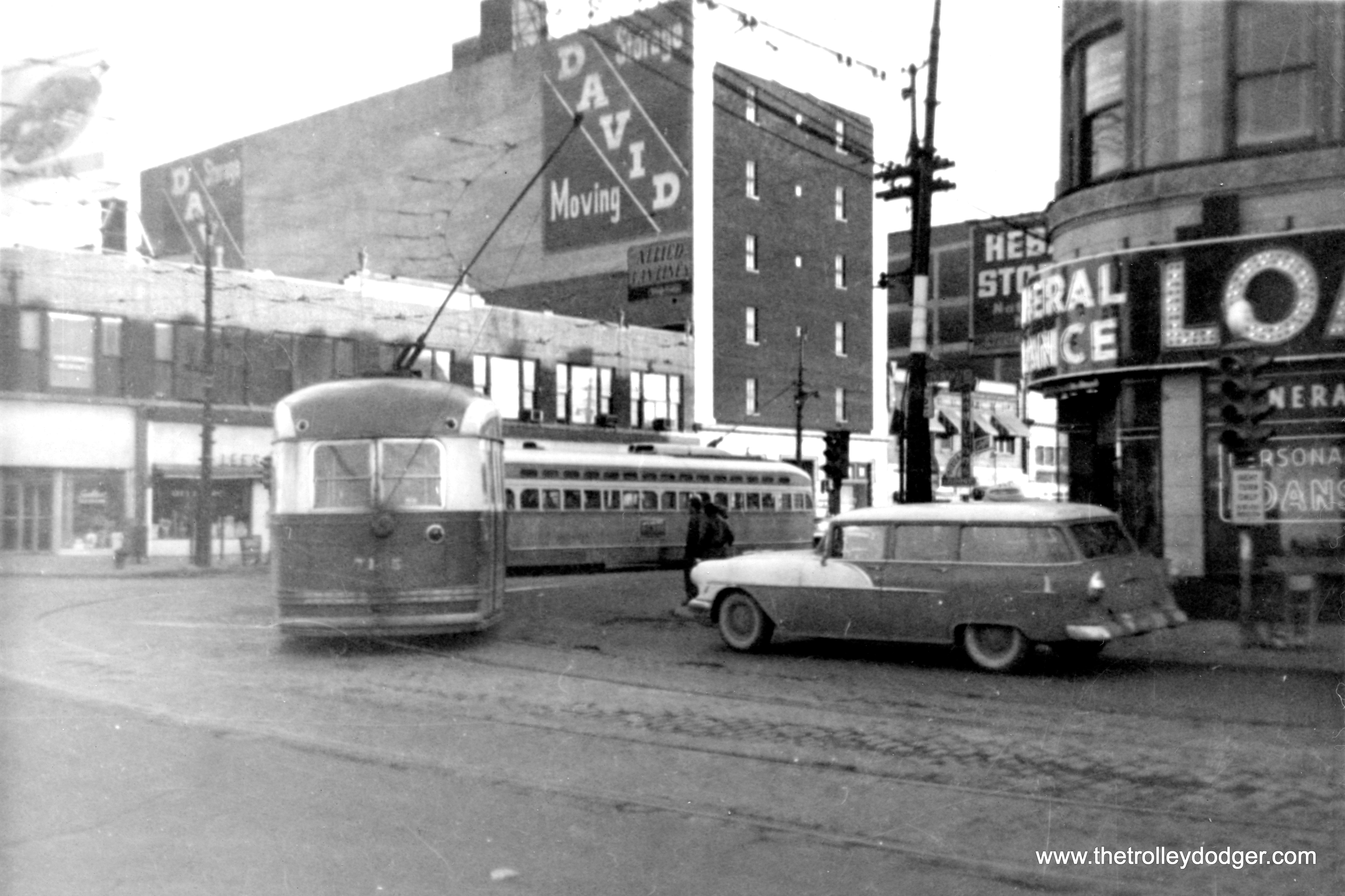


