Reflections in a Golden Wye

This photo, showing a mirror at the North Shore Line's Milwaukee terminal, was taken on January 21, 1963 (after abandonment) by Allan Y. Scott for the Milwaukee Journal. You can see the photographer in the picture, apparently using a Leica M2 or M3. This picture came from the collection of the late John Horachek. Rather than being a double exposure, it seems like the ghostly image of an Electroliner was applied to the mirror using a stencil and a product known as Glass Wax.

This photo, showing a mirror at the North Shore Line’s Milwaukee terminal, was taken on January 21, 1963 (after abandonment) by Allan Y. Scott for the Milwaukee Journal. You can see the photographer in the picture, apparently using a Leica M2 or M3. This picture came from the collection of the late John Horachek. Rather than being a double exposure, it seems like the ghostly image of an Electroliner was applied to the mirror using a stencil and a product known as Glass Wax.

For today’s post, we are going back in time, often even further back in time than we usually do, to feature some important historical images. Each one is like a small ray of light, that form a beacon when taken together, illuminating the past, like the reflections in a mirror.

It’s the earliest, and oldest pictures that are the hardest to find. So, we’ve had to redouble our efforts to seek them out.

In addition, we have important news about our new book Chicago’s Lost “L”s. We recently received a small number of “author’s copies” from the publisher, and the book is now a reality. We hope you will like the results.

Our initial order is on the way to us, and we are confident that we will soon begin shipping out books to our contributors and everyone who has ordered one in our pre-sale. All such books should be in the post prior to the July 12 release date.

More information about Chicago’s Lost “L”s, including how to order, can be found at the end of this post, or you can click on the link at the top of this page to go to our Online Store.

We would like to thank Kevin Horachek, Andre Kristopans, and William Shapotkin for their contributions to this post.

Enjoy!

-David Sadowski

Recent Finds

As a practical matter, color photography didn't exist in 1910, which is the postmark date of this postcard showing the Lake Street "L" at ground level in the Austin neighborhood on Chicago's west side. The view looks west from Central Avenue along South Boulevard (or, more appropriately, Lake Street, since the name did not change until the line reached suburban Oak Park). The "L" was extended there in 1901. This colorized photo may date to a bit before 1910, though, as by then, the Chicago & North Western trains, which ran parallel to the "L", had already been raised onto the embankment where the "L" joined them in 1962. This is a westbound train, as Lake Street ran left handed in those days (as did the C&NW).

As a practical matter, color photography didn’t exist in 1910, which is the postmark date of this postcard showing the Lake Street “L” at ground level in the Austin neighborhood on Chicago’s west side. The view looks west from Central Avenue along South Boulevard (or, more appropriately, Lake Street, since the name did not change until the line reached suburban Oak Park). The “L” was extended there in 1901. This colorized photo may date to a bit before 1910, though, as by then, the Chicago & North Western trains, which ran parallel to the “L”, had already been raised onto the embankment where the “L” joined them in 1962. This is a westbound train, as Lake Street ran left handed in those days (as did the C&NW).

The same location today. This portion of Lake Street was renamed to Corcoran Place in the mid-1960s, to honor the late Chicago Alderman in this area, who was a close friend of Mayor Richard J. Daley. Lake Street used to run north and south of the two railroads here for a few blocks between Pine Avenue and Austin Boulevard. There were no duplicate street numbers.

The same location today. This portion of Lake Street was renamed to Corcoran Place in the mid-1960s, to honor the late Chicago Alderman in this area, who was a close friend of Mayor Richard J. Daley. Lake Street used to run north and south of the two railroads here for a few blocks between Pine Avenue and Austin Boulevard. There were no duplicate street numbers.

I recently purchased this turn-of-the-century photo showing a Chicago Union Traction streetcar on the Lincoln Avenue line. CUT existed from 1899 to 1908, when it was absorbed into Chicago Railways. Sharpshooter's Park is where Riverview Amusement Park opened in 1904, which narrows down the time of this photo to circa 1899-1903. But the car itself looks like the "Matchbox" type, which was built by St. Louis Car Company in 1903. Car 1374 in this series has been restored and is at the Illinois Railway Museum. In 2015, the body of car 1137 was found in Wisconsin, where it had been used as an addition to someone's house. It is now in Grass Lake, MI.

I recently purchased this turn-of-the-century photo showing a Chicago Union Traction streetcar on the Lincoln Avenue line. CUT existed from 1899 to 1908, when it was absorbed into Chicago Railways. Sharpshooter’s Park is where Riverview Amusement Park opened in 1904, which narrows down the time of this photo to circa 1899-1903. But the car itself looks like the “Matchbox” type, which was built by St. Louis Car Company in 1903. Car 1374 in this series has been restored and is at the Illinois Railway Museum. In 2015, the body of car 1137 was found in Wisconsin, where it had been used as an addition to someone’s house. It is now in Grass Lake, MI.

CSL "Sedan" (aka Peter Witt) 6283 appears to be southbound on Clark, just south of downtown, in this circa 1940 photo. Don's Rail Photos: "6283 was built by CSL in 1929." This might seem unusual, that the Surface Lines had the capability or even the desire to build their own streetcars. But CSL was very much involved with the project that eventually created the PCC car just a few years after this, and it was CSL and not the ERPCC that had the two experimental pre-PCCs (4001 and 7001) built in 1934. Eventually, the CTA became the largest stockholder in the Transit Research Corporation, the successor to the ERPCC.

CSL “Sedan” (aka Peter Witt) 6283 appears to be southbound on Clark, just south of downtown, in this circa 1940 photo. Don’s Rail Photos: “6283 was built by CSL in 1929.” This might seem unusual, that the Surface Lines had the capability or even the desire to build their own streetcars. But CSL was very much involved with the project that eventually created the PCC car just a few years after this, and it was CSL and not the ERPCC that had the two experimental pre-PCCs (4001 and 7001) built in 1934. Eventually, the CTA became the largest stockholder in the Transit Research Corporation, the successor to the ERPCC.

Chicago Surface Line experimental pre-PCC 4001 in 1935, running on Route 22 - Clark-Wentworth. 40001 was built in 1934 by Pullman-Standard and was retired in 1944. The body has survived and is now at the Illinois Railway Museum. Here, it still has the striped trolley pole.

Chicago Surface Line experimental pre-PCC 4001 in 1935, running on Route 22 – Clark-Wentworth. 40001 was built in 1934 by Pullman-Standard and was retired in 1944. The body has survived and is now at the Illinois Railway Museum. Here, it still has the striped trolley pole.

Chicago Surface Lines experimental pre-PCC 7001 on Route 22 - Clark-Wentworth in 1935. It was built by Brill in 1934 and retired in 1944, scrapped in 1959. Here, it already appears to have a dent on the front end.

Chicago Surface Lines experimental pre-PCC 7001 on Route 22 – Clark-Wentworth in 1935. It was built by Brill in 1934 and retired in 1944, scrapped in 1959. Here, it already appears to have a dent on the front end.

Don's Rail Photos: "51 was built by the SP&S in August 1941. It was purchased by the North Shore in December 1947 and was completed as 459 on November 22, 1948." Here it is at the Portland yard on September 9, 1946.

Don’s Rail Photos: “51 was built by the SP&S in August 1941. It was purchased by the North Shore in December 1947 and was completed as 459 on November 22, 1948.” Here it is at the Portland yard on September 9, 1946.

A two-car train of North Shore Line Silverliners in Milwaukee in 1962. Larry Sakar writes: "The train is northbound at the north end of the 6th Street viaduct (which no longer exists). Below it on the right of the train is what was then Fowler Street. Today, that is St. Paul Ave which in NSL days used to end at 6th St. All of that changed when The Milwaukee Road built their new station at 5th St. Impending construction of the Marquette interchange and the end of the Milwaukee Road's 4th & everett St. station gave the city the opportunity to continue St. Paul Ave. beneath 6th St. to connect with then Fowler St. which then became the continuation of W. St. Paul Ave. The warehouse next to the train is also long gone. If you were standing here today you would be looking at the Milwaukee Intermodal station on the right and the main Post Office immediately next door east. If you look two blocks down on the left that is where the present day HOP Streetcar terminates. The train is northbound at the north end of the 6th Street viaduct (which no longer exists). Below it on the right of the train is what was then Fowler Street. Today, that is St. Paul Ave which in NSL days used to end at 6th St. All of that changed when The Milwaukee Road built their new station at 5th St. Impending construction of the Marquette interchange and the end of the Milwaukee Road's 4th & everett St. station gave the city the opportunity to continue St. Paul Ave. beneath 6th St. to connect with then Fowler St. which then became the continuation of W. St. Paul Ave. The warehouse next to the train is also long gone. If you were standing here today you would be looking at the Milwaukee Intermodal station on the right and the main Post Office immediately next door east. If you look two blocks down on the left that is where the present day HOP Streetcar terminates."

A two-car train of North Shore Line Silverliners in Milwaukee in 1962. Larry Sakar writes: “The train is northbound at the north end of the 6th Street viaduct (which no longer exists). Below it on the right of the train is what was then Fowler Street. Today, that is St. Paul Ave which in NSL days used to end at 6th St. All of that changed when The Milwaukee Road built their new station at 5th St. Impending construction of the Marquette interchange and the end of the Milwaukee Road’s 4th & everett St. station gave the city the opportunity to continue St. Paul Ave. beneath 6th St. to connect with then Fowler St. which then became the continuation of W. St. Paul Ave. The warehouse next to the train is also long gone. If you were standing here today you would be looking at the Milwaukee Intermodal station on the right and the main Post Office immediately next door east. If you look two blocks down on the left that is where the present day HOP Streetcar terminates. The train is northbound at the north end of the 6th Street viaduct (which no longer exists). Below it on the right of the train is what was then Fowler Street. Today, that is St. Paul Ave which in NSL days used to end at 6th St. All of that changed when The Milwaukee Road built their new station at 5th St. Impending construction of the Marquette interchange and the end of the Milwaukee Road’s 4th & everett St. station gave the city the opportunity to continue St. Paul Ave. beneath 6th St. to connect with then Fowler St. which then became the continuation of W. St. Paul Ave. The warehouse next to the train is also long gone. If you were standing here today you would be looking at the Milwaukee Intermodal station on the right and the main Post Office immediately next door east. If you look two blocks down on the left that is where the present day HOP Streetcar terminates.”

A Chicago & North Western train of bi-levels at the Milwaukee station on the Lakefront in 1962.

A Chicago & North Western train of bi-levels at the Milwaukee station on the Lakefront in 1962.

This is how the Chicago & North Western's right-of-way looked in Winnetka in July 1964. We are looking south from Elm Street. This area was grade-separated around 1940, with some financial help from the federal government through the PWA agency, in a similar fashion to how Chicago's Initial System of Subways was built. The North Shore Line's Shore Line Route ran at left until July 1955. (William Shapotkin Collection)

This is how the Chicago & North Western’s right-of-way looked in Winnetka in July 1964. We are looking south from Elm Street. This area was grade-separated around 1940, with some financial help from the federal government through the PWA agency, in a similar fashion to how Chicago’s Initial System of Subways was built. The North Shore Line’s Shore Line Route ran at left until July 1955. (William Shapotkin Collection)

An eastbound Lake Street "L" train is in Oak Park in July 1960, running alongside South Boulevard. (William Shapotkin Collection)

An eastbound Lake Street “L” train is in Oak Park in July 1960, running alongside South Boulevard. (William Shapotkin Collection)

A westbound C&NW commuter train stops in Oak Park in July 1960. (William Shapotkin Collection)

A westbound C&NW commuter train stops in Oak Park in July 1960. (William Shapotkin Collection)

A westbound Chicago & North Western commuter train departs from Oak Park in July 1960. Note the ground-level Lake Street "L" station at Marion Street at left. Just over two years later, the "L" was moved to this embankment. (William Shapotkin Collection)

A westbound Chicago & North Western commuter train departs from Oak Park in July 1960. Note the ground-level Lake Street “L” station at Marion Street at left. Just over two years later, the “L” was moved to this embankment. (William Shapotkin Collection)

An eastbound C&NW "scoot" (commuter train) has just departed the Elmhurst station and is seen crossing York Road. The view looks west. (William Shapotkin Collection)

An eastbound C&NW “scoot” (commuter train) has just departed the Elmhurst station and is seen crossing York Road. The view looks west. (William Shapotkin Collection)

What was billed as Manhattan's last elevated train heads north on the Third Avenue El on May 12, 1955.

What was billed as Manhattan’s last elevated train heads north on the Third Avenue El on May 12, 1955.

CSL 5769 on Route 5 - Cottage Grove-South Chicago circa 1940. According to Don's Rail Photos, Nearside 5769 "was built by Brill Car Co in 1912, (order) #18322, It was retired on November 8, 1948."

CSL 5769 on Route 5 – Cottage Grove-South Chicago circa 1940. According to Don’s Rail Photos, Nearside 5769 “was built by Brill Car Co in 1912, (order) #18322, It was retired on November 8, 1948.”

CSL Pullman 621, signed for Clark and Devon, is apparently running on Route 22 and headed north on Clark, having just passed Lake Street in this circa 1940 scene. The Shreve Building, built in 1875, was located at the northwest corner of Clark and Lake. Its construction was supervised by William Warren Boyington (1818-1898), who designed the landmark Chicago Water Tower. Not sure when it was demolished.

CSL Pullman 621, signed for Clark and Devon, is apparently running on Route 22 and headed north on Clark, having just passed Lake Street in this circa 1940 scene. The Shreve Building, built in 1875, was located at the northwest corner of Clark and Lake. Its construction was supervised by William Warren Boyington (1818-1898), who designed the landmark Chicago Water Tower. Not sure when it was demolished.

CSL pre-war PCC 7024 is eastbound on Madison Street at Mayfield Avenue (5900 W.) circa 1940.

CSL pre-war PCC 7024 is eastbound on Madison Street at Mayfield Avenue (5900 W.) circa 1940.

CSL Pullman 329 is on Route 21 - Cermak Road, possibly at the west end of the line, circa 1940.

CSL Pullman 329 is on Route 21 – Cermak Road, possibly at the west end of the line, circa 1940.

CSL 1801 is signed for Adams-Downtown in this circa 1940 photo. Part of Route 7 - Harrison Street went downtown via Adams Street. A nearby truck is delivering Ogden's Milk.

CSL 1801 is signed for Adams-Downtown in this circa 1940 photo. Part of Route 7 – Harrison Street went downtown via Adams Street. A nearby truck is delivering Ogden’s Milk.

The U.S. Patent Office in Washington, DC in the 1920s, with a streetcar out front, apparently powered by conduit via a electric plow running in a trough between the two rails.

The U.S. Patent Office in Washington, DC in the 1920s, with a streetcar out front, apparently powered by conduit via a electric plow running in a trough between the two rails.

Chicago Aurora & Elgin car 403 at Laramie Avenue on July 19, 1933. It was described as "red with gold trim." 403 was a Pullman product, built in 1923. Sister car 409 is at the Illinois Railway Museum. The view looks to the northeast.

Chicago Aurora & Elgin car 403 at Laramie Avenue on July 19, 1933. It was described as “red with gold trim.” 403 was a Pullman product, built in 1923. Sister car 409 is at the Illinois Railway Museum. The view looks to the northeast.

CTA trolley bus 9421 on February 12, 1973. Andre Kristopans adds, "Trolley bus 9421 SB on Pulaski at Sunnyside (4500 N). Old police station, now community center, on right." William Shapotkin Collection)

CTA trolley bus 9421 on February 12, 1973. Andre Kristopans adds, “Trolley bus 9421 SB on Pulaski at Sunnyside (4500 N). Old police station, now community center, on right.”
William Shapotkin Collection)

CTA trolley bus 9458 on February 10, 1973. (Michael N. Charnota Photo, William Shapotkin Collection) Bill Jas: "The pic of the Pulaski trolley bus is just North of Grand. You can see the old streetcar power house on the right. The same building that later collapsed onto Jimmy’s Hot Dog Stand."

CTA trolley bus 9458 on February 10, 1973. (Michael N. Charnota Photo, William Shapotkin Collection) Bill Jas: “The pic of the Pulaski trolley bus is just North of Grand. You can see the old streetcar power house on the right. The same building that later collapsed onto Jimmy’s Hot Dog Stand.”

The Chicago & Milwaukee Electric

The North Shore Line started out as the Chicago & Milwaukee Electric, before it was reorganized by Samuel Insull in 1916. Here are some early photos that reflect that history.

The Chicago & Milwaukee Electric station in Lake Forest. It was torn down around 1970, 15 years after the last North Shore Line trains ran here on the Shore Line Route.

The Chicago & Milwaukee Electric station in Lake Forest. It was torn down around 1970, 15 years after the last North Shore Line trains ran here on the Shore Line Route.

A close-up of the previous image, showing Chicago & Milwaukee Electric car 10. It was built by Pullman in 1899.

A close-up of the previous image, showing Chicago & Milwaukee Electric car 10. It was built by Pullman in 1899.

After the North Shore Line abandoned service on the Shore Line Route in 1955, their former Lake Forest station was used as a campaign headquarters in the 1956 presidential election. (Chicago Tribune Photo)

After the North Shore Line abandoned service on the Shore Line Route in 1955, their former Lake Forest station was used as a campaign headquarters in the 1956 presidential election. (Chicago Tribune Photo)

A Chicago & Milwaukee electric buffet observation car, from an undated postcard. Don's Rail Photos: "401 was built by Jewett Car in 1909 as parlor-buffet car. In 1917 it was converted to straight coach and retired in 1935. It was leased to Chicago Aurora & Elgin and renumbered 142 in 1936. It came back for a short time with the CA&E number in 1945 and sold to CA&E in 1946. It was retired in 1953."

A Chicago & Milwaukee electric buffet observation car, from an undated postcard. Don’s Rail Photos: “401 was built by Jewett Car in 1909 as parlor-buffet car. In 1917 it was converted to straight coach and retired in 1935. It was leased to Chicago Aurora & Elgin and renumbered 142 in 1936. It came back for a short time with the CA&E number in 1945 and sold to CA&E in 1946. It was retired in 1953.”

The Chicago & Milwaukee Electric's Zion station, from a postcard postmarked 1911. The religious fanatics who started this town made the interurban build a large station, in anticipation of rapid growth that did not occur.

The Chicago & Milwaukee Electric’s Zion station, from a postcard postmarked 1911. The religious fanatics who started this town made the interurban build a large station, in anticipation of rapid growth that did not occur.

The Chicago & Milwaukee electric station in Libertyville, from a real photo postcard postmarked 1906.

The Chicago & Milwaukee electric station in Libertyville, from a real photo postcard postmarked 1906.

Chicago & Milwaukee Electric Birney car 334 at 6th and Clybourn in Milwaukee. Don's Rail Photos: "334 was built by Cincinnati Car Co in December 1922, #2625. It was retired in 1947 and scrapped in April 1948." The C&ME name was used on these North Shore Line city streetcars, since that was the franchise holder in Milwaukee.

Chicago & Milwaukee Electric Birney car 334 at 6th and Clybourn in Milwaukee. Don’s Rail Photos: “334 was built by Cincinnati Car Co in December 1922, #2625. It was retired in 1947 and scrapped in April 1948.” The C&ME name was used on these North Shore Line city streetcars, since that was the franchise holder in Milwaukee.

North Shore Line wood car 305 (former Chicago & Milwaukee Electric) in Kenilworth circa 1930, running as a Chicago local on the Shore Line Route. Don's Rail Photos: " 303 thru 305 were built by American Car in 1910 and were almost identical. In 1939 they became sleet cutters and were retired and scrapped in 1940." (Kenilworth Historical Society)

North Shore Line wood car 305 (former Chicago & Milwaukee Electric) in Kenilworth circa 1930, running as a Chicago local on the Shore Line Route. Don’s Rail Photos: ” 303 thru 305 were built by American Car in 1910 and were almost identical. In 1939 they became sleet cutters and were retired and scrapped in 1940.” (Kenilworth Historical Society)

Did Not Win

They say you can’t win ’em all, and we certainly don’t. But while we did not win the auctions for these images, they definitely still worth looking at:

1899 New York City Shopping @ 22nd St & 6th Avenue L Train Glass Photo Negative recently sold for $247.50. Looks like the 6th Avenue line was still using steam power then.

1899 New York City Shopping @ 22nd St & 6th Avenue L Train Glass Photo Negative recently sold for $247.50. Looks like the 6th Avenue line was still using steam power then.

I did not win this auction, but I still think this is a pretty neat picture, of a four-car train of CTA 4000s southbound at Bryn Mawr in 1970. This is a southbound Evanston Express. By then, only freight locos were using the overhead wire here.

I did not win this auction, but I still think this is a pretty neat picture, of a four-car train of CTA 4000s southbound at Bryn Mawr in 1970. This is a southbound Evanston Express. By then, only freight locos were using the overhead wire here.

The following three glass plate negatives were identified as “1915 New York 7th Ave Subway Explosion Collapse 7 Dead.”

The next three glass plate images show women working as streetcar conductors on the New York Railways during World War I:

North Shore Line box motor 230 at the Milwaukee Terminal in 1941. By the late 1950s, the apartment building at rear had been torn down.

North Shore Line box motor 230 at the Milwaukee Terminal in 1941. By the late 1950s, the apartment building at rear had been torn down.

Book Review:

From Garfield ‘L’ to Blue Line Rapid Transit
by David A. Wilson
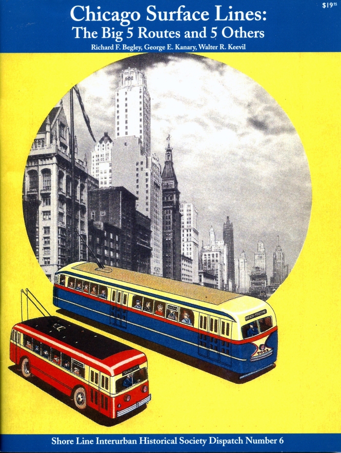
Dispatch Number 11 of the Shore Line Interurban Historical Society

Congratulations to David Wilson on his excellent new book From Garfield ‘L’ to Blue Line Rapid Transit. I would naturally like this book, since these are subjects I have written about extensively, in my own books and blogs.

Like many other people my age, I became fascinated with the extensive changes going on in the west side during the late 1950s, as construction of the Congress Expressway proceeded west and approached suburban Oak Park. I recall seeing the Garfield Park “L” and Chicago Aurora & Elgin interurban trains, but I never rode on them. We mostly took the Lake Street “L” downtown, and until 1962, that still ran on the ground west of Laramie.

I recall seeing “L” cars parked in Lockwood Yard, and I vividly remember our first drives on the new Congress Expressway, which partially opened in 1955, although it only went as far as Laramie Avenue (5200 W.). It was extended in stages in 1960, first to Central Avenue (5600 W.), and then all the way through Oak Park and Forest Park, to connect with existing highways west of there. I have naturally been a frequent rider on the Congress line (today’s Forest Park branch of the Blue Line) my whole life.

So, I have been interested in learning the details of how all this came to be for a long time, and I have been researching this subject ever since I was a small child. This interest culminated in my 2018 Arcadia book Building Chicago’s Subways, which is available from our Online Store and elsewhere.

The approach I took with that book was a comprehensive overview of the entire subject of Chicago Subways, starting with the river tunnels, first opened in 1869, the extensive downtown freight tunnel system, the various subway plans that were hashed out over 40 years, the Initial System of Subways (first started in 1938), and its culmination in the West Side Subway in 1958, as the Congress rapid transit line was originally known.

This is a large topic, and therefore it should hardly be possible for anyone to have the “last word” on these matters. Chances are, after we are all long gone, others will still find new things to say.

Dave Wilson has lived in Oak Park for a long time, and is also fascinated with this history.  His new book concentrates on just the transition from the Garfield “L” to the current Blue Line setup, and therefore it goes into greater detail than it was possible to do in my book. It will answer just about any questions that anyone might have had about how this all happened, excepting fanatics like me, who are constantly trying to learn more. (In fact, I bring up a few additional related topics later on in this post.)

Now that I have a few volumes under my belt, I tend to pay close attention to editorial decisions that others make, in their own works. This book packs a lot of information into its pages, and it should be no surprise that a few compromises had to be made.  There are only so many pages to fill in any book, something I know from personal experience.

Unfortunately there is no biographical information about the author, and I wish there were. I have known Dave Wilson for a long time, and he has been an avid railfan photographer since his teenage years. He has scanned thousands of his images, and has posted them to Flickr, for all to enjoy. You would do well to check them out.

For a time he worked for the Wisconsin Central railroad, and later, in bus planning for the Chicago Transit Authority.

The maps in this new book are excellent, and were made by Dennis McClendon, who always does fine work. In fact, he also did the book layout, which is attractive and skillfully done.

The photo selection is excellent. While there are a few images that also appear in Building Chicago’s Subways, they are great images in both books.

Another editorial decision was to include some lo-res images in the book. One in particular is rather pixilated, but in general when the image quality suffers, those images are made smaller in turn, so this is less noticeable. I am probably the only person who would notice this, though.  Any author has to collect the best images that are available, and they are not all going to be of the same resolution.

There is yet another book I can recommend, if you are still interested in learning why it was not possible to save the Chicago Aurora & Elgin interurban, despite the best efforts of three powerful Illinois politicians (Mayor Richard J. Daley, Governor William Stratton, and Cook County Board President Dan Ryan): Political Influence by Edward C. Banfield, originally published in 1961 by the Free Press of Glencoe.  I covered that book extensively in a 2015 blog post that you can read here.

In the meantime, I can wholeheartedly recommend David Wilson’s book, which is available anywhere that Shore Line products are sold. They are called Dispatches, even though the North Shore Line used the unusual spelling “despatch” back in the day.

Garfield Park, Where Are You?

A portion of a CTA track map dated October 1955. The tracks curved south west of Lockwood, unlike the way it appears here.

A portion of a CTA track map dated October 1955. The tracks curved south west of Lockwood, unlike the way it appears here.

As you can see here, the Garfield "L" ran straight east and west through Laramie Yard between Laramie (5200 W.) and Lavergne (5000 W.). (From a CTA track map dated October 1955.)

As you can see here, the Garfield “L” ran straight east and west through Laramie Yard between Laramie (5200 W.) and Lavergne (5000 W.). (From a CTA track map dated October 1955.)

For many years, I have been interested in just where the old Garfield Park “L” once ran. By 1960, it was completely replaced by the current Forest Park branch of the Blue Line (formerly the Congress line), most of which runs in the median of I-290.

The Chicago Tribune reported on June 4, 1928 that the Chicago Rapid Transit Company wanted to expand the Garfield Park “L” from two tracks to four between Marshfield and Cicero Avenues. The article states that CRT had already purchased 60% of the necessary land for expansion via private sale.

This expansion never took place (perhaps due to the Great Depression), but naturally the idea behind it may have been a factor in planning for the Congress median line, which has space for four tracks in approximately the same locations as the 1928 CRT plan, in addition to the section east of Marshfield, which leads to four subway portals near Halsted, only two of which have ever been used.

As noted in my book Building Chicago’s Subways (Arcadia Publishing, 2018), when the highway plans were being formulated, the idea was to relocate the Lake Street “L” into the median of the expressway, via a connection either at 4600 West, or near Kedzie (3200 W.).  Lake trains would have then run next to, but separate from, regular Congress rapid transit trains.

At the subway portal, Lake trains would have continued into a new Clinton Street Subway, which would have formed a subway “Loop,” connecting with the sections on Lake, Dearborn, and Congress.  Presumably, Lake trains were intended to circle this subway Loop before heading back out towards the west side.

The City of Chicago’s goal in all this was to tear down the Loop “L”, inspired by New York City’s gradual elimination of all the elevated lines in Manhattan.  This remained the City’s plan until Mayor Jane Byrne decided the Loop “L” was worth saving after all.  Chicago eventually built a new “L” line, the Orange Line, which opened in 1993 and connects to the Loop.

I traced the old right-of-way of the Garfield Park “L” on Google Street View recently, and came to a few interesting conclusions.  Although the “L” ran pretty much in a straight line between Kedzie Avenue (3200 W.) and Lockwood Avenue (5300 W.), heading west, at times, the “L’ is south of the adjacent alleyway, and at other times, it is north of it.

In general, the Garfield line was built mid-block, but at times, the location is about 620 South, and at other times, it is more like 650 South.  Maps seem to show a slight jog just west of Tripp Avenue (4232 W.), but this doesn’t seem like a definitive explanation for the change in alignment relative to the alleys.

The “L” crossed a railroad at around 4600 West, and it’s likely that the areas west of there were not yet developed when the “L” was built.  Early photos seem to show a rather barren area.  Perhaps the alleys preceded the “L” east of here, while they were built after the “L” in the western section.

Interestingly, there weren’t alleys for the entire stretch between Kedzie and Lockwood, because Fifth Avenue, an angle street that was once an important thoroughfare, crossed through near Pulaski Road (4000 W.).  The block narrows near that location, and alleys come to an end.

In general, it seems as though the “L” ran mostly south of the alley east of Cicero Avenue (4800 W.), which was the original end-of-the-line starting in 1895.  It was extended to Laramie (5200 W.) in 1902, and west of Cicero, the “L” seems to run north of the alley.  But of course, there were no alleys in the Laramie Yard area until after the “L” was demolished and the yard removed.  There is an alley where parts of Lockwood Yard once were, but it’s possible there were still tracks in place there for perhaps a year or so after the Congress line opened in June 1958.

Here are some pictures from Google Street View:

649 S. Homan (3400 W.), looking east. Here, the "L" was definitely south of the alley.

649 S. Homan (3400 W.), looking east. Here, the “L” was definitely south of the alley.

649 S. Homan (3400 W.), looking west, showing the area south of the alley, once occupied by the Garfield Park "L".

649 S. Homan (3400 W.), looking west, showing the area south of the alley, once occupied by the Garfield Park “L”.

648 S. St. Louis (3500 W.), looking west. The "L" was south of the alley here.

648 S. St. Louis (3500 W.), looking west. The “L” was south of the alley here.

617 S. Pulaski, looking east. The cross street is Fifth Avenue, which is at an angle running northeast/southwest. The Garfield Park "L" ran east-west here, and crossed Pulaski and Fifth at the same time. The "L" ran right over the area occupied by the building near the mailbox. Not sure if it was the same building then, but parts of it do look similar. There is no alley here, due to the narrowing of this block, as Fifth Avenue approaches from the north.

617 S. Pulaski, looking east. The cross street is Fifth Avenue, which is at an angle running northeast/southwest. The Garfield Park “L” ran east-west here, and crossed Pulaski and Fifth at the same time. The “L” ran right over the area occupied by the building near the mailbox. Not sure if it was the same building then, but parts of it do look similar. There is no alley here, due to the narrowing of this block, as Fifth Avenue approaches from the north.

614 S. Karlov (4100 W.), looking west. The "L" ran south of the alley here.

614 S. Karlov (4100 W.), looking west. The “L” ran south of the alley here.

This is around 650 S. Kilbourn (4500 W.), looking southwest. There was a Garfield Park "L" station at Kilbourn, and it appears to have been south of the alley.

This is around 650 S. Kilbourn (4500 W.), looking southwest. There was a Garfield Park “L” station at Kilbourn, and it appears to have been south of the alley.

At approximately 650 S. Kolmar (4532 W.), the Chicago Transit Authority has a building. Not sure what it is used for, or if the Garfield Park "L" ran over head. It's possible that the "L" ran in the area just north of the alley here. This view looks west.

At approximately 650 S. Kolmar (4532 W.), the Chicago Transit Authority has a building. Not sure what it is used for, or if the Garfield Park “L” ran over head. It’s possible that the “L” ran in the area just north of the alley here. This view looks west.

At around 620 S. Kilpatrick (4700 W.), the Garfield Park "L" ran south of the alley. This view looks east.

At around 620 S. Kilpatrick (4700 W.), the Garfield Park “L” ran south of the alley. This view looks east.

At 650 S. Lavergne (5000 W.), the Garfield Park "L" ran just north of the alley. Laramie Yard was just west of here, and the "L" at this point was descending to ground level from the Cicero Avenue "L" station, two blocks east. This view looks east.

At 650 S. Lavergne (5000 W.), the Garfield Park “L” ran just north of the alley. Laramie Yard was just west of here, and the “L” at this point was descending to ground level from the Cicero Avenue “L” station, two blocks east. This view looks east.

The Garfield Park "L" tracks crossed Lockwood at about 650 South. A short distance west of here, they made a sweeping curve and went a bit to the south, and ran parallel to the B&OCT railroad tracks through Oak Park and Forest Park.

The Garfield Park “L” tracks crossed Lockwood at about 650 South. A short distance west of here, they made a sweeping curve and went a bit to the south, and ran parallel to the B&OCT railroad tracks through Oak Park and Forest Park.

The view looking south at 646 S. Lockwood Avenue (5300 W.), showing the hump where the Garfield Park "L" crossed here. There was no alley to the right until after the "L" was removed, as that was where Lockwood Yard had been.

The view looking south at 646 S. Lockwood Avenue (5300 W.), showing the hump where the Garfield Park “L” crossed here. There was no alley to the right until after the “L” was removed, as that was where Lockwood Yard had been.

And here are some additional clues from the CTA Transit News, reporting on the demolition of the Garfield Park (and Metropolitan main line) “L” after the Congress line opened in June 1958. They show that the “L” ran south of the alley at Kilpatrick Avenue (4700 W.) but at Lavergne Avenue (5000 W.), it was north of the alley.

The Garfield Park "L" crossed over railroad tracks at about 4600 West. Interestingly, note that between the two sides of the railroad embankment, the alley between Harrison and Flournoy is not quite in the same location.

The Garfield Park “L” crossed over railroad tracks at about 4600 West. Interestingly, note that between the two sides of the railroad embankment, the alley between Harrison and Flournoy is not quite in the same location.

Recent Correspondence

We recently wrote to fellow historian Andres Kristopans:

It has been my understanding for many years that the CTA right-of-way between the Lotus Tunnel (5400 W.) and Forest Park was planned for three tracks.

This is a self-evident fact; the tunnel has portals on both sides, there is room for a third track north of the existing two west of there, and the bridge over DesPlaines Avenue was obviously designed for three tracks.

The question of what this third track was intended for recently came up in a discussion on the Facebook Chicago Elevated group. My source on that point, that the third track was intended for use by the Chicago Aurora & Elgin interurban, was my discussions and correspondence with George Krambles some 40 years ago).

But that did get me interested in looking into the matter further.

By 1940, planning for the new Congress expressway envisioned replacing the Garfield Park “L” with a line in the expressway median to Laramie Avenue (5200 W.), at least according to the film Streamlining Chicago.

This raises the question, when was the Lotus Tunnel planned, and why are there three tunnels?

The Congress median right-of-way was, to some extent, based on the existing Garfield setup. Garfield had four tracks as far as Paulina (1700 W.), although there had been plans to add two more tracks west of there in the late 1920s.

The three branches of the Met came together at Marshfield Junction, and this was undoubtedly seen as an undesirable situation, one that should be avoided in the future. By routing abandoning the Humboldt Park branch, and re-routing Logan Square into the new Milwaukee-Dearborn subway, this problem was solved.

But another goal of city planners was the gradual elimination of all the “L”s and their replacement by subways. The Lake Street “L” was targeted for this process, first with a plan to connect it to the Milwaukee-Dearborn subway just west of the Loop, and later by diverting it to the Congress median via a mile-long subway or elevated connection, either at Kedzie (3200 W.) or later, at 4600 W.

The Lake Street tracks were to be kept separate from other Congress line trains, therefore requiring a four-track right-of-way all the way to the subway portals just east of Halsted Street. The two unused portals were intended for a Clinton Street subway, a north-south branch that would have created a downtown subway loop in conjunction with the portions on Lake, Dearborn, and Congress.

Lake Street trains could have circled this loop, since otherwise, there was no obvious way to through-route them with another line at that time. It was thought that this change would have made it possible to tear down half of the Loop “L”, namely the Lake Street and Wabash Avenue legs, the exact opposite of what the City hoped to do in the 1970s.

So, the Congress median line, in the planning stages, had space enough for four tracks from Halsted to wherever the Lake line could have been brought in, which could have been as far as 4600 W.

This still does not explain why planners thought there should be three tracks starting at the Lotus Tunnel (5400 W.) and heading west.

As far back as 1945, it was expected that the CA&E tracks running through Forest Park, and the B&OCT, would run in an open cut in the expressway through suburban Oak Park. There are Cook County plans with such illustrations.

CRT leased CA&E’s tracks west of Laramie, and CA&E leased CRT’s tracks east of there, an arrangement that largely resulted in a wash financially for both companies (and, later, CRT’s successor, the CTA).

In the stretch between Forest Park and Laramie, the CA&E operated what amounted to an express service, and CRT, locals. There was a passing track at Gunderson, where express trains could pass slower locals.

That was the “old” way of operating a railroad, one increasingly at odds with the more modern way of doing things. It was labor-intensive and required a high level of competence; split-second timing, in fact.

IMHO, the solution to this in the new plan was simply to keep the locals and expresses separated. There would be two tracks for the CRT locals and one for the CA&E expresses.

As the highway plans neared fruition, the CA&E reported in 1950 that they lacked the funds to build new tracks in a highway right-of-way west of Austin Boulevard. CA&E owned the current trackage west of Laramie Avenue. The City of Chicago only had responsibility to build the Congress expressway as far as the city limits (Austin, 6000 W.).

The Lotus Tunnel was needed all along, because there needed to be some way to connect the CA&E tracks with CRT’s, and it made sense to have the new track alignment run on the south side of the highway footprint, parallel to the B&OCT. It must have been planned early on, perhaps as far back as 1945.

The CTA proposed taking over the right-of-way to Forest Park in 1952, as a way to solve the problems with CA&E. By then, the interurban had already decided not to run downtown on CTA’s tracks. The CTA had abandoned the Westchester branch in December 1951, as a means of saving money. So, CA&E no longer had income to offset the cost of using CTA’s tracks. Continuing operations into the City would be a drain of CA&E’s coffers, whatever the merits pro and con would have been for running on the Van Buren Street temporary trackage.

The highway planners, in the early 1950s, understood that if CA&E had been unable to connect with the CTA somewhere, this would have immediately put them out of business. Hence the county was very much interested in a solution to this problem. CA&E said they could not afford to build new tracks and facilities in the two miles or so of the relocated right-of-way between Austin Boulevard and DesPlaines Avenue.

All the more reason not to change the plans, likely made circa 1945, for three tracks in the new section. Cook County government did not want to be the cause of CA&E’s demise.

It was fortunate that the CTA stepped in and offered a creative solution to this problem, which also allowed them, as a result, to continue operating service to Forest Park.

So, in 1953 CA&E sold their right-of-way to the county as far west as DesPlaines Avenue (but not the river crossing, not until 1957), and the CTA purchased their fixed assets, the tracks, signals, stations, etc., which would all need to be replaced anyway.

This gave the CTA “skin in the game” to continue operating service to Forest Park. The plan to hand off CA&E riders to the CTA at DesPlaines Avenue did not come about until 1953. This is evidenced both in contemporary newspaper reports, and in how the Forest Park Terminal was hurriedly altered at practically the last minute to adopt the new arrangements.

Until then, it was expected that this handoff would take place at Laramie Avenue, where CA&E’s tracks ended and CTA’s began. There was also an intermediate plan to make Central Avenue the changeover point instead, as the CTA briefly considered building a bus-rail facility there instead of Forest Park. CTA made an artist’s rendering of this, which I have seen.

So, in sum, the plan for three tracks west of Laramie probably dated as far back as 1945, when engineering was being done for the expressway extension into the western suburbs. This plan was not changed when the facilities were built. The Lotus Tunnel has three tunnels, the right-of-way has space for three tracks (north of the existing two), and the steel bridge over the DesPlaines Avenue underpass was designed for three tracks.

By the time the final design work was done for the stations in this section, in the late 1950s, the CA&E was no longer an issue. The CTA had built what they needed built, and did the minimum that was necessary just in case it might have been possible for the CA&E to resume operations downtown.

And this is something that CA&E went back and forth on. Both CTA and CA&E seemed perfectly happy to separate their tracks from each other in 1953. It is my belief that, early on, the CA&E decided on a policy of a gradual or piecemeal abandonment, selling off parts of their line, and distributing the proceeds to their shareholders, instead of using it to buy new equipment.

This is based on the notion that the new highway itself had doomed the interurban, which in an era where there were no government subsidies, was likely the only logical conclusion.

The CTA still had to figure out where their yard would be for the new Congress service. In the late 1950s, they were still considering using Laramie Yard, which would need to be connected to the median line by an elevated connection, estimated to cost $1m.

Building a new yard at DesPlaines Avenue was a cost-saving alternative. But there was still the question of who owned the terminal there, as CA&E hadn’t sold it as part of the 1953 deal. It wasn’t part of the highway project, and in fact, in 1957, CA&E had filed suit to evict the CTA from the Forest Park terminal, as a way of putting pressure on the powers-that-be to get more money for the river crossing (which they did) and get the courts to agree to a “temporary” abandonment of passenger service (which they did).

That those two events happened almost simultaneously makes one wonder if perhaps there was a “quid pro quo” involved, although at this stage, there is probably no way to prove it.

Andre replies:

I will go along with your analysis. The whole problem was a lack of money. CTA in 1945 was set up on the premise of taking over all local transportation in the metro area, but there was a fatal flaw in that CTA had no outside income except by selling bonds. When the suburban bus and rail lines were found to be more highly valued than expected, CTA could not come up with enough money to buy them out. There were ideas to take over CA&E to Wheaton and North Shore to Waukegan, but nothing came of them because the various towns along the lines could not agree on financial assistance. Those directly on line demanded those further, especially along CA&E, kick in as they would also benefit, but places like Addison and Bloomingdale refused, so nothing could be agreed to and the idea died. It took until RTA in 1982 to finally do this, with federal money.

In many ways, CTA was an idea way ahead of its time. Remember CTA was the very first “transit authority”. Before you had municipal operations like Cleveland where city took over failing private operations, but this was the first “independent governmental body” with jurisdiction not based on municipal boundaries. Too bad nobody thought to give it taxing authority at the time, as everyone thought once relieved of regulation and duplication, transit would be profitable again, and in fact the idea was that CTA would only be a “temporary” owner, who after restructuring Chicago area transit into profitability would then sell the system to a private operator and use the proceeds to retire the bonds sold to buy and modernize the system. But because nothing could be done with the suburban operators, CTA became the permanent owner of the city system, for 74 years now.

There was the negative example of municipal ownership in New York City, where building the IND subway practically bankrupted the city. So it is no wonder that Chicago had to be dragged, kicking and screaming, into it.

The City of Chicago resisted the idea of public ownership for years, until all the various schemes for unifying CSL and CRT had failed, and there was no other viable option (by 1943). The situation might have festered, but the city had pledged to push through transit unification as a condition of accepting federal funds to pay for 45% of the Initial System of Subways (which ended up being more like 33% by the time the Milwaukee-Dearborn subway opened).

When WWII ended, the City resumed work on the unfinished Dearborn-Milwaukee subway, and soon work began in earnest on building the Congress superhighway. But there was no more federal money in the offing, and it was a struggle just to get the subway open by 1951.

The City had to float a $25m bond issue, which in essence reimbursed the transit improvement fund for monies that were taken from it during the Great Depression.

The scope of projects had to be scaled back. It seems as though the idea of re-routing Lake onto Congress was still alive as of 1948, but got put off into an indefinite future, due to the cost of building a mile long connection between the two lines, plus the Clinton subway.

Once CTA was in charge, they quickly identified the Lake Street “L”s problem area as the grade-level outer end, and not the elevated portion. And service was speeded up by using A/B skip-stop service, which became a model for the rest of the system.

The ultimate solution to Lake’s problems was not realized until 1962, when the line was elevated onto the Chicago & North Western embankment, followed by a proper yard west of Harlem.

The Van Buren temporary trackage gummed things up on Garfield for a few years, but inadvertently helped turn the eventual Congress line into something more like an express service. The CTA responded to the slow running times on Van Buren by closing some of the more minor stations on the line west of there, to the point where Garfield travel times in 1958 were largely the same as they had been prior to the September 1953 change.

This, in turn, influenced the locations of stations on the new Congress line. Whereas at first, plans called for merely replacing the old Garfield stations with new ones on Congress, over time, fewer new stations were planned.

The one glaring exception, of course, was Kostner, which was mandated by the City Council for political reasons, as there were three Aldermen lobbying for it (their wards were nearby). This one example of the “old” way of doing things turned out to be a dismal failure, and the station barely lasted a decade.

Andre:

Actually since 1913 CSL was a strange situation of private ownership but municipal operation. Chicago Surface Lines Joint Board of Management and Operation (the full name) was a city agency that directed day to day operations while CRys, CCRy, C&SCRys, all stock companies, were the actual owners. Probably only such arrangement anywhere. So in fact in 1945 city ceded control to an independent agency, though ownership transfer of assets took two more years to arrange.

CSL was not in trouble per se. Bankruptcy was more to keep franchise from expiring than any real financial collapse, whereas CRT was basically barely able to make payroll, with nothing left over for maintenance, etc. If CRT could not be foisted off on CSL, it would have been abandoned soon.

The Dean of Chicago Railfans

Raymond DeGroote, Jr. waits for DC Transit pre-PCC streetcar 1053 to descend a viaduct in Washington, DC on October 15, 1961, so he can get his picture. Streetcars in portions of the District of Columbia were forbidden to use overhead wire, and were powered by an underground conduit instead. (William C. Hoffman Photo)

Raymond DeGroote, Jr. waits for DC Transit pre-PCC streetcar 1053 to descend a viaduct in Washington, DC on October 15, 1961, so he can get his picture. Streetcars in portions of the District of Columbia were forbidden to use overhead wire, and were powered by an underground conduit instead. (William C. Hoffman Photo)

My friend Raymond DeGroote, Jr. will turn 91 years old on July 15th. He has been very active in Chicago’s railfan community since the 1940s. He was most likely a first-day rider when Chicago’s first subway opened on October 17, 1943, over 77 years ago.

He has taken thousands of photos over the years, starting in about 1948 with black-and-white, and color slides since 1954. Ray is a world traveler, has written numerous articles, and has given numerous presentations on a wide range of railfan subjects. His work has appeared in many books, and he has been a mentor to me in this field since we first met in the late 1970s.  He has worked tirelessly for many of the leading railfan organizations over the years.

Thanks to Ray, I became part of what he likes to call the “intelligence network” of railfans, in an era before the Internet made it possible to have a world of information at your fingertips.

Therefore, when I started work on my new book Chicago’s Lost “L”s, I could not think of anyone more deserving to dedicate the book to than Ray, who I consider the Dean of Chicago railfans. Once I received a small number of “author’s copies,” I sent one to him.

Here is his reply:

Thank you very much for my copy of Chicago’s Lost “L”s. The book is much appreciated and will provide many hours of pleasure reading and looking at the pictures.

I already found several very interesting ones. For example, I had never seen a picture of Willow or Calvary, the latter going even before my time, and the former just as I was becoming interested in the hobby. Also the view of Lower Level Wilson looking southeast (interesting angle) before the structure was above it, and Merchandise Mart under construction. Both must be relatively rare pictures.

On page 17 you had a view of a Robertson streetcar at 63rd. I remember those cars on South Side lines such as Riverdale, but we also had them up north on Riverview-Larrabee– slow cars, but with a commanding presence.

I am glad you included the Lost Interurbans section and also the Lost Terminals section. I vaguely remember Market Street, but know I rode out of Congress Street a few times, and many times out of North Water. That was even used as a display area to introduce and show off the new North Shore Silverliner paint scheme.

This is another good book to your credit. Keep up the good work.

Apparently, he did not initially notice that the book is dedicated to him, so I had to bring that to his attention.

He then wrote:

I am terribly embarrassed that I did not notice my name on the dedication page. I remember looking at the top of the page and seeing the Library of Congress data, and then going right to the Table of Contents. When I saw Northwestern “L” I turned right there to see what pictures you had included.

This is the first time anyone has dedicated a book to me, and I am very surprised and honored. It was totally unexpected. Thank you very much for this recognition, although I do not think I merit the title of “Dean”. “Old Man” might have been more appropriate as there are many others who deserve to be called “Dean.”

So, thank you again for the book dedication. It is a fine book, and I hope it will generate many sales.

Sincerely, Ray

When I can slip a few pictures in there that Ray DeGroote hasn’t seen before, I think I have done pretty well, because Ray has seen just about everything before.  And, he is characteristically modest about his accomplishments.  I can only hope for a small fraction of his wisdom, if I am lucky enough to reach his years.

Keep those cards and letters coming in, folks!

-David Sadowski

Our Latest Book, Now Available for Pre-Order:

Chicago’s Lost “L”s

Arcadia Publishing will release our new book Chicago’s Lost “L”s on July 12, 2021. Reserve your copy today!

From the back cover:

Chicago’s system of elevated railways, known locally as the “L,” has run continuously since 1892 and, like the city, has never stood still. It helped neighborhoods grow, brought their increasingly diverse populations together, and gave the famous Loop its name. But today’s system has changed radically over the years. Chicago’s Lost “L”s tells the story of former lines such as Garfield Park, Humboldt Park, Kenwood, Stockyards, Normal Park, Westchester, and Niles Center. It was once possible to take high-speed trains on the L directly to Aurora, Elgin, and Milwaukee, Wisconsin. The L started out as four different companies, two starting out using steam engines instead of electricity. Eventually, all four came together via the Union Loop. The L is more than a way of getting around. Its trains are a place where people meet and interact. Some say the best way to experience the city is via the L, with its second-story view. Chicago’s Lost “L”s is virtually a “secret history” of Chicago, and this is your ticket. David Sadowski grew up riding the L all over the city. He is the author of Chicago Trolleys and Building Chicago’s Subways and runs the online Trolley Dodger blog.

The Images of America series celebrates the history of neighborhoods, towns, and cities across the country. Using archival photographs, each title presents the distinctive stories from the past that shape the character of the community today. Arcadia is proud to play a part in the preservation of local heritage, making history available to all.

Title Chicago’s Lost “L”s
Images of America
Author David Sadowski
Edition illustrated
Publisher Arcadia Publishing (SC), 2021
ISBN 1467100007, 9781467100007
Length 128 pages

Chapters:
01. The South Side “L”
02. The Lake Street “L”
03. The Metropolitan “L”
04. The Northwestern “L”
05. The Union Loop
06. Lost Equipment
07. Lost Interurbans
08. Lost Terminals
09. Lost… and Found

Each copy purchased here will be signed by the author, and you will also receive a bonus facsimile of a 1926 Chicago Rapid Transit Company map, with interesting facts about the “L” on the reverse side.

The price of $23.99 includes shipping within the United States.

For Shipping to US Addresses:

For Shipping to Canada:

For Shipping Elsewhere:

NEW DVD:

A Tribute to the North Shore Line

To commemorate the 50th anniversary of the demise of the fabled North Shore Line interurban in January 2013, Jeffrey L. Wien and Bradley Criss made a very thorough and professional video presentation, covering the entire route between Chicago and Milwaukee and then some. Sadly, both men are gone now, but their work remains, making this video a tribute to them, as much as it is a tribute to the Chicago North Shore & Milwaukee.

Jeff drew on his own vast collections of movie films, both his own and others such as the late William C. Hoffman, wrote and gave the narration. Bradley acted as video editor, and added authentic sound effects from archival recordings of the North Shore Line.

It was always Jeff’s intention to make this video available to the public, but unfortunately, this did not happen in his lifetime. Now, as the caretakers of Jeff’s railfan legacy, we are proud to offer this excellent two-hour program to you for the first time.  The result is a fitting tribute to what Jeff called his “Perpetual Adoration,” which was the name of a stop on the interurban.

Jeff was a wholehearted supporter of our activities, and the proceeds from the sale of this disc will help defray some of the expenses of keeping the Trolley Dodger web site going.

Total time – 121:22

# of Discs – 1
Price: $19.99 (Includes shipping within the United States)

Keep those cards and letters coming in, folks!

-David Sadowski

Help Support The Trolley Dodger

This is our 269th post, and we are gradually creating a body of work and an online resource for the benefit of all railfans, everywhere. To date, we have received over 777,000 page views, for which we are very grateful.
You can help us continue our original transit research by checking out the fine products in our Online Store.
As we have said before, “If you buy here, we will be here.”
We thank you for your support.
DONATIONS
In order to continue giving you the kinds of historic railroad images that you have come to expect from The Trolley Dodger, we need your help and support. It costs money to maintain this website, and to do the sort of historic research that is our specialty.
Your financial contributions help make this web site better, and are greatly appreciated.

Roy G. Benedict

Some very sad news via Eric Bronsky:

We rail preservationists and historians have lost an important member of our community. Roy G. Benedict, prolific writer and historian active with several rail organizations over the course of 60+ years, passed away unexpectedly. He was 78.

Among other activities, Roy was long involved with CERA publications and also served a term as editor of First & Fastest, published by the Shore Line Interurban Historical Society. His historic research and writings were meticulous, thorough and accurate. A native of Chicago’s South Side, he was considered a ‘walking encyclopedia’ of Chicago Surface Lines routes and operations.

Roy was a bachelor who lived alone on Chicago’s Northwest Side. He was employed as a schoolteacher. After retiring, he started Roy G Benedict Publisher’s Services as a sole proprietorship. He did not own a car and used public transportation to get wherever he needed to go, traveling frequently to Indiana to observe NICTD board meetings or to distant libraries to research electric railways. When invited to ride with others to railroad museums, model meets, and other events not accessible by bus or train, Roy was always grateful for the opportunity to tag along.

Roy would occasionally join me, Dan Joseph, and others on day trips. The photo below shows Roy enjoying Bob Olson’s South Bend Electric Railway in October of 2016. Dan spoke with Roy only last Wednesday, inviting him to join us Sunday to visit the Illinois Railway Museum. Our pickup point was the CTA Belmont Blue Line station. Roy, normally punctual, was not there when we arrived. We tried calling his home and mobile phone but there was no answer. Growing concerned, we made several phone calls in an attempt to find someone who could check on Roy. Our worst fears were confirmed on Monday.

There will be no funeral service. Roy bequeathed his collection to the Illinois Railway Museum’s Strahorn Library. I have no other information.

— Eric

Jeff Wien notes:

Roy was one of the most intelligent people that I have ever had the pleasure of knowing.

Roy G. Benedict started out as a mapmaker as a teenager in the 1950s. An early example of his work, a mimeographed track map of the Chicago Aurora & Elgin, is reproduced below.

He was the co-author, along with James R. MacFarlane, of Not Only Passengers: How the Electric Railways Carried Freight, Express, and Baggage, Bulletin 129 of the Central Electric Railfans’ Association (1992).

Roy was very helpful to Carl Bajema, offering helpful advice on the book that became The Street Railways of Grand Rapids (co-author: Tom Maas), Bulletin 148 of Central Electric Railfans’ Association (2017). He was a stickler for getting details correct, and did not suffer fools gladly. If you disagreed with Roy, you had better have the facts at hand to make your case.

Mr. Benedict was interviewed on-camera for the Chicago Streetcar Memories DVD produced by Jeff Wien and the late Bradley Criss for Chicago Transport Memories. He was also a contributor to Chicago Streetcar Pictorial: The PCC Car Era, 1936-1958, by Jeffrey L. Wien and myself, (Bradley Criss Photo Editor), published in 2015 by Central Electric Railfans’ Association as Bulletin 146.

In recent years, Roy had also been very active in the yearly Hoosier Traction Meet that takes place in Indianapolis each September.

This is a great loss to the railfan community. He will be missed.

-David Sadowski

Help Support The Trolley Dodger

gh1

This is our 234th post, and we are gradually creating a body of work and an online resource for the benefit of all railfans, everywhere. To date, we have received over 527,000 page views, for which we are very grateful.

You can help us continue our original transit research by checking out the fine products in our Online Store.

As we have said before, “If you buy here, we will be here.”

We thank you for your support.

DONATIONS

In order to continue giving you the kinds of historic railroad images that you have come to expect from The Trolley Dodger, we need your help and support. It costs money to maintain this website, and to do the sort of historic research that is our specialty.

Your financial contributions help make this web site better, and are greatly appreciated.

From the Collections of Bill Shapotkin

On August 13, 1971 Chicago Rock Island & Pacific #303 and 125 are backing into Blue Island (Burr Oak) yard. Bill Shapotkin adds, "The train is a ROCK Mainline Suburban train (if it had operated via Beverly, it would be west of the depot (to left)."

On August 13, 1971 Chicago Rock Island & Pacific #303 and 125 are backing into Blue Island (Burr Oak) yard. Bill Shapotkin adds, “The train is a ROCK Mainline Suburban train (if it had operated via Beverly, it would be west of the depot (to left).”

Today, we feature more classic photos of buses, trolleys, and trains, courtesy of Bill Shapotkin, long a friend of this blog. Mr. Shapotkin should be well-known to many of you from his longtime activities as a transit historian, author, and the many informative programs he has given over the years.

Today’s sampling from the Shapotkin Collection includes some rare pictures of Chicago & North Western RDCs (Budd Rail Diesel Cars), which were self-propelled and ran in Chicago area commuter train service for a short period of time in the 1950s. They replaced steam-powered trains and were in turn replaced by the familiar push-pull diesel bi-levels still in use today.

In addition, there are several pictures of Grand Central Station, a Chicago landmark in use between 1890 and 1969, which was torn down in 1971. We have some interesting correspondence, plus some new images of our own.

Enjoy!

-David Sadowski

PS- We have done our part to make these old images look as good as they possibly can. The C&NW RDC pictures were all shot around 1956 on early Ektachrome film, whose dyes turned out to be unstable and quickly shifted to red. (Technically, the red layer was relatively stable, while the green and blue layers faded.)

It used to be some people thought these sorts of images were only suitable for use as black-and-whites. But with modern technology, it is possible, to some extent, to bring back the original colors. This was easier to do on some than others, but the results look much better than you might expect. If you have ever seen one of these early red Ektachromes, you will know what I mean. Modern films are much more stable and resistant to dye fading.

I would be remiss without mentioning Bill has been involved for many years with the annual Hoosier Traction meet, which takes place in September:

It is that time of year again — the 35th annual gathering of the Hoosier Traction Meet is being held Fri-Sat, Sept 7-8 in Indianapolis, IN. The meet includes two full days of interesting presentations on a variety of subjects, as well as our “Exhibition Room” of vendors — with everything from transfers to track charts available. Book now and you can join us for just $25.00 ($40.00 at the door). We recommend that once you book hotel accommodations as early as possible, as there is an event scheduled at the Indianapolis Motor Speedway that same weekend. By calling the number of the Waterfront Inn (where our event is being held), by mentioning that you are with the Hoosier Traction Meet, you should be able to register at our group rate.

For those of you would are unable to attend both days, we have a special “Saturday Only” rate of just $15.00 ($25.00 at the door). As many of our Friday presentations are repeated on Saturday, you will be able to partake of a wide variety of subjects and presenters.

We hope you are able to join us for what many consider to be THE electric railway gathering in the country…see you there!

Thanking you in advance,

Bill Shapotkin

The Milwaukee Road's Elgin terminal in August 1970. Bill Shapotkin adds, "The MILW depot in Elgin was built 1948. It is the second depot constructed at the same site. View looks south from Chicago St."

The Milwaukee Road’s Elgin terminal in August 1970. Bill Shapotkin adds, “The MILW depot in Elgin was built 1948. It is the second depot constructed at the same site. View looks south from Chicago St.”

Chicago & Milwaukee Electric 354, built in 1928 by the St. Louis Car Company, is seen at the Illinois Railway Museum in May 1977. It ran in Milwaukee and Waukegan as a North Shore Line city streetcar.

Chicago & Milwaukee Electric 354, built in 1928 by the St. Louis Car Company, is seen at the Illinois Railway Museum in May 1977. It ran in Milwaukee and Waukegan as a North Shore Line city streetcar.

The Chessie Steam Special in Wellsboro, IN on June 17, 1978.

The Chessie Steam Special in Wellsboro, IN on June 17, 1978.

The Chessie Steam Special in Wellsboro, IN on June 17, 1978.

The Chessie Steam Special in Wellsboro, IN on June 17, 1978.

The Chessie Steam Special in Wellsboro, IN on June 17, 1978.

The Chessie Steam Special in Wellsboro, IN on June 17, 1978.

The Chessie Steam Special in Wellsboro, IN on June 17, 1978.

The Chessie Steam Special in Wellsboro, IN on June 17, 1978.

The Chessie Steam Special in Peru, IN on June 17, 1978.

The Chessie Steam Special in Peru, IN on June 17, 1978.

The Chessie Steam Special in Wellsboro, IN on June 17, 1978.

The Chessie Steam Special in Wellsboro, IN on June 17, 1978.

Minneapolis & St. Louis "doodlebug" GE 29, was used as a railway post office (RPO). According to http://www.rrpicturearchives.net/, " Number GE-29 was built in 1931, body by Saint Louis Car Company (c/n 1550), the power plant was 400 horsepower EMC Winton Model 148 gasoline engine (c/n 491) coupled to GE electrical gear. I don't know who is responsible for the boxy structure on the roof but it's likely the cooling system for the prime mover. This unit went by the name 'Montgomery' (painted above the rear truck) and was repowered in August 1950 with a Caterpillar 400 horsepower Model D diesel."

Minneapolis & St. Louis “doodlebug” GE 29, was used as a railway post office (RPO). According to http://www.rrpicturearchives.net/, ” Number GE-29 was built in 1931, body by Saint Louis Car Company (c/n 1550), the power plant was 400 horsepower EMC Winton Model 148 gasoline engine (c/n 491) coupled to GE electrical gear. I don’t know who is responsible for the boxy structure on the roof but it’s likely the cooling system for the prime mover. This unit went by the name ‘Montgomery’ (painted above the rear truck) and was repowered in August 1950 with a Caterpillar 400 horsepower Model D diesel.”

CTA bus 4606 is at the Roosevelt/Monitor Loop in October 1992 (same one used by trackless trolleys a few years earlier). The view looks E-N/E (toward Monitor Avenue). I don't know much about the GM Fishbowl next to it, however.

CTA bus 4606 is at the Roosevelt/Monitor Loop in October 1992 (same one used by trackless trolleys a few years earlier). The view looks E-N/E (toward Monitor Avenue). I don’t know much about the GM Fishbowl next to it, however.

A Milwaukee Road dome car near Union Station in Chicago.

A Milwaukee Road dome car near Union Station in Chicago.

Milwaukee Road equipment in downtown Chicago.

Milwaukee Road equipment in downtown Chicago.

Pace buses in Elgin, June 2003.

Pace buses in Elgin, June 2003.

A westbound NYC passenger train as it approaches LaSalle Street Station in November 1963. At right is the CRI&P's coach yard. The view looks south from the Roosevelt Road bridge. (John Szwajkart Photo)

A westbound NYC passenger train as it approaches LaSalle Street Station in November 1963. At right is the CRI&P’s coach yard. The view looks south from the Roosevelt Road bridge. (John Szwajkart Photo)

Chicago, IL. NYC loco #7300 is seen as it passes the CRI&P coachyard. The view looks south from the Roosevelt Road bridge in November 1963. (John Szwajkart Photo)

Chicago, IL. NYC loco #7300 is seen as it passes the CRI&P coachyard. The view looks south from the Roosevelt Road bridge in November 1963. (John Szwajkart Photo)

Metra Milwaukee District loco 124 is pushing an eastbound train towards Union Station in Chicago. The view looks east from DesPlaines Street. August 1995. (Dan Munson Photo)

Metra Milwaukee District loco 124 is pushing an eastbound train towards Union Station in Chicago. The view looks east from DesPlaines Street. August 1995. (Dan Munson Photo)

Loco 604 leads a northbound (timetable: westbound) Metra/Milwaukee District passenger train out of Union Station in Chicago. The view looks south-southwest off the Lake Street bridge over the south branch of the Chicago River. July 19, 1990. (Dan Munson Photo)

Loco 604 leads a northbound (timetable: westbound) Metra/Milwaukee District passenger train out of Union Station in Chicago. The view looks south-southwest off the Lake Street bridge over the south branch of the Chicago River. July 19, 1990. (Dan Munson Photo)

Control cab 3244 brings up the reat of a westbound Metra/Rock Island train at Joliet Union Station. The view looks west in December 1990. (Paul D. Schneider Photo)

Control cab 3244 brings up the reat of a westbound Metra/Rock Island train at Joliet Union Station. The view looks west in December 1990. (Paul D. Schneider Photo)

Joliet, IL: Loco 163 is seen pushing an eastbound Metra/Rock Island suburban train across the ATSF/IC (ex-ICG, former GM&O, nee C&A) diamonds at Union Station. The view looks south in December 1990. (Paul D. Schneider Photo)

Joliet, IL: Loco 163 is seen pushing an eastbound Metra/Rock Island suburban train across the ATSF/IC (ex-ICG, former GM&O, nee C&A) diamonds at Union Station. The view looks south in December 1990. (Paul D. Schneider Photo)

The imposing clock tower of Grand Central Station, in operation from 1890 to 1969. Located at the southwest corner of Wells and Harrison, it was demolished in 1971. This view looks northwest. (Ron Peisker Photo)

The imposing clock tower of Grand Central Station, in operation from 1890 to 1969. Located at the southwest corner of Wells and Harrison, it was demolished in 1971. This view looks northwest. (Ron Peisker Photo)

The Wells Street side of Grand Central Station in Chicago. The view looks north along Wells Street in the 1960s. (Ron Peisker Photo)

The Wells Street side of Grand Central Station in Chicago. The view looks north along Wells Street in the 1960s. (Ron Peisker Photo)

In the 1960s, and auto is parked on Wells Street in front of Grand Central Station. The view looks to the west-northwest across Wells Street. (Ron Peisker Photo)

In the 1960s, and auto is parked on Wells Street in front of Grand Central Station. The view looks to the west-northwest across Wells Street. (Ron Peisker Photo)

Looking west from the clock tower at Grand Central Station in the 1960s. Through these windows are various railroad offices. The building at left in the background is the CGW freight house. (Ron Peisker Photo)

Looking west from the clock tower at Grand Central Station in the 1960s. Through these windows are various railroad offices. The building at left in the background is the CGW freight house. (Ron Peisker Photo)

Grand Central Station, Chicago is viewed from the west side of Franklin Street from a point north of Harrison Street. The view looks southwest. (Ron Peisker Photo)

Grand Central Station, Chicago is viewed from the west side of Franklin Street from a point north of Harrison Street. The view looks southwest. (Ron Peisker Photo)

Looking north on Holden Court in March 2000, under the South Side "L", we are looking north under the St. Charles Air Line bridge. (William Shapotkin Photo)

Looking north on Holden Court in March 2000, under the South Side “L”, we are looking north under the St. Charles Air Line bridge. (William Shapotkin Photo)

A westbound B&O freight train prepares to cross the IHB at the Illinois/Indiana state line. The view looks east in September 1959. (John Szwajkart Photo)

A westbound B&O freight train prepares to cross the IHB at the Illinois/Indiana state line. The view looks east in September 1959. (John Szwajkart Photo)

This is 91st St Tower in November 1949 -- protecting the PRR/ROCK Xing on the ROCK's Suburban (now Beverly) Branch. The tracks heading off to the upper right are the ROCK. Tracks heading off to the upper left are the PRR.

This is 91st St Tower in November 1949 — protecting the PRR/ROCK Xing on the ROCK’s Suburban (now Beverly) Branch. The tracks heading off to the upper right are the ROCK. Tracks heading off to the upper left are the PRR.

This billboard, advertising SouthShore Freight, is located west of Indianapolis Boulevard north of the Indiana Toll Road in East Chicago, IN. The view looks west. June 28, 2018. (William Shapotkin Photo)

This billboard, advertising SouthShore Freight, is located west of Indianapolis Boulevard north of the Indiana Toll Road in East Chicago, IN. The view looks west. June 28, 2018. (William Shapotkin Photo)

C&NW cab-coach 152 in Chicago, north of the Clinton Street Tower on August 2, 1978.

C&NW cab-coach 152 in Chicago, north of the Clinton Street Tower on August 2, 1978.

An eastbound C&NW train is passing under the CGW bridge on July 9, 1968. Bill Shapotkin adds, "This photo was taken in Lombard east of Grace St. Today, a Great Western Trail x/o over the UP (C&NW) at the same location. View looks west."

An eastbound C&NW train is passing under the CGW bridge on July 9, 1968. Bill Shapotkin adds, “This photo was taken in Lombard east of Grace St. Today, a Great Western Trail x/o over the UP (C&NW) at the same location. View looks west.”

C&NW cab car 254 at Davis Street in Evanston on July 18, 1976.

C&NW cab car 254 at Davis Street in Evanston on July 18, 1976.

C&NW GP7 is at an unknown location, on a morning train running between Milwaukee and Madison, Wisconsin in March 1954. Bill Shapotkin: "This location is West Allis, WI just west of Belden Tower (the freight line to Butler is in background). View looks N/E."

C&NW GP7 is at an unknown location, on a morning train running between Milwaukee and Madison, Wisconsin in March 1954. Bill Shapotkin: “This location is West Allis, WI just west of Belden Tower (the freight line to Butler is in background). View looks N/E.”

C&NW KO Tower in Lake Bluff, IL on May 5, 1977.

C&NW KO Tower in Lake Bluff, IL on May 5, 1977.

C&NW 1653 at Kenmore station, Chicago.

C&NW 1653 at Kenmore station, Chicago.

The C&NW commuter stop in Zion, July 30, 1966.

The C&NW commuter stop in Zion, July 30, 1966.

The C&NW commuter stop in Zion, July 30, 1966.

The C&NW commuter stop in Zion, July 30, 1966.

The C&NW commuter stop in Zion, July 30, 1966.

The C&NW commuter stop in Zion, July 30, 1966.

The C&NW commuter stop in Zion, July 30, 1966.

The C&NW commuter stop in Zion, July 30, 1966.

The C&NW commuter stop in Zion, July 30, 1966.

The C&NW commuter stop in Zion, July 30, 1966.

The C&NW commuter stop in Zion, July 30, 1966.

The C&NW commuter stop in Zion, July 30, 1966.

C&NW RDC cars in Park Ridge, IL.

C&NW RDC cars in Park Ridge, IL.

C&NW RDC cars southbound departing Kenmore station (Granville Avenue) in Chicago.

C&NW RDC cars southbound departing Kenmore station (Granville Avenue) in Chicago.

C&NW 1531 in Kenmore station, Chicago in May 1956.

C&NW 1531 in Kenmore station, Chicago in May 1956.

C&NW RDC cars, southbound at Kenmore station, Chicago, 1956.

C&NW RDC cars, southbound at Kenmore station, Chicago, 1956.

C&NW RDC cars in Waukegan, IL.

C&NW RDC cars in Waukegan, IL.

C&NW RDC car 9933 just north of Thome Avenue in August 1956.

C&NW RDC car 9933 just north of Thome Avenue in August 1956.

Chicago Surface Lines 6213. Tony Waller adds, "The photo of the red streetcar on route 95 captioned as being at 93rd and Anthony Ave. is actually at 93rd and Exchange Ave. The streetcar line westbound turned from Exchange onto 93rd. Anthony Ave. parallels the PRR/NYC viaducts (and now the Skyway bridge alignment) that is in the near distance; crossing the streetcar line at a perpendicular angle."

Chicago Surface Lines 6213. Tony Waller adds, “The photo of the red streetcar on route 95 captioned as being at 93rd and Anthony Ave. is actually at 93rd and Exchange Ave. The streetcar line westbound turned from Exchange onto 93rd. Anthony Ave. parallels the PRR/NYC viaducts (and now the Skyway bridge alignment) that is in the near distance; crossing the streetcar line at a perpendicular angle.”

CTA 6213 at 95th and State in 1949.

CTA 6213 at 95th and State in 1949.

CSL 6212 on Route 93 near Blackstone, west of Stony Island on August 13, 1947.

CSL 6212 on Route 93 near Blackstone, west of Stony Island on August 13, 1947.

Here, we are looking north (from 31st Street) under the South Side "L" mainline. Note supports at left - that portion of the structure dates back to 1892. The pillars and structure at right was added when a third main (express) track was added. June 28, 2018. (William Shapotkin Photo)

Here, we are looking north (from 31st Street) under the South Side “L” mainline. Note supports at left – that portion of the structure dates back to 1892. The pillars and structure at right was added when a third main (express) track was added. June 28, 2018. (William Shapotkin Photo)

A southbound Englewood train approaches 31st Street on the South Side "L" main line. The view looks north from 31st Street. June 28, 2018. (William Shapotkin Photo)

A southbound Englewood train approaches 31st Street on the South Side “L” main line. The view looks north from 31st Street. June 28, 2018. (William Shapotkin Photo)

A southbound CTA Englewood train has just crossed over 31st Street on the South Side "L" main line. The view looks south across 31st. June 28, 2018. (William Shapotkin Photo)

A southbound CTA Englewood train has just crossed over 31st Street on the South Side “L” main line. The view looks south across 31st. June 28, 2018. (William Shapotkin Photo)

A southbound CTA Jackson Park train makes its stop at the 35th Street "L" station. The view looks north. June 28, 2018. (William Shapotkin Photo)

A southbound CTA Jackson Park train makes its stop at the 35th Street “L” station. The view looks north. June 28, 2018. (William Shapotkin Photo)

A westbound Metra train in Blue Island on June 26, 1992. (R. Bullermann Photo)

A westbound Metra train in Blue Island on June 26, 1992. (R. Bullermann Photo)

Metra loco #104 is seen heading a westbound Metra/Milwaukee District suburban train out from Union Station in August 1995. The view looks east from DesPlaines Street. (Dan Munson Photo)

Metra loco #104 is seen heading a westbound Metra/Milwaukee District suburban train out from Union Station in August 1995. The view looks east from DesPlaines Street. (Dan Munson Photo)

A 7900-series CTA bus, working a westbound trip on Route 31 - 31st, is westbound in 31st Street approaching the South Side "L" main line. The view looks east. June 28, 2018. (William Shapotkin Photo)

A 7900-series CTA bus, working a westbound trip on Route 31 – 31st, is westbound in 31st Street approaching the South Side “L” main line. The view looks east. June 28, 2018. (William Shapotkin Photo)

CTA bus 1158, working an eastbound trip on Route 103 - West 103rd, is eastbound in 103rd Street, approaching the Metra Rock Island tracks at Hale Avenue. The view looks west. June 28, 2018. (William Shapotkin Photo)

CTA bus 1158, working an eastbound trip on Route 103 – West 103rd, is eastbound in 103rd Street, approaching the Metra Rock Island tracks at Hale Avenue. The view looks west. June 28, 2018. (William Shapotkin Photo)

CTA bus 1158, working an eastbound trip on Route 103 - West 103rd, is eastbound in 103rd Street, makes a stop before crossing over the Metra Rock Island tracks at Hale Avenue. The view looks west. June 28, 2018. (William Shapotkin Photo)

CTA bus 1158, working an eastbound trip on Route 103 – West 103rd, is eastbound in 103rd Street, makes a stop before crossing over the Metra Rock Island tracks at Hale Avenue. The view looks west. June 28, 2018. (William Shapotkin Photo)

CTA bus 1158, working an eastbound trip on Route 103 - West 103rd, is eastbound in 103rd Street, crossing over the Metra Rock Island tracks at Hale Avenue. The view looks west. June 28, 2018. (William Shapotkin Photo)

CTA bus 1158, working an eastbound trip on Route 103 – West 103rd, is eastbound in 103rd Street, crossing over the Metra Rock Island tracks at Hale Avenue. The view looks west. June 28, 2018. (William Shapotkin Photo)

CTA bus 1158, working an eastbound trip on Route 103 - West 103rd, is eastbound in 103rd Street, having just crossed over the Metra Rock Island tracks at Hale Avenue. The view looks east. June 28, 2018. (William Shapotkin Photo)

CTA bus 1158, working an eastbound trip on Route 103 – West 103rd, is eastbound in 103rd Street, having just crossed over the Metra Rock Island tracks at Hale Avenue. The view looks east. June 28, 2018. (William Shapotkin Photo)

CTA bus 1094, working a westbound trip on Route 103 - West 103rd, is westbound in 103rd Street at Hale Avenue and the Metra Rock Island tracks. View looks northeast. June 28, 2018. (William Shapotkin Photo)

CTA bus 1094, working a westbound trip on Route 103 – West 103rd, is westbound in 103rd Street at Hale Avenue and the Metra Rock Island tracks. View looks northeast. June 28, 2018. (William Shapotkin Photo)

CTA bus 1094, working a westbound trip on Route 103 - West 103rd, is westbound in 103rd Street, having just crossed over Hale Avenue and Metra Rock Island tracks. The view looks northwest. June 8, 2018. (William Shapotkin Photo)

CTA bus 1094, working a westbound trip on Route 103 – West 103rd, is westbound in 103rd Street, having just crossed over Hale Avenue and Metra Rock Island tracks. The view looks northwest. June 8, 2018. (William Shapotkin Photo)

My Metra title slide... nice, eh? December 1990. (Paul D. Schneider Photo)

My Metra title slide… nice, eh? December 1990. (Paul D. Schneider Photo)

A close-up of Metra 126 and its brethren in December 1990. (Paul D. Schneider Photo)

A close-up of Metra 126 and its brethren in December 1990. (Paul D. Schneider Photo)

Recent Site Additions

This picture was added to our recent post The Magic of Jack Bejna (August 4, 2018):

Don's Rail Photos says, (North Shore Line) "213 was built by Cincinnati in March 1920, #2445, as a merchandise despatch car. In 1940 it was rebuilt as a disc harrow ice cutter. It was retired in 1955 and sold to CHF as their 242. It was donated to Illinois Railway Museum in 1964." Here, we see the car at the Chicago Hardware Foundry Company in February 1960. This was also then the location of the Illinois Electric Railway Museum.

Don’s Rail Photos says, (North Shore Line) “213 was built by Cincinnati in March 1920, #2445, as a merchandise despatch car. In 1940 it was rebuilt as a disc harrow ice cutter. It was retired in 1955 and sold to CHF as their 242. It was donated to Illinois Railway Museum in 1964.” Here, we see the car at the Chicago Hardware Foundry Company in February 1960. This was also then the location of the Illinois Electric Railway Museum.

Chicago Streetcar Tracks Exposed

Exposed streetcar tracks are a rare sight in Chicago nowadays. We recently took some pictures of some on Western Avenue under a viaduct just north of 18th Street, in the northbound lane.

-David Sadowski

While we were in the neighborhood, we took this picture of an inbound CTA Orange Line train on Archer:

Recent Finds

CTA 2029-2030 on the turnaround loop at the DesPlaines Avenue terminal in October 1964. We are looking west. Here, you can see the close proximity of the Chicago Great Western tracks to the right. These have since been removed, and the area turned into a bike path connecting with the Illinois Prairie Path at First Avenue in Maywood.

CTA 2029-2030 on the turnaround loop at the DesPlaines Avenue terminal in October 1964. We are looking west. Here, you can see the close proximity of the Chicago Great Western tracks to the right. These have since been removed, and the area turned into a bike path connecting with the Illinois Prairie Path at First Avenue in Maywood.

On July 12, 1955 we see Pittsburgh Railways car 4398 at the Drake Loop. It is signed for the Washington interurban, which continued for several miles from here until interurban service was cut back a few years before this picture was taken. Don's Rail Photos adds, "4398 was built by St. Louis Car Co. in 1916." This car was retired in 1956 and has been at the Pennsylvania Trolley Museum in (fittingly) Washington, PA ever since. Service to the Drake Loop ended in 1999, when the last PCC streetcars were retired. In its last few years, it had operated as a shuttle. You can read more about the final days of the Drake Loop here. (C. Foreman Photo)

On July 12, 1955 we see Pittsburgh Railways car 4398 at the Drake Loop. It is signed for the Washington interurban, which continued for several miles from here until interurban service was cut back a few years before this picture was taken. Don’s Rail Photos adds, “4398 was built by St. Louis Car Co. in 1916.” This car was retired in 1956 and has been at the Pennsylvania Trolley Museum in (fittingly) Washington, PA ever since. Service to the Drake Loop ended in 1999, when the last PCC streetcars were retired. In its last few years, it had operated as a shuttle. You can read more about the final days of the Drake Loop here. (C. Foreman Photo)

We recently acquired this World War II-era brochure promoting the Chicago Aurora & Elgin interurban’s services as a way to get around in spite of wartime gasoline rationing and tire shortages:

Here is an article about the new Chicago Subway, from the May 1943 issue of Trains magazine. (For information about our new book Building Chicago’s Subways, see the end of this post).

Recent Correspondence

Mark Batterson
writes:

We recently purchased the Navy Yard Car Barn, built in 1891 by the Washington and Georgetown Railroad Company. It was one of four streetcar barns in DC. We’d like to celebrate the history of streetcars in our buildout of the space. I know you’ve got some amazing images in your collection. Is there a way to purchase some of those? We’re also trying to purchase an old DC streetcar. Thought I’d ask if you know where we might be able to find one?

Thanks so much for your time and consideration.

Thanks for writing.

FYI, there is a web page that lists the current whereabouts (as of 2014) of all surviving DC trolley cars:

http://www.bera.org/cgi-bin/pnaerc-query.pl?sel_allown=DC+Transit&match_target=&Tech=Yes&pagelen=200

After the DC system quit in 1963, some PCC cars were shipped overseas and others were heavily modified for use in the Tandy Subway operation, which no longer exists. The bulk of remaining equipment is in museums.

Unfortunately, there were a few DC streetcars that were preserved at first, but were later destroyed. These include the Silver Sightseer PCC and pre-PCC car 1053.

We can offer prints from some of the images on this site, but not others… only the ones we own the rights to. We specialize in the Chicago area, and as a result, do not have that many DC images. But perhaps some of our readers can point you in the right direction for those. (If anyone reads this and can help, write to me and I can put you in touch with Mr. Batterson.

-David Sadowski

Chicago Rapid Transit Company Door Controls

A picture appeared in our last post The Magic of Jack Bejna that has stirred up some correspondence:

This three-car train of Chicago Transit Authority 4000-series "L" cars is signed as a Howard Street Express in June 1949. (L. L. Bonney Photo) Our resident south side expert M. E. adds, "Methinks this photo was taken looking west at the Indiana Av. (at 40th St.) station. Because the train destination sign says Howard Express, the location has to be on the main north/south line. (Plus, this train had to originate on the Jackson Park branch, because Englewood trains at that time ran to Ravenswood.) Also, I don't recall any other three-track main anywhere else on the north/south line. Also, Indiana Ave. had the overhead walkway to get to and from the Stock Yards L, which terminated to the left of the left-hand platform in the photo. When this photo was taken, the Kenwood L ran as through service from 42nd Place, through Indiana Ave., up to Wilson Ave. Later in 1949, the Kenwood service was cut back to a shuttle ending at Indiana Ave. The inbound station platform was extended over the northernmost track, then mainline north/south service used the middle track heading downtown. A fuller explanation is at https://www.chicago-l.org/operations/lines/kenwood.html . Also of interest is that this photo shows a three-car train. Before the advent of new equipment in 1950 there were no "married pairs" of cars. Trains could be as small as a single car, which I recall seeing on the Englewood branch on Sunday mornings. Plus, the three-car train shown in the photo would have had two conductors whose job was to open the passenger entry doors (which were on the sides, at the ends of the cars) using controls situated between the cars. So conductor #1 operated the doors at the rear of car 1 and the front of car 2. Conductor #2 operated the doors at the rear of car 2 and the front of car 3. Side doors at the front of car 1 and the rear of car 3 were not used by passengers. To operate his side doors, a conductor had to stand between the cars. (Yes, in any weather.) And the conductors had to notify the motorman when to proceed. To do this, the conductors had to observe when there was no more boarding or alighting at their doors. They used a bell system to notify the motorman. Two dings meant "proceed". One ding meant "hold". The rearmost conductor started with his bell, then the next rearmost, etc., until two dings rang in the motorman's compartment, his signal to go. The longer the train, the longer it took to leave the station."

This three-car train of Chicago Transit Authority 4000-series “L” cars is signed as a Howard Street Express in June 1949. (L. L. Bonney Photo) Our resident south side expert M. E. adds, “Methinks this photo was taken looking west at the Indiana Av. (at 40th St.) station.
Because the train destination sign says Howard Express, the location has to be on the main north/south line. (Plus, this train had to originate on the Jackson Park branch, because Englewood trains at that time ran to Ravenswood.) Also, I don’t recall any other three-track main anywhere else on the north/south line. Also, Indiana Ave. had the overhead walkway to get to and from the Stock Yards L, which terminated to the left of the left-hand platform in the photo.
When this photo was taken, the Kenwood L ran as through service from 42nd Place, through Indiana Ave., up to Wilson Ave. Later in 1949, the Kenwood service was cut back to a shuttle ending at Indiana Ave. The inbound station platform was extended over the northernmost track, then mainline north/south service used the middle track heading downtown. A fuller explanation is at
https://www.chicago-l.org/operations/lines/kenwood.html .
Also of interest is that this photo shows a three-car train. Before the advent of new equipment in 1950 there were no “married pairs” of cars. Trains could be as small as a single car, which I recall seeing on the Englewood branch on Sunday mornings.
Plus, the three-car train shown in the photo would have had two conductors whose job was to open the passenger entry doors (which were on the sides, at the ends of the cars) using controls situated between the cars. So conductor #1 operated the doors at the rear of car 1 and the front of car 2. Conductor #2 operated the doors at the rear of car 2 and the front of car 3. Side doors at the front of car 1 and the rear of car 3 were not used by passengers. To operate his side doors, a conductor had to stand between the cars. (Yes, in any weather.)
And the conductors had to notify the motorman when to proceed. To do this, the conductors had to observe when there was no more boarding or alighting at their doors. They used a bell system to notify the motorman. Two dings meant “proceed”. One ding meant “hold”. The rearmost conductor started with his bell, then the next rearmost, etc., until two dings rang in the motorman’s compartment, his signal to go. The longer the train, the longer it took to leave the station.”

Recently, Jim Huffman commented:

Photo #365? 3-car train of CTA 4000s standing at the 38th St station. I differ with your explanation of the conductors door work.
1. When the CTA took over they made all the doors on the 4000s one-man operated, allowing for trains with odd number of cars . Thus, 8-cars, 4-cars, 3-cars, 1-car= only 1-conductor per train.
2. Way prior to that, the CRT used a conductor between each two cars, doing the doors as you described. 8-cars=8-conductors, etc.
3. But later, prior to the CTA, the CRT re-wired (air?) the 4000s so that a conductor between every two cars could operate all the doors on two cars. 8-cars=4-conductors etc.
4. On multi conductor trains, there was only one signal used and that was by the front conductor, not by the other conductors. Nor were there differing sounds or number of bells or buzzers! The front conductor monitored the rear conductors doors, when all were closed, then he would signal the Motorman. There usually was not much of any delay, the reason for less men was to lower labor costs, not to speed up the train.
This is from my memory & further info from conductors back then.

We replied:

You are referring to the explanation of how door controls worked on the 4000s, given by one of our readers (M. E.) in the caption for the photo called proofs365.jpg.

We had previously reproduced a CTA training brochure dated March 1950 in our post Reader Showcase, 12-11-17. By this time, the 4000s had been retrofitted into semi-permanent married pairs, so a three-car train, as shown in the June 1949 picture, no longer would have been possible.

The 1950 training brochure does mention using a buzzer to notify the next train man in one direction.

This is how Graham Garfield’s excellent web site describes the retrofit:

After the CTA ordered the first set of 6000s (6001-6200), they set about retrofitting the 4000s to make them operate more safely, economically and basically more like the forthcoming 6000s. By the time the 6000s started rolling in, the changes had been pretty much completed. In this overhaul, the 4000s were given multiple unit door control, standardized to use battery voltage for control, the trolley feed on Evanston cars was tied together so only one pole per pair was needed, and they were paired up into “semi-permanently coupled pairs” (as opposed to the “married-pairs” of the 6000s), usually in consecutive numerical order. Additionally, the destination signs (which were all still hand-operated) were changed to display either the route names (i.e. “Ravenswood” or “Lake A”) or both terminals (i.e. “Howard – Jackson Park B”) so they wouldn’t have to be changed for the reverse trip. The number of signs per car was reduced from four to two, not counting the destination board on the front. All this allowed a two-man crew to staff a train of any length.

This does not of course explain door operation prior to 1950, and I promised to do further research, by contacting Andre Kristopans.

PS- in addition to this, in a previous comment on this post, Andre Kristopans wrote, “On CRT the conductor was the man between the first and second cars. The rest were Guards. Motorman and conductor worked together all day but guards were assigned according to train length that trip.”

So, I asked Andre to explain. Here’s what he wrote:

Wood cars very simple – man between each two cars as doors were completely local control. End doors of train were not used. Steel cars more complicated. Originally same as woods – man between each two cars. Remember steels and woods were mixed. In 1940’s changed so man could control doors at both ends of cars on either side of him, so conductor between 1and 2, guards between 3 and 4, 5 and 6, 7 and 8 only. Then in 1950’s full trainlined doors. Initially one conductor for 2 or 4 car trains, working between last 2 cars, on 6 or 8 car trains conductor between cars 3 and 4, guard between last two. Guard eliminated late 50’s, conductor in sane (same?) position now controls all doors.

Thanks for the info. On the woods and early 4000s, how did the guards and conductor signal each other?

They had signal bells. First rear guard pulled the cord that rang the gong at forward end of that car. Then that guard pulled the rope by his position to signal the next guard up. When the conductor got the signal and pulled his rope, the gong by the motorman rang and he released and started up.

Yes the 4000’s evolved. Originally basically operationally identical to woods. Circa 1943 before subway, converted from line voltage control to battery control. Now they were no longer able to train with woods. Around same time changed to door control at each end controlling doors at both ends. In 1950’s full mudc, paired with permanent headlights and permanent markers (over a period of a decade or so!). Shore Line’s Baldies book shows how this happened over time if you compare photos. Large door controls early for single door control, small door controls for entire car control, then no door controls on paired sets.

This is something that has not been looked into much, but a 1970’s 4000 was VERY different from a 1930’s 4000!

Our thanks to Andre and everyone else who contributed to this post. Keep those cards and letters coming in, folks!

-David Sadowski

Pre-Order Our New Book Building Chicago’s Subways

There are three subway anniversaries this year in Chicago:
60 years since the West Side Subway opened (June 22, 1958)
75 years since the State Street Subway opened (October 17, 1943)
80 years since subway construction started (December 17, 1938)

To commemorate these anniversaries, we have written a new book, Building Chicago’s Subways.

While the elevated Chicago Loop is justly famous as a symbol of the city, the fascinating history of its subways is less well known. The City of Chicago broke ground on what would become the “Initial System of Subways” during the Great Depression and finished 20 years later. This gigantic construction project, a part of the New Deal, would overcome many obstacles while tunneling through Chicago’s soft blue clay, under congested downtown streets, and even beneath the mighty Chicago River. Chicago’s first rapid transit subway opened in 1943 after decades of wrangling over routes, financing, and logistics. It grew to encompass the State Street, Dearborn-Milwaukee, and West Side Subways, with the latter modernizing the old Garfield Park “L” into the median of Chicago’s first expressway. Take a trip underground and see how Chicago’s “I Will” spirit overcame challenges and persevered to help with the successful building of the subways that move millions. Building Chicago’s subways was national news and a matter of considerable civic pride–making it a “Second City” no more!

Bibliographic information:

Title Building Chicago’s Subways
Images of America
Author David Sadowski
Edition illustrated
Publisher Arcadia Publishing (SC), 2018
ISBN 1467129380, 9781467129381
Length 128 pages

Chapter Titles:
01. The River Tunnels
02. The Freight Tunnels
03. Make No Little Plans
04. The State Street Subway
05. The Dearborn-Milwaukee Subway
06. Displaced
07. Death of an Interurban
08. The Last Street Railway
09. Subways and Superhighways
10. Subways Since 1960

Building Chicago’s Subways will be published on October 1, 2018. Order your copy today, and it will be shipped on or about that date. All copies purchased through The Trolley Dodger will be signed by the author.

The price of $23.99 includes shipping within the United States.

For Shipping to US Addresses:

For Shipping to Canada:

For Shipping Elsewhere:

Redone tile at the Monroe and Dearborn CTA Blue Line subway station, showing how an original sign was incorporated into a newer design, May 25, 2018. (David Sadowski Photo)

Redone tile at the Monroe and Dearborn CTA Blue Line subway station, showing how an original sign was incorporated into a newer design, May 25, 2018. (David Sadowski Photo)

Help Support The Trolley Dodger

gh1

This is our 218th post, and we are gradually creating a body of work and an online resource for the benefit of all railfans, everywhere. To date, we have received over 432,000 page views, for which we are very grateful.

You can help us continue our original transit research by checking out the fine products in our Online Store.

As we have said before, “If you buy here, we will be here.”

We thank you for your support.

DONATIONS

In order to continue giving you the kinds of historic railroad images that you have come to expect from The Trolley Dodger, we need your help and support. It costs money to maintain this website, and to do the sort of historic research that is our specialty.

Your financial contributions help make this web site better, and are greatly appreciated.

A Chicago Traction Valentine

This "red border" Kodachrome shows CTA salt car AA-104 at South Shops on January 4, 1956. Don's Rail Photos says, "AA104, salt car, was built by South Chicago City Ry in 1907 as SCCRy 339. It was rebuilt in 1907 and became C&SCRy (Calumet and South Chicago Railway) 838 in 1908. It was renumbered 2853 in 1913 and became CSL 2853 in 1914. It was later converted as a salt car and renumbered AA104 in 1948. It was retired on December 14, 1956." This was one of the few railroad-roof cars on the Chicago system. The main color here is Pullman Green. (James J. Buckley Photo)

This “red border” Kodachrome shows CTA salt car AA-104 at South Shops on January 4, 1956. Don’s Rail Photos says, “AA104, salt car, was built by South Chicago City Ry in 1907 as SCCRy 339. It was rebuilt in 1907 and became C&SCRy (Calumet and South Chicago Railway) 838 in 1908. It was renumbered 2853 in 1913 and became CSL 2853 in 1914. It was later converted as a salt car and renumbered AA104 in 1948. It was retired on December 14, 1956.” This was one of the few railroad-roof cars on the Chicago system. The main color here is Pullman Green. (James J. Buckley Photo)

After our recent forays to the East Coast, part of a series by guest contributor Kenneth Gear, we are back in Sweet Home Chicago for this one. Watch this space for additional posts in Ken’s series.

Although we are a few days late for Valentine’s Day, we nonetheless have many photographic gifts for Chicago-area traction fans in today’s post, that constitute a virtual Valentine to our readers. First, we have some recent finds. Next, a few color slides courtesy of William Shapotkin. Then, a bevy of classic black-and-white images taken by the late Robert Selle, one of the greatest railfan photographers.

We also have a book review, and there are two new audio CD collections in our ongoing efforts to digitize 1950s steam railroad audio for the 21st Century.

Enjoy!

-David Sadowski

Recent Finds

When the CTA opened the five-mile long Skokie Swift branch in April 1964 (over a small portion of the former North Shore Line) ridership far exceeded expectations. So the four articulated 5000-series cars were quickly renovated and adapted for Swift service. These were experimental when built in 1947-48 and became "oddballs" on the CTA system. Here, we see car 51 (renumbered from 5001) in October 1964 at Kostner. These cars continued to run into the 1980s. Two of the four sets were saved, and this set is now at the Fox River Trolley Museum. (Color correction by J. J. Sedelmaier)

When the CTA opened the five-mile long Skokie Swift branch in April 1964 (over a small portion of the former North Shore Line) ridership far exceeded expectations. So the four articulated 5000-series cars were quickly renovated and adapted for Swift service. These were experimental when built in 1947-48 and became “oddballs” on the CTA system. Here, we see car 51 (renumbered from 5001) in October 1964 at Kostner. These cars continued to run into the 1980s. Two of the four sets were saved, and this set is now at the Fox River Trolley Museum. (Color correction by J. J. Sedelmaier)

Three CTA trains of 6000-series "L"/Subway cars are lined up by the old Tower 18 in the early 1950s. As you can see, with the tower in the middle of the junction, not all moves could be made. For example, eastbound trains coming from Lake Street could not go straight east, but had to turn south. At this time, traffic on both the inner and outer Loop tracks went in the same direction (counter-clockwise). This arrangement was changed in 1969 when the CTA wanted to through-route Lake with the new Dan Ryan line. The tower was moved and replaced with a new one, and new eastbound trackage was built where the old tower was. That was also the beginning of bi-directional operations on the Loop, which continue to this day.

Three CTA trains of 6000-series “L”/Subway cars are lined up by the old Tower 18 in the early 1950s. As you can see, with the tower in the middle of the junction, not all moves could be made. For example, eastbound trains coming from Lake Street could not go straight east, but had to turn south. At this time, traffic on both the inner and outer Loop tracks went in the same direction (counter-clockwise). This arrangement was changed in 1969 when the CTA wanted to through-route Lake with the new Dan Ryan line. The tower was moved and replaced with a new one, and new eastbound trackage was built where the old tower was. That was also the beginning of bi-directional operations on the Loop, which continue to this day.

One-man CSL 3117 is eastbound on 18th Street at Carpenter (approx. 1100 West) in the 1940s. Don's Rail Photos: "3117 was built by CSL in 1922. It was scrapped in 1948." This was part of a series known as CSL Safety Cars, aka "Sewing Machines." (Joe L. Diaz Photo)

One-man CSL 3117 is eastbound on 18th Street at Carpenter (approx. 1100 West) in the 1940s. Don’s Rail Photos: “3117 was built by CSL in 1922. It was scrapped in 1948.” This was part of a series known as CSL Safety Cars, aka “Sewing Machines.” (Joe L. Diaz Photo)

The same location today.

The same location today.

Two CTA PCCs (4064 and 4115) and red car 368, all Pullmans, at Kedzie Station (Fifth and Kedzie) on August 22, 1953. The main portion of Route 20 - Madison was converted to bus on December 13 of that year, and the Fifth Avenue branch continued for a few more months as a shuttle operation. The PCC at left is in its original colors (Mercury Green, Croydon Cream and Swamp Holly Orange), while the one in the center has been repainted in Everglade Green and Alpine White. (Robert Selle Photo)

Two CTA PCCs (4064 and 4115) and red car 368, all Pullmans, at Kedzie Station (Fifth and Kedzie) on August 22, 1953. The main portion of Route 20 – Madison was converted to bus on December 13 of that year, and the Fifth Avenue branch continued for a few more months as a shuttle operation. The PCC at left is in its original colors (Mercury Green, Croydon Cream and Swamp Holly Orange), while the one in the center has been repainted in Everglade Green and Alpine White. (Robert Selle Photo)

CTA Postwar PCC 7200, a product of the St. Louis Car Company, at 81st and Halsted on January 2, 1954. This was the south end of Route 22, Clark-Wentworth. It's been pointed out to me that fans took a lot of pictures at this location, but here we had the opportunity to purchase the original medium-format neg, and not just a print. Notice the dents on the front of 7200. (Robert Selle Photo)

CTA Postwar PCC 7200, a product of the St. Louis Car Company, at 81st and Halsted on January 2, 1954. This was the south end of Route 22, Clark-Wentworth. It’s been pointed out to me that fans took a lot of pictures at this location, but here we had the opportunity to purchase the original medium-format neg, and not just a print. Notice the dents on the front of 7200. (Robert Selle Photo)

"One-man PCC 4021, now northbound on the (private right-of-way) portion of the South Cottage Grove line." This was on May 30, 1955. 4021 is now the only preserved prewar PCC, and is now at the Illinois Railway Museum. (Robert Selle Photo)

“One-man PCC 4021, now northbound on the (private right-of-way) portion of the South Cottage Grove line.” This was on May 30, 1955. 4021 is now the only preserved prewar PCC, and is now at the Illinois Railway Museum. (Robert Selle Photo)

Color Slides, Courtesy of William Shapotkin:

"Looking westbound on (North) Lake Street toward Austin Boulevard., cars 3153 and 1757, woring CTA Lake Street line, lay over at west end-of-line. In distance (SW corner of Lake and Austin in Oak Park), a bus working the Chicago & West Towns Lake Street line takes its layover. May 15, 1954." (About two weeks before the end of streetcar service on Route 16).

“Looking westbound on (North) Lake Street toward Austin Boulevard., cars 3153 and 1757, woring CTA Lake Street line, lay over at west end-of-line. In distance (SW corner of Lake and Austin in Oak Park), a bus working the Chicago & West Towns Lake Street line takes its layover. May 15, 1954.” (About two weeks before the end of streetcar service on Route 16).

"Chicago, IL. CTA car #3153, working an eastbound trip on Route 16 - Lake, is eastbound in (North) Lake Street, having just crossed over Central Avenue. View looks west/northwest from the Chicago & North Western embankment. May 15, 1954."

“Chicago, IL. CTA car #3153, working an eastbound trip on Route 16 – Lake, is eastbound in (North) Lake Street, having just crossed over Central Avenue. View looks west/northwest from the Chicago & North Western embankment. May 15, 1954.”

CTA 1812 at Lake and Pine in February 1953, heading west on the ground-level portion of the Lake Street "L", which was elevated onto the adjacent embankment in 1962. Pine is where Route 16 streetcars crossed the "L" to go from what was then called South Lake Street to North Lake Street. In 1964, the South Lake Street portion in this area was renamed Corcoran Place, after the death of the local alderman. (Thanks to J. J. Sedelmaier for twerking, er "tweaking" this one to make it look better.)

CTA 1812 at Lake and Pine in February 1953, heading west on the ground-level portion of the Lake Street “L”, which was elevated onto the adjacent embankment in 1962. Pine is where Route 16 streetcars crossed the “L” to go from what was then called South Lake Street to North Lake Street. In 1964, the South Lake Street portion in this area was renamed Corcoran Place, after the death of the local alderman. (Thanks to J. J. Sedelmaier for twerking, er “tweaking” this one to make it look better.)

The same location today (Lake and Pine). This is where Lake Street takes a jog to the north side of the former Chicago & North Western embankment, and the CSL/CTA Route 16 streetcar went along with it. Since Lake Street pretty much split in two at this point, the section west of here (behind the photographer) was referred to as either North Lake or South Lake, depending on which side of the embankment you were on. This was a reasonable system, since there were no duplicate street numbers. But in 1964, the south portion between Pine and Austin (a distance of just over half a mile) was renamed Corcoran Place, after the local alderman, an ally of then-Mayor Richard J. Daley's, who died suddenly from a heart attack. The "L" was relocated onto the embankment in 1962 and the street it was in (either Lake Street, South Lake Street aka Corcoan Place, or South Boulevard in Oak Park) made wider, or made into parking lots.

The same location today (Lake and Pine). This is where Lake Street takes a jog to the north side of the former Chicago & North Western embankment, and the CSL/CTA Route 16 streetcar went along with it. Since Lake Street pretty much split in two at this point, the section west of here (behind the photographer) was referred to as either North Lake or South Lake, depending on which side of the embankment you were on. This was a reasonable system, since there were no duplicate street numbers. But in 1964, the south portion between Pine and Austin (a distance of just over half a mile) was renamed Corcoran Place, after the local alderman, an ally of then-Mayor Richard J. Daley’s, who died suddenly from a heart attack. The “L” was relocated onto the embankment in 1962 and the street it was in (either Lake Street, South Lake Street aka Corcoan Place, or South Boulevard in Oak Park) made wider, or made into parking lots.

"Chicago, IL. CTA car #4333 brings up the rear of an eastbound Lake Street "L" train. View looks east from Lake/Laramie station. Note pull-offs for overhead trolley wire, used west from Laramie station. June 23, 1959,"

“Chicago, IL. CTA car #4333 brings up the rear of an eastbound Lake Street “L” train. View looks east from Lake/Laramie station. Note pull-offs for overhead trolley wire, used west from Laramie station. June 23, 1959,”

"Chicago, IL. Looking westbound on CTA's Lake Street "L" at (South) Lake Street (now Corcoran Place), at Menard Avenue. Line car #S200 is seen doing wire work. In distance is the Austin/Lake "L" station. At right (on embankment) is one-time "Boulevard" Chicago & North Western station (located at Austin Boulevard). May 27, 1960." Don Ross: "S-200 was built by Barney & Smith in 1901 at M-WSER 783. It was renumbered in 1913 as 2783. In 1916 it was rebuilt as a work motor and numbered S-200. It became CRT S-200 in 1924."

“Chicago, IL. Looking westbound on CTA’s Lake Street “L” at (South) Lake Street (now Corcoran Place), at Menard Avenue. Line car #S200 is seen doing wire work. In distance is the Austin/Lake “L” station. At right (on embankment) is one-time “Boulevard” Chicago & North Western station (located at Austin Boulevard). May 27, 1960.” Don Ross: “S-200 was built by Barney & Smith in 1901 at M-WSER 783. It was renumbered in 1913 as 2783. In 1916 it was rebuilt as a work motor and numbered S-200. It became CRT S-200 in 1924.”

"Oak Park, IL. A pair of 4000s, working a westbound trip on CTA's Lake Street "L", are on South Boulevard at Kenilworth Avenue. Visible in distance (on embankment) is one-time "Avenue" Chicago & North Western passenger station, located at Oak Park Avenue. View looks east on January 18, 1962."

“Oak Park, IL. A pair of 4000s, working a westbound trip on CTA’s Lake Street “L”, are on South Boulevard at Kenilworth Avenue. Visible in distance (on embankment) is one-time “Avenue” Chicago & North Western passenger station, located at Oak Park Avenue. View looks east on January 18, 1962.”

In the center, we see the portal at the north end of the State Street subway, just south of Armitage. The two middle "L" tracks were moved to the outer edge of the structure when the subway was built. The "L" continued south from this point with four tracks to Chicago Avenue. In recent years, the two outer tracks have been removed, and just a siding remains at this point.

In the center, we see the portal at the north end of the State Street subway, just south of Armitage. The two middle “L” tracks were moved to the outer edge of the structure when the subway was built. The “L” continued south from this point with four tracks to Chicago Avenue. In recent years, the two outer tracks have been removed, and just a siding remains at this point.

Chicago, Burlington & Qunict locomotive 4978 in Mendota, IL on September 2, 2010 with a Metra Electric (ex-Illinois Central "Highliner" at left. Both are at the Union Depot Railroad Museum. (Mike Sosalla Photo)

Chicago, Burlington & Qunict locomotive 4978 in Mendota, IL on September 2, 2010 with a Metra Electric (ex-Illinois Central “Highliner” at left. Both are at the Union Depot Railroad Museum. (Mike Sosalla Photo)

Classic Bob Selle Images

If you are a regular reader of this blog, you probably already know that the late Robert Selle (1929-2013) was an excellent photographer who specialized in black-and-white. As with many other railfan photographers, his extensive collection of images got scattered after his death.

Now and again, some of them pop up on eBay, but not always identified as his work in the auction listings. Fortunately, Selle is one of those few photographers whose work can be recognized at a glance, as it is often a cut above the rest.

Over the years, we have purchased a few Bob Selle negatives, which have been featured on this blog (including three in today’s post).

In 2011, Jeff Wien and the late Bradley Criss visited Mr. Selle in Florida, and he generously allowed them to scan some of his negatives. Tragically, Bradley Criss passed away in 2016 (you can read an appreciation of him here). He would have been 55 years old on February 4th.

As a tribute to both Bob Selle and Bradley Criss, here is a selection from the images they scanned, courtesy of Jeff Wien and the Wien-Criss Archive.

CTA Pullman 495 at Limits Station (car barn), so named because it was once at the north end of the city limits when first built. (Robert Selle Photo, Wien-Criss Archive)

CTA Pullman 495 at Limits Station (car barn), so named because it was once at the north end of the city limits when first built. (Robert Selle Photo, Wien-Criss Archive)